By Paul Knights (read about my work here).
If you have any comments or contributions, please email me at pauljamesknights@gmail.com or post at the bottom of the page.
Introduction: The Heritage Detective Project
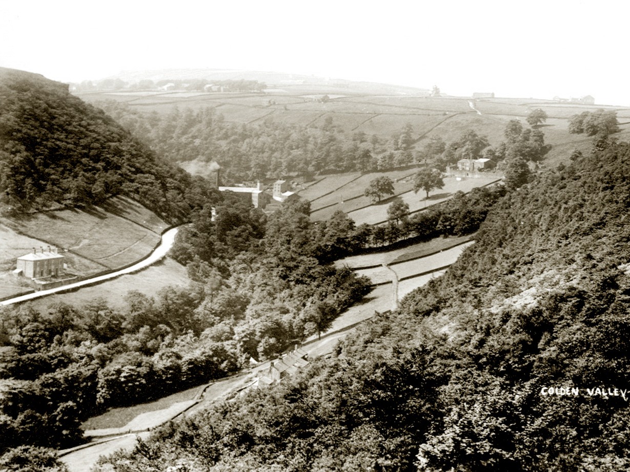
This essay is one of the outcomes of the Heritage Detectives project, commissioned by Arvon Lumb Bank and supported by the National Lottery Heritage Fund. The project set out to explore Colden Clough and Lumb Bank as a living archive: a landscape in which the traces of previous generations survive not only in buildings, maps and photographs, but also in the woodlands, fields, streams and habitats of this small tributary valley.
The project combined several strands of work. It began with archival research, drawing on estate plans, historic maps, newspapers, photographs, census records and other documentary sources to reconstruct the history of the clough and its inhabitants.
Alongside this research, I worked closely with the Friends of Colden Clough, a voluntary conservation group, whose members generously shared their own knowledge of the landscape and its ecology through two ‘walking workshops’, in which we explored the clough, compared old maps and photographs with the landscape as it appears today, discussed ecological change and local history, and reflected on the many ways in which past human activity continues to shape the valley. (See the FoCC Facebook page for details of how to get involved in their regular conservation work parties.)
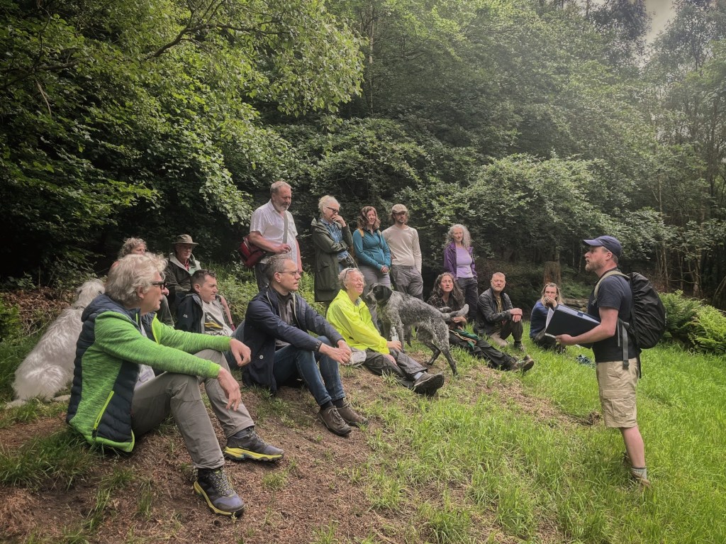
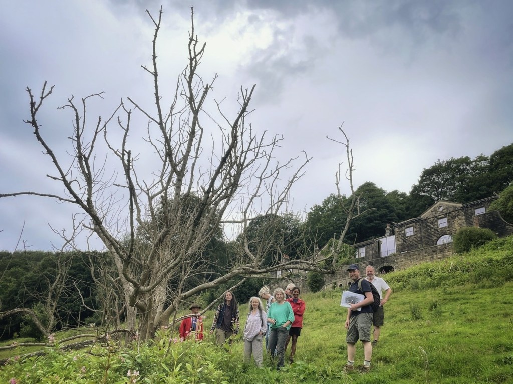
Those workshops developed the material for a guided heritage walk for the public in July 2026, on which we stopped at six locations to uncover the stories hidden within the landscape. Rather than simply recounting the history of the valley, the walk sought to show how that history remains written into the ecology we see today, and how understanding that legacy can inform the very live deliberations about how the Friends of Colden Clough, together with Calderdale Council, who own much of the clough and have designated it a Local Nature Reserve, can carry that inheritance forward.
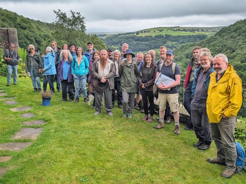
That walk is now also available as an online self-guided Heritage Trail, hosted by the Friends of Colden Clough on their website: https://friendsofcoldenclough.org.uk/projects/heritage-detectives/. The trail follows the same route through the valley as the guided walk did, and allows visitors to explore it at their own pace, and read about the stories we uncovered along the way.
This essay is intended to complement the Heritage Trail – each of its six ‘chapters’ concerns the six stopping places along the route, providing those who are interested with further information, and the references and sources from which it was drawn. Here, also, there is space for more reflection on the many meanings that may be drawn from the complex, layered history of this place.
Lastly, the project also gave me the opportunity, in the background, to develop a way of reading landscapes that has gradually emerged from my own work as a landscape historian, conservationist and environmental educator. It is an approach that treats places not as static scenery, but as living inheritances: landscapes whose histories are written into their ecology, and whose futures depend upon how we choose to understand and carry that inheritance forward.
Before beginning our journey through the six stopping places in the clough, then, I’ll explain this way of reading the landscape, because it underpins everything that follows.
Historical Ecology
Each generation leaves behind traces of its activities. Some of these traces survive in the more traditional forms that are counted among heritage: as buildings, monuments and archaeological sites, as well as documents, artworks, clothing and other artefacts. But the decisions, intentions, ambitions and failures of our predecessors have been left behind in another, less obvious but no less significant way: they are written into the very ecology of landscapes themselves – the trees, plants, wildlife and habitats that we inherit today.
It is remarkably easy to mistake familiarity for permanence. The landscapes we know best – the lane we pass down on our way to work, the woods in which we take a daily walk, the fields and walls and watercourses that make up our everyday surroundings, as well as the plants and birds and other creatures that we share these spaces with – can come to seem simply the way things are. They are the background against which our own lives unfold, and we inherit them already formed, because most of the processes that shaped them happened before we arrived. And because living ecology changes so slowly and gradually, it can come to appear almost timeless.
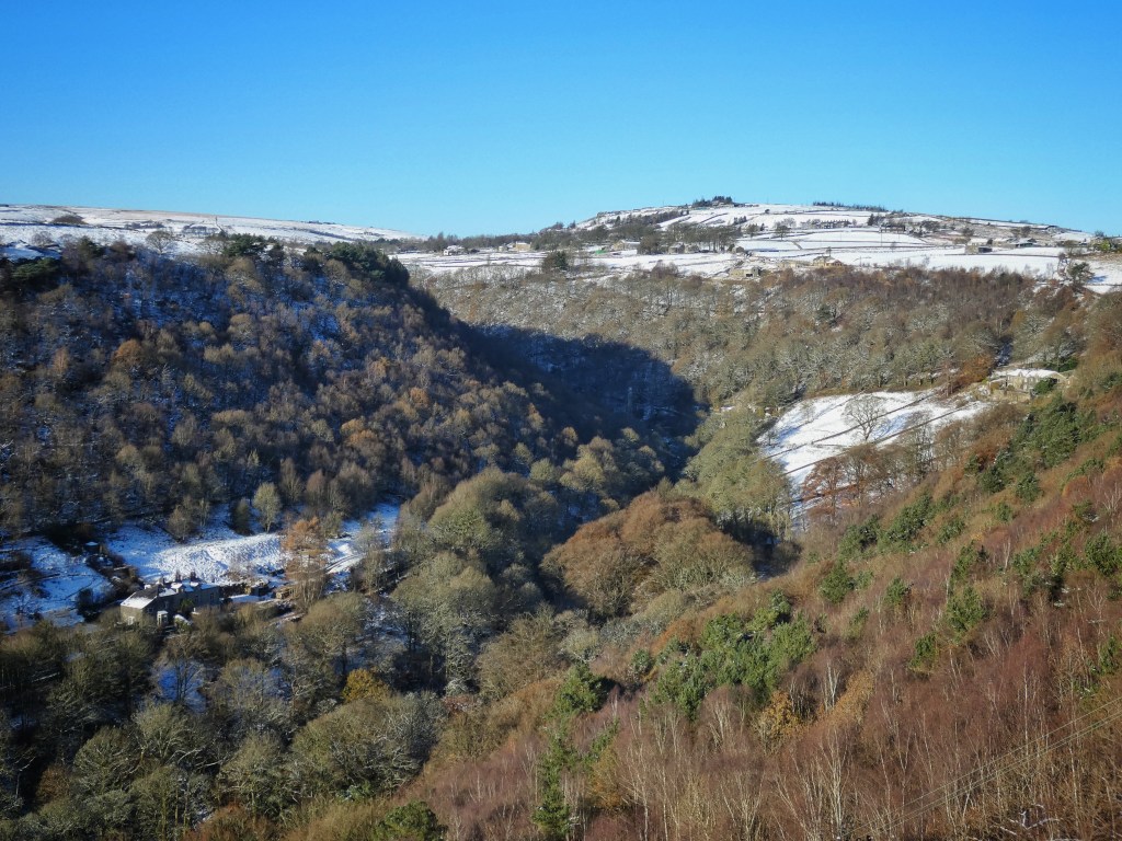
Yet every landscape is freighted with the past. Places are the products of their history. Every woodland has been managed, or has been felled then replanted, or has just regrown by itself. Every field has been enclosed, grazed, mown, abandoned or reclaimed. Rivers and streams have been diverted. Lanes have developed from beginnings as rough informal paths. Buildings within the landscape have been raised, replaced, renovated, repurposed. Even the living creatures we share our environments with have come – finding a home of their own free will or by our intentional or accidental introduction – and gone, fading away for want of food in habitats that we have transformed, or driven away by deliberate persecution.
Rather than treating the history of our cherished places and the nature that inhabits them alongside us as separate subjects, we can ask how they illuminate one another. How has human activity shaped the ecology we see here today? And conversely, how can today’s ecology help us understand the stories of the people who lived and worked here before us?
The approach is simple. We begin with the landscape as it appears today and look closely for clues – dry stone walls, veteran trees, abandoned buildings, woodland flowers – and we supplement these clues in the field with other clues from the more conventional archives – from field names, old photographs, newspaper reports, estate maps and so on. All become pieces of evidence, and as each clue is placed alongside the others, the landscape begins to reveal the successive layers of its own history. What first appeared flatly familiar and ordinary gradually becomes stacked high with stories and deep with time. What was just the way things are becomes meaningful in unexpected ways, and satisfyingly intelligible.
Understanding that history, fascinating though it is, is not an end in itself. The stories we recover change how we see the places we inhabit or visit. They reveal that landscapes are not simply a collection of unchanging habitats, nor merely a record of human activity, but an inheritance created through the continual interaction of both. They invite us to reflect upon what those inherited landscapes mean, recognising that different people will legitimately find different values within the same place. Open fields being reclaimed by the woodland from which they were once carved out may be read as ecological recovery or as the disappearance of centuries of pastoral farming. A mill ruin may represent industrial exploitation or human ingenuity. Landscapes can and do embody multiple meanings.
Understanding a place’s history cannot, of itself, tell us what we ought to do with it now. It does, however, help us ask better questions concerning its future. For every generation inherits landscapes that are already full of stories, values and ecological legacies, and every generation must decide which parts of that inheritance to continue, which to restore, which to transform, and which to relinquish. Stewardship begins not with certainty, but with an understanding that the places we care for carry a plurality of meanings, not all of which can be preserved.
Colden Clough has been the perfect place to explore as a living archive of the stories that have shaped it. Over centuries its ecology has been wrought by farming, woodland management, quarrying, industry, housing, recreation and conservation. Each has left traces that remain visible, if we learn how to look for them. This essay, and the Heritage Trail it accompanies, will walk you through those traces.
Note: This article has footnotes. Click on the footnote number to be taken to the reference, and to return to where you were in the text, use your browser’s back button.
1. Eaves Avenue: Layers in the Landscape
Stand on the recreation ground at Eaves Avenue and it is easy to feel that you already understand this place. A broad sweep of mown grass, a couple of goals and a basketball hoop, a children’s playground with swings and a slide. A scene from generations of childhoods up and down the country.
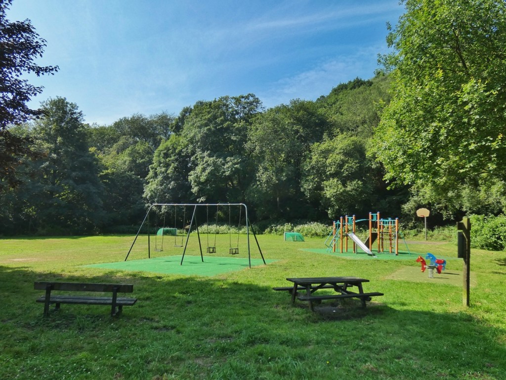
Facing it across the road is a row of houses, each with front gardens meeting the pavement, and long back gardens rising up the hillside behind them. Above the backs of these, woodland climbs the steep hillside.
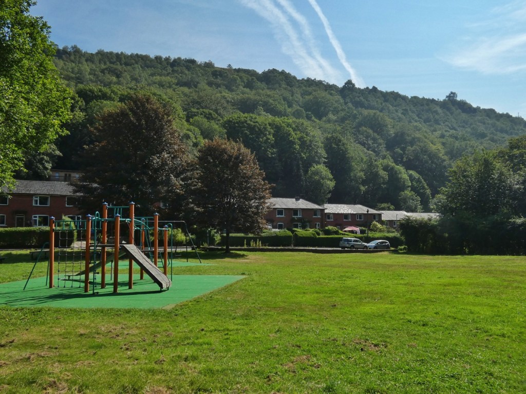
And there is the sound of a stream, somewhere down among the trees in the bottom of the valley. It feels familiar and complete, as though these features have always belonged together.
Eaves Avenue provides a perfect place to begin reading the landscape: we’ll peel back its historical layers, asking how each generation has reshaped what was handed on by those before it, and what ecological legacies those changes have left behind.
The most recent layer is the housing estate itself. The 62 houses along this road were built during the 1920s by Hebden Bridge Urban District Council as part of the ambitious programme of municipal house building that followed the First World War. It was an optimistic moment in the town’s history, reflecting new ideas about public housing, health and community. (It had a precursor a decade previously in the aspirations of the short-lived Eaves Self-Help Manufacturers Society to ‘raise a co-operative community of houses, workshops, and institutions, with a free and happy people’ in Colden Clough.1
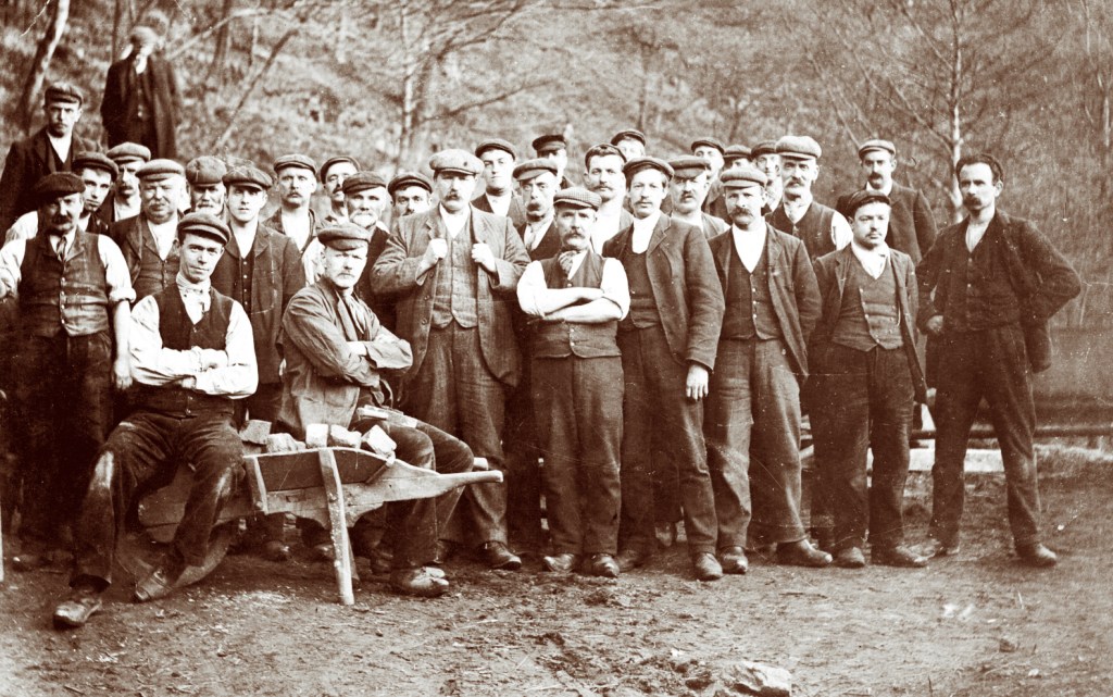
To build the housing, the council entered into discussion with Messrs. Greenwood and Stansfield, the owners of the Eaves Bottom Estate, in 1918,2 and purchased it in 1920. The accounts of the discussions they had over those years envisioned, in addition to housing, a cemetery, a refuse destructor, ‘pleasure grounds’, and turning the old Eaves Mill ponds – already ‘popular resorts’ – into open-air swimming baths.3
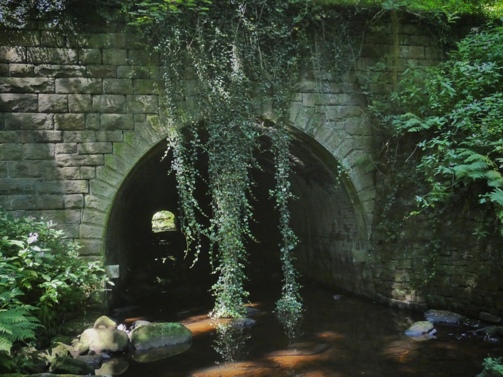
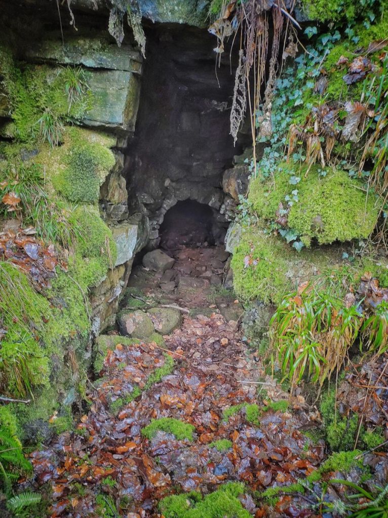
Long before the council purchased the whole estate, however, it had already begun reshaping the valley. The recreation ground itself stands upon what was once Hebden Bridge’s municipal refuse tip. In 1897 the town purchased three and a half acres of land here, culverted the Colden Water through a substantial stone tunnel, and gradually filled this part of the valley with almost 30 years’ worth of domestic refuse, road sweepings and night soil.4
Today, it is difficult to conceive that the solution to Hebden Bridge’s waste problem was found in filling up the deep ravine of the clough. Some were appalled at the time: in 1906, a furious attack on the tip was published, in which the author lamented the ‘ruthless despoilation’ of one of the district’s ‘loveliest valleys’ with such an ‘ugly sore’, something they considered to be ‘rampant folly’ and a ‘public scandal’.5
Undeterred, the council borrowed further money to extend the tip in 1909, and in 1920, at the same meeting in which they were examining plans for the new housing scheme, the council’s sanitary inspector noted that the tip remained the only one that Hebden Bridge had, and even though it only had capacity for another five years, it would be possible to extend it when required by further arching over the river.6
Indeed, this general relaxed air about the possible environmental effects on the clough and its new residents pervaded the meeting: Dr Lawson, the medical officer, had no objection to the ‘fumes and gases’ coming from the proposed refuse destructor; Mr Bottomley, the sanitary inspector, was blithely unaware of any complaints concerning ‘flies or rats’ associated with the rubbish tip, although Uttley notes7 that it was several years after the housing was built before the ‘plagues of vermin were eradicated’; and in response to a concern that the burial ground might contaminate the water in the river, Mr Atack, the chair of the finance committee, brushed away such worries by cheerfully reassuring the meeting that ‘There is a wall round the field, and all it is necessary is for a hole to be dug and the coffin put in.’8
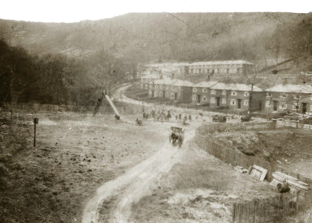
The fact that none of these mooted schemes were realised remind us that the landscape before us was never inevitable. It is the outcome of countless decisions, debates and abandoned plans, most of them now forgotten. Despite the capacity to expand it, the tip was finally closed and capped, and, with support from the Carnegie Trust and the National Playing Fields Association,9 Hebden Bridge’s first municipal children’s playground was sited upon it in 1932.10 The image below shows the tip still in use after the playground was built – a queue of children are climbing the precipitous slide, while a horse and cart is led across the playing field on a well-used track which must lead down into the part of the tip still open.
Yet this municipal landscape had itself been written over an earlier one. Before the houses and the refuse tip came industry. Two six-storey mills – the Eaves Mills – once stood a short distance downstream, originally built for silk spinning before later becoming dye works.11
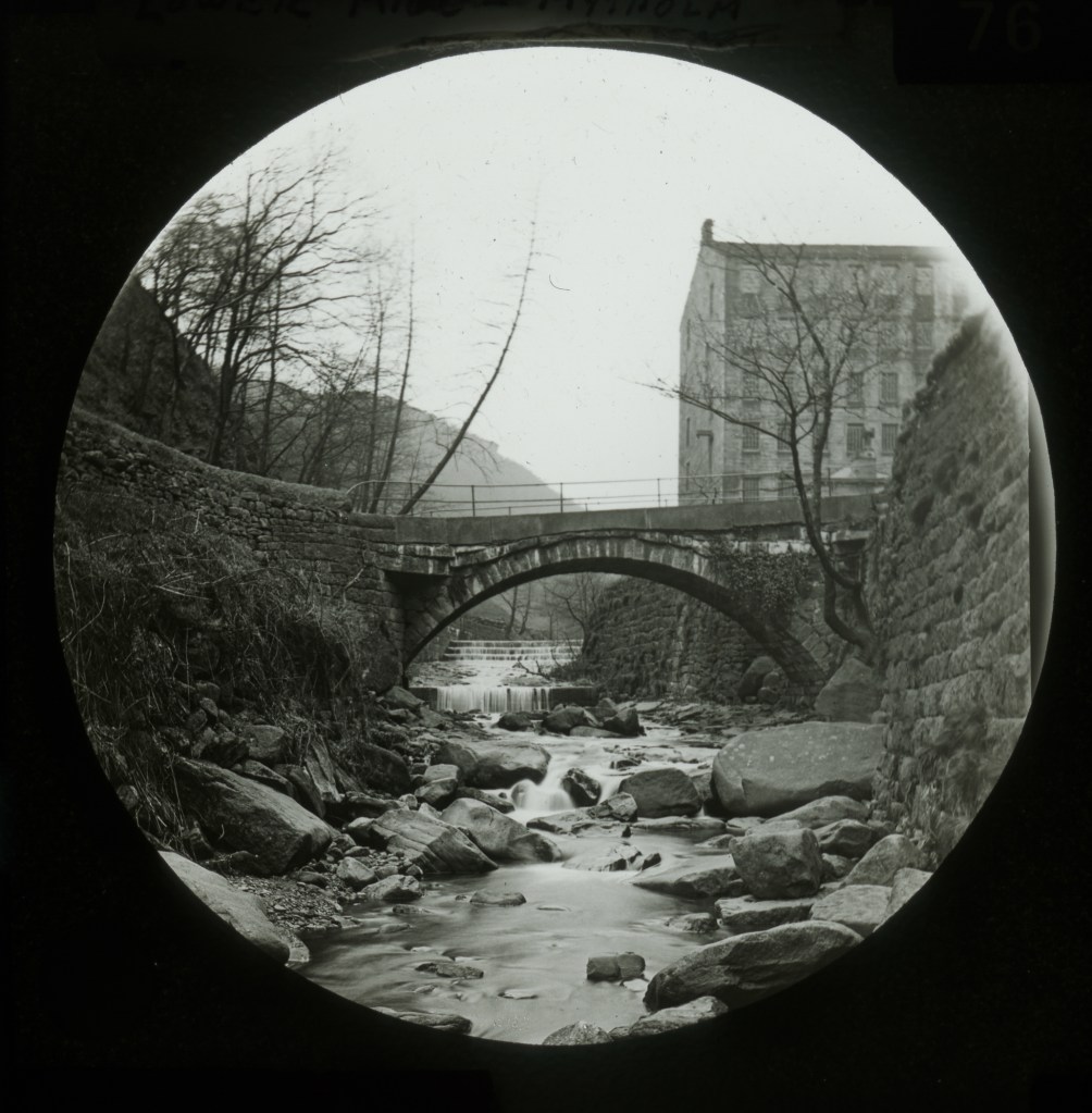
Water was diverted from the Colden Water more than 600 metres upstream, carried through tunnels, goits and ponds before driving the machinery and finally returning to the stream below the mills.
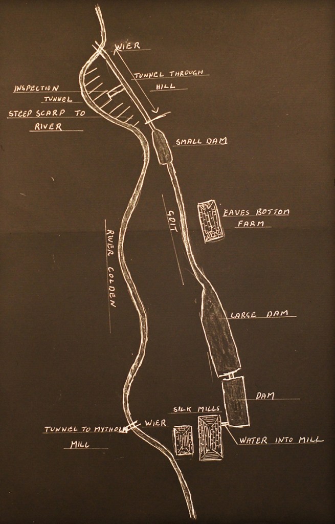
The remains of that remarkable water-management system still survive in subtle traces throughout the clough, and in places remains of the mills are still turned up by residents digging their gardens.
But even the mills were not the beginning. Long before industry arrived, these slopes formed part of an agricultural landscape, with 12 fields carved out of the lower reaches of Eaves Wood. We can see them on the 1835 Heptonstall Valuation map, where some are named as Brinks, or specified as meadows or wheat (almost certainly oat) fields.12 We can also see them on an 1868 plan of the Mytholm Estate when it was put up for sale, and on here we get more names: Goit Field (still open today but overgrown, below the Eaves Mount terraces), Plantation Field (in which 1–5 Eaves Mount is situated), Dam Field (now occupied by 11–26 Eaves Avenue) and Mill Field (1–10 Eaves Avenue).13 These names were obviously applied to them after they had been disrupted, though not obliterated, by the water infrastructure of the mills.
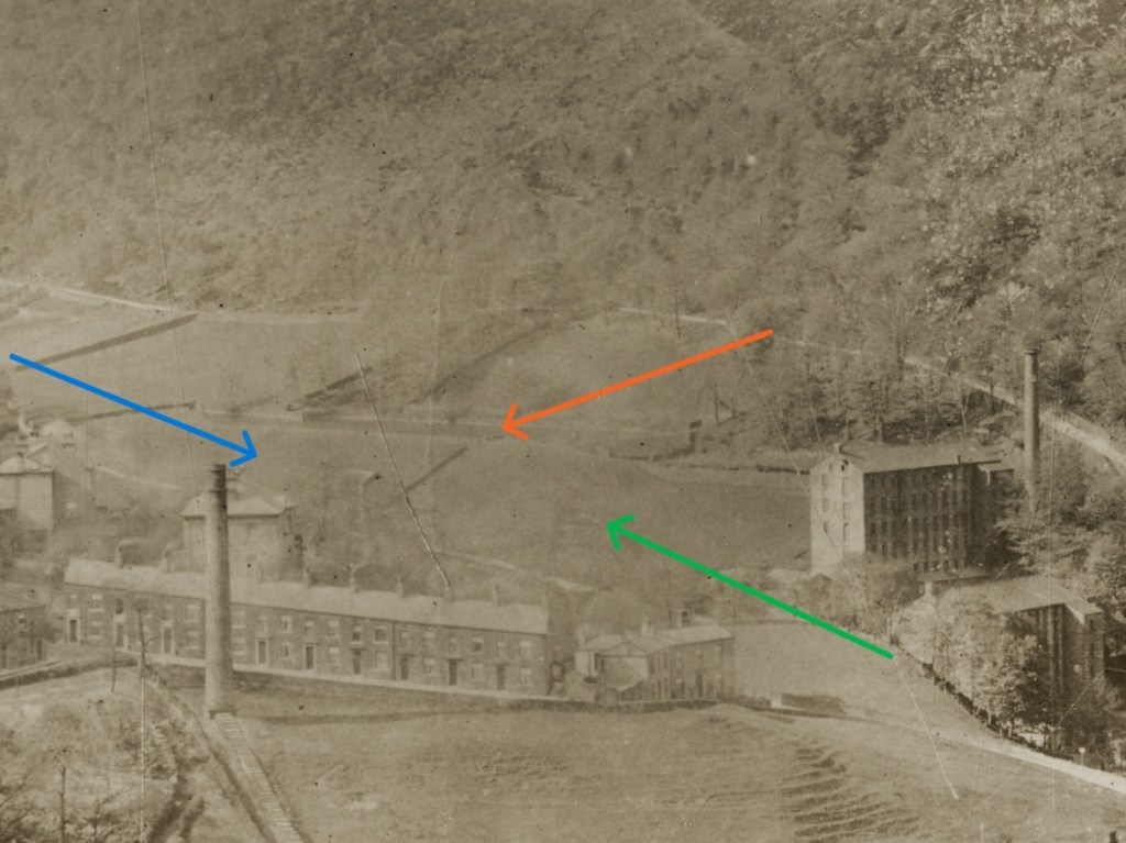
From what can be seen in photographs, grazing continued in them for many years afterwards: industry altered the existing landscape but did not erase it. (Although there was also what must have been an extraordinarily steep field called Low Lands on the west side of the valley between Colden Road and the Colden Water that was definitively submerged beneath the waste of the tip.)
This is perhaps the most striking lesson of the place before us. The landscape is not composed of separate historical periods neatly replacing one another. Instead, each generation inherited what came before, altered it according to its own needs, and handed it on once again. Woodland was cleared, in certain areas, for agriculture; agriculture was disrupted, in parts, by industry; industry gave way to municipal housing; and each transformation left traces.
Landscapes such as this are therefore like medieval palimpsests – parchments that were written upon, and later scraped clean to be reused and written upon again. On these parchments, the older writings underneath – just like a landscape’s older stories – remain faintly legible.
Seen in this way, the ecology of the clough also becomes more complex. Woodland was cleared to create fields, yet species-rich grasslands were cultivated in their place. Industry undoubtedly damaged habitats through pollution and water engineering, yet it also created new environments in ponds, channels and stonework. Housing replaced meadows, but introduced gardens that today support an extraordinary diversity of wildlife. Every historical change brought ecological losses, ecological gains and entirely new possibilities.
The landscape we inherit is therefore neither pristine nor degraded, neither wholly natural nor wholly artificial. It is a living record of successive relationships between people and place, each leaving its own marks upon the ecology that followed.
Understanding those successive layers does not tell us what we ought to do next. It does, however, allow us to ask better questions of what futures we might shape out of that past. Once we appreciate what has been inherited, we can begin to reflect upon its meanings, recognise the richness and complexity of the legacy before us, and consider how our own generation might contribute the next layer in the long story of Colden Clough.
2. Far Long Meadow: The Memories of Place
Towering beech and sycamore on the one hand, young oak and birch and rowan on the other. A sliver of open sky above, and grass in the glade below. At first glance it appears to be nothing more than a woodland clearing.
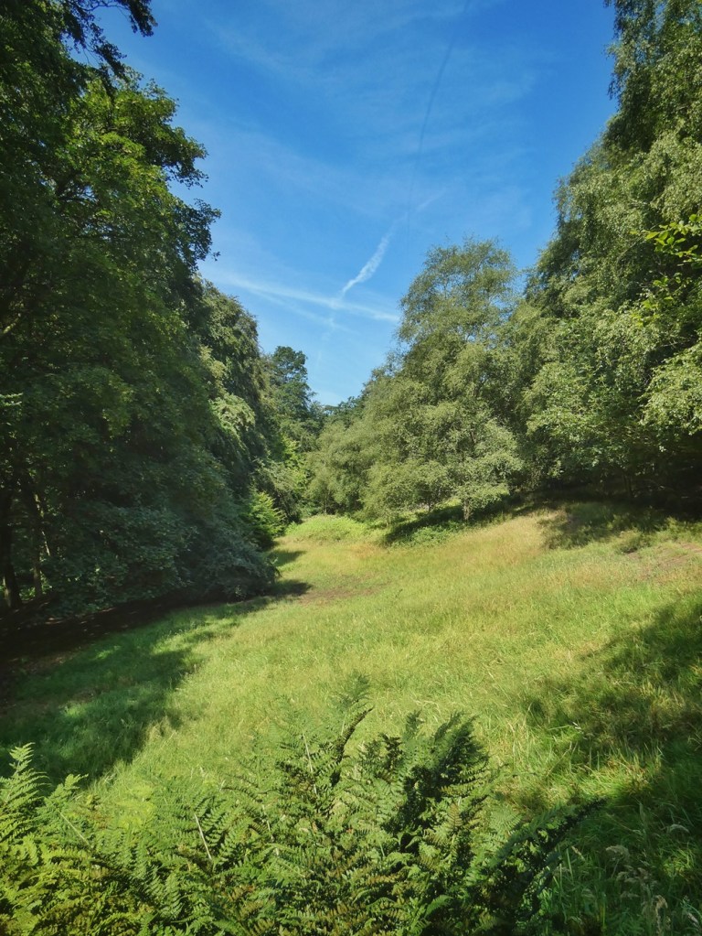
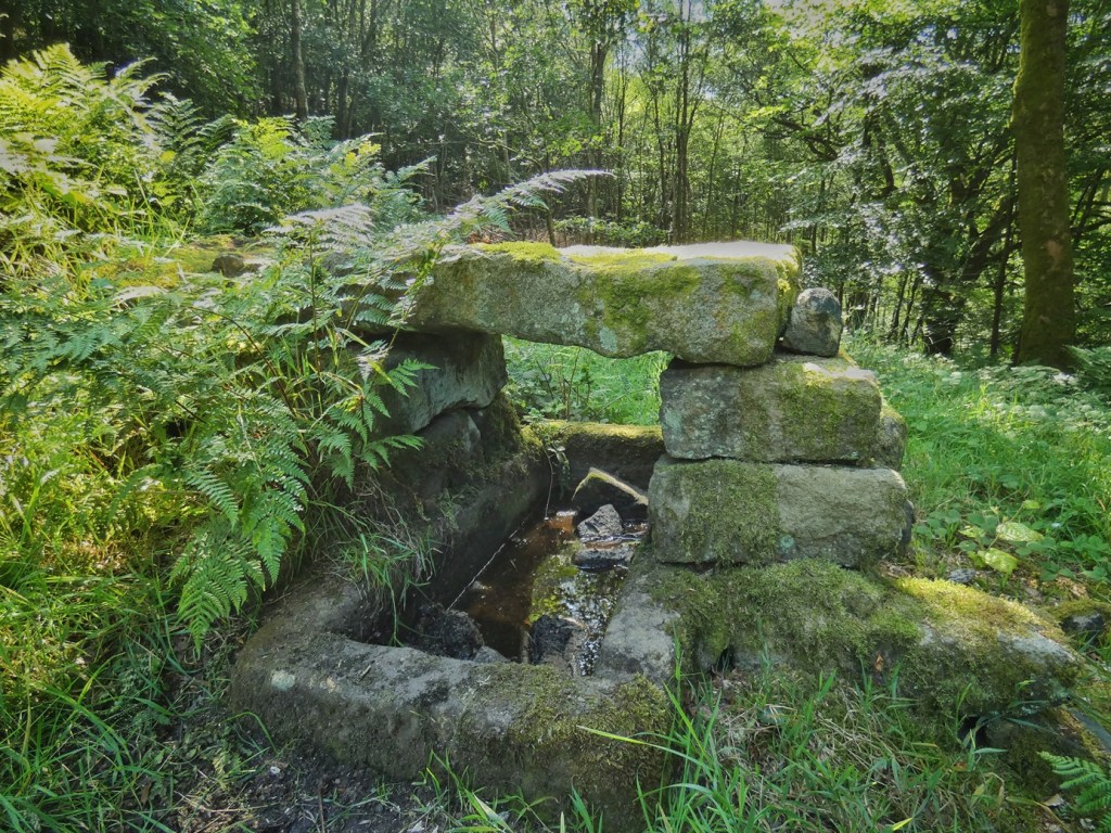
Yet, as elsewhere in the clough, appearances conceal a more complex story. Look carefully and the clues begin to emerge. Dry stone walls run unexpectedly through the trees. Massive stone gateposts with grooves for wooden stang poles stand where no gates now hang. Ferns crowd around an old stone water trough. And the track that runs along the edge of the glade hints at an earlier pattern of movement through the landscape. Together, these clues suggest that this little nook of the clough was not always as we find it today.
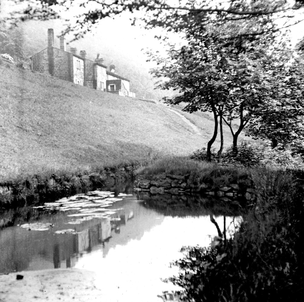
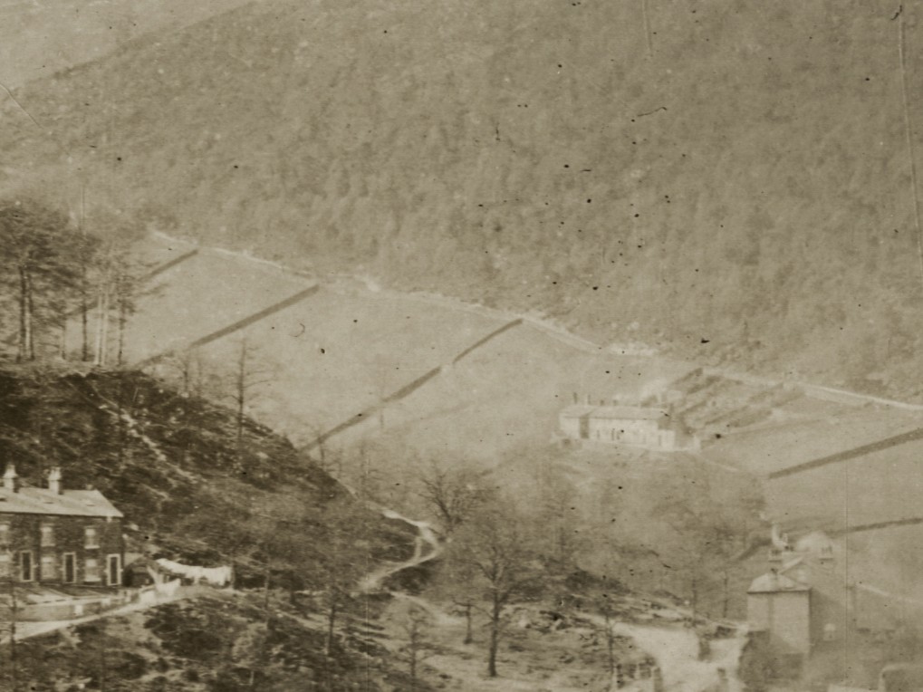
The archives confirm what the landscape still just about remembers. Until surprisingly recently this was a chain of four adjoining fields – the northernmost four of the string of 12 mentioned earlier. Early photographs show open grassland grazed by cattle, and tightly bounded by woodland.
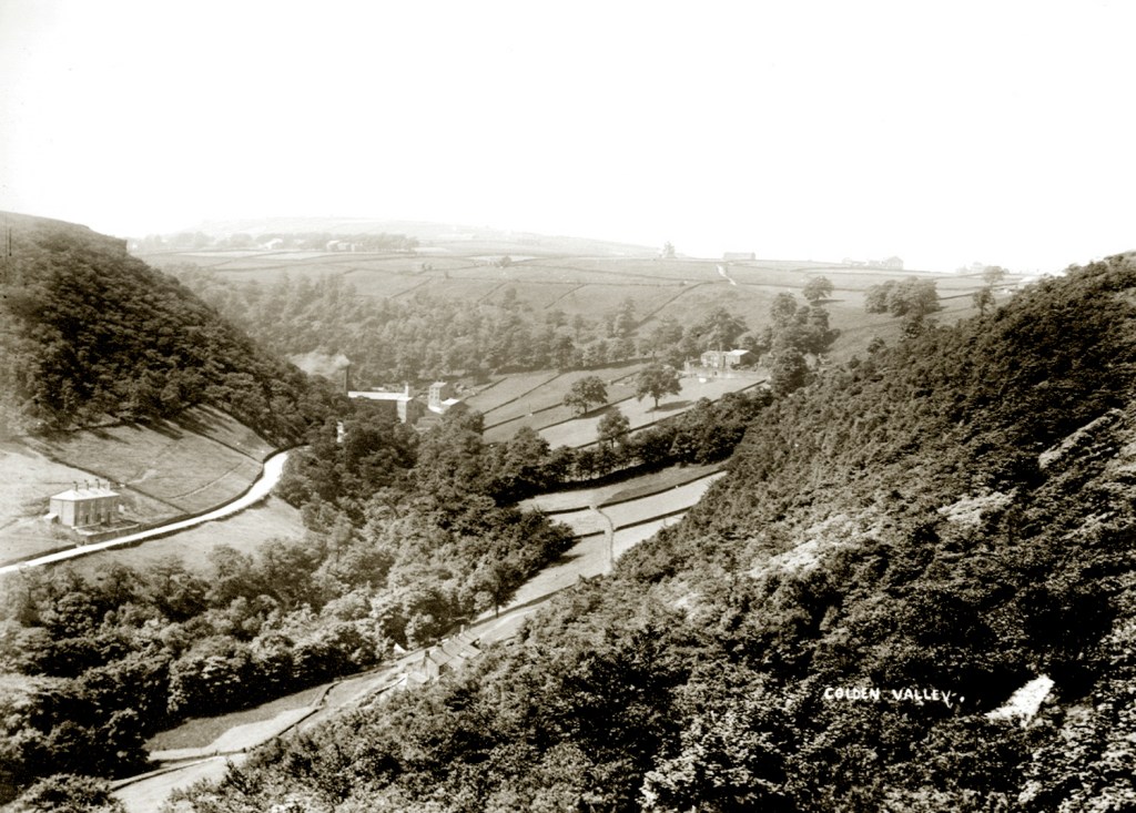

The first edition of the Ordnance Survey map, surveyed in 1848, records their boundaries clearly, while the Heptonstall Valuation map of 1835 gives them the collective name Far Long Meadow, suggesting that these four fields may once have formed a single larger enclosure before later subdivision.
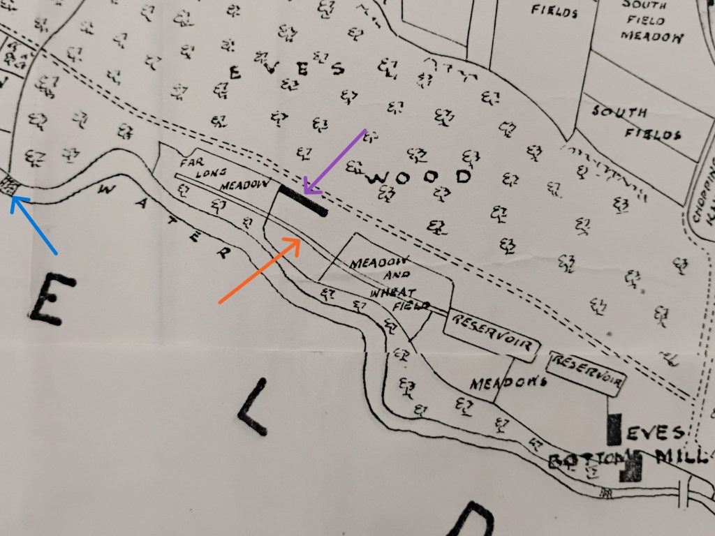
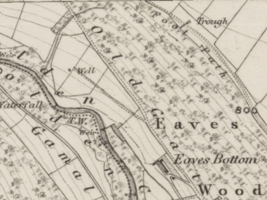
But these old and fading fields themselves represented an earlier act of transformation: in order for pasture and meadow to be established here, the woodland had to be cleared. At first thought, that might seem a story of ecological loss: woodland replaced by agriculture. Yet, as so often in historical ecology, the picture is more nuanced.
Long before farming reached the Pennines, this landscape would probably not have been an unbroken canopy of trees, but a shifting mosaic of woodland interspersed with sunny glades and larger open areas maintained by wild grazing animals. Many of the flowering plants now associated with traditional meadows evolved in just such places. By clearing woodland and replacing wild herbivores with cattle and sheep, generations of farmers created a different kind of open habitat, but one that, in many respects, continued to provide the conditions those species required. Through careful grazing, the annual cycle of haymaking, the spreading of lime and manure, and centuries of patient labour, they fashioned grasslands of extraordinary botanical richness. Meadow foxtail, sweet vernal grass, common bent and red fescue grew alongside meadow buttercup, bird’s-foot trefoil, red clover, tormentil, yarrow, pignut, heath bedstraw and ribwort plantain. Yellow rattle and eyebright kept the more vigorous grasses in check, allowing dozens of flowering species to flourish where otherwise only a few would have dominated.
That diversity of grasses and wildflowers sustained an abundance of life far beyond the plants themselves. Bees, hoverflies, butterflies, moths, beetles and grasshoppers found nectar, pollen and food plants throughout the summer. In turn they supported insect-eating birds and small mammals. The meadows were also remarkable below ground. Ancient, unimproved grasslands support some of Britain’s richest fungal communities, and Calderdale is internationally important for its waxcap fungi.
Just as important were the woodland edges themselves. Where open meadow met ancient woodland, sunlight, shelter and structural diversity combined to create one of the richest transition habitats in the landscape, supporting greater biodiversity than either woodland or grassland alone, because species from both habitats overlap there, while others specialise in the boundary itself.
These fields were therefore never simply the absence of woodland. They became habitats in their own right, shaped by generations of human management yet ecologically rich precisely because that management continued.
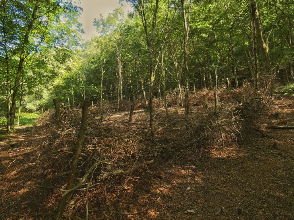
Then, quietly, that chapter ended. At some unheralded point during the middle decades of the 20th century livestock disappeared from these fields, and the grazing which sustains and renews the grassland came to an end. With no livestock needing to be penned, the gates and walls were no longer maintained, and they rotted and crumbled away. No one deliberately planted woodland here: the surrounding woodland had been scattered their seeds on the grassland all along, but now, with no livestock to nibble them, the seedlings established themselves, and gradually turned into saplings. Shade deepened. The grassland slowly contracted from the field edges, until today, only a small remnant survives, a small green pool, slowly drying out. We are not looking at a completed landscape but at a process still unfolding, and now approaching its conclusion.
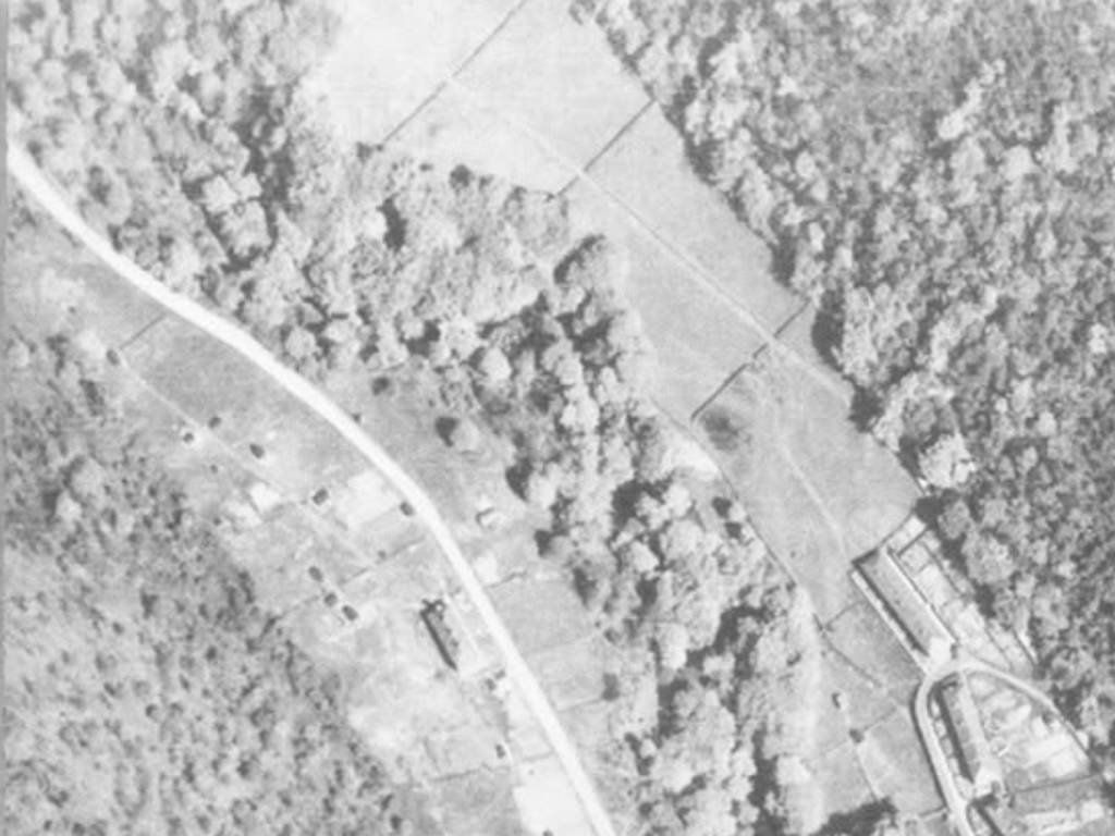
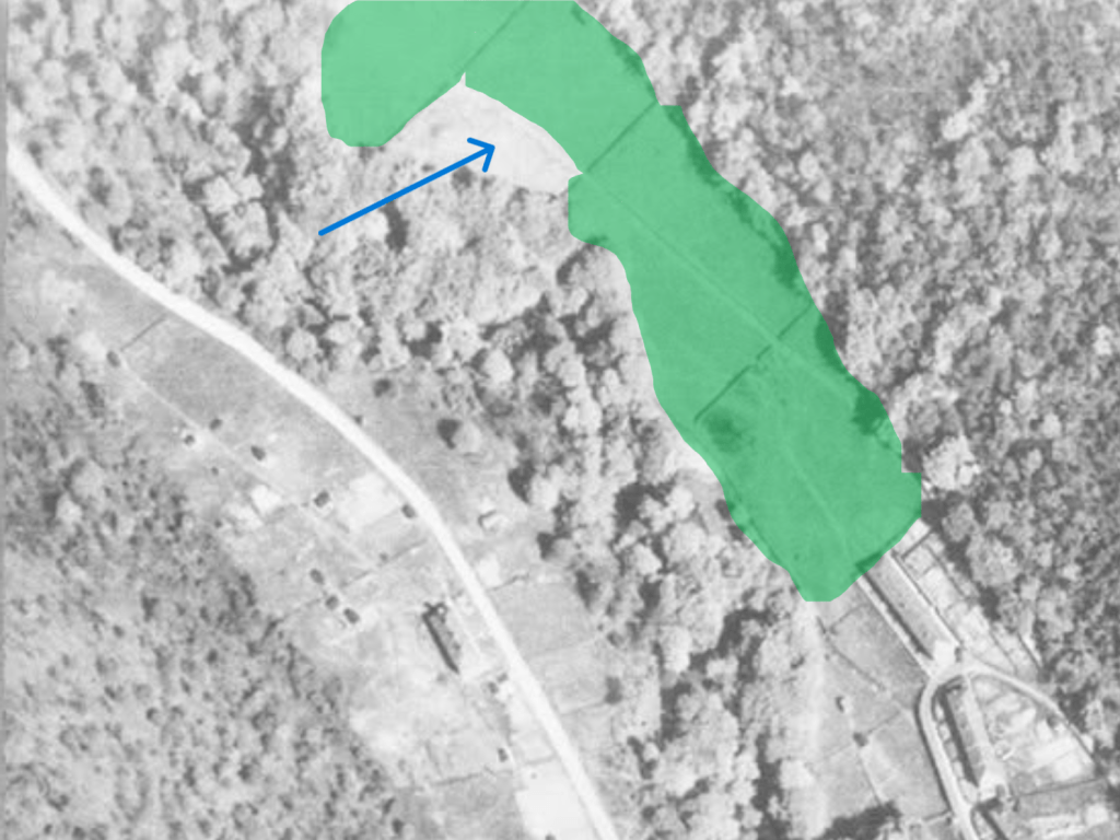
Who farmed these fields, before they were abandoned? By the 20th century they formed part of the Eaves Bottom Estate purchased by Hebden Bridge Urban District Council in 1920. The nearby row of six cottages known as Eaves Bottom stood on the site now occupied by the uppermost terrace of houses on Eaves Mount. (It strikes me as likely the name occurred to the planners because 6–11 are literally mounted on the foundations of the old cottages.) It seems possible that these cottages were created by subdividing a single farmhouse before – a common enough pattern in the 19th century – although I have no evidence for this. At present, then, I am not certain from where these fields were originally farmed.

But the story revealed by the fields themselves is perhaps the clearest example in the whole of Colden Clough that historical understanding does not produce simple answers for how to carry our inheritance forward. For what, exactly, are we looking at? One person may see neglected, once species-rich grassland sustained by centuries of labour slowly and sadly disappearing beneath scrub and trees. Another may see rich future woodland recovering ground that had been destructively cleared.
Neither interpretation is entirely wrong. Both arise from the same history, yet each places different values upon it. If our sympathies lie with traditional farming, hay meadows and ancient grassland species, these fields may evoke a sense of loss. If we begin instead from Britain’s long history of woodland clearance and our nation’s shamefully sparse woodland cover today, the same scene may appear hopeful.
Looking at ecology through a historical lens does not ask us to choose between these perspectives. Rather, it encourages us to recognise that both are present simultaneously. The landscape embodies a plurality of meanings at once, and understanding its history deepens rather than simplifies our appreciation of it.
Perhaps that is the most valuable lesson this forgotten corner of the clough occupied by these quietly disappearing fields. Every inherited landscape is the product of successive choices, each creating opportunities while closing others. Every ecological gain has usually involved another kind of loss. Stewardship, therefore, is rarely about determining the single correct future. It is about making thoughtful decisions between possibilities that all possess value, informed by a fuller understanding of the stories that have brought the landscape to the present day.
3. Eaves Wood: The Woodland Archive
Stepping beneath the canopy of Eaves Wood, it is easy to feel that the short span of human history has been left behind. Woodland like this can feel primeval. The very term ancient woodland – which this is designated as – encourages that impression, inviting us to imagine a place that far predates the coming of people into this clough.
Yet ancient woodland does not mean unchanged woodland. Indeed, few places in Colden Clough demonstrate more clearly that the history of human activity can be read directly in ecology. The trees around us, the paths beneath our feet, even the relative sparsity of plants on the woodland floor, each preserves traces of earlier decisions and earlier ways of living. This woodland remembers all that we have done here.
The wide straight track which gently climbs along what was once the bottom of Eaves Wood was labelled on the 1848 Ordnance Survey as Old Gate, and was clearly an important route. But regular visitors will also know of the paths which zig-zag their way up through the wood to Heptonstall. As Christopher Goddard notes, they have long been ‘a peculiar mystery, appearing like those of a formal estate’, and are ‘thought to have been built during the Cotton Famine in the 1860s to provide work for unemployed labourers.’14 Given they all lead to Hell Hole Quarry, their original purpose must have been practical – to bring stone down the hillside.
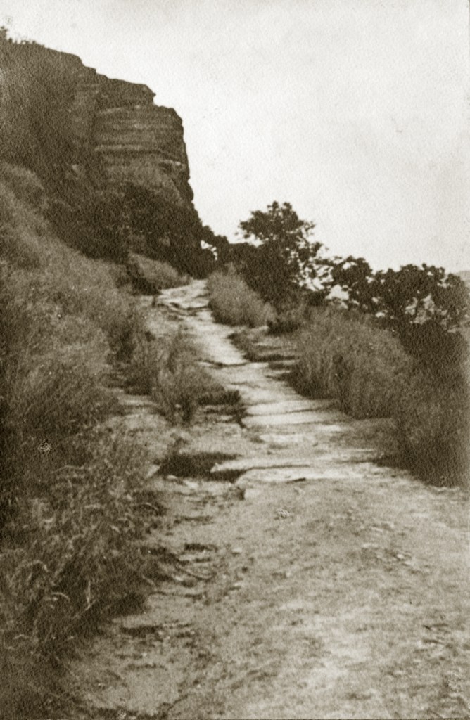
But they appear to have been ‘beautified’ with stone edging and steps some time afterwards. As to when that might have been, recall that Hebden Bridge Urban District Council had plans for ‘pleasure grounds’ as part of the development of the Eaves Bottom Estate, but no detail was given on what form these might take. We can guess, though, that they meant making something of Eaves Wood, because they give the acreages of their various plans, and the lion’s share (42 out of 48 acres) is earmarked for the ‘pleasure grounds’. In addition, in 1920, they state that they are not planning to spend any money on developing the pleasure grounds at present because ‘the woods were now more or less open to the public’ anyway.15 But two years later, the Leeds Mercury reports that ‘With the object of carrying out a development scheme on the Eaves Bottom Estate at Hebden Bridge, and also providing work for the local unemployed, Hebden Bridge Council have got out plans for the conversion of a dam into an open-air swimming bath, and the laying out of footpaths, at a total estimated cost of £2,750.’16

Once again, the stories etched into the landscape are layered: before the tread of today’s daily dog-walkers and Sunday ramblers are the footsteps of quarrymen and the rumble of stone-laden sleds and horse-drawn carts descending from Hell Hole Quarry. As the valley changed from a place of industry to one increasingly valued for recreation, the paths themselves acquired a new kind of use, but their routes to the quarry lead us back to their earlier, original purpose.
Nor were quarrymen the only people constantly moving through these woods. A newspaper report from 1888 describing the discovery of a body in Eaves Wood contains a small detail that is easily overlooked: the young boy, Francis Shackleton, who had the misfortune to stumble across the body, told the coroner ‘I was in Eaves Wood…my mother having sent me to gather sticks’.17 That brief remark hints at a practice that must once have been commonplace. Dead branches that would today remain on the woodland floor, slowly feeding fungi, insects and countless other organisms, were instead gathered and carried home for fuel, likely kindling for lighting a coal fire. We cannot know precisely what ecological consequences that long tradition produced, but it almost certainly left absences of specialist deadwood (saproxylic) species that are no less real for being difficult to see.
Fire, too, repeatedly scraped clean and rewrote this woodland. On a Sunday afternoon in late July 1868, for example, in what was thought to have been an act of arson, a fire ‘spread with great rapidity and threatened to devastated the whole hillside’, burning ‘through the night and during the following day, and it was only by cutting a deep trench from the top to the bottom that the progress of the fire was stayed’, but it left ‘about half the hillside…a blackened mass’.18 It was again ‘burning fiercely’ in May 1886 as a consequence of ‘thoughtless or evil disposed persons’.19 Three years later, in July 1889, ‘some malicious persons set fire to the undergrowth of Eaves Wood. Several attempts were made to extinguish the flames but without avail, and they had to be left to their own will and a large amount of damage was done.’20 Hebden Bridge Urban District Council’s stewardship of the Eaves Bottom Estate got off to a calamitous start in 1921 when a fire of ‘serious and alarming dimensions’ broke out.21
‘It was first noticed at the higher end of Eaves Wood, which was purchased by the Hebden Bridge Council for park and recreation ground. Starting from directly under Sandal House, it spread with amazing rapidity, and practically the whole of the hillside has been denuded of its dense undergrowth. The leaves in many of the large trees were also consumed, in some cases being almost denuded. The flames continued to spread round the corner of the hill above Bankfoot and a large number of hencotes were in danger of catching fire, but fortunately the flames were kept off. Some of the Council’s men have been engaged in stemming the progress of the fire. The fire was still smouldering yesterday. Dense clouds of smoke arose from the fire, filling both the Hebden and Calder Valley with a thick pall. The smoke in the Hebden valley gave rise to a rumour that Nutclough works were on fire. The pretty and attractive hillside has been reduced to a blackened and charred mass and presents a distressing aspect.’
In photographs from the late-19th and early-20th centuries, it can be seen that Eaves Wood, particularly in the upper reaches, is considerably sparser than it is today.
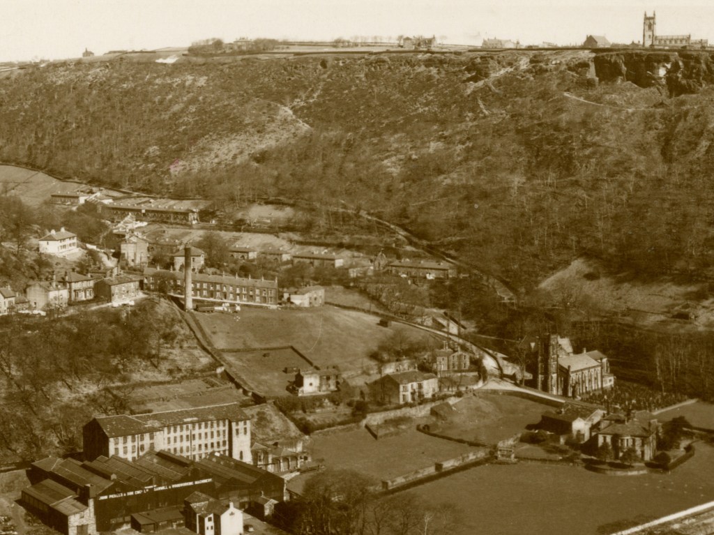
Woodland fires seem thankfully to be less common today, although as recently as 1980 there was a fire, thought to have been started deliberately, which, according to Hebden Bridge Fire Station Officer Michael Crabtree ‘completely ruined the top end of the valley’ from Lumb Cottages to Jack Bridge. Crews and volunteers battled 15 feet-high flames through the night, pumping water out of the clough stream through 80 lengths of hose.22 Although the image below image is undated, I suspect that it is the aftermath of that 1980 fire that it shows.
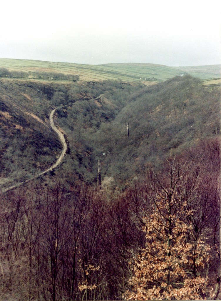
‘This area will probably take at least 10 years to recover’, lamented Michael Crabtree after getting the blaze under control. ‘Who’s going to replace the trees?’ But as we have seen, the trees take care of this themselves. These repeated fires remind us that ‘ancient woodland’ is not a synonym for pristine woodland. Its continuity is not the continuity of individual trees, or even of an unbroken canopy, but of the place itself as woodland. Take any ancient woodland in the UK, and it will have been felled, burned, and, in some cases, as we shall see next, replanted with entirely different species.
Distressing as it will have been for people to witness, in the lifetime of a woodland, these slopes stood bare and blackened only briefly. Yet they were never transformed into fields or settlements. Instead, they remained within the long trafition of woodland, repeatedly disturbed, yes, but repeatedly renewed. Ancient woodland, then, is less a story of permanence than of resilience: a landscape that has absorbed centuries of change while retaining its identity as woodland.
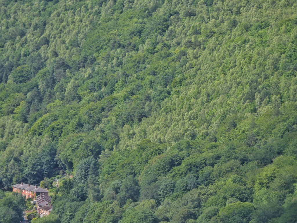
But even if the identity of a woodland can survive disturbance, its ecological character can change as the species that make it up shift, either naturally or through human intervention. The great beech trees dominating much of Eaves Wood are an example of the latter. Beech is native to southern England but not naturally characteristic of the Pennines, and in Eaves Wood, their size, their age, their local dominance and, in places, their regular spacing all point towards deliberate planting.
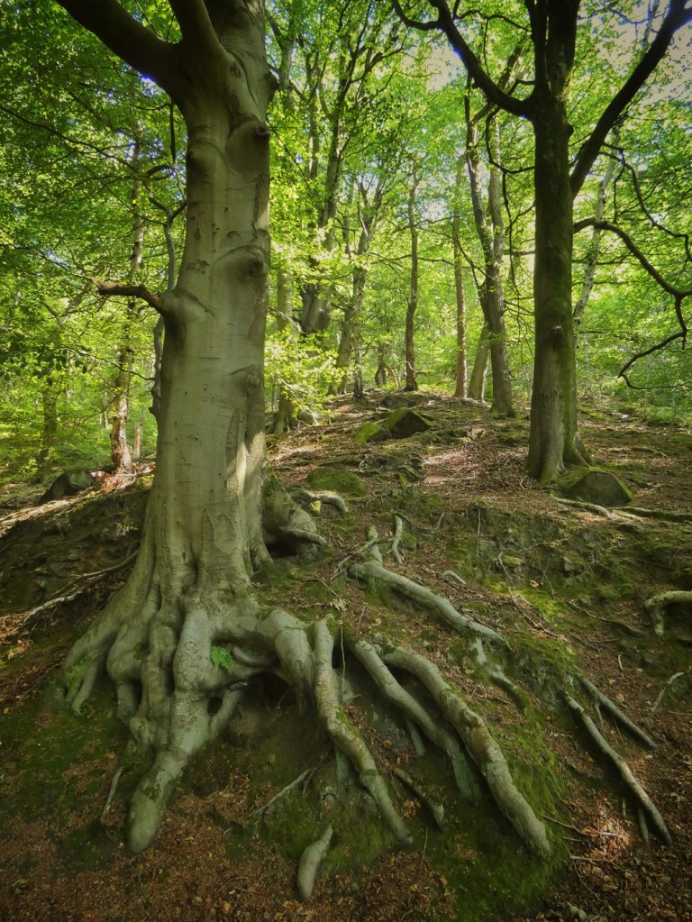
Local tradition has long maintained that the beeches that cloak many a valley side slope were planted to provide timber for bobbins and shuttles used by the textile mills. This explanation fits the historical context. Textile production demanded suitable timber, and replanting nearby woodland with beech would have represented a rational investment in a future supply of raw material.
History, however, intervened. By the time these trees had reached maturity, the textile industry that inspired their planting was itself collapsing. Instead of being harvested for the purpose for which they were intended, they survived to become magnificent veteran trees, monuments to an economic future that never quite arrived.
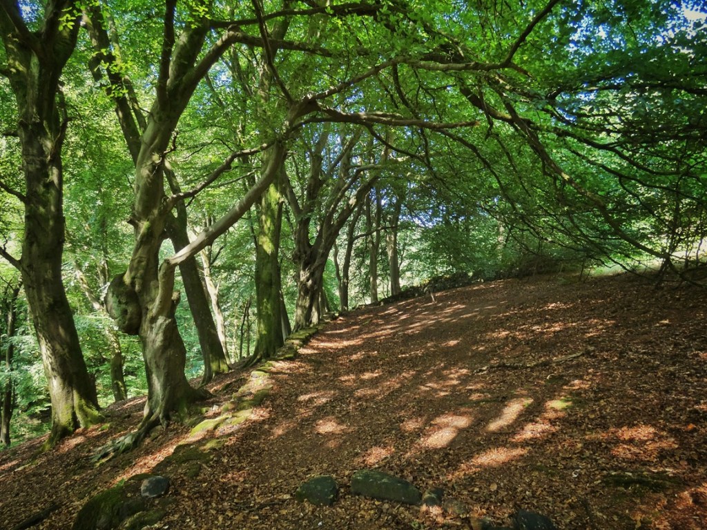
That unrealised plan has left us with a troubling ecological legacy. Dense beech canopies admit relatively little light. Thick carpets of slowly decomposing leaves suppress many woodland flowers and shrubs while making it difficult for other tree species to establish. The woodland floor beneath mature beech is therefore noticeably more spare than beneath neighbouring oak woodland. This also means that in heavy rain, there is little surface vegetation to slow the flow into the Colden Water. Ironically, the species regenerating most successfully are the beeches themselves, ensuring that decisions taken perhaps two centuries ago continue to influence ecological processes today.
Understanding these aspects of Eaves Wood’s history – tracks, stick-collecting, fires, replanting – changes the way the woodland appears. It is no longer simply an attractive stand of trees. It becomes a living archive of forestry, industry, quarrying, fire, fuel and changing human priorities, all still legible in the ecology before us.
Should these beech stands simply continue their natural development? Should greater structural and species diversity be encouraged? Should elements of the earlier oak-and-birch woodland be restored? Each possibility values a different part of the woodland’s inheritance. Historical understanding does not eliminate such choices, but does help us to make them with a fuller appreciation of the landscape we have inherited, and the many stories to which we are now adding our own chapter.
4. Lumb Bank: A Legible Landscape
Lumb Bank presents a scene of harmony unmatched anywhere else in Colden Clough. The house rests confidently and contentedly on its terrace; a green apron of fields sweep elegantly down towards the river below; and such is the perfection of its position that, as the deep shadows of the clough swing across the surrounding hillsides, Lumb Bank basks the day long in a benefaction of light.
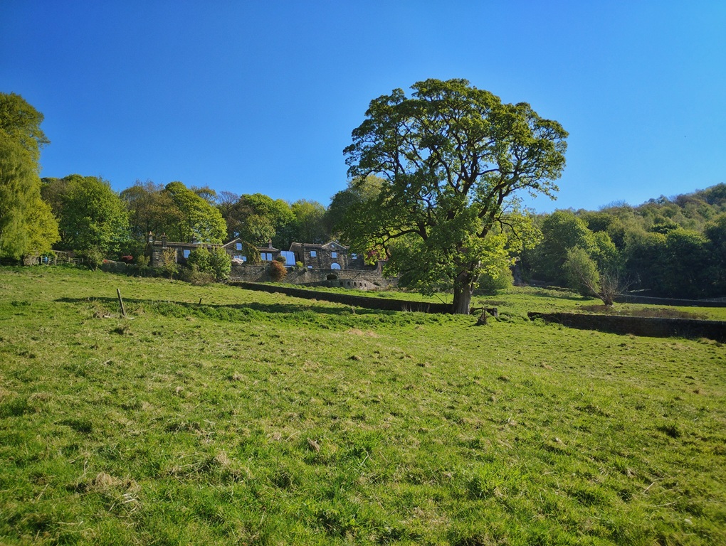
It can feel as though the house, its fields and the woods that swaddle them have always belonged together. Yet, as we have already discovered elsewhere in the clough, a sense of stasis always conceals a continually developing narrative. The stories that a landscape has to tell may contain episodes of dramatic upheaval and change, or long slow centuries of tradition and continuity. Lumb Bank has, in a sense, both.
If we look across the fields sweeping downhill from the house, perhaps the most revealing clue is not what has changed, but what has remained remarkably constant. Compare these fields with those at Eaves Bottom. There, grazing ceased decades ago and the woodland has steadily reclaimed what had once been open pasture and meadow. Here, by contrast, the fields remain open. Sheep still graze them today, just as livestock have done for generations. The landscape itself is already telling us something important: these fields have been grazed in an unbroken tradition since they were created.

Today, most visitors know Lumb Bank as a place of literature rather than agriculture. The poet Ted Hughes bought the house in 1969, and it subsequently became an Arvon Foundation writing centre in 1975. Generations of writers have come here in search of quiet, inspiration and time to work. It is now internationally recognised as a place where stories are crafted. Yet while poems, novels and memoirs have been taking shape inside the house for more than half a century, another quieter continuity has continued outside. The fields have remained fields. The livestock have continued grazing. The rhythms of farming have never entirely disappeared from the landscape surrounding the writers.
Lumb Bank’s literary chapter was preceded by the perhaps even more unexpected episode of the Mansfield family.23 In 1952 Captain Harold Goldsmith Mansfield – then 63, having led an adventurous life, being awarded the Military Cross in 1917,24 and later joining the Canadian Mounted Police25 – discovered the house advertised in the Exchange and Mart. He had been living in Croydon, where he had been breeding mink and coypu in sheds behind his suburban semi-detached house. But he needed more space. He travelled north alone to view Lumb Bank, bought it for £1,700, returned home and moved his family to Colden Clough.
His younger son, Dougie, was only five years old. Many years later he recalled arriving after dark and walking down the lane towards the house, hearing the sound of the Colden Water somewhere below in the darkness. This, he said, was his first memory, and marked the beginning of a wonderful childhood. For his mother Lily, however, the experience of arriving – at 10 o’clock at night, after a 16-hour journey in the removal van – was rather different. Accustomed to suburban south London, she arrived to find a house without electricity, with only cold running water and dry toilets that had to be manually emptied. Years later she admitted to Dougie that she had very nearly taken her children back to London on the first train the very next day.
But the family stayed, and came to love the place. Harold Mansfield gave Lumb Bank an entirely new identity: signs went up pointing the way down the lane to the ‘White Horse Fur and Pony Ranch’. He bred mink and coypu for the first year, but when he brought this enterprise to an end, he donated his stock to Belle View Zoological Gardens in Manchester to feed their lions and tigers. But other sources of income were established when the Mansfields opened a riding school – Dougie would sometimes ride a pony up to school in Heptonstall and tie it up outside – and a tea room for visitors exploring the valley. Even today, faint but still legible through the trees from across the stream, the painted word ‘TEAS’ survives as a small archaeological trace of that remarkable decade.
The details are colourful, even eccentric, but from the perspective of the landscape just one thing mattered: throughout the Mansfield years these fields continued to be grazed.
Whatever else changed, the broad ecological character of its fields remained consistent. The continuity of these fields depended not simply on walls, soils or climate, but on people. Fields remain fields – particularly if they are surrounded by woodland – only while successive generations continue to graze them, repair their boundaries and cut their hay. Most of those lives have left only the faintest traces in the archive. One, however, stands out in remarkable detail. John Henry Clegg’s story deserves telling, not only because it is fascinating in its own right, but because it illustrates how deeply one person’s life could become entwined with the landscape of Colden Clough.
John Henry Clegg was born in 1869 at Windy Harbour, scarcely 300 yards up Green Lane from Lumb Bank.26 His father, Jonathan Clegg, who died aged 54 in 1884, managed Lower Lumb Mill.27 At some stage the family had moved from Windy Harbour to Lumb Bank, for this is where Jonathan was residing with his family when he died, when John Henry was just 14. In July 1895 John Henry married Florence Amy, daughter of a Todmorden chemist, at Christ Church, Todmorden.28 He later re-married, to a Mary Jane Knight, at Todmorden Register Office in 1917.29 They had a daughter, Emma, who was born in 1918.30
Professionally, John Henry occupied an interesting position between agriculture and industry. In 1895 he was elected a member of the Institute of Mechanical Engineers,31 an indication of the respect he had already earned within the textile industry, for he followed in his father’s footsteps and became, around this time, the manager of Lower Lumb Mill, a position he occupied for more than 20 years until it closed.32 He regularly attended the Manchester Cotton Exchange as part of his work, before later establishing himself as a cotton yarn agent.33 One of his obituaries observed that with his death ‘one of the last links with the days when there was industrial activity in the Lumb Valley’ had been broken.34
As well as managing Lower Lumb Mill, which by this time had passed out of the hands of the Sutcliffe family, he acted as estate agent for one of the descendants of its owners, William Sutcliffe, who resided at Sandal House above Lumb Bank; John Henry regularly advertised Sutcliffe’s estate farms and houses to let, including Smithwell House in 193135 and his own birthplace, Windy Harbour, in 1911.36
William Sutcliffe died on 7th April 1923.37 Interestingly, but a fortnight later, an advertisement appeared in the Sheffield Independent, offering ‘a restful holiday in pleasant surroundings at a comfortable West Riding farmhouse’.38 Application was to be made to Mary Clegg. It is the only instance of such an advertisement, so perhaps this idea, which seems to have been waiting for the opportunity presented by the death of the landlord, came to nothing. However, if it was for the sake of additional income, this was soon to be no longer a concern, for in his will, Sutcliffe left John Henry Lumb Bank itself, and ‘all the lands belonging thereto’, including Windy Harbour, Lower Lumb Mill, as well as its warehouse and cottages.39 It was an extraordinary inheritance, placing in John Henry’s hands not simply a house, but much of the landscape whose history we are tracing.

Like many prominent figures in rural communities of the period, John Henry’s life reached into almost every aspect of local society. He chaired concerts for the Heptonstall-slack Mechanics’ Institute Cricket Club;40 served as President of the Homing Society, which met in the Cross Inn, Heptonstall to discuss the ‘average velocity’ of their birds;41 became Vice-President of Sandal Bowling Club under William Sutcliffe’s presidency,42 presenting prizes at its annual gatherings.43 He even won a pigeon-shooting competition at Stubbing Wharf, beating its landlord by four birds to three, and being treated to a supper afterwards.44
During the First World War he acted as recruiting sergeant for Hebden Bridge before serving as quartermaster-sergeant at a prisoner-of-war camp near York.45 He was a Freemason, a sidesman at Heptonstall Church and one of the oldest members of Hebden Bridge’s Conservative (or possibly Constitutional,46 obituaries disagree) Club.47 Newspaper reports repeatedly bring him into view as one of those dependable local figures to whom responsibilities naturally gravitated: giving evidence after a Dawson City navvy rolled a large stone down Lumb Road causing damage to walls and trees,48 or helping evacuated children reunite a stray lamb with its owner during the Second World War.49
Yet alongside all these public roles, John Henry continued farming. The newspapers reveal a capable and enthusiastic smallholder. From at least 1908 he was exhibiting pedigree Yorkshire boars at the Hebden Bridge and Calder Valley Agricultural Society’s annual show in Calder Holmes Park, where his stock won prizes alongside more than a thousand entries of horses, cattle, sheep, poultry, rabbits and produce.50 He repeatedly advertised his prize-winning Large White and Middle White Yorkshire boars for stud,51 their success extending as far as the East Riding County Show.52 Even as late as 1937 he was still advertising nine-week-old store pigs for sale from Lumb Bank.53
By the time the National Farm Survey reached Lumb Bank during the Second World War, however, the holding had become much smaller.54 The survey of June 1941 nevertheless classed John Henry as a full-time farmer. It recorded him as occupying a little over 20 acres, 18 of which was classed as permanent pasture and two and a half as managed for mowing. By this time he had but three cows in calf and a single goat. He estimated the annual rental value (if he had been renting) at £35 and stated that he had occupied the holding for 35 years, placing him as starting farming at Lumb Bank in 1906, at age 36. The surveyor judged the holding rather harshly, grading its management as only moderate and remarking that the farmer appeared to have little interest in increasing production – a reflection perhaps of John Henry’s advancing age rather than any lack of ability.
At the end of his long life, John Henry was living at No. 4 Lumb Bank55 (for Lumb Bank was subdivided into several residences at this time), while his married daughter, Emma Helliwell, occupied No. 5 next door.56 When he died there on 9th July 1949, aged 80, he left an estate valued at £2,385.57 Mary survived John Henry by six years, dying in 1955 at Windy Harbour58 – the house where her husband had first entered the world.
It was a remarkable life, but for our purposes, the most important detail remains simply that John Henry continued farming Lumb Bank’s fields. Through all the changes in his varied life – engineer, mill manager, estate agent, soldier, churchman, Freemason, pig breeder and community leader – he husbanded his cattle, goats and pigs, cut the hay, and kept the boundaries against the woodland in good order. The open landscape we admire today is therefore partly his legacy.
William Sutcliffe was the last of the family that established themselves here after moving down from Stoneshey Gate on the hill above Lumb Bank. Gamaliel Sutcliffe built Upper and Lower Lumb Mills lower down the valley and almost certainly either built or substantially rebuilt Lumb Bank itself. Industry and agriculture developed together.
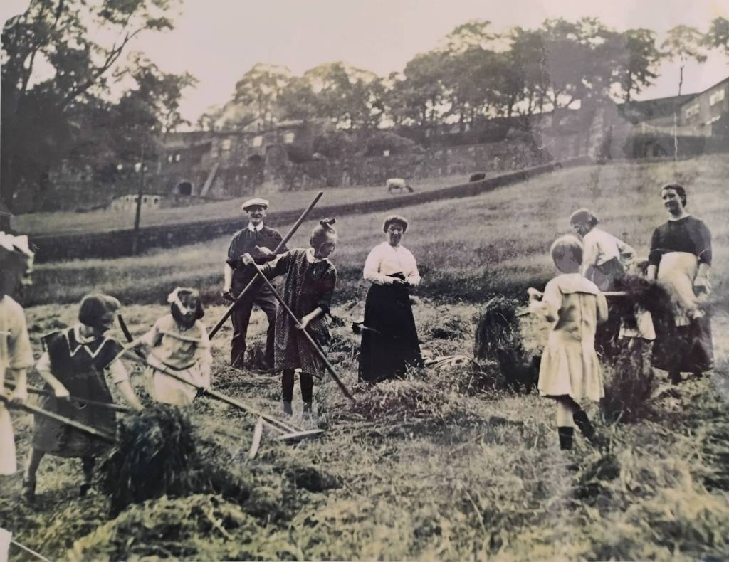
The evidence survives all around us. The beautifully dressed coping stones crowning the dry-stone walls speak of unusual prosperity. This was not one of the poorer farms on the surrounding uplands. The names recorded on the 1820 and 1868 estate plans and the Heptonstall Valuation map of 1835 – Wheat Field, Lime Field, Gold Field, House Meadow and Far Meadow – reveal how carefully every part of the holding was organised and managed. The name ‘Wheat Field’ reminds us that oats were once grown here, as they were on most Calder Valley farms before the practice died out in the mid-19th century. ‘Lime Field’ perhaps records that this land needed crushed lime spread upon it to reduce its acidity, another common practice. The two meadows would have been cut for hay: indeed, it is Far Meadow in which the Cleggs are haymaking in the photograph above. Above the terrace on which Lumb Bank rests, several former estate fields – Sizing (or Singing) Brink, Three Nooked Meadow and Halstead Brink among them – have already succeeded naturally to woodland following the end of grazing.
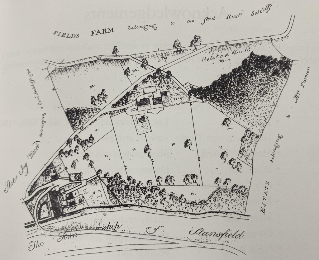
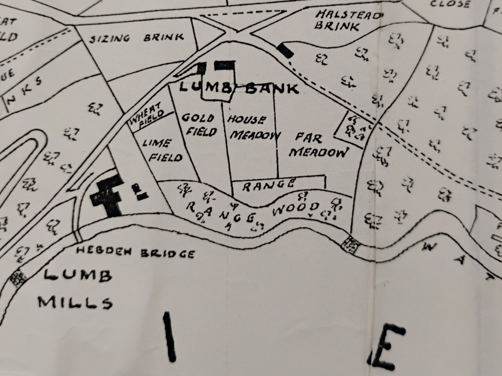
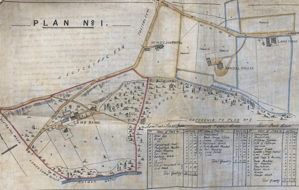
The veteran trees in the fields have been witness to the comings and goings of the generations. The great ash, which has only recently succumbed to ash dieback…

…was already significant enough to be marked individually on the first Ordnance Survey map of 1848 as a field tree.
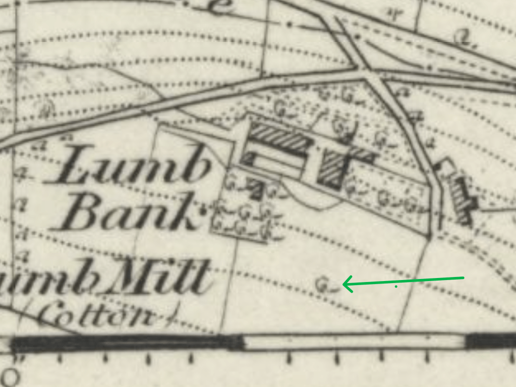
Having stood first as a living field tree for generations, it now begins another ecological chapter as standing deadwood, providing habitat for fungi, beetles and countless other organisms. Even in death, the tree continues participating in the ecology of the place. The continuity of these fields does not mean they have remained entirely unchanged.
Together with the vast sycamore and another ash – sadly also succumbing to dieback – the landscape is lent an almost parkland character quite unlike the more exposed farms higher on the moors.
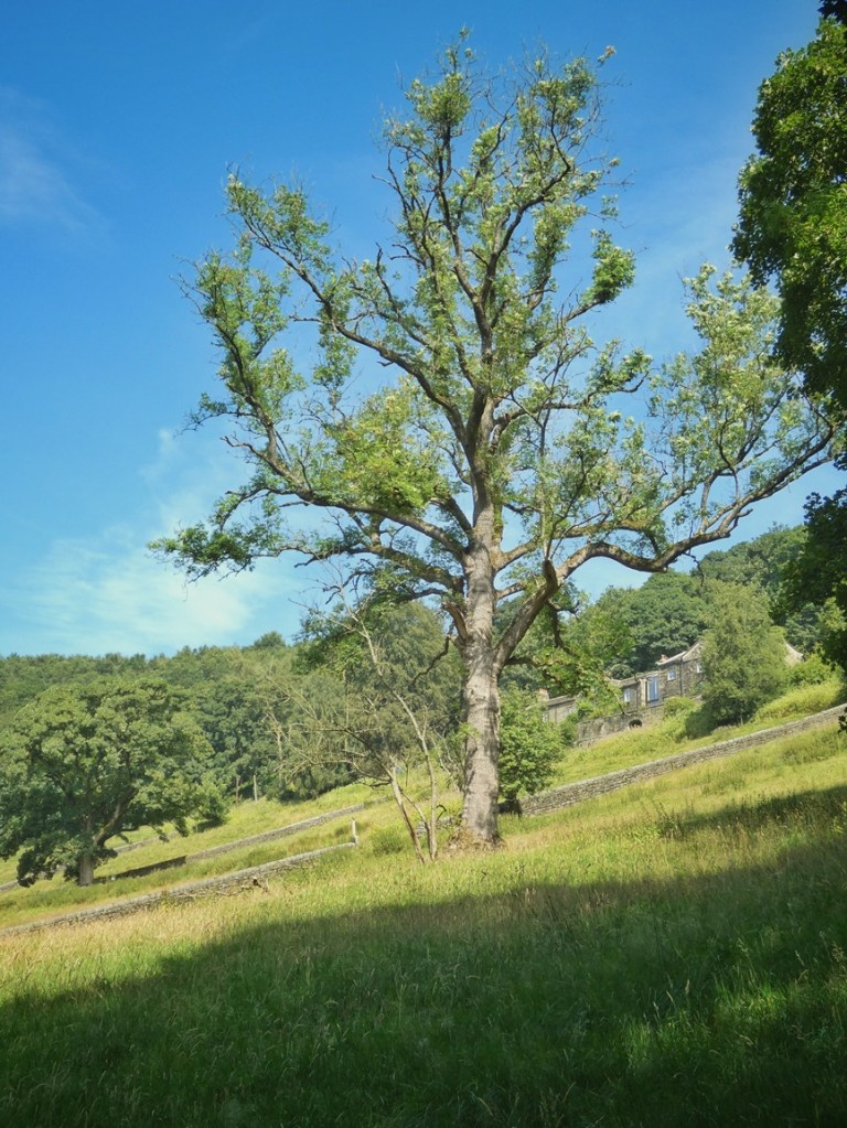
Although the fields are still grazed, the end of haymaking, and the invasion from species like Himalayan balsam, bramble, thistles and docks, mean the fields have become relatively species-poor in places. This, too, is part of the inheritance, presenting current generations with the question of how to shape their own legacy. What kind of fields should these become? Restoring species-rich meadow management could encourage a far greater diversity of grasses, wildflowers, fungi, insects and birds. Around the margins, the recently planted native hedge – more than 2,500 trees including bird cherry, guelder rose, crab apple and spindle – already hints at another future. If managed well, it will itself become an entirely new habitat woven into this much older landscape.
Looking across Lumb Bank today, it would be easy to imagine that little has changed. In reality, everything has changed, except perhaps the one thing that matters most in sustaining the broad character of the landscape. For more than two centuries each generation has inherited these fields, found its own reasons for keeping them open, and passed them on to those who followed. Yet the landscape remains recognisably the same because each generation has, consciously or otherwise, chosen to carry that inheritance forward.
5. The Lumb Mills: Industry Becomes Ecology
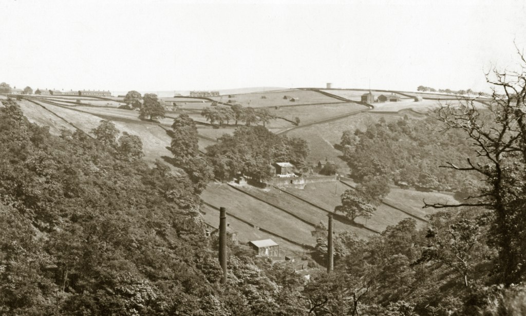
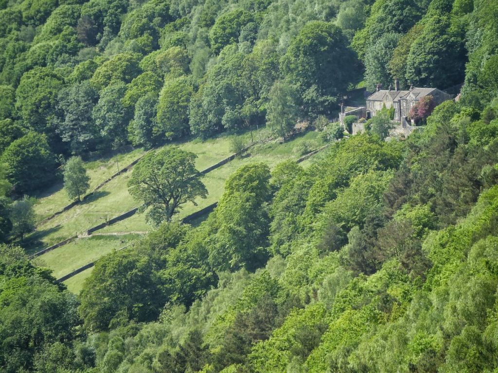
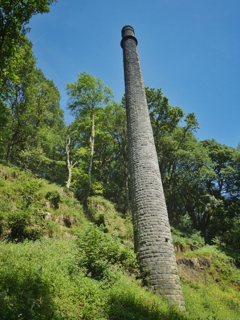
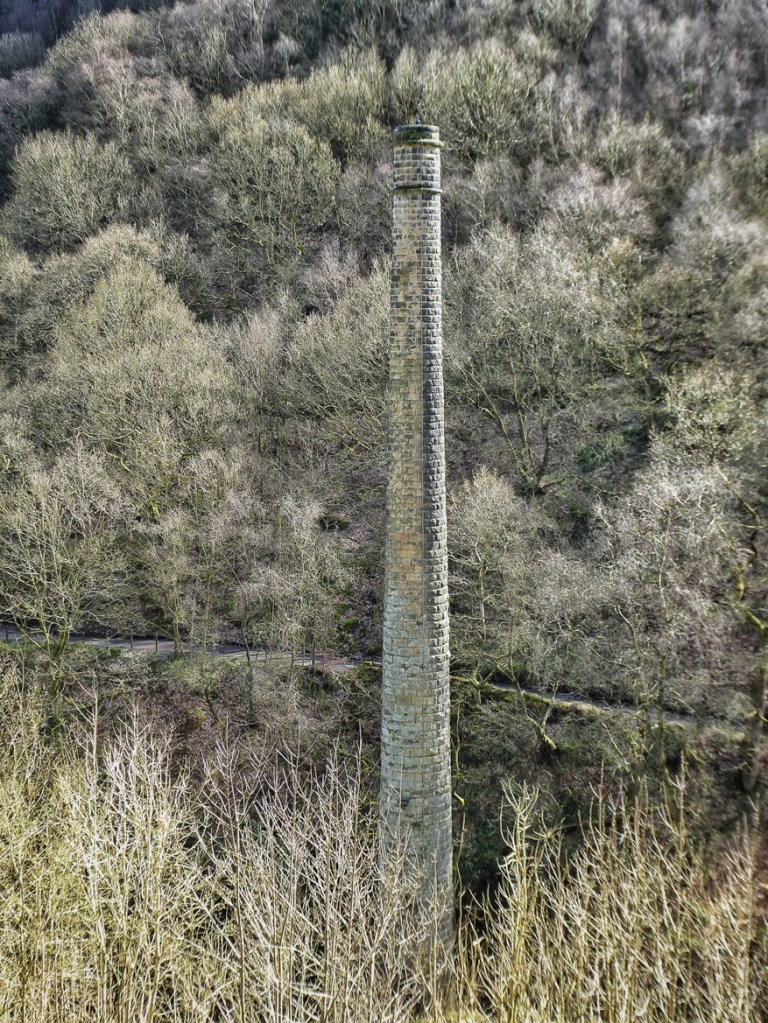
The two chimneys of the Lumb Mills periscope up through the tree like relics of a lost civilisation in a tropical jungle. In their own small way, they are: monuments to an industrial past of this valley whose just sheer clamour is sometimes difficult to conjure into the imagination now. Nature seems to have so comprehensively reclaimed the valley that it’s easy to imagine the chimneys are all that’s left.
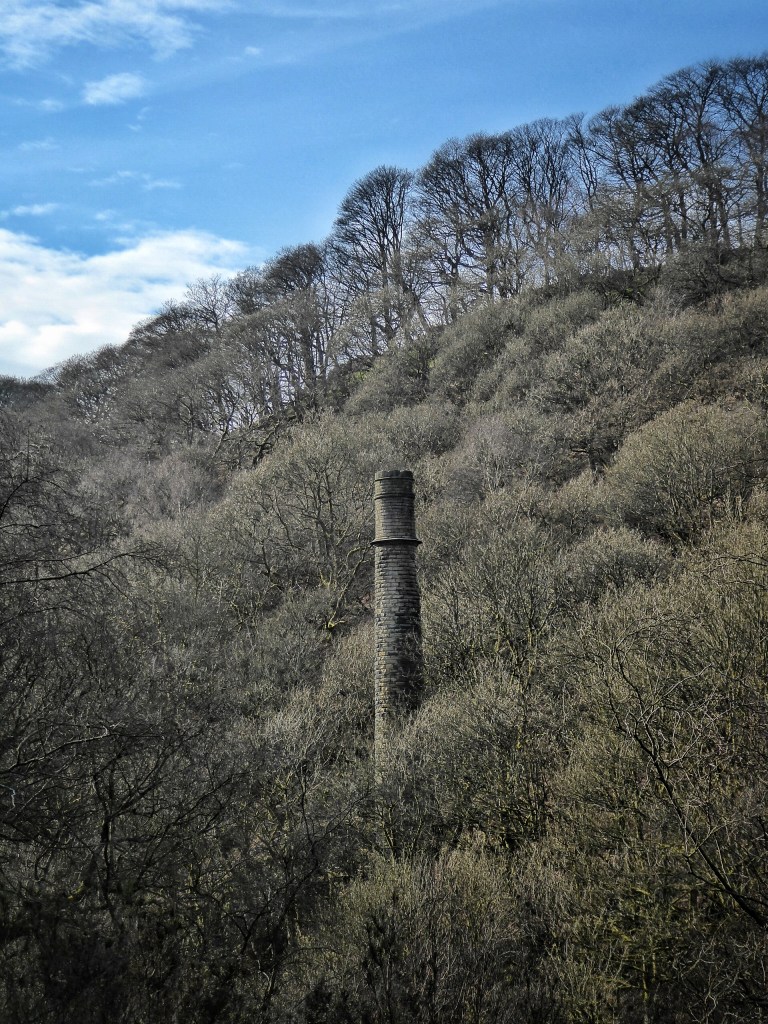
Yet the chimneys are only the most conspicuous survivors. The mills disappeared long ago, but their history did not disappear with them. It became woven into the ecology of the clough. Long after the machinery fell silent and the buildings were swept away, their influence reverberates down through the decades, in the changes they wrought to the river, the woodland, the soils and even the species that live here today.
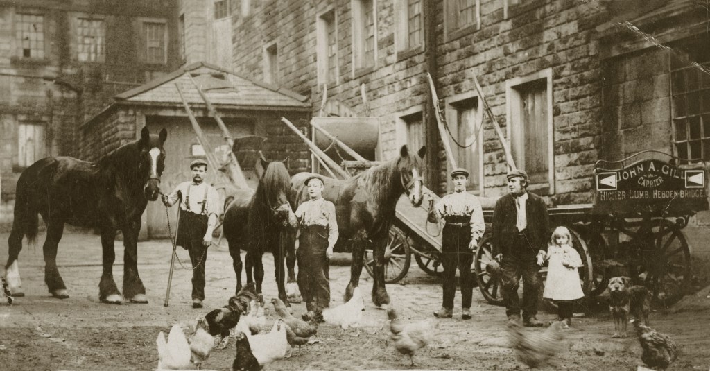
The story of industry in Colden Clough begins higher up the valley. Hudson Mill above Hebble Hole was the earliest to make use of the power of the Colden Water, a medieval corn mill whose origins reach back to at least 1363.59 In the late 18th century came Bob Mill, further downstream, a water-powered cotton spinning mill, until it was largely destroyed by fire in the early years of the 19th century. Its replacement, built by Gamaliel Sutcliffe of Lumb Bank, was Upper Lumb Mill. Soon afterwards he added Lower Lumb Mill. Both were initially water-powered, with Upper Lumb’s mill dams being 300 yards upstream, and Lower Lumb’s hard against the mill itself, but both added steam power to their workings in the 1830s and ‘40s.
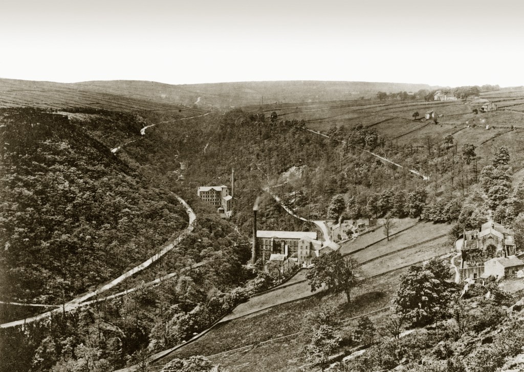
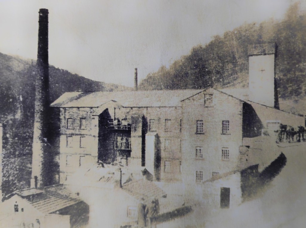
Upper Lumb Mill ceased production in 18766…
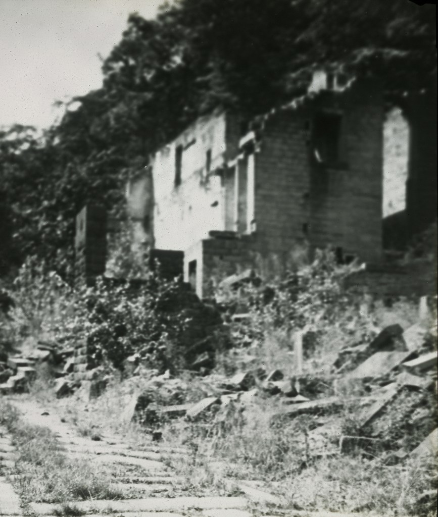
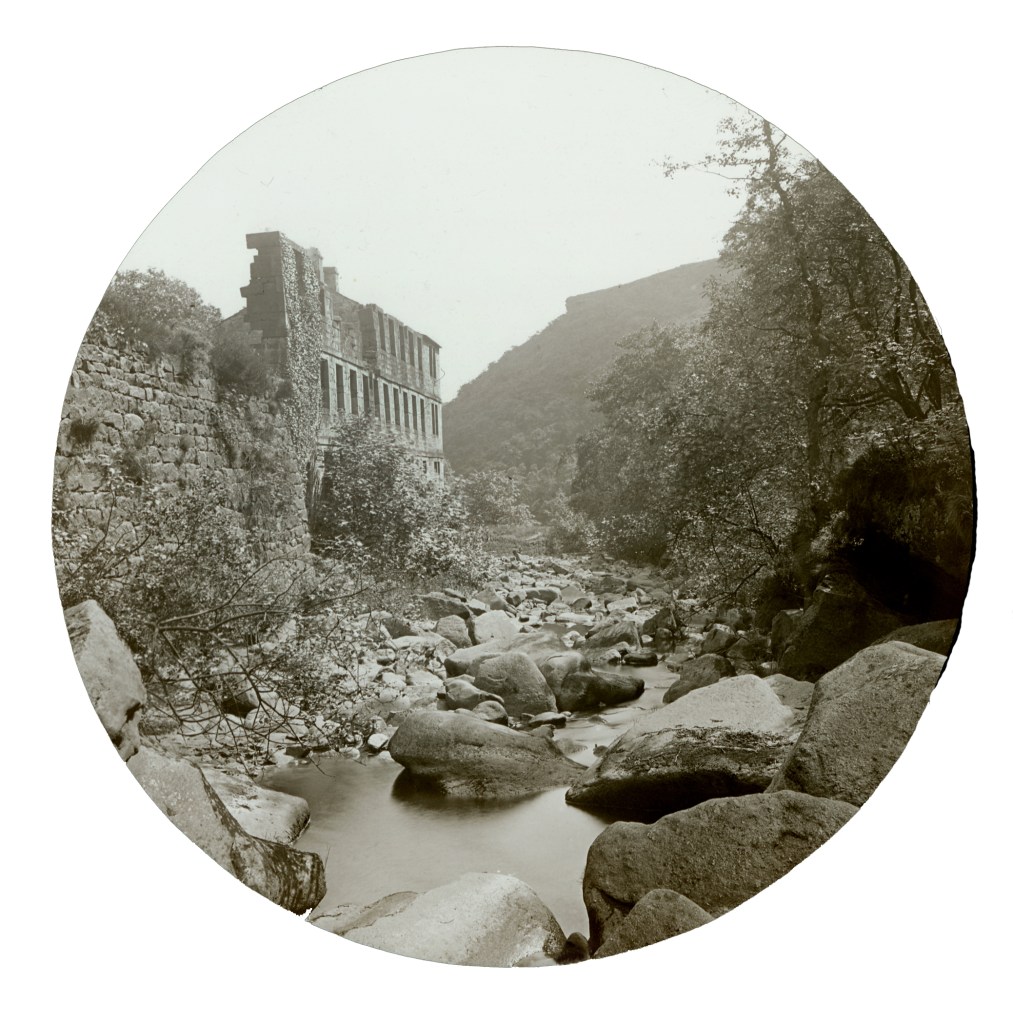
…while Lower Lumb limped some way into the 20th century. John Henry Clegg was still advertising for staff in March 1911,61 but by June 1912 it was put up for sale as a going concern.62 It took until January 1913, after a period of closure, for it to be purchased and resume spinning.63 But the Walsh Brothers’ venture was short-lived, and by April 1915 Lower Lumb was again for sale.64 It took until at least the November of that year to sell,65 and until April 1917 for its demolition to begin, when its ‘Boards, Spars, Joists, Beams, Purlins, Principals, Skylights, Windows, Doors, Slates, Tiles, Flags, Setts, Heads, Sills, Columns’ and all are offered for sale by the Salford firm of C.H. Jones.66 The Halifax Daily Guardian was unsentimental: ‘Since their utility departed the mills have been more or [sic] an eyesore than anything else’ in the Colden Valley.67
The dismantling took well over a year: in August 1918, the chain of a wagon pulled by two horses and loaded with a six-ton, 22 foot-long boiler snapped, and the boiler went ‘full tilt’ into the wall outside St James’s Church, carrying the wall and an electric street lamp away, while the wagon careered into the railings of the vicarage.68
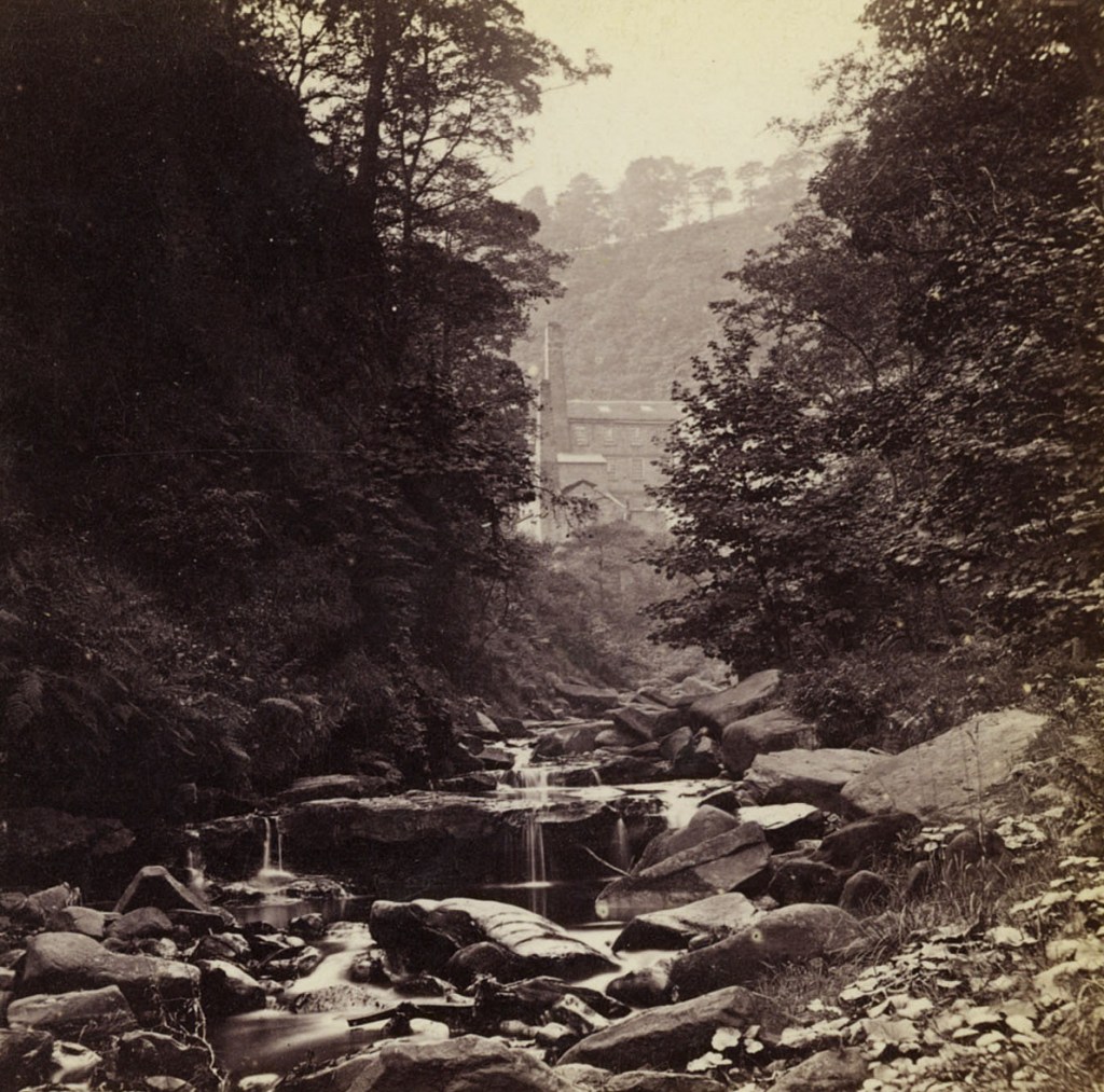
With that mishap, the industrial life of this part of the valley was over. In one sense, therefore, that life was surprisingly brief. But in another, their effects have never really gone away.
One of the most enduring transformations occurred to the river itself. Before the mills arrived, Colden Water simply followed its steep descent through the clough. The mills interrupted that natural movement. Weirs were built across the main channel and water was extracted into mill goits, carrying it first to Upper Lumb Mill and then again to Lower Lumb Mill before returning it to the river downstream. The watercourse became something engineered as well as natural.
Those alterations remain with us today. The weirs continue to present a barrier to the natural movement of fish and other aquatic species. Across Calderdale, the Calder Rivers Trust is now surveying hundreds of these historic structures to understand where restoring more natural river processes might benefit wildlife. Yet even here the story resists simple conclusions. Five miles downstream, several weirs on Luddenden Brook have protected a small population of native white-clawed crayfish from the invasive American signal crayfish.69 As elsewhere in the clough, the ecological legacy is more complicated than simple damage or simple benefit.
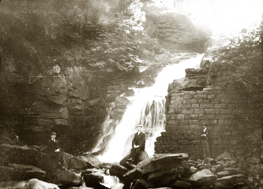
The mills also created habitats that had never previously existed here. In a steep Pennine valley, water naturally rushes downhill. Mill ponds introduced something entirely new: areas of still, standing water. After the mills closed, those ponds gradually silted up, becoming marshy wetlands supporting plants and animals that would otherwise have found no place within the narrow valley. Even industrial infrastructure eventually became ecology.
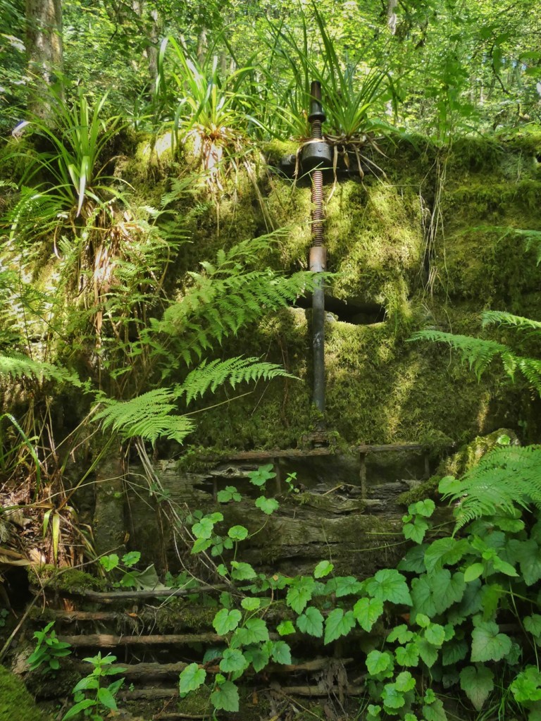
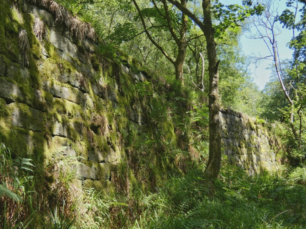
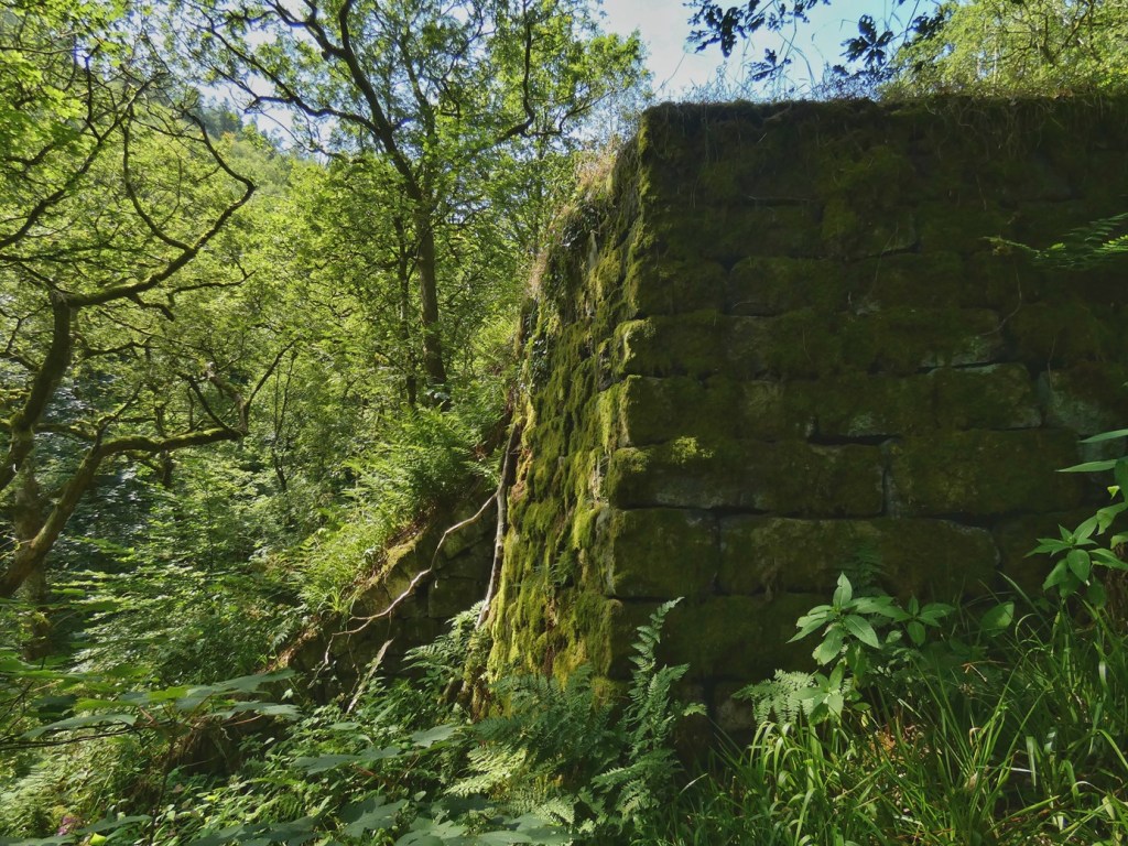
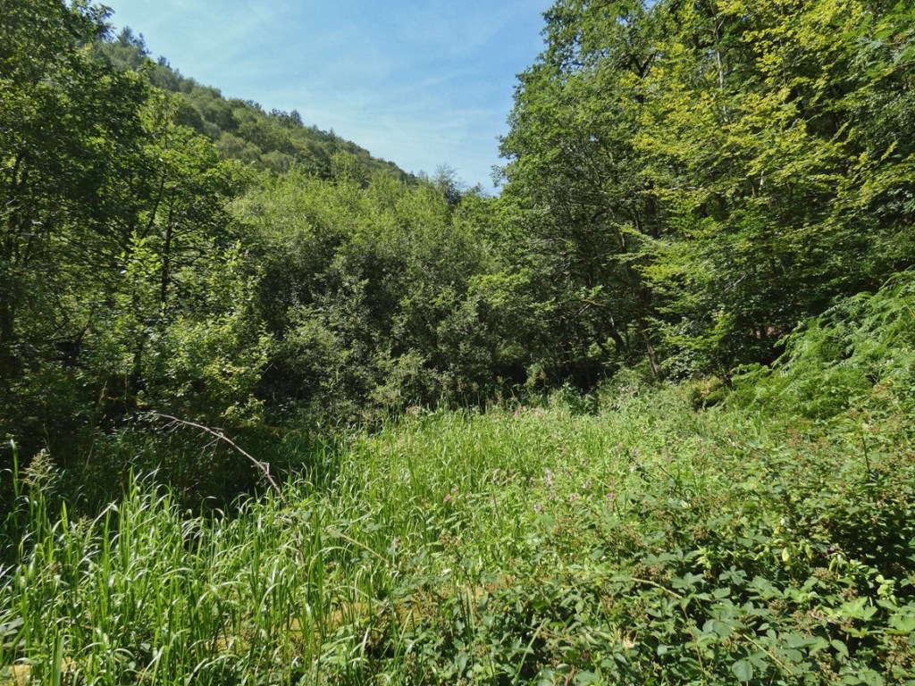
The water itself was altered in another way. Manufacturing processes returned their waste to the river. When some of the downstream mills became dye works, their effluent flowed back into Colden Water before continuing towards the Calder. In 1866, Dr James Fowler, reporting to a Royal Commission, described streams receiving waste from Yorkshire dye works as carrying ‘froth of every conceivable colour and degree of filthiness’. Those words capture something of the environmental pressures that once affected rivers throughout the textile districts.
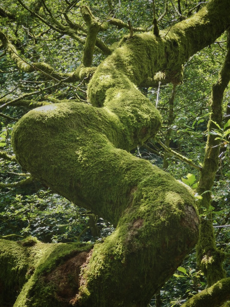
The air changed as well. Although the earliest mills relied upon water power, coal-fired boilers soon supplemented that energy. Smoke and sulphur dioxide filled the narrow valley. Trees grew less vigorously, their growth and habits noticeably stunted in archival photographs. Mosses, liverworts and lichens – among the most sensitive indicators of air quality – declined dramatically.

Here, however, the story also includes recovery. Recent surveys by bryologist Johnny Turner have documented remarkable increases in these groups as atmospheric sulphur dioxide pollution has fallen over recent decades. The woodland still bears the imprint of its industrial past, but it is also demonstrating nature’s capacity for renewal once those pressures are removed.
The mills impacted more than air and water. They transformed the human ecology of the valley as well. Every working day hundreds of people travelled through Colden Clough, descending from Heptonstall, Blackshaw Head, entering the clough from Hebden Bridge, Mytholm and Charlestown. They created and maintained networks of paths through the woodland. They gathered firewood, collected mushrooms and other wild foods, disturbed wildlife and wore tracks into the hillside. Their daily journeys became another ecological force shaping the woodland.
Even the repeated fires that swept through Eaves Wood during the late 19th and early 20th centuries may owe something to that increased human presence. While the precise causes usually went unrecorded, with only suspicions of ‘wanton mischief’, the coincidence is suggestive. More people inevitably brought more opportunities for accidental ignition from dropped lit cigarettes in a landscape that had once been far quieter.
When the mills finally closed, another ecological transformation began. The buildings collapsed, their stonework weathered, and even when mills were demolished, it was usually incomplete and took time. Mill ponds filled with silt. Goits became overgrown. The industrial landscape was quickly reclaimed by the living world it had once displaced. The ruins themselves developed into habitats – vast rockeries – while abandoned watercourses and ponds acquired ecological roles never intended by their builders. What had begun as industrial engineering gradually became part of the ecology of Colden Clough.
That is perhaps the most striking lesson this place offers. It is tempting to think of industry and nature as opposites: one replacing or destroying the other. The history of the Lumb Mills suggests something more subtle. Industry undoubtedly damaged habitats, polluted air and water, and radically reshaped the valley. Yet its remains have themselves become part of the landscape that later generations inherited. Nature has not erased industry, but rather absorbed it.
That understanding leaves us with difficult questions. Should old weirs be removed to restore more natural river processes? Should mill ponds be preserved for the habitats they now support? Should ruins be stabilised, reconstructed or simply allowed to decay? Every choice preserves one inheritance while changing another.
The afterlife of Lower Lumb Mill provides thoughtful answers to those questions. For more than 40 years, Bede has cared for the former Lower Lumb Mill site. He has repaired the surviving chimney, recognising it as an important reminder of the valley’s industrial history, while at the same time restoring the old mill goit to generate hydroelectric power. Water that once drove textile machinery now produces renewable electricity for around 50 homes.
It is a reminder that stewardship is not simply about preserving the past unchanged. Sometimes it means discovering new purposes for old inheritances, allowing a landscape’s history to remain active within its future rather than merely surviving as a memory.
6. Ragley Road: Remembering What Is Lost
Across the landscape of Colden Clough and Lumb Bank, we have been looking for clues that remain physically present in the landscape. Dry-stone walls reveal former fields. Mill chimneys speak of vanished industry. Tracks and trees and tunnels hint at different lives once lived here.
But landscapes preserve another kind of evidence as well. Sometimes the most important clue is not what has survived, but what has disappeared. Silence speaks its own story. Absence is a record of a different kind.
Without the written accounts left by earlier generations, many ecological losses would simply pass unnoticed. We would accept today’s landscape as complete because we would never know what had once been part of it. Fortunately for us, Colden Clough attracted generations of naturalists who carefully recorded what they found, leaving behind another kind of archive – not one of deeds and estate plans and photographs, but of living things now lost.
Throughout the 19th century and well into the 20th, this valley became a celebrated destination for botanists, ornithologists and natural history societies from across Yorkshire and Lancashire. In particular, members of the Halifax Scientific Society and the Natural History Section of the Hebden Bridge Literary and Scientific Society made repeated visits specifically to study the plants and animals that made Colden Clough their home. Their excursions were regularly reported in the Hebden Bridge Times, the Todmorden and District News and other local newspapers, often listing in meticulous detail the species they had encountered. The high point came in May 1930 when the Yorkshire Naturalists’ Union chose to visit Colden Clough, a significant recognition of the valley’s reputation.70
Those reports now read rather differently. Instead of simply celebrating what was found, they have become records of what has since been lost. The bird lists alone tell a remarkable story. Redstarts,71 long-eared owls,72 wood warblers,73 tree pipits,74 spotted flycatchers,75 whitethroats76 and nightjars77 all featured among the species observed here. Even something as apparently ordinary as a flock of 700 starlings speaks to us today of abundance that has largely disappeared.78
The botanical records are equally striking. Adder’s-tongue fern.79 Wintergreen.80 Moonwort.81 Woodsage.82 Toothwort.83 Marsh violet.84 Wood sanicle.85 Lesser spearwort.86 As far as present surveys suggest, all have vanished from the clough.
Had those naturalists not written down what they saw, we would never have known these species had ever lived here. The archive has therefore become a record not only of presence, but of absence.

That knowledge can be a burden. The conservationist Aldo Leopold wrote in 1949 that ‘one of the penalties of an ecological education is that one lives…in a world of wounds’.87 There is something of that feeling here. Once we know what has disappeared, we cannot entirely recover the innocence of seeing only what remains.
Perhaps no story illustrates this more poignantly than the melancholy thistle. For decades this uncommon plant – found only on one site in Calderdale today – grew among the ruins of Bob Mill. It became one of the botanical treasures of Colden Clough, attracting visitors from considerable distances who came specifically to see it.88 Then, in 1967, the ruins were ‘tidied’ by young offenders working under the supervision of a probation officer. They also cleared the vegetation growing among the old masonry. Their intentions were undoubtedly good. Yet with that well-meaning act, the melancholy thistle disappeared from Colden Clough.89 Its loss reminds us that decisions that leave a legacy – of presence or absence, transformation or continuity – are not always made knowingly. Here we left something precious simply because of ignorance.
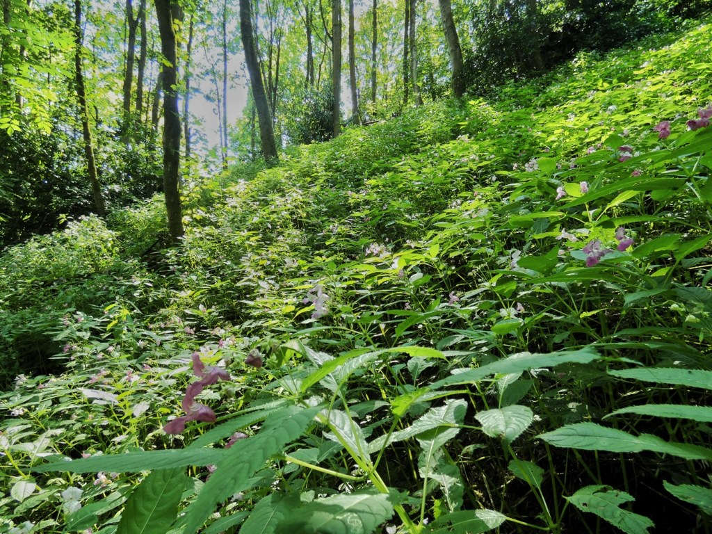
Another botanical mystery emerged from the newspaper archive. Repeated reports referred to the presence of ‘balsam’ growing around the old mill ruins, which along with the melancholy thistle, naturalists were always keen to visit. At first it seemed obvious to me that this must refer to Himalayan balsam, now only too familiar to those who love any of the woodlands and cloughs of the Calder Valley. But one report, in 1938, described it instead as ‘yellow balsam’.90 This species is nowadays known as small-flowered balsam, and like the Himalayan balsam, it is an introduced species. It is is described as growing ‘in great profusion’ in several reports, and interestingly, when the Yorkshire Naturalist Union came to visit, Mr W.A. Sledge, the leader of the botanical section, ‘was impressed…by the prolific way in which an alien balsam was growing amongst the old ruins’, presumably of either or both of Bob Mill and the Lumb Mills.91 But it is not an invasive plant. Indeed, it is specified that it only grows in three distinct places within the clough,92 perhaps just the three mill sites, and it seems to have kept itself to itself for many decades.
Until, that is, 1942, when a country writer that went by the sobriquet ‘Nomad’ and who had a regular column in the Halifax Evening Courier lamented that ‘the other balsam of foreign extraction’, which has a ‘rampant habit’, ‘has found its way into Colden Valley, and the two are in some instances growing side by side’.93
Evidently, the Himalayan balam outcompeted the small-flowered species, although I mentioned this history with workers from Rooting for Change, who are making great strides in removing Himalayan balsam from nearby Rawtonstall Wood, and they mentioned discovering a yellow-flowered balsam there the previous day. Perhaps, hidden somewhere within the clough, a small remnant of this former botanical curiosity still persists.
Why has so much wildlife been lost from the clough? There is unlikely to be a single explanation. Pollution undoubtedly played its part. Yet I cannot help suspecting that the changing structure of the woodland itself is also important. As grazing ended and former fields gradually succeeded to woodland, the clough became increasingly dominated by mature woodland habitat. That undoubtedly benefited many woodland species, while making life more difficult for others that depended upon open grassland, woodland edge or periodically disturbed ground. As we have seen throughout this journey, ecological gains and ecological losses rarely occur separately. One almost always accompanies the other.
Heritage, then, is not only about preserving what survives. It is also about remembering what has disappeared. Recovering those lost stories from our naturalist predecessors deepens our understanding of what we have inherited, even when what has been inherited sadly includes absence itself.
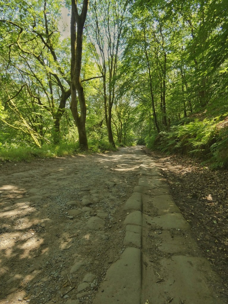
Before returning to natural history, I hope the reader will indulge an excursion into one of my favourite archival habitats: the council meeting. At first glance this will seem little more than a bureaucratic squabble about an obscure country lane – Ragley Road, which is today officially known as Colden Road to its junction with Lumb Road, and Hudson Mill Road thereafter up to Jack Bridge (but locals still know it as Ragley Road, or simply Ragley). In fact, this forgotten administrative argument turns out to have had profound consequences for the ecology, both past and future, of Colden Clough.
In February 1911, Lord Savile removed the toll bar at which he had charged wayfarers for using Ragley Road and replaced it with two walls, one at Lumb Mill, the other at Hudson Mill, entirely blocking traffic.94 He appears to have done so in an attempt to persuade Todmorden Rural District Council to adopt the private road as a public highway, and they obliged him by entering into negotiations. By 8th December, there were high hopes – particularly among Blackshaw Head’s farmers, who used the road to get their produce down to the valley95 – that the road was to be re-opened to vehicular traffic again, and higher hopes still about the future: ‘Once in the hands of the public authority, it is more than likely that this road will be greatly improved and become of considerable public utility. There is a real, and we may say urgent, demand for the road to be restored, as witnessed by a largely-signed memorial from ratepayers, addressed to the Rural District Council.’96
But luckily for the enduring tranquility and ecological health of the Colden Valley we enjoy today, Lord Savile seems to have overlooked the fact that it was not only Todmorden R.D.C. councillors who he needed on board. This is because the parish boundary which separated Todmorden Rural District Council’s area from Hebden Bridge Urban District Council’s, after snaking through Rawtonstall Wood, descends through what was once known as Nursery Wood down to the Milking Bridge, cutting across Ragley Road on the way. This meant that although the lion’s share of the one-and-a-half-mile length of the road was within the Todmorden district, the last 300 yards was in Hebden Bridge’s. It was only the week after the optimism expressed on the 8th December that Basil Lipscombe, Lord Savile’s agent, belatedly wrote to Hebden Bridge U.D.C., asking if it too would be willing to accept the portion of the road in their district.97
The councillors considered the matter and gave their answer at a meeting on 31st January 1912: unlike Todmorden R.D.C., Hebden Bridge’s councillors were unwilling to take responsibility for the road in its present condition. Why the difference in stance, given it was such a short section of road that Hebden Bridge would be taking on compared to Todmorden? A clue lies in an incidental detail earlier in the account of this crucial meeting. It had begun with a report from the Highways and Buildings Committee who had met a few days prior, and the account of that meeting, heard by the councillors just before they were asked to consider Lord Savile’s offer, included a report from the Surveyor that likely spooked them – that a ten-yard-long, two-yard-wide section of Ragley Road, along with its retaining road wall, had collapsed and fallen into the clough the previous week.98 With that report fresh in their mind, the answer was ‘no’.
By the following year, their position had hardened: the road must be ‘paved, sett, and channelled, and a sufficient road-retaining wall built’ before they would consider taking responsibility.99 Todmorden R.D.C. were so dismayed at the obstacle presented by Hebden Bridge’s position that proposals for an alternative route from the tops to the valley from Hippins Bridge, down through Jumble Hole Clough to Cow Bridge, were considered,100 while they continued petitioning Hebden Bridge’s councillors.101 Blackshaw Parish councillors even began manoeuvring behind the scenes, securing what they thought was an undertaking from Lord Savile to hand over the road to Todmorden R.D.C. regardless of opposition from Hebden Bridge, but in the end, he was unwilling to do so in the absence of full agreement.102
The issue occasionally resurfaced through the 1920s and ‘30s, and so it had not been forgotten come August 1947 when the succeeding Lord Savile offered Dill Scout’s Wood – which clothes all the western side of the valley opposite Eaves Wood, and curves around on the southern side of the upper clough – to Hepton Rural District Council for ‘preservation as an open space’.103 (This was a year before he offered Hardcastle Crags to Hepton R.C. and the National Trust.) As we discovered at the beginning of our journey, the Council acquired much of the Eaves Bottom Estate in order to build housing, almost accidentally becoming custodians of large areas of woodland on the eastern side of the valley, which they saw principally then as ‘pleasure grounds’. But here they were being offered the western side of the valley as well.
But almost disastrously, no doubt with the previous 40 years of debate concerning the road in mind, the council decided for the time being that ‘having regard to the high cost of the maintenance of the road involved, the offer be not accepted.’104 It was moved, instead, to approach West Riding County Council to request that they accept responsibility for the road, but again luckily, they did not consider it ‘sufficient public utility’ to take over,105 and the gift was eventually, after long discussion, accepted regardless.106

Looking back, it is remarkable how contingent the history of the clough proved to be. Had Lord Savile’s proposals succeeded in 1911, this quiet valley might today carry a metalled public road from Hebden Bridge to Blackshaw Head. The tranquillity that now characterises the upper clough would instead be punctuated by passing traffic, engine noise and exhaust fumes. Wildlife would contend not only with habitat fragmentation but with road mortality and constant disturbance. The naturalists who came here in search of rare plants, and the walkers who now come seeking peace, would have encountered a very different place. Historical ecology reminds us that landscapes are shaped not only by deliberate acts of stewardship but also by contingency and chance.
Returning to the careful observation established by those early-20th-century naturalists, this tradition gradually evolved into modern conservation. In the 1990s Calderdale Council – finding themselves in possession of almost the entirety of Colden Clough through historical contingency – recognised its ecological importance by designating it as the district’s first Local Nature Reserve. That achievement was itself another historical legacy.
Today that tradition continues. The Friends of Colden Clough are the successors to those earlier naturalists. Like them, they begin by paying close attention to the landscape: observing, recording, learning. But observation now leads directly into stewardship. The questions are no longer only ‘What lives here?’ but ‘What should we protect?’ and ‘How should we care for what we have inherited?’
One of those contemporary challenges concerns the very plant whose story we have told in this chapter: Himalayan balsam. Together with rhododendron, it has become part of Colden Clough’s ecological history, and its management will help determine the next chapter. Just as previous generations unknowingly shaped the landscape we inherited, our own decisions will become part of the ecological legacy passed to those who come after us.
An Ending, and a Beginning: The Ecology of Meaning
At the end of this journey through Colden Clough, even though the landscape will not have changed, perhaps how we look at it might have shifted. The recreation ground is no longer simply a playing field, but a capped refuse tip which culverted the river and buried fields, and hosted generations of childhoods. The woodland is no longer simply ancient woodland, but the product of forestry, industry, fire and regeneration. The open fields below Lumb Bank speak not only of pastoral tranquillity but of generations of graziers, traditional and innovative, that have held the woodland at bay. The mill chimneys are no longer isolated relics but part of an ecological story that continues long after the looms fell silent. We might even be aware of absences – of silences and spaces in the ecology – through the knowledge, bequeathed to us by naturalists long passed, of species that no longer find a home here.
The landscape has, I hope, become more legible, more intelligible, more meaningful. That, ultimately, has been the purpose of this essay, and of the project as a whole. Not to provide a complete history of Colden Clough, for no single account ever could, but to demonstrate one way of reading a place that might be familiar: recognising it as a living archive in which ecological and historical processes have become inseparably entwined.
Such a reading does not produce simple conclusions. On the contrary, it often reveals greater complexity. The same field may be understood simultaneously as a recovering woodland and a disappearing meadow. The same industrial remains may represent environmental damage and be celebrated as cultural heritage. Different stories reveal different meanings, and different meanings lead thoughtful people towards different visions of the future.
Rather than eliminating disagreement, a richer understanding enlarges it. Yet it also makes that disagreement more generous. We become less certain that there is only one correct way to care for a place, and more willing to recognise that cherished places may embody many kinds of value at once.
Every landscape is an inheritance. There are no blank maps, no terrae incognitae. The ecologies we live among are a consequence of decisions made by countless predecessors. Some were wise, some short-sighted; most simply responded to the circumstances of their own time. We inherit ancient woodland and planted woodland, restored meadows and neglected fields, mill ruins and nature reserves, losses as well as that which has been salvaged, or just accidentally survived or unexpectedly thrived. Our task is not merely to admire that inheritance, nor merely to preserve it unchanged. Our task is to weave our own stories into it, and to hand it on.
The Friends of Colden Clough, Calderdale Council’s countryside team, the staff and visiting writers at Lumb Bank, local residents, visitors, conservationists, historians and land managers are all participating in the next chapter of this landscape’s story. Their decisions, like those of the generations before them, will one day become part of the ecological legacy inherited by those who follow. Our hope is that it will be a legacy of a landscape richer in wildlife and greater in ecological diversity, and one in which we continue to learn how to share this place more generously with our more-than-human neighbours.
The story, in other words, has never really been about the past. It has always been about the future.
Acknowledgements
I am grateful to Helen Meller, Co-Director of Arvon Lumb Bank, for commissioning this Heritage Detective project, and to the National Lottery Heritage Fund for making it possible through their generous funding.
It has been a pleasure to work alongside the Friends of Colden Clough, whose enthusiasm, knowledge and encouragement have enriched the project from beginning to end. Particular thanks go to Robin Howarth, Bede Mullen, Sally Barker, Peter Edwards, Aidan Thimmaya, Anna Tyler and Dervila O’Brien. I am also grateful to everyone who took part in the two walking workshops and the public heritage walk, contributing their memories, observations and questions along the way.
Peter Edwards has transformed my original (myopic) vision for the online Heritage Trail into something far better than I had imagined, and I am deeply appreciative of the time, skill and care he has devoted to it.
My thanks also go to Bede Mullen for generously lending me his invaluable collection of documents and photographs relating to Lower Lumb Mill.
Finally, I owe a debt of gratitude, as I have on many projects, to Ann Kilbey of the Pennine Heritage Digital Archive, who once again provided the historic images that have helped bring the story of Colden Clough to life.
Footnotes
1. Halifax Evening Courier. 10th January 1908, p. 4.
2. Halifax Daily Guardian. 30th August 1918. ‘The Eaves Bottom Estate’, p. 2.
3. Todmorden & District News. 20th February 1920. ‘The Eaves Bottom Estate’, p. 7 & Leeds Mercury. 26th October 1922. No title, p. 3.
4. Uttley, Jack. 1997. The Colden Valley, with reference to the Early Textile Industry. 10 King Street, Mytholmroyd, Hebden Bridge: Jack Uttley, pp. 7–8, 11.
5. Shipley Times and Express. 23rd March 1906. ‘Historic Sketches, by “A Border Tyke”’, p. 2.
6. Todmorden & District News. 20th February 1920. ‘The Eaves Bottom Estate’, p. 7.
7. Uttley, Jack. 1997. The Colden Valley, with reference to the Early Textile Industry. 10 King Street, Mytholmroyd, Hebden Bridge: Jack Uttley, pp. 5–11.
8. Todmorden & District News. 20th February 1920. ‘The Eaves Bottom Estate’, p. 7.
9. Todmorden Advertiser and Hebden Bridge Newsletter. 11th March 1932. ‘Notes and Comments’, p. 4.
10. Todmorden & District News. 6th January 1933. ‘Hebden Bridge in 1933: A Difficult Year’, p. 2.
11. Uttley, Jack. 1997. The Colden Valley, with reference to the Early Textile Industry. 10 King Street, Mytholmroyd, Hebden Bridge: Jack Uttley, p. 10.
12. Newsam, Thomas. 1835. Plan of the township of Heptonstall. 6 chains: 1 inch. Hebden Bridge Local History Society Archive. MP 85 LT & Iredale, Ann. 1957. Plan of the township of Heptonstall based on an original survey by Thomas Newsam of Leeds in 1835. Hebden Bridge Local History Society Archive. MP 85 T.
13. Wyatt, Justine. 2007. Power in the Landscape: Water-powered Mills in the Upper Calder Valley. Hebden Bridge: Alternative Technology Centre.
14. Goddard, Christopher. 2016. The West Yorkshire Woods, Part I: The Calder Valley: a hand-drawn guide to walking and exploring the woodlands in the borough of Calderdale. Hebden Bridge: Gritstone Publishing Co-operative.
15. Todmorden & District News. 20th February 1920. ‘The Eaves Bottom Estate’, p. 7.
16. Leeds Mercury. 26th October 1922. No title, p. 3. (My emphasis)
17. Todmorden Advertiser and Hebden Bridge Newsletter. 12th October 1888. ‘Extraordinary Case of Suicide at Hebden Bridge: Coroner’s Inquest’, p. 3.
18. Halifax Guardian. 1st August 1868. ‘The Moor Fires’, p. 6.
19. Todmorden Advertiser and Hebden Bridge Newsletter. 7th May 1886. ‘Wanton Mischief’, p. 5.
20. Todmorden & District News. 5th July 1889. ‘Mischief’, p. 5.
21. Todmorden & District News. 1st July 1921. ‘Moor and Woodland Fires’, p. 1.
22. Hebden Bridge Times. 23rd May 1980. Families flee as beauty spots burn’, p. 9.
23. All details, except where referenced otherwise, are drawn from the following oral history interview with Dougie Mansfield conducted by Tony Wright: ‘Dougie Mansfield’. 2010. Wild Rose Heritage and Arts. Available at https://wildrosearts.net/interviews-and-storytelling/interviews/1940-1949/dougie-mansfield
24. Evening Star. 17th August 1917. ‘Military Cross’, p. 1.
25. Personal conversation with Vicky Mansfield, Dougie’s daughter, and Lily and Harold’s granddaughter.
26. Todmorden & District News. 18th July 1949. ‘Obituary: Mr John Henry Clegg’, p. 4.
27. Todmorden Advertiser and Hebden Bridge Newsletter. 12th December 1884. ‘Sudden Death of Mr Jonathan Clegg’, p. 5.
28. Todmorden Advertiser and Hebden Bridge Newsletter. 5th July 1895. ‘Marriages’, p. 4.
29. Todmorden & District News. 3rd August 1917. ‘Marriages’, p. 2.
30. Groves, David. 2000. Lumb Bank: a brief history. Hebden Bridge, no page numbers.
31. Hebden Bridge Times. 7th May 1897. ‘Heptonstall’, p. 5.
32. Halifax Evening Courier. 11th July 1949. ‘Former Mill Manager: Death of Hebden Bridge Octogenarian’, p. 3.
33. Halifax Evening Courier. 11th July 1949. ‘Former Mill Manager: Death of Hebden Bridge Octogenarian’, p. 3.
34. Todmorden & District News. 18th July 1949. ‘Obituary: Mr John Henry Clegg’, p. 4.
35. Burnley Express. 22nd July 1931. ‘To Be Let’, p. 4.
36. Hebden Bridge Times. 11th August 1911. ‘To Be Let’, p. 4.
37. Halifax Evening Courier. 13th June 1924. ‘Many Legacies’, p. 4.
38. Sheffield Independent. 23rd April 1923. ‘Seaside and Country Apartments’, p. 2.
39. Halifax Evening Courier. 13th June 1924. ‘Many Legacies’, p. 4.
40. Todmorden & District News. 29th November 1901. ‘Cricket Club Concert’, p. 5.
41. Todmorden & District News. 9th March 1906. ‘Homing Society’, p. 8.
42. Todmorden & District News. 17th December 1909. ‘Sandal Bowling Club’, p. 8.
43. Todmorden & District News. 31st May 1912. ‘Bowling’, p. 7.
44. Hebden Bridge Times. 27th January 1911. ‘Pigeon Shooting’, p. 3.
45. Halifax Evening Courier. 11th July 1949. ‘Former Mill Manager: Death of Hebden Bridge Octogenarian’, p. 3.
46. Todmorden & District News. 18th July 1949. ‘Obituary: Mr John Henry Clegg’, p. 4.
47. Halifax Evening Courier. 11th July 1949. ‘Former Mill Manager: Death of Hebden Bridge Octogenarian’, p. 3.
48. Todmorden Advertiser and Hebden Bridge Newsletter. 7th July 1905. ‘A Dangerous Practice’, p. 8.
49. Todmorden & District News. 25th April 1941. ‘Kindness to Animals’, p. 2.
50. Todmorden & District News. 5th June 1908. ‘Agricultural Show at Hebden-Bridge’, p. 3.
51. Todmorden & District News. 6th November 1908. ‘Public Notices’, p. 4.
52. Hebden Bridge Times. 6th January 1911. ‘At Stud’, p. 2.
53. Halifax Evening Courier. 28th October 1937. ‘Horses, Livestock, Vehicles, &c.’, p. 2.
54. National Farm Survey 1941–43. Available to view at the Hebden Bridge Local History Society archives at the Birchcliffe Centre, Hebden Bridge.
55. Todmorden & District News. 18th July 1949. ‘Deaths’, p. 2.
56. Halifax Evening Courier. 7th March 1950. ‘Local Wills’, p.3.
57. Halifax Evening Courier. 7th March 1950. ‘Local Wills’, p.3.
58. Halifax Evening Courier. 21st January 1955. ‘Mrs M.J. Clegg’, p. 8.
59. Wyatt, Justine. 2007. Power in the Landscape: Water-powered Mills in the Upper Calder Valley. Hebden Bridge: Alternative Technology Centre, p. 23.
60. Wyatt, Justine. 2007. Power in the Landscape: Water-powered Mills in the Upper Calder Valley. Hebden Bridge: Alternative Technology Centre, p. 19.
61. Hebden Bridge Times. 24th March 1911. ‘Wanted’, p. 4.
62. Yorkshire Post and Leeds Intelligencer. 15th June 1912. ‘As a Going Concern’, p. 3.
63. Bradford Daily Argus. 17 January 1913. ‘Northern Brevities’, p. 6.
64. Todmorden & District News. 9th April 1915. ‘Sales by Auction’, p. 4.
65. Manchester Courier. 13th November 1915. ‘To Be Let’, p. 2.
66. Yorkshire Post and Leeds Intelligencer. 26th April 1917. ‘Miscellaneous, Furniture, &c.’, p. 2.
67. Halifax Daily Guardian. 13th April 1917. ‘An Old Hebden Bridge Mill to Disappear’, p. 3.
68. Halifax Daily Guardian. 23rd August 1918. ‘Alarming Boiler Accident at Hebden Bridge’, p. 2.
69. Environment Agency. 2022. ‘Population of endangered native species thriving in Yorkshire’. Available at https://www.gov.uk/government/news/population-of-endangered-native-species-thriving-in-yorkshire
70. Halifax Evening Courier. 19th May 1930. ‘Naturalists in Colden Valley’, p. 3.
71. Todmorden & District News. 12th May 1911. ‘Ramble in Colden Valley’, p.5.
72. Todmorden Advertiser and Hebden Bridge Newsletter. 16th May 1930. ‘Yorkshire Naturalists’ Union: What to See in Hebden Bridge’, p. 2.
73. Hebden Bridge Times. 15th May 1987. ‘Seeking Colden’s Secrets’, p. 5.
74. Todmorden Advertiser and Hebden Bridge Newsletter. 16th May 1930. ‘Yorkshire Naturalists’ Union: What to See in Hebden Bridge’, p. 2.
75. Todmorden & District News. 3rd June 1960. ‘Natural History Society’, p. 6.
76. Todmorden Advertiser and Hebden Bridge Newsletter. 16th May 1930. ‘Yorkshire Naturalists’ Union: What to See in Hebden Bridge’, p. 2.
77. Todmorden & District News. 3rd June 1960. ‘Natural History Society’, p. 6.
78. Halifax Evening Courier. 6th July 1927. ‘Halifax Scientific Society: Natural History Section’s Week-end’, p. 3.
79. Todmorden & District News. 9th July 1909. ‘Found in Colden Clough’, p. 5.
80. Todmorden & District News. 24th March 1933. ‘Literary and Scientific Society: The Colden Valley Survey’, p. 8.
81. Halifax Daily Guardian. 16th July 1908. ‘Halifax Naturalists’, p. 5.
82. Todmorden Advertiser and Hebden Bridge Newsletter. 16th May 1930. ‘Yorkshire Naturalists’ Union: What to See in Hebden Bridge’, p. 2.
83. Todmorden & District News. 25th April 1958. ‘Natural History Society’, p. 4.
84. Todmorden & District News. 3rd June 1960. ‘Natural History Society’, p. 6.
85. Halifax Daily Guardian. 16th July 1908. ‘Halifax Naturalists’, p. 5.
86. Halifax Daily Guardian. 16th July 1908. ‘Halifax Naturalists’, p. 5.
87. Leopold, Aldo. 1949. A Sand County Almanac. Oxford: Oxford University Press.
88. Halifax Daily Guardian. 24th July 1907. ‘Halifax Naturalists’ Ramble’, p. 4.
89. Uttley, Jack. 1997. The Colden Valley, with reference to the Early Textile Industry. 10 King Street, Mytholmroyd, Hebden Bridge: Jack Uttley, pp. 18–19.
90. Halifax Evening Courier. 3rd August 1938. ‘Naturalists’ Ramble’, p. 5.
91. Yorkshire Post and Leeds Intelligencer. 19th May 1930. ‘Naturalists visit Colden Valley’, p. 12.
92. Halifax Daily Guardian. 16th July 1908. ‘Halifax Naturalists’, p. 5.
93. Halifax Evening Courier. 18th September 1942. ‘A Country Note’, p. 2.
94. Hebden Bridge Times. 3rd February 1911. ‘Ragley Road’, p. 5.
95. Todmorden & District News. 8th February 1918. ‘Wanted: A Better Approach to Blackshaw Farms’, p. 3.
96. Hebden Bridge Times. 8th December 1911. ‘A Closed Road’, p. 4.
97. Todmorden & District News. 22nd December 1911. ‘Proposed Dedication of Ragley Road’, p. 6.
98. Todmorden & District News. 2nd February 1912. ‘Hebden Bridge U.D. Council’, p. 7.
99. Todmorden & District News. 31st January 1913. ‘Hebden Bridge U.D. Council’, p. 6.
100. Todmorden & District News. 10th January 1919. ‘Rural District Council’, p. 4.
101. Todmorden & District News. 16th April 1920. ‘Rural District Council’, p. 8.
102. Todmorden & District News. 14th May 1920. ‘Rural District Council’, p. 8.
103. Halifax Evening Courier. 21st August 1947. ‘Dill Scout Wood Offered to Hepton Council’, p. 4.
104. Todmorden & District News. 16th January 1948. ‘Housing in Rural District’, p. 4.
105. Todmorden & District News. 17th July 1948. ‘Lighting in Hepton Rural District’, p. 2.
106. Halifax Evening Courier. 20th May 1948. ‘Rural Council’s Move for Preservation’, p. 3.
Bibliography
Burrows, Rebecca, Alison Montgomery and Harriet Still. 2026. Lumb Bank: Conservation Management Plan: A Storied House in a Heritage Landscape. Donald Insall Associates. Available at https://storymaps.arcgis.com/stories/ecb5bd2f7dd54a79ba02c51e57e57e5b
Flynn, Charles. 2004. Colden Clough Wildlife Survey.
Goddard, Christopher. 2021. The West Yorkshire Woods, Part I: The Calder Valley: a hand-drawn guide to walking and exploring the woodlands in the borough of Calderdale. Second edition. Hebden Bridge: Gritstone Publishing Co-operative.
Groves, David. 2000. Lumb Bank: a brief history. Hebden Bridge.
Leopold, Aldo. 1949. A Sand County Almanac. Oxford: Oxford University Press.
Uttley, Jack. 1997. The Colden Valley, with reference to the early textile industry. Hebden Bridge.
Wyatt. Justine. 2007. Power in the Landscape: Water-powered Mills in the Upper Calder Valley. Hebden Bridge: Alternative Technology Centre.
Records, maps, archives, websites, photographs
British Newspaper Archive, through which I have accessed newspaper articles from, among others, the Halifax Evening Courier, Todmorden & District News, Yorkshire Post and Leeds Intelligencer, Leeds Mercury, Todmorden Advertiser and Hebden Bridge Newsletter and the Halifax Daily Guardian
National Farm Survey 1941–43
Ordnance Survey Maps, viewable at the National Library of Scotland map images site, Six-inch maps 1842–1952 (https://maps.nls.uk/os/6inch-england-and-wales/), 25-inch maps 1841–1952 (https://maps.nls.uk/os/25inch-england-and-wales/)
Pennine Heritage Digital Archive, https://penninehorizons.org/
Power in the Landscape, powerinthelandscape.co.uk
Wild Rose Heritage and Arts, https://www.wildrosearts.net/
All uncredited photos are my own.

