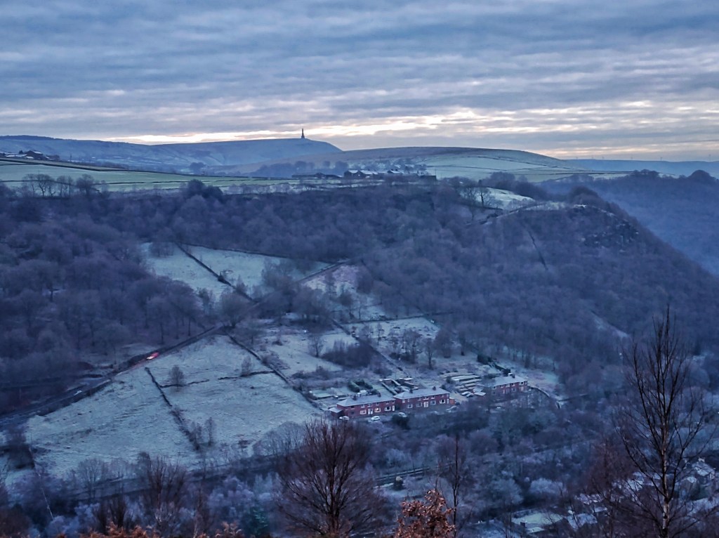
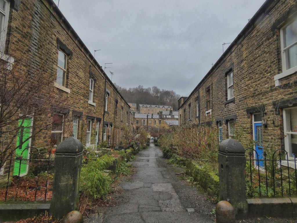
Winter’s first foray has one more day to offer. The birch are once more feathered with frost, shining in the glare of the low sun, until a haze softens the vividness of the day into a dusk of pastel shades. The woods that basked and defrosted in the sun blacken as the gloom deepens, those which spent the day in the shadowed sinews of the valley are still ashy with ice. The tractor-gritters are out in force from Far Shawcroft Farm, but they have not made it up the relentlessly steep lane to Horsehold yet, so the post van must make a dash for it even as the glitter of new frost forms in its headlights. Deliveries made, back down it comes, only to turn up to Weasel Hall, re-built at the Reverend James Armitage Rhodes’ insistence when the original had to make way for a tunnel for the new railway.
Above Hell Hole Rocks, below the allotments on Whins Lane, a four-way wary stand-off is taking place: a cat squats on a wall, glaring at a crow retching out insults from a willow, while a hapless pheasant clucks its discomfort at being caught in the middle and a pair of roe does periscope up through the withering weeds. A wren and a robin are similarly offended at each other’s presence beside the bench on the slope of the Whins, clicking their similar alarm calls with displeasure, while a blackbird ‘pinks’ at a cat in Granny Wood further down the hill. The blue flicker of an ambulance threads its way down the valley from Todmorden on its way to Halifax, and its shrill siren briefly drowns out these discontents.
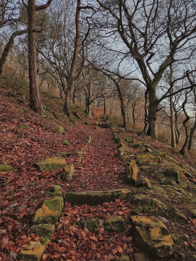
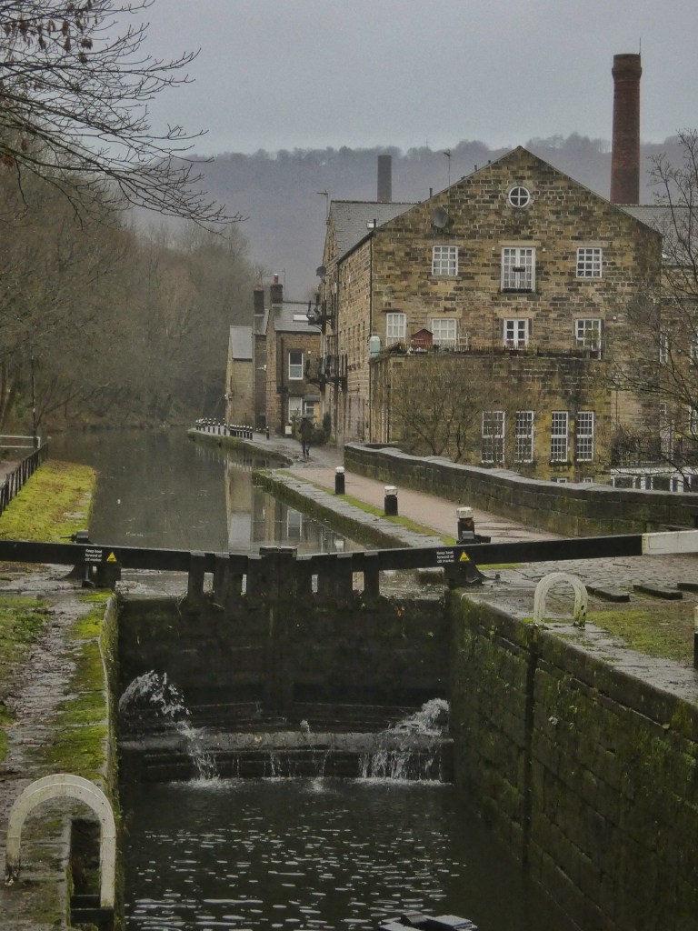
The temperature continues to drop after the last of the light has gone, almost touching zero by 7.00pm and with a new layer of frost already well formed, but within two hours, in a sudden about turn, the night warms and the frost vanishes by midnight. The next morning, the formerly solid ice sheet on the canal is broken into wafer-thin floes, the drips from the overhanging trees resounding on its surface. Days of unceasing rain follow. Dale Clough is filled with the obliterating roar of its waterfalls. Winds rush through Knott Wood. On the holly-and-hawthorn-lined lane that leads out of it at Turret Brink; jays join forces with magpies, robins and wrens, each heckling after their own fashion – a tearing rasp, a mocking cackle, agitated tutting, the clacking of stones – to expel a sparrowhawk from a tangle of honeysuckle.
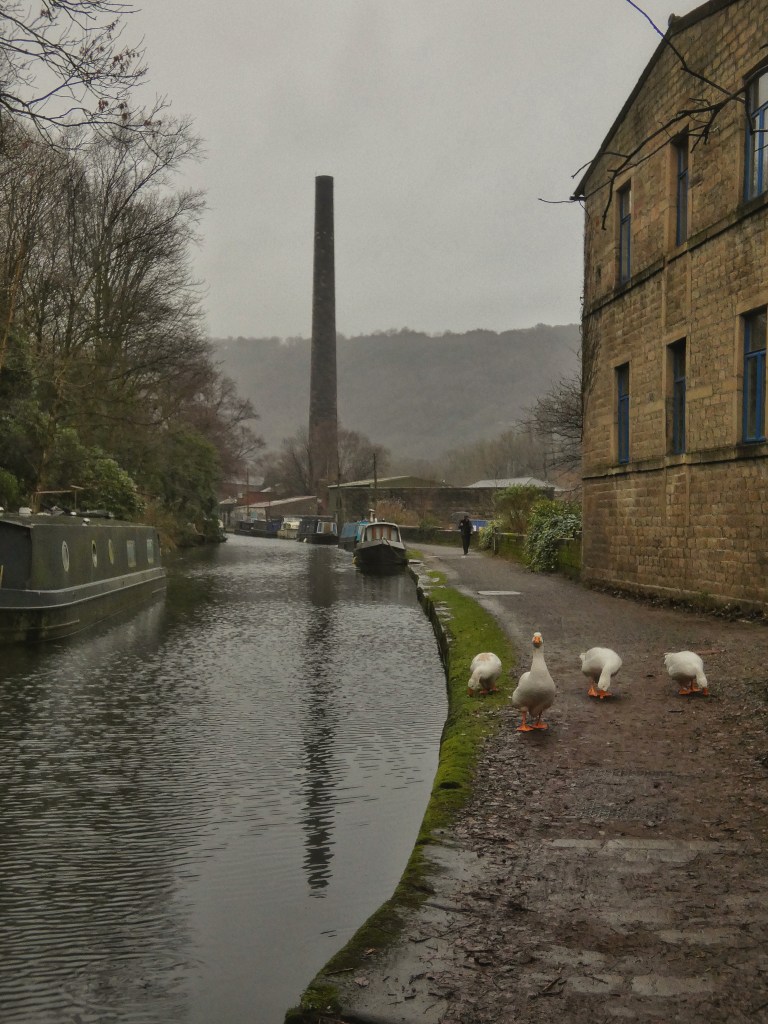
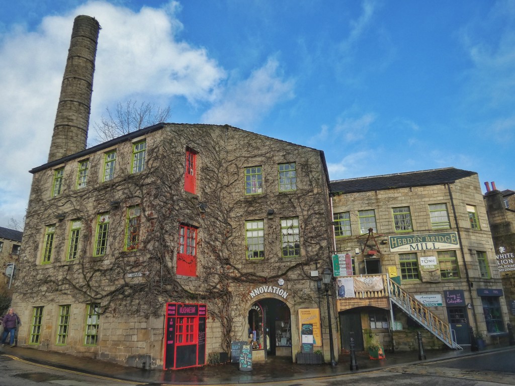
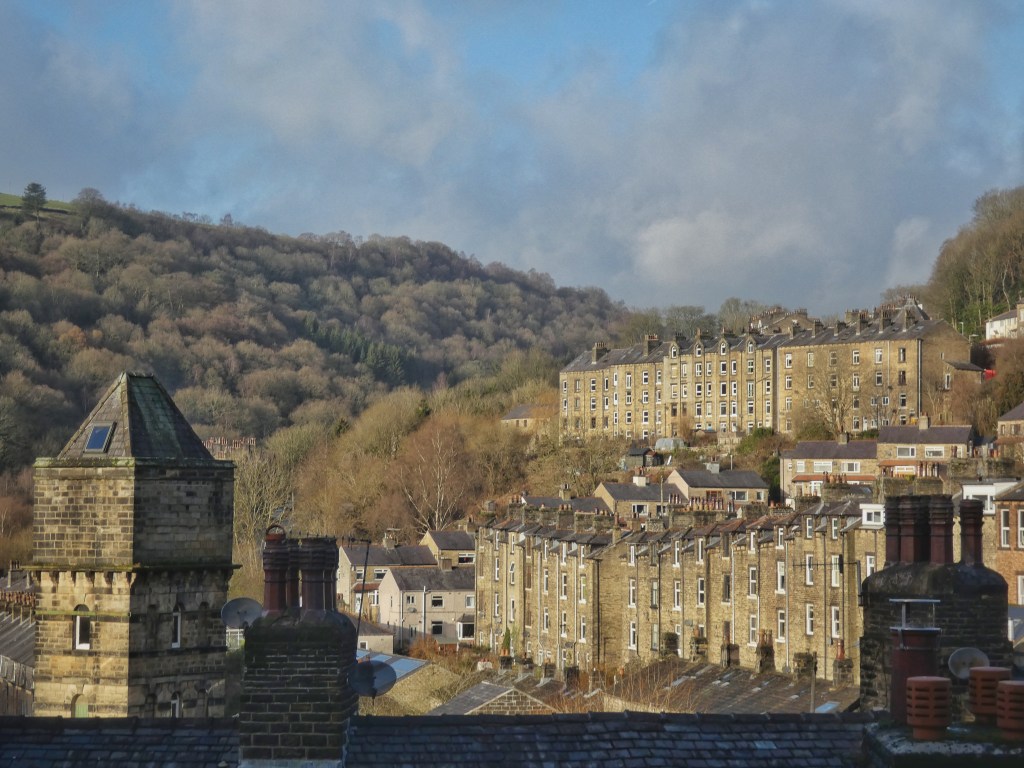
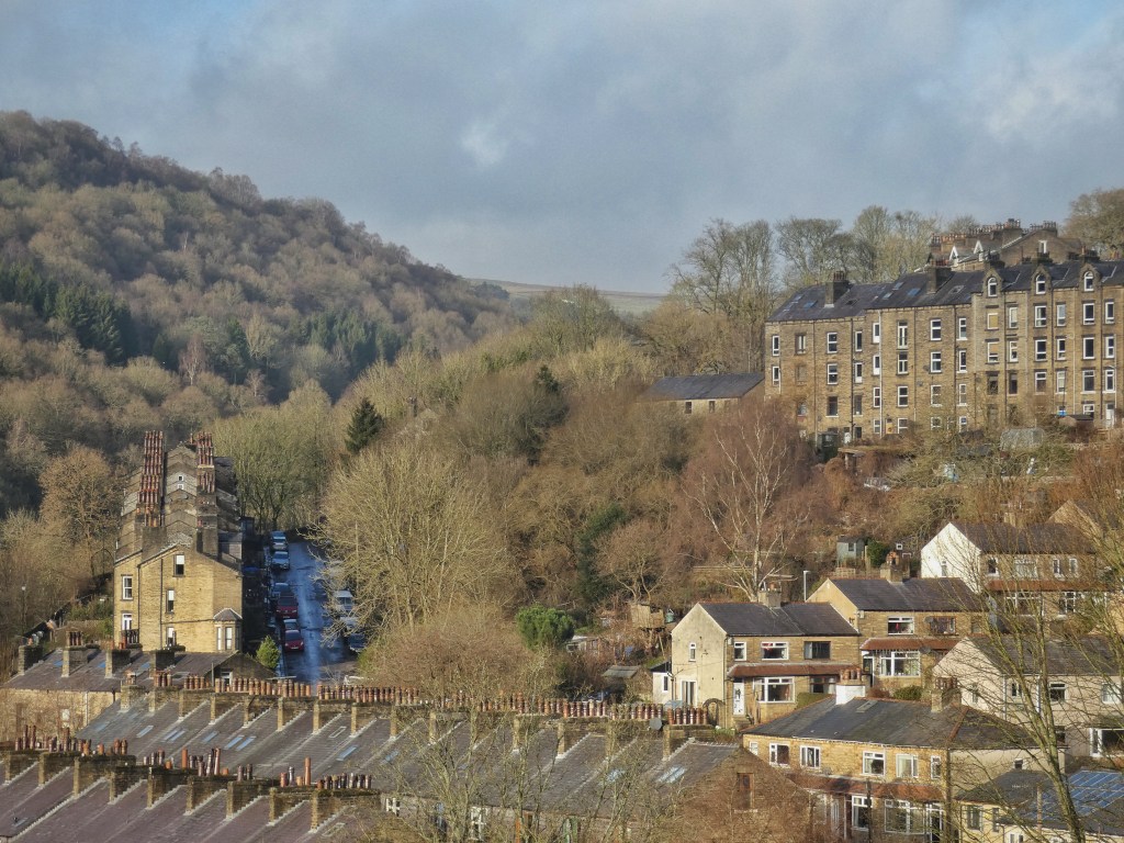
The gusts bring down a willow above the riverside walk in Hebden Bridge, and the tree surgeons are out early the next morning to remove it, cordoning off part of the St Pol car park on Bridge Gate. This space is no exception to the rule in this town that if there is a gap, be it a car park or a piece of waste ground or green space, chances are it was formerly occupied by a mill or other industrial building, for Hebden Bridge was at the centre of the fury of industrial production that transformed the north of England. Built around and dominated by fustian and cotton mills, dye works, weaving sheds and iron foundries, their clamour is almost as unimaginable today as it would have been before the town exploded from the small kernel it had been.
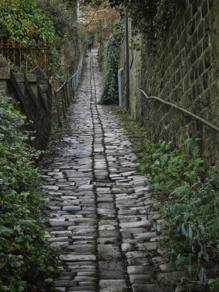
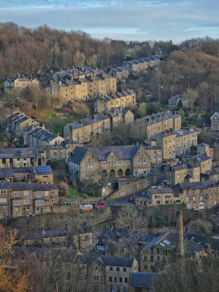
That kernel had been developing slowly for long quiet centuries. First a 14th-century corn mill; then a 16th-century stone bridge to replace the earlier wooden crossing of the Hebden Water for the Halifax–Burnley packhorse route which still plummets down Stoney Lane (also known as Bankside) and then labours up The Buttress to Heptonstall; then Kings Farm in 1657, which took advantage of the passing trade on the first turnpike road and converted to the White Lion Inn in the mid-1700s. Another pub, the White Horse, soon followed, built on the site of Bannister’s Farm. But even eight decades after the first Birchcliffe Chapel was built in 1764, the named fields that would soon be developed – Croft, Gem Lands, Brigg Field, Lower and Higher Stubbing – were still open. The Rochdale Canal was opened in 1798, and then following the coming of the Leeds–Manchester Railway in 1841, it took barely 50 years for the town to largely take the shape it still has today, for its terraces of famous over-and-under dwellings to stagger up the steep hillsides, leaving only a few significant gaps remaining to be filled in by 20th-century housing at Fairfield, Moss Lane and Highfield Crescent. The original single crossing of the Hebden Water came to be joined by five others, at Foster Mill Bridge, Victoria Road, St George’s Bridge, West End Bridge and a footbridge; and the Calder came to be crossed in five places itself, at Victoria Bridge, the canal aqueduct, the Fountain Street footbridge, Hebble End and Stubbing Holme.
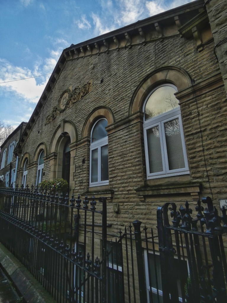
The cathedrals of the town were the vast mill complexes of Foster and Crossley, Salem and Calder, but among them the non-conformist chapels ministered to the swelling population. The Methodists built Cross Lanes, Salem and the Tin Tabernacle, which was later replaced by Foster Lane. None of these remain, with Cross Lanes destroyed by fire in 1965, and the others demolished, their congregations inherited by the Hebden Bridge Methodist Church, built in the 1970s on the site of the grand Salem Chapel, which seated 1050. The Baptist Chapels have largely survived, with the Ebeneezer formerly the home the Hebden Bridge Times and now a shop; Mount Zion converted to houses; the third incarnation of the Birchcliffe becoming the home of Pennine Heritage; and the classical Hope recently refurbished, still a place of worship as well as a vibrant community hub.
The geography of the town is complex, sitting as it does at the confluence of the Hebden Water and the River Calder, the tide of its houses washing up the three hillsides of Wadsworth, Heptonstall and Erringden. Initially, it clustered just around the Hebden Water, whose southward course is deflected first south-east at Slater Bank Scout, then south-west by another precipitous cliff face known simply as the Scout at the foot of Birchcliffe hillside, into which the Lees–Hebden Bridge turnpike road was carved. But here at the foot of Hebden Dale, and either side of the swirling meeting of the waters at the Black Pit, there was flat land. Of course, the wisdom of building a town in a place that was avoided by our forebears for all but a quick river crossing for so long is questioned every few years, when the latest in the long history of floods occurs. But this is where history decreed it should be, and the Environment Agency is putting the finishing touches to a £70 million scheme to defend it from all but the worst that the Pennine weather can speed down the hills to it. Most of the time, the Hebden Water dutifully keeps to its side of the walls erected to contain it, but every so often it issues a forceful reminder of why the fields on which Hebden Bridge was built – Ing, Mill Holm(e), Thistle Holme, Cow Houle Holm(e) – literally meant ‘water-meadow’.
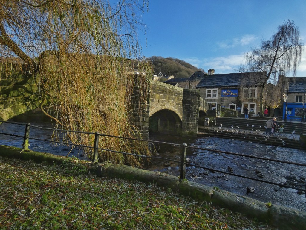
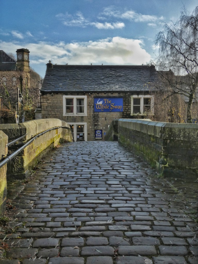
After a weekend-long deluge threatened to briefly reclaim those meadows once again, the river levels have returned to normal. The low soft sun glances over the beech trees of Crow Nest Wood, lighting the last green-gold leaves hanging on the end of the pendulous birch branches beside the half-a-milennium-old packhorse bridge. Goldfinch prise at the cones of the alder that lean out over the water behind the Shoulder of Mutton, paving the way for a party of long-tailed tits, who swing and pivot their way like gibbons through the twigs. Always moving, they leap across the bridge to the weeping willow that rests an elbow on the parapet, and then cross Old Gate to the bank of sycamore where the rabbit-warren slum terrace of Buttress Brink stood until demolished in the 1960s. Pigeons coo above the Wavy Steps, the single place which allows access to the river on its passage through the town, then descend when a couple arrive to feed them and the ever-present ducks. The peace of the scene makes it difficult to conjure the turmoil of a flood, or the riot of humanity that must have passed through here when the shifts changed at the mills for which this town was built.


Hello PaulJust wanted to let you know how much I’ve been enjoying your writing and photography since I joined a couple of your walks in the summer during the Arts Trail. You mentioned your blogs during one of your walks and I subscribed shortly afterwards. I love your intimate knowledge and the language you use to describe the landscape, its people and history through the changing seasons. A few of the photographers and musicians I follow seem to fall into the realms of psychogeography, something I really became aware of during my first visit to Orkney a couple of years back. I want to explore some of this through my reading and photography in coming months. Lisa’s just written to volunteers about The Man Who Planted Trees project coming up in 2024 and I’m aiming to get involved in capturing some of that through photography, as well as any Arts Trail activity – I really enjoyed doing that last summer. I’m also hoping to do some walking in and around the Hebden Bridge area in the New Year, and your blogs will likely form a brilliant guide. It’s not an area I know well. All the best to you and yours for Christmas and 2024. Kind regards R
LikeLike
Hello Ron. Good to hear from you. That’s ever so kind of you to let me know you’ve been enjoying my writing and photography. It was great to have you along on the walks, and I really appreciated the wonderful photographs of them that you took. If you fancy meeting up for a walk on one of your visits to Hebden next year, then do get in touch. Best wishes, Paul.
LikeLike