Chatter filters down through the trees from the terrace of Lumb Bank. This grand house was built at the beginning of the 19th century by Gamaliel Sutcliffe to look proudly down on his creations, the Lower and Upper Lumb mills. Their two chimneys periscope up through the swell of the winter tree canopy, but little else of them remains, although Bede has worked long and hard to bring their goits and dams back into use for his hydro scheme. By the 1940s, Lumb Bank’s occupant, a Mr Clegg, was showing little interest in farming the five fields that elegantly sweep down from the bee-bole-punctuated wall of the garden terrace, his stock consisting all of three head of cattle and a single goat. And since 1968 it has been occupied by writers, first Ted Hughes, and for nearly the last 50 years by a residential writing centre run by the Arvon Foundation. But nonetheless, its pastures are today in good condition. One of the impressive field trees they contain, a shrunken, ancient ash still sprouting from the remains of its trunk, is among the few to survive in the local area from those individually marked on the 1851 first edition OS map. Last year, Forus Tree planted 2500 trees around the 400-metre boundary of the fields, the slender whips – bird cherry and guelder rose, crab apple and spindle and many other native species – almost invisible in their winter nakedness.
Almost abutting Lumb Bank’s eastern field is the topmost of eight fields that once belonged to Eaves Bottom, squeezed onto a shelf of land between the twisting ravine of Colden Clough and the boulder-choked hillside of Eaves Wood. Beech leaves skitter across the old pastures in the chill wind, darting like voles seeking cover from a kestrel. But the green grass of these fields is not long for this world; two of the eight walled enclosures have already been claimed by woodland, with four others taken for council housing, starting in 1924, which also replaced the five farm cottages of Eaves Bottom. And every year, the sliver of sky that still greens the grass of the two remaining pastures narrows as more birch tumble down the hill and the beech planted within the ravine reach outwards for the remaining light.
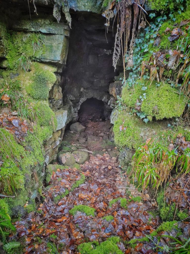
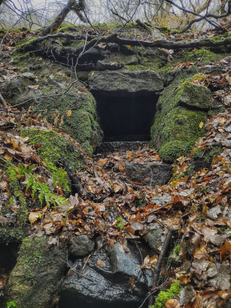
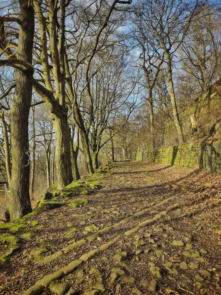
But these fields were disturbed long before the coming of housing. A century and more earlier, an extraordinary system of culverts, weirs, tunnels, goits and dams was constructed to feed the two silk-spinning Eaves mills, half a mile downstream from Lumb Bank. It begins with an open, stone-lined culvert threaded between the eastern field of Lumb Bank and the westernmost of Eaves Bottom’s. The lower section has now collapsed in a landslide, but it was clearly intended to help keep the pool behind a weir on the Colden Water topped up, for it is here that the water for the Eaves mills was drawn, first into a 175-yard-long tunnel through the banks of the ravine, then into a small mill pond gouged into one of Eaves Bottom’s fields, on into a long head goit that sliced through the next two fields and into two much larger reservoirs that drastically reduced the the size of the lower two pastures. But like so many mills they did not even celebrate a centenary; the open stone culvert is now dry, blocked somewhere higher up, the tunnel entrance at the weir is choked by the landslip that collapsed the culvert, the upper mill dam is a quagmire fringed by woodrush, the head goit is hidden under the houses, the reservoirs empty under the beech trees, and the mills, demolished in the 1920s, replaced by houses. But up in the remaining two fields, the spring-fed rough stone trough that will have once watered the cattle is still full and reflecting the white sky.
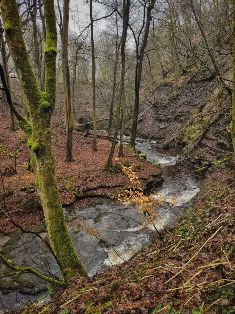
Far above the exposed layers of flood-scoured strata along the twists of the sinuous clough, bleached clouds scud over the pine-fringed escarpment above Dill Scout’s Wood. Above the line of Colden Road, once called Gamaliel Sutcliffe Road and leading to his mills, a pair of buzzards beat upstream in their laborious way. They perform one soaring circle above Crowther Terrace before labouring onwards. Deep in the confines of the clough, the green railings on the 18th-century Milking Bridge are easily outshone by the mosses, buckler ferns and bramble which almost glow in the dank light. Bluebells thrust boldly through the leaf litter, a mat of fragrant fringecup has made good its escape from a garden above, and a patch of opposite-leaved golden saxifrage is threatening to flower a month early if the mildness continues. Pastel lichens thirl every branch and terminal twig of the sodden sycamores, fat cold drips pelting down from them in the humid air. Perhaps this should have been submitted as a potential site for the public mapping of the lost temperate rainforests of Britain; certainly there are epiphytic plants festooning some trees, and it is only a mile or two outside of the area judged as having the right climatic and rainfall conditions. Being owned by Calderdale Council, designated as a Local Nature Reserve and already being subjected to a natural flood management programme to adjust the mix of its native tree species, perhaps ambitions for its restoration could enlarge to encompass recognition of this globally threatened habitat in the future.
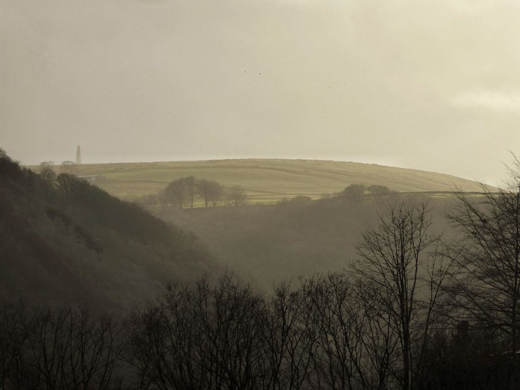
The clough is empty of people, but not evidence of their use: Goldsworthy-esque sculptures of balanced stones are perched on river boulders and children’s dens are constructed around the wet elephant hide of beech trunks. Downstream, the playground – set atop an old municipal dump under which the river was culverted in or soon after 1897 – quietly awaits the exodus from school. A couple start the ascent of the maze of the steps in Eaves Wood that, one way or another, promises delivery to Heptonstall. Out beyond the jaws of the valley, Stoodley Pike Monument looms like a spectre through the mists over Edge End Farm.


Great images and story. There’s a bit more about Eaves including the ‘self-help’ organisation here http://www.powerinthelandscape.co.uk/mills/col_val_mills_low.html
LikeLike
Thank you, David. Much appreciated.
LikeLike
Fascinating how much built evidence remains of these old systems. Not many people left who will know how they are connected or what they served. When I was a kid visiting No1 Winters Cottages Walter Greenwood at no3 knew all these water systems. How I wish now i had paid more notice, or some of his conversations with my dad had been recorded.
LikeLike
It is remarkable, Ann, isn’t it? But you’re right, there are few left who know where it all is. I did a little research on the water system coming down from Old Town Reservoir to Nutclough last year, and managed to piece together a little from the Local History Society archives and from talking to older residents, but it was just a fraction of the system of springs, drains, culverts and pipes in that area. Putting together a complete picture would be, I suspect, an insurmountably enormous task.
LikeLike
Very evocative.
And now to add to the story, the Friends of Colden Clough are carrying out nature restoration works to increase biodiversity in the Clough.
LikeLike
Thanks Robin. It’s strange to think sometimes that what we’re doing in the landscape will one day be part of its history too.
I’ll keep an eye out for opportunities to find those field names for you.
LikeLike