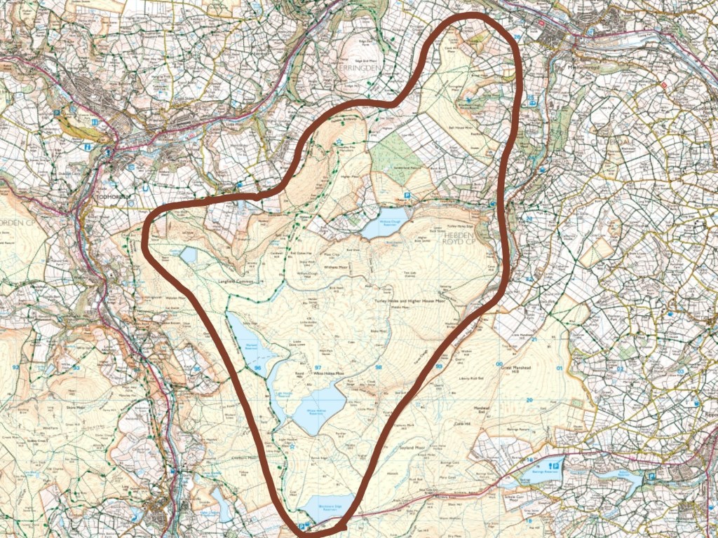
These are the stories of the moors which lie between Todmorden and Cragg Vale. The main moors which are covered are Langfield Common, Erringden Moor, and Turley Holes and Higher House Moor – roughly, the catchments of Withens Clough and Broadhead Clough, plus the south-eastern slopes descending to Turvin Clough and the northern slopes sweeping down under Gaddings Dam and Stoodley Pike.
The following account of the history and heritage of this high ground brings together material drawn from two kinds of sources: documentary research and community memory. It is based on the study of local history books, pamphlets, archival records and maps, alongside knowledge and recollections shared by 29 people who attended two heritage gathering sessions held as part of the PeatZine project in September 2025.
Across those sessions, participants contributed memories of work and leisure on the moors, stories handed down through families, and fragments of local knowledge about the changing landscape. Some described features that have vanished from view; others offered insights that brought the historical record into clearer focus. Each contribution added depth, detail and texture to the story of this place drawn from archival sources and published local history research. The account that follows is therefore a synthesis – a weaving together of written records and lived experience.
For their generosity in sharing their time, their knowledge and their memories of the moors, the project team would like to thank: Christine, Tabitha, Bob, Jude, Lawrence, Evie, John, Matt, Stella, Alison, Steve, Annie, Jim, Andy, Roy, Shirley, David, Tom, Luke, Anna, Graham, and four participants who wished to remain anonymous, whose contributions I have labelled ‘L’, ‘S’, ‘C’ and ‘H’.
NB. To see the details for each footnote, click on the superscript number, which will take you down to the reference list. To return to where you were in the text, click the back button in your browser.
Landforms
The landscape we find today around Langfield Common, Stoodley Pike and Erringden Moor is the latest chapter in a long geological story that began 329 million years ago. During the Carboniferous period, this part of northern England lay near the equator, at the bottom of a shallow sea into which flowed a vast tropical river delta.1 Torrenting down from the eroding Caledonian mountains to the north and west, these rivers carried gravels, sands, silt and mud into the coastal waters for 10 million years, eventually hardening into the rocks that now shape the upper Calder Valley.
Layers in the Land
These rocks are not uniform, though. They are distinctly layered, their strata a record of sea levels rising and falling as vast ice sheets advanced and retreated across the supercontinent of Gondwana in the southern hemisphere. When the sea was deeper and the delta front more distant, only fine particles of silt and mud were carried out here to settle, but when it was shallower and the delta front nearer, larger particles and pebbles were deposited. The softer, fine-grained mudstones and shales in this region that were laid down when the sea was deeper are known to geologists as the Hebden Formation, and the coarser, harder sandstones from the times of shallower seas are known as Millstone Grit.
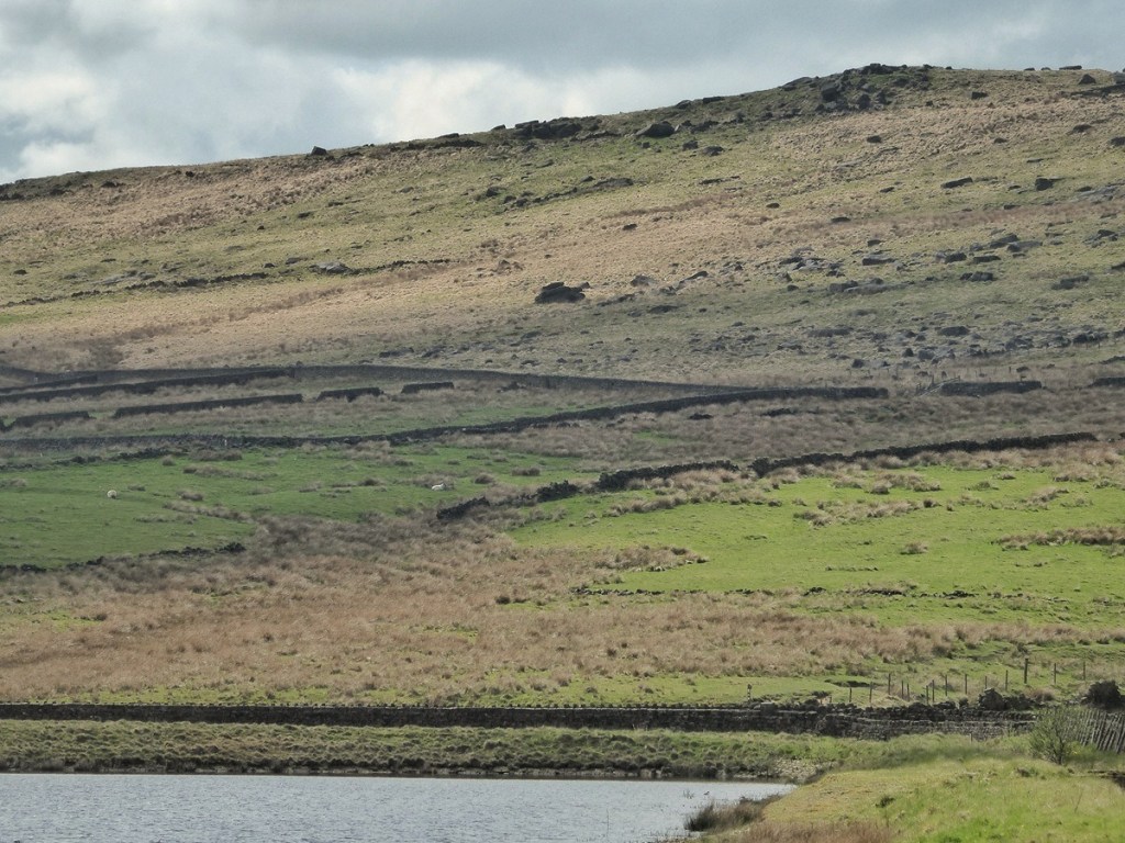
The way they alternate in layers accounts for the ‘stepped’ profile of Calderdale. From the valley bottom between Todmorden and Mytholmroyd, the mudstones of the Hebden Formation dominate the slopes of the deep, narrow ‘inner’ valley, while the rocky escarpments at its lip are formed of harder, more resistant layers of Millstone Grit, in particular two distinct strata that have been given separate names: Todmorden Grit and Lower Kinderscout Grit. These layers then underlie the flatter areas above, around Longfield, Mankinholes Tops and Harvelin Park, and also the dome of Edge End Moor.
Another layer of Hebden Formation then rises again above London Road and Kilnhirst Lane towards Stoodley Pike and Erringden Moor, before a further step is then reached, the moor being capped with another layer of Millstone Grit – Lower Kinderscout Grit around the escarpments of Langfield Edge just under Gaddings Dam and all across Blake Moor towards White Holme and Blackstone Edge reservoirs, and then Upper Kinderscout Grit crowning Stoodley Pike, and stretching across Erringden Moor. On the south and east sides, the bowl of Withens Clough and the scoop of Broadhead Clough have formed because softer layers of mudstones in these areas were more easily eroded than the Millstone Grit layers that enfold them.2
As Lawrence explained to us, after the deposition of the gritstones ended around 319 million years ago, the land that would become Langfield Common and Erringden Moor was caught up in immense tectonic forces. During the late Carboniferous, the collision of ancient continents produced the Variscan Orogeny, folding the strata and pushing the land upward to heights comparable to the modern Alps.3 The fold was not equal, with what were previously the horizontal layers of gritstone and mudstone tilted more steeply on the west side, more gently to the east. These angles can be seen in exposed outcrops.
The Pennines we know today are the weathered stumps of the great mountain chain created by this upheaval. Two hundred and fifty million years of relentless water and wind wore them down, reducing rocks back into the sand from which they were formed, smoothing slopes, carving cloughs.4
Understanding the meaning of the very shape of this landscape’s rocks and the composition of its soils can allow us to see that we are time travelling as we traverse it. Climbing, you accelerate through time from older to younger strata; descending, you plunge further back into the unfathomably distant past. Ascending a gentle mudstone slope, we bask in a warmer period when the tropical sea in which this sediment settled was deeper. When we reach the rearing crags at the moor’s edge, an ice age pulsed across a distant ancient continent, lowering global sea levels and bringing the raging river’s cargo of crumbling mountains sweeping out to sea.
Ice and Water
And then came two and a half million years of ice, giving the landscape its final dramatic form. During the height of the last glaciation, around 23,000 years ago, ice sheets from the north and west pressed against this part of the Pennines, but did not quite cover them. Ice flowing from the Irish Sea basin and the Ribble and Burnley valleys reached the Calder watershed, sometimes overtopping it, with tongues of ice pushing through Cliviger Gorge towards Todmorden. Withens Clough may have been occupied by a local glacier, hollowing out its basin.5
When the climate began to warm, the melting of this vast volume of ice unleashed torrents of water that carved deeply into the landscape. Meltwater rushing eastwards through the Cliviger gorge to the north and the Summit gorge to the south converged at Todmorden and thundered down the valley, deepening and steepening its course.6 The impact was immense: the Calder Valley was gouged by as much as 150 metres, creating the striking ‘valley within a valley’ most of us live in today. This inner gorge – the narrow trench of the modern river – lies far below the broad upland terrace that still holds the farms and lanes of Langfield and Erringden. From these higher shelves, the deep inner valley is invisible until one stands on its brink, where the ground suddenly falls away to the river far below.
The Making of the Moor
The moors above this shelf are today open, treeless and waterlogged, but this was not always so. Ten thousand years ago, as the ice of the final, Devensian glacial period retreated, the high plateaux of Langfield and Erringden were colonised by birch and pine. Soils were richer then, renewed each year by leaf fall, and even the summits would have carried a thin, wind-shaped woodland. The natural tree line in the South Pennines stood at around 1,300 feet.7 Much of Langfield Common and Erringden Moor lies close to that limit. Here the cover would always have been sparse, the trees stunted, their growth checked by the shallow soils and by exposure to frost and wind.
Over millennia, climatic change and human activity together transformed this landscape. As the Neolithic gave way to the Bronze and Iron ages, temperatures cooled and rainfall increased. Early farmers, from the later Neolithic onwards, felled and burned upland trees to create grazing and temporary cultivation plots. Without roots to bind the thin soils or humus to replenish them, minerals were leached away by heavy rain and washed into deeper layers, where they hardened into an impermeable iron pan. Above this layer, the surface soil became increasingly impoverished and waterlogged.
In these wet, acidic, oxygen-poor conditions, normal decay could not take place. Instead, vegetation such as sphagnum moss, cotton grass and tufted moor grass began to accumulate year after year. Over time, their remains built up into thick deposits of peat.8 While the peat of Erringden Moor is never more than a metre deep, areas of Langfield Common behind Gaddings Dam, and significant parts of Turley Holes and Higher House Moor are more than three metres deep. These blanket bogs sealed in the remains of trees, seeds and pollen, preserving a record of their own formation.
The treeless, heather- and moss-clad appearance of Langfield and Erringden today is the outcome of this long history of natural change compounded by human impact — the combined legacy of climate, soil and the earliest clearings made by people on the high ground.
Picking our way carefully across boggy ground on the moorland plateau, we are treading on the topmost layer of a living archive of millennia of vegetation. Each step compresses thousands of seasons of growth and decay: the remains of mosses, grasses and heathers laid down year after year since the close of the last Ice Age. Yet this record is not only natural but human in origin. Our ancestors, by felling upland woods and breaking the cycle of renewal, helped create the very conditions that allowed these plants to endure. What they exposed and exhausted became a vault of preservation, sealing in the traces of all that grew above it. The peat beneath our feet is both a monument to loss and a remarkable storehouse of memory – a landscape that began keeping its own history when people first began to alter it.
How the Land Holds Its History
This understanding of how the landscape was formed allows us to make sense of the habitats and human relationships that have developed. The moors are plateaus because they are capped with weather-resistant gritstone, and it is partly because they are plateaus that their soils are waterlogged and therefore form peat. The steep inner slopes of the valley were unsuitable for pasture and meadow, and so remained wooded, while the flatter shelf above was ideal for cultivation. Farmsteads are strung along springlines that trace the shape of the strata. Withens Clough contains a reservoir, and Broadhead Cloughs contains a boggy woodland, because of their scalloped shapes, which was in turn destined by their more yielding geology. Quarries bite into the natural escarpments of Langfield Edge because its prized stone was created in particular global conditions over 300 million years ago.
From the mudstones of the cloughs to the gritstone escarpments of the edges and caps of the moors, each layer of rock has left its mark on the landscape – in the shape of the hills, the springs that watered the first farmsteads, the pattern of fields and the texture of every wall and barn. The very form of the ground, its rocks and soils, tells a story of shifting rivers, ancient deltas, changing climates and the first peoples to influence the landscape we now inhabit.
Traces
The moors are full of traces. Some are obvious: a leaning monolith beside an ancient path, a boundary stone half-swallowed by heather, a deep inscription in gritstone. Others are harder to see: place-names that preserve older languages, ditches worn to shallow shadows picked out in evening light, the faint suggestion of a terrace or a mound. Still others lie beyond sight entirely, buried deep beneath the peat. Much of what once stood here has been weathered, reused or simply lost. But if the visible record is fragmentary, the landscape remains thick with memory. To walk here is to move across ground shaped and reshaped by those who came before – hunters, herders, farmers, travellers, freeholders – each leaving marks that still guide and divide and name the moor.
The First Marks
The archaeological record of these moors is unfortunately sparse. There are no prehistoric sites or finds in the official record of Scheduled Ancient Monuments, though there are five sites of rock art – grooves and cup-ring marks – recorded on Langfield Common on Andy Burnham’s The Megalithic Portal website,9 and a further five scattered across Turley Holes and Higher House Moor,10 along with four standing stone sites.11 No definitive date or period are given for these.
There is an intriguing reference in a Todmorden newspaper from 1906 of a Mr Joshua Holden finding a ‘barbed and stemmed arrow-head which he picked up on Heeley Hill’,12 and it is on this thrusting promontory that looms above Lumbutts that cartographer J.F. Myers placed a circular ‘Camp’ on ‘Mount Ely’ on his 1835 map of the parish of Halifax, though this is likely to have been fanciful, for no other reference to it can be found.
There is also the tradition that tells of a great stone cairn on Stoodley Pike, said to mark the grave of an ancient chieftain. When workmen were digging the foundations of the first monument in 1814, they reportedly unearthed human bones. In 1890, John Travis claimed to have ‘information from workmen who assisted in the erection of the monument, and others who were present at the time the skeleton was said to have been found, and all that I can learn is that some bones were found at a considerable depth in the earth. They were almost black, but as they were not submitted to the inspection of any professor of anatomy, and as they were not able to judge, from what they had found, whether they were the bones of a human being or a brute, the subject remains, as it must forever do, a mystery.’13 Might this have been a Bronze Age burial mound? The cairn was obliterated, the bones lost. We are left with only stories.
But this absence of evidence is unlikely to reflect an absence of prehistoric peoples, for comparable upland areas nearby – at Manshead on the far side of Cragg Vale, Whirlaw on the other side of the Calder, further north at Gorple and Widdop, downstream on Midgley Moor, all within a seven-mile radius – have yielded Mesolithic and Neolithic flint and chert tools and speartips; Bronze Age funerary cairns, barrows and possible ritual or boundary standing stones; and Iron Age settlement terraces, hillforts and pre-Roman trackways. Given the proximity and continuity of these landscapes, it seems almost certain that similar traces once existed here, but are now buried deep beneath the peat, or were eroded away by centuries of rain, or have simply been overlooked on these wide, exposed moors. Chance, rather than absence, has kept the spoor of Langfield and Erringden’s earliest peoples out of sight. Rather, their memory is held in their legacy of peaty soils and sodden sphagnum. There is little doubt that Mesolithic hunter-gatherers once roamed this high ground, that Bronze Age and Iron Age farmers felled the forests and grazed their livestock, turning the once-wooded ridges of Langfield and Erringden into rough grazing grounds.
Frontiers and Grazing Grounds
Through this period of environmental transformation, permanent habitation moved to the more fertile lower terraces above the Calder and its tributaries. The Roman occupation established routes through the area, but none that crossed our particular moors. Their presence in the uplands was always light; enough to secure these routes rather than settle every hillside, and the interior high moors continued to be a frontier of woodland and seasonal grazing.
After Rome’s withdrawal, a Britonnic (Celtic) kingdom known to later sources as Elmet occupied much of what is now West Yorkshire. Elmet appears to be a survival and re-working of earlier Brigantian social organisation and cultural identity, and it persisted as a discrete British polity until its overthrow and annexation by the Anglian kingdom of Northumbria in the early 7th century.14

From the late 6th and into the 7th centuries Anglian settlers colonised the valleys, laying down the village pattern remembered in place-name endings such as ‘-ton’, ‘-worth’ and ‘-ing’. Later, between the 9th and 10th centuries, Danish and Norse arrivals added another layer – the Danes mainly in lowland Yorkshire and the Norse settling upland farmsteads and shielings suited to hill-pastoral life. Through these phases Langfield and Erringden will have remained marginal to dense settlement, though no doubt important as summer grazing, as part of transhumant networks and as the corridors of ancient trackways. And by the time of the Norman Conquest they would have been recognisable as open, rough moorland crossed by long-used routes and shaped by millennia of climate change, tree loss and grazing.
After 1066 the process continued: Norman manorial structures, the colonisation of valley sites and events such as the mid-late 11th-century campaigns in the north altered tenure and control, while rural economy and common rights evolved through the 12th and early-13th centuries, so that by around 1250 the basic pattern – settlement on the terraces, enclosed fields below and commons and rough grazing above – had become firmly established.
The Language of the Land
Some of the earliest traces left by our ancestors are not built in stone or buried in peat, but spoken and written in the names of places. Formed a thousand years or more ago, these names preserve the languages once heard on the hills – Old English, Norse and their mingled descendants – and they describe with simple precision the land as it was first known: its woods and valleys, its clearings and moors.
Langfield – or ‘Langefelt’, as it was recorded in the Domesday Book of 1086 – means simply ‘long open stretch of land’.15 The name joins the Old English ‘lang’, meaning long, and ‘feld’, meaning unenclosed ground or moorland, not the walled fields of today. Indeed, the township of Langfield does have a panhandle shape, with a long, thin stretch of high ground attached to the lower shelves around present-day Longfield, possibly allocated so that it had sufficient common upland summer grazing land for the farmsteads on the shelf.16
‘Erringden’ has its roots in the Scandinavian settlement of the Pennines. It derives from the Old Norse personal name Eiríkr – Eric – and the Old English ‘denu’, meaning valley, giving the sense of ‘Eric’s valley’. The earliest known spellings, such as ‘Ayrykedene’ and ‘Ayrikdene’ from the late-13th century, retain the Norse name quite clearly.17 The addition of the ‘-ing-’ element in the modern form came later, by analogy with other English place names.
Withens, first recorded in 1314 as ‘le Withens’, means ‘the willows’. It comes from the Old English ‘wīðign’, for willow tree,18 and was a common name for places where willows grew along damp stream edges. The name fits the topography exactly: willows would have thrived in the upper reaches of the clough.
‘Turley Holes’ has one of those richly descriptive names that reveals the texture of the land. In its earliest form, ‘Tornelymosse’, from 1314, it combines the elements ‘trun’ or ‘turn’ – meaning rounded – and ‘lēah’, an Old English word for a clearing or meadow. The later additions ‘mos’ and ‘hol’, meaning bog and hollow, describe the broken, peaty ground of the moor edge. Taken together, the name means something like ‘the round clearing by the boggy hollows’.19 It evokes a wet, uneven terrain of moss and water channels, perhaps once cleared for rough grazing. The succession of spellings over time – Turneleye Mosse, Turmleemosse, and later Turley Holes – shows how successive generations adapted the old words to their own tongue.
‘Stoodley’, recorded as ‘Stodeley’ in 1307, derives from the Old English ‘stōd’, meaning a stud or herd of horses, and ‘lēah’, a woodland clearing or pasture. The name therefore means ‘the stud clearing’ – a place where horses were kept and grazed. Later spellings such as Stoythley and Stouthley reflect local dialect developments, but the meaning remains constant.20 The later addition of ‘Pike’, meaning ‘pointed hill’, refers originally to the natural prominence itself, centuries before the 19th-century monument was raised.
Scores on the Moors
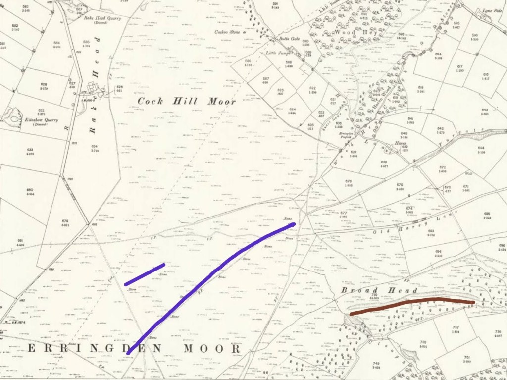
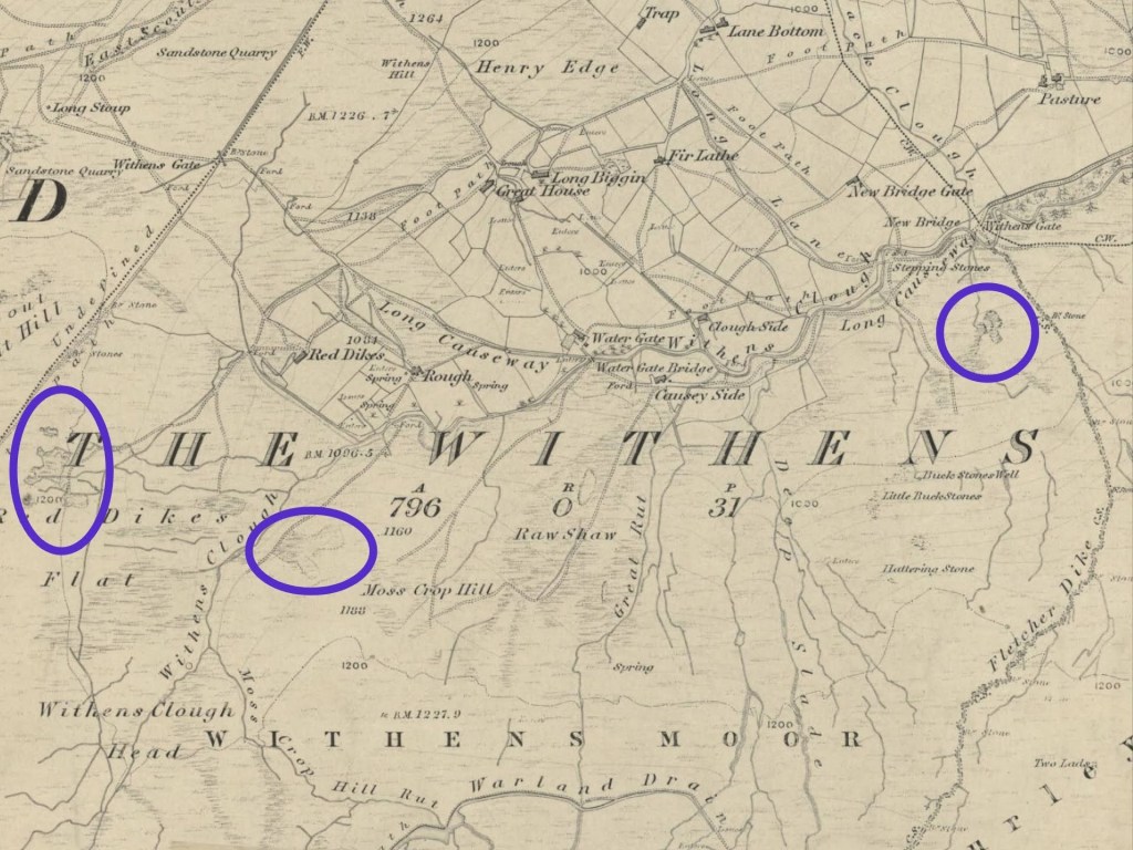
Besides the rock art and standing stones and place names, the earliest tangible trace of human presence and activity on Langfield Common and Erringden Moor may be the Mandike. Nigel Smith convincingly argues that this is a pre-Conquest, Anglo-Saxon boundary ditch; its name originates in Old English ‘(ge)mæne’, meaning ‘common’, and ‘dic’ meaning ‘ditch’ or ‘dyke’.21 It is referred to in court roll documents that ‘dispaled’ the Erringden Deer Park in 1451 (a process that legally transformed its status, and literally removed the palings of its boundary), and its route is marked on Yewart’s map of Langfield from 1606, running from the very top of Turvin Clough across Blake Moor (from the Dove Lowe Stones, to the Wool Pack Stone and just east of the Little Holder Stones, as determined by Nigel Smith), and then following what appears to be the current current boundary between the civil parishes of Todmorden and Hebden Royd around the top of Withens Clough Head, beside the top of the enclosure walls of Red Dikes to Withens Gate, along the line of the wall to the south of Stoodley Pike to the north-west corner of the Sunderland Pasture plantation. From there, its continuation was along what became Dick (likely a corruption of Dyke) Lane to Johnny Gap, and then across Erringden Moor and down to Old Chamber and Spencer Lane to Wood Top.
Of this five and a quarter miles, all but a 500-yard stretch from Johnny Gap to the top of Whittaker Lane, and a 420-yard stretch down the last steep descent of Cock Hill Moor and across the fields above Old Chamber, almost to the top of Spencer Lane, have been obliterated by time.
At these short surviving stretches, we can imagine our Anglo-Saxon ancestors labouring with wooden spades and iron-tipped mattocks, cutting through turf and heather to carve a boundary for their overlord – the local ‘thegn’ or chieftain who governed these uplands in the centuries before the Norman Conquest. Their work was practical, but also symbolic: marking out the limits of jurisdiction, defining where one estate or community ended and another began, a line still faintly visible a millennium and more later.
The Mandike is the oldest, but not the only ancient ditch on our moors. The Erringden Deer Park appears, according to Nigel Smith, to have used the Mandike as its northerly boundary from its creation in the 1320s until its expansion in or before 1385,22 but it also needed boundaries on which to mount its oak paling fence running down from the high moor to the valley bottom. There is a possible line of its boundary ditch on the south side of Withens Clough downstream of the reservoir dam, and a 270-yard stretch of its ditch remains visible between the Pennine Way and London Road above Strait Hey.
Other ditches scar the moors, of less certain age and purpose. A maze of apparently man-made channels on Erringden Moor, in particular, can be traced, some aligning with boundary stones, others not. A significant ditch descends from the moor on the north side of Broadhead Clough to the ancient farm of Broadhead End. Who invested the labour to create them, and why?
Setting Boundaries in Stone
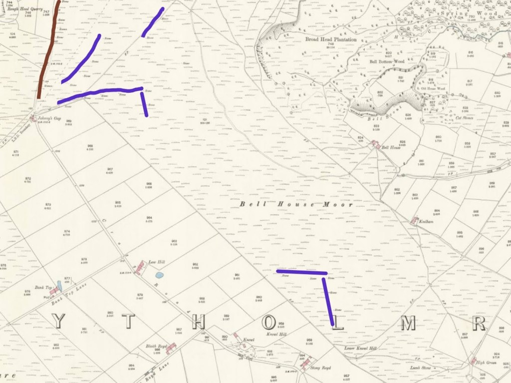
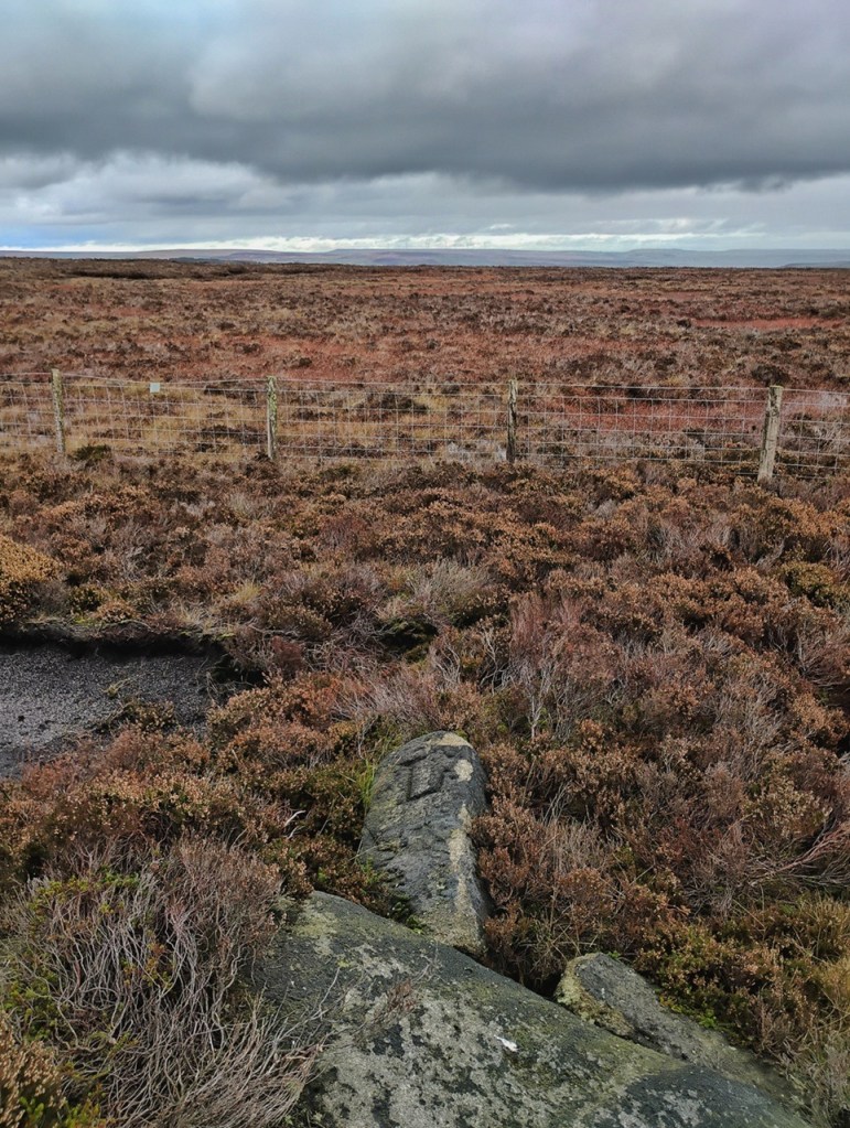
Ditches were not the only way to mark borders; the moors are also scattered with boundary stones. Christopher Goddard marks 20 stones across Erringden Moor on his maps, mostly denoted as boundary stones but some as standing stones.23 However, the 1894 editions of the 25-inch Ordnance Survey map mark 33, suggesting some have either been swallowed by the moor, or else removed.
Eight of these stones run in a line beside the remnant of the Mandike from Johnny Gap to the top of Whittaker Road. Four run in another line north-east from Johnny Gap, and another line of 11 seem to pick up their thread, but slightly offset. Two are free-floating to the north of this line, and another to the south. The remainder – a set of six and another set of five – form two headlands jutting out from the enclosures south of Johnny Gap, and are apparently older boundaries of ownership prior to this area’s taking in from the moor in the 1830s.24 (There are ditches and banks visible on Lidar maps that align with these shapes, and my son discovered a short stretch of raised causeway on the line of the southern one.) Most of the stones are blank, but some on the line of 11 (or perhaps 15) are carved with letters – ‘A’, possibly for the older spellings of Erringden (e.g. Ayrykedene), and ‘S’, presumably for Sowerby, the township that was to the east before Erringden was enlarged.
Yorkshire CCXXX.9, Surveyed: 1892 to 1893, Published: 1894. Credit: National Library of Scotland.
Yorkshire CCXXX.5. Surveyed: 1892, Published: 1894. Credit: National Library of Scotland.
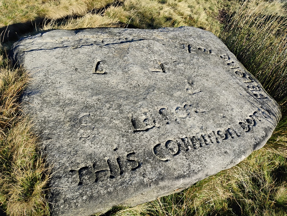
During the 19th century the boundary of Langfield Common was surveyed and marked several times, leaving a legacy of boundary stones across the moor. In 1840, after a long dispute over grazing and encroachment, the Langfield freeholders (of which more later) perambulated the boundary and set out positions for 25 painted and numbered boundary stones to divide Langfield Outpasture from Withens and Turley Holes Moss.25 A year later, a further 12 stoops were jointly erected to mark the newly-agreed boundary between Langfield and the Turley Holes estate of Christopher Rawson, each inscribed with an ‘L’ for Langfield and an ‘R’ for Rawson.26 These stones, substantial blocks of grit sunk deep into the peat, can still be traced on the moor, though only one remains standing. When the Ordnance Survey resurveyed the area in 1890 they recorded additional marked stones around Gaddings Dam, evidence of further markings of the boundary line, this time abutting the Manor of Rochdale. There is also a flat rock on Red Dikes Flat inscribed ‘This common doth belong to L…’, with the rest of what must have been ‘Langfield’ having been defaced. Together these scattered stones bear witness to a century of attempts to fix in stone what had long been disputed in custom and memory.
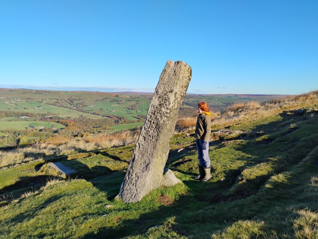
There are many other stones placed by our ancestors across the moors. The Long Stoop is an impressive ancient waymarker beside the Long Causeway above Lumbutts, a monolith nine-foot tall, though leaning quite alarmingly. This lean, however, is not new; a photograph of members of the Hebden Bridge Local History Society standing beside it in 1956 shows it at the same angle.
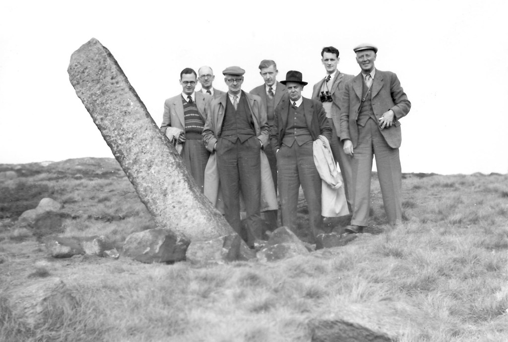
Credit: Pennine Horizons Digital Archive.
The causey stones of the Long Causeway themselves are undoubtedly of considerable age, and we shall return to them later, as we will to the Te Deum Stone, and to the dry stone walls and scattered remains of the community of The Withens and of Law Hill.
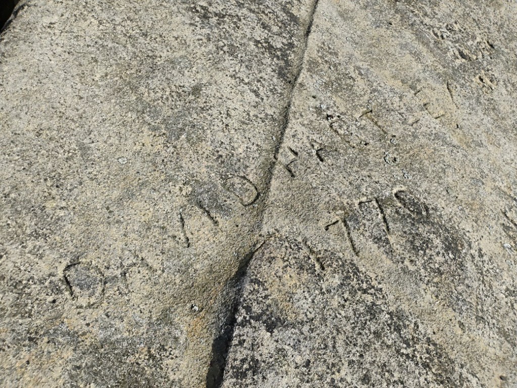
As well as the possibly prehistoric carvings on the outcrops of the moor, there are more modern marks. ‘David Hartley 1770’ is carved on the Holder Stones, together with the year of his execution. Could this be a memorial carved at the time of his execution?
And this attempt to etch something lasting on high ground has not come to an end: a local sculptor has left a trail of enigmatic faces – bearing a Viking or Norse character – carved on the rocks across the moors, at least four of which are in the region of Langfield Common. And in 2012, poet Simon Armitage had one of his six Stanza Stone poems inscribed in Cow’s Mouth Quarry. Up here, on the ‘brunt of the world’, lettercarver Pip Hall’s tungsten chisel battled with quartz crystals to leave their mark.
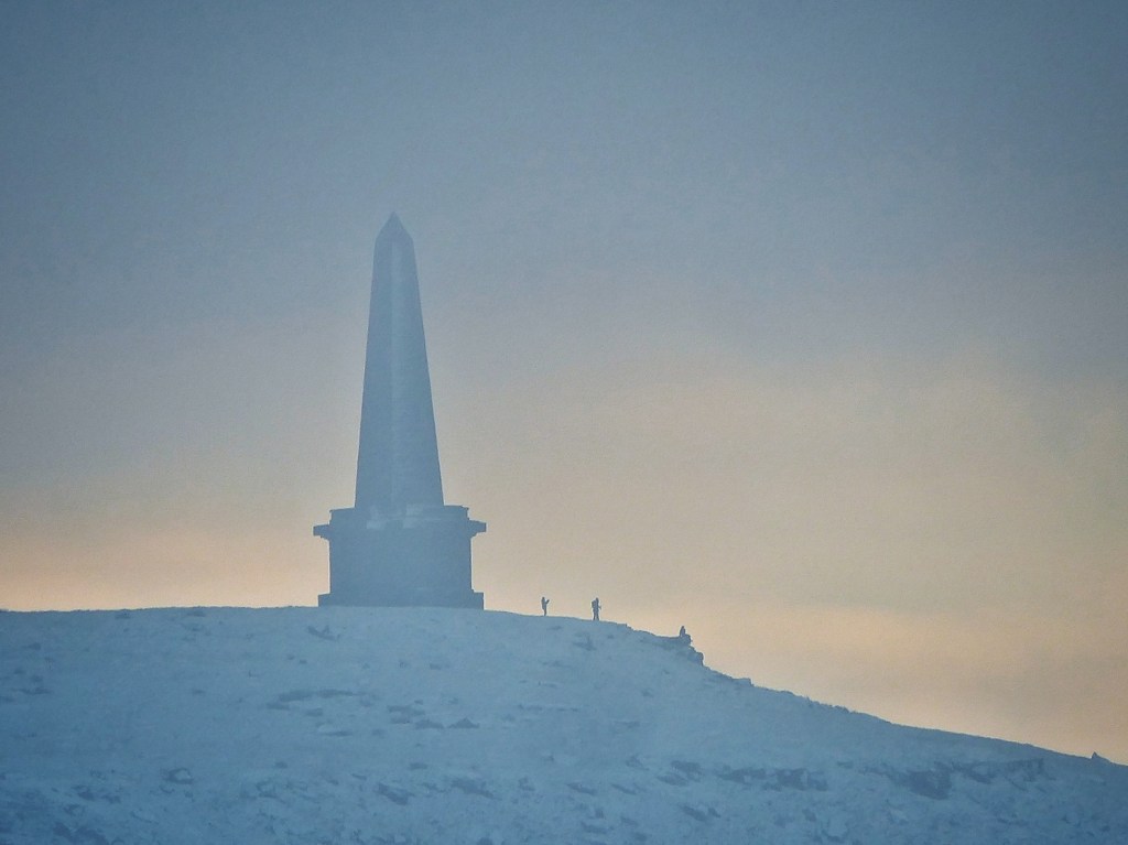
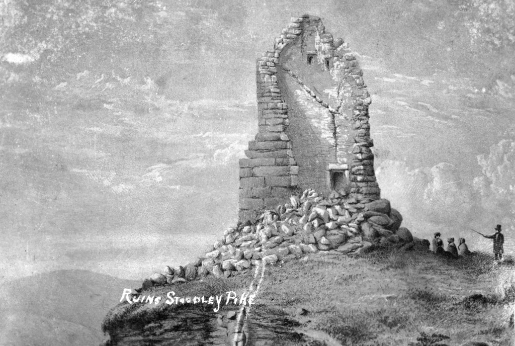
A Monument to Peace
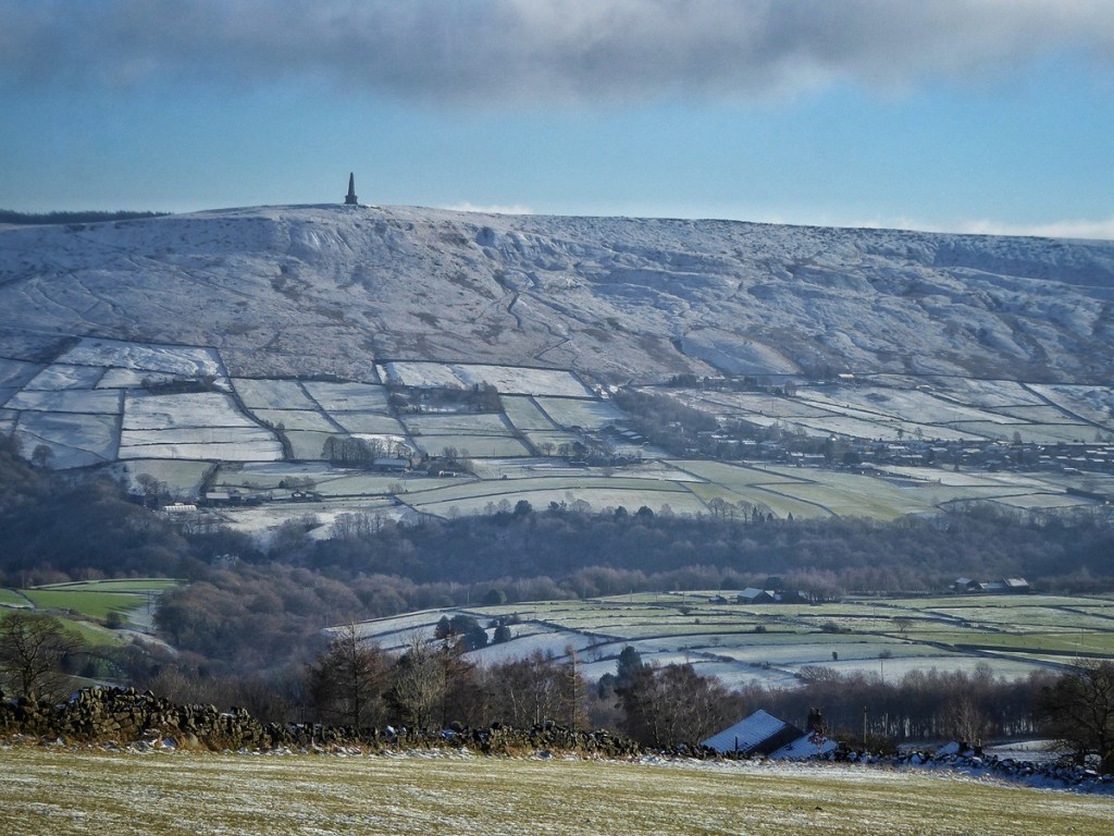
But undoubtedly the most commanding of all the stone memorials raised on the moor is Stoodley Pike Monument. When work began there was already the cairn on the summit – a modest, timeworn heap said to mark an ancient burial place – but it was soon replaced by something far grander, swept aside for a monument of national ambition, a column meant to speak of peace across the valleys below. Whether it will endure as long as its humbler predecessor once did, only the passing centuries will tell.
The first Stoodley Pike monument was built in 1814 to commemorate peace following Napoleon’s defeat and the surrender of Paris.27 For almost 40 years it stood above the valley, its form stark against the skyline, until a lightning strike cracked its walls and weakened its core. On 8th February 1854, as evening fell over Langfield Moor, the tower collapsed with a sound heard miles away. The coincidence of its fall with the departure of the Russian ambassador from London on the eve of the Crimean War led some to call it an omen: peace, it seemed, had fallen too.
Credit: Pennine Horizons Digital Archive. Code: TAL00370.
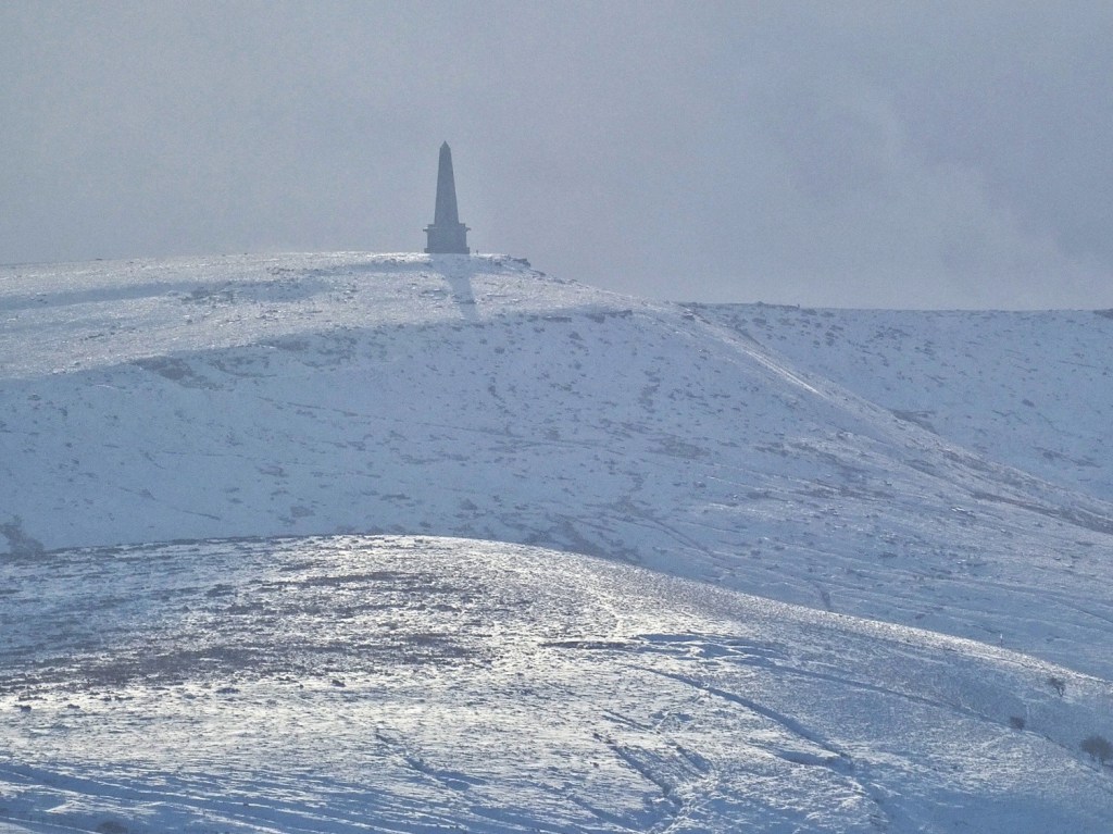
The freeholders met within a week and resolved to rebuild. Subscriptions were again raised, and in 1854 a new design by James Green of Todmorden was chosen: a 120-foot obelisk with a gallery at 40 feet and a short stairway leading to it from within. The monument was set slightly further back from the exposed edge, and completed in 1856 when peace was again declared. Later repairs in 1889 added a lightning conductor and a grill to admit light to the stairwell. For over a century and a half, the obelisk has withstood the Pennine weather – black, severe, and unmistakable – a monument not to war but to the difficult endurance of peace.
Taken together, all these traces allow us to read the moor not as empty upland but as a long-inhabited place. The peat holds the memory of forests and fires; the place-names remember the speech of Britons, Anglians and Norse settlers; the ditches and stones mark the reach and limitations of lords and communities, rights and responsibilities; and the great monument on the skyline speaks to more recent ambitions of peace and remembrance. The moor has never been untouched. It has been used, crossed, marked, claimed, grazed, commemorated. To understand its traces is to understand that our present landscape is not a backdrop but a palimpsest – its meanings layered and worn, yet still legible to those who take the time to look.
Enclosure
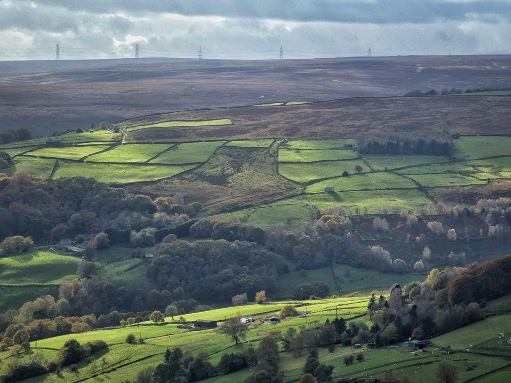
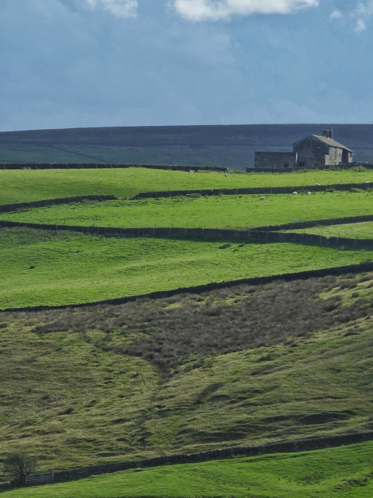
To understand the enclosure of Langfield and Erringden, we must begin by remembering that the moor was once far more extensive than it appears today. The tough moorland grasses and the heather that now cling to the plateau and upper slopes once reached much further down the hillsides. The green fields that climb towards the moor are not natural grasslands but the result of centuries of labour – land cut, turned, drained, limed, walled and won from the ‘waste’. Enclosure here did not arrive all at once, nor did it follow a single plan. It unfolded gradually, in phases: first in the medieval vaccaries of Cruttonstall and Withens, and the common fields of Mankinholes; later in the piecemeal and parliamentary enclosures that pressed steadily upward across the slopes; and finally, in the 19th century, in the last ambitious attempts to push farming to the very crest of the moor. What survives today is the visible border between what could be claimed and what resisted being changed.
Islands of Meadow in the Moor
Cruttonstall and Withens were among the earliest enclosed farmed areas on either side of Erringden Moor. Long before the patchwork of small fields and walls that later spread across the high slopes, these two sites formed distinct islands of worked land. Their origins lie not in the later periods of individual freeholding or parliamentary enclosure, but in the medieval era, when they were established as vaccaries – cattle-rearing farms held directly by the lord of the manor.
A vaccary was a ‘demesne’ farm: part of the lord’s own estate, worked to supply his household or to provide a rental income, rather than being let out from the start to tenants. The term comes from the Latin ‘vacca’, for cow, and by the 13th century referred specifically to upland dairy and cattle-rearing stations, producing milk, butter, cheese, hides and young animals.28 These were not isolated steadings; they belonged to the managed landscape of the medieval ‘forest’. In this period, ‘forest’ meant a legal territory set aside for hunting, where the lord’s rights over game and grazing were protected. Within such forests, vaccaries were semi-enclosed, organised units that represented the first systematic exploitation of upland grazing.
In the Forest of Sowerbyshire, part of the manor of Wakefield, six vaccaries were established in the later 12th and 13th centuries: Upper Saltonstall, Fernyside, Withens, Cruttonstall, Nettletonstall and Hathershelf.29 They belonged to the Warenne earls of Surrey, lords of Wakefield, who sought during this period to extend their direct estate into the marginal upland slopes of the upper Calder Valley. Here, where cold, wet soils limited arable but grazing was abundant, vaccaries became dependable centres of cattle production.
Cruttonstall and Withens were both in existence by 1309, when they appear in the Extent of Sowerby Graveship, a detailed manorial survey. The Cruttonstall vaccary is recorded as having 24 acres of meadow for winter fodder; Nigel Smith has shown that these were customary acres measured with a seven-yard perch, making the true area closer to 39 modern acres, matching the surviving field pattern we see at Cruttonstall today.30 The remainder of its land ran up onto Edge End Moor, where the herd grazed through the summer.
Withens was likely similar in scale, supporting roughly 30 cows, 20 calves and a bull – the typical stocking levels for the Sowerbyshire vaccaries — and using Turley Moss and Mankinholes Moor (the older name for Langfield Common) as its seasonal pasture.
By the 1320s and 1330s, both Cruttonstall and Withens were leased out on long tenancies, marking the shift away from direct management by the lord’s officers towards tenant farming. But their form and their purpose remained clear: enclosed meadow close to the steading; open rough grazing sweeping up toward the high ground; and a rhythm of seasonal movement across the moor.
As such, Cruttonstall and Withens represent the first clear shaping of this upland landscape into managed agricultural ground, their meadows and pastures forming the earliest framework of enclosure around Erringden Moor. Centuries later, further waves of enclosure would extend outward from these very sites, multiplying walls and dividing slopes. But the pattern began here: two medieval cattle farms, on either side of the moor, marking the first sustained claim of the high land for pastoral use.
Fields Shared and Divided
The other land that would certainly have been cultivated and enclosed at the base of the moor was at Makinholes. On the northern flank of Langfield Common, Mankinholes is recorded as early as 1225 in the Wakefield Court Rolls, pointing to an ancient farming community within the manor, its name probably derived from ‘Mancan’s Hollow’ (from an Old Irish name, Manc(h)án)31 or ‘the hollow of the wild men’ (where a ‘mankin’ in a ‘fierce wild man’)32. By the 13th century it was already a recognised vill, its inhabitants clearing and cultivating land on the lower slopes through assarting – the piecemeal enclosure of woodland or waste for farming.
Around the hamlet lay the town fields, or common arable lands, where villagers held scattered strips of oats and meadow under the manorial system. These open fields were regulated by the court, with grazing and cropping governed by seasonal custom. In spring, livestock were driven onto the moor while the inbye land was closed for cultivation; in late summer, after the hay and grain were gathered, animals were allowed back to graze the ‘fog’ and stubble.33 Over time, this pattern of shared cultivation and grazing produced the permanent boundaries of drystone walls, transforming temporary divisions into fixed enclosures.
As the population thinned after the 14th century and tenures became freer, the old communal strips were consolidated into independent holdings. A number of long, thin fields on the west side of Mankinholes today preserve that history: each enclosure marks a converted town-field plot, enclosed centuries before parliamentary enclosure.34

Greening the Waste
Across the Pennines, the move from communal to individual farming unfolded gradually, from the late Middle Ages to the 19th century. Early in the 15th century, some fields still lay open and intermingled, but by the 1500s they were being enclosed into small closes. This shift reflected a change in husbandry: land was now alternately cropped and grazed, so permanent boundaries became necessary. Much of the early enclosure was informal – small ‘intakes’ from the common, or encroachments later legalised by manorial surveys.
By the 17th century, commons were being subdivided by local agreement. From the 1770s, the Parliamentary Enclosure Acts formalised the process, setting out allotments, access roads and quarries in each township. The new landscape of straight walls and more formally-shaped fields spread across the moorland fringes. Economic forces hastened the trend: during the Napoleonic Wars, high grain prices and food shortages encouraged the enclosure of even the bleakest ‘wastes’. Yet much of this high ground was soon abandoned as uneconomic. The limits of soil, altitude and exposure reasserted themselves, leaving today’s familiar pattern: a patchwork of regular fields, fading back into rough, open moor at the fringes.35

Enclosure was not just a legal reform but a physical act of remaking the land. Trees and scrub were cut, roots and stones hauled out by hand, and rocks piled into rough walls tracing the contours of each new close. Early boundaries were irregular and personal, built in varying styles by individual farmers. As enclosure gathered pace in the 16th and 17th centuries, itinerant wallers appeared – craftsmen whose tall, straight, double-faced drystone walls reshaped the Pennine hillsides.
To break up the raw moorland, farmers used the heavy local ‘graving’ spade, its short shaft and T-handle suited for driving deep into the ground. Working in pairs, one man cut with the spade while another, the ‘putter-ower’, flipped each spit of turf with a ‘hack’ or mattock. Stones were set aside for walling; the ground was limed, often with crushed limestone brought by packhorse from Boulsworth Hill along Limers’ Gate. Gradually the dark moor was greened into pasture and meadow, divided by miles of wall still standing, or more often crumbling, today. These boundaries turned the lines on a map into enduring features of the landscape, living records of the toil that went into what W.B. Crump, historian of the ‘little hill farms’ of the Calder Valley, called ‘winning from the moor’.36
The Hill Farm Household
By the time the process of enclosure was complete in the middle of the 19th century, the upper reaches of the Calder Valley above Mytholmroyd supported over 500 farms.37 A comparable area of, say, the Peak District or the Yorkshire Dales would have contained nothing like this number. So why such an incredible density? Several factors were involved. One was that since medieval times, the climate had cooled, making the growing season in the Pennines shorter and arable growing less reliable. Another was partible inheritance, meaning farms were subdivided among sons rather than passed whole to the eldest. Smaller, less productive holdings were less able to support families, so another source of income was sought. Abundant soft water, a cool, moist climate, relative freedom from manorial control or other restrictive landed interests meant that farmers’ existing pastoral economy and familiarity with wool as a byproduct was ripe for entrepreneurial development into a domestic handloom weaving industry. The mixture of field and workshop made this life possible – farmers could live off their few acres and earn cash at the loom.38
These smallholdings afforded a simple subsistence, with cattle their mainstay, a small herd of dairy shorthorns kept for beef and butter, milk and muck. A few hens or geese would have scratched around the fold, a pig or two was a luxury. Oats were the staple of the diet, porridge and havercake the bedrock of meal after meal. A small garden plot would have grown cabbages, onions and potatoes. Only a minority of farms kept sheep, flocks of the hardy local Lonk summered up on the moorland commons, with the fine fleece for worsted being imported from kinder climes to the east.39
Life at Bell House
A little vignette of a particular household can bring this into focus. Let’s look at that of John Cockroft. Almost 80 years before ‘King’ David Hartley turned Bell House into the headquarters of his Cragg Vale coiners, Cockroft’s will from 1691 shows a very different life within its walls. Its author was a modest hill farmer and handloom weaver making an honest living on the upland edge of Erringden.
Cockcroft’s will and inventory reveal the rhythms of a small self-sufficient household.40 In the kitchen stood a table and wooden forms, a cupboard bright with pewter and brass, and a bakestone for oatcakes – the everyday bread of the Pennine hills. An ‘arke’ held oatmeal and a cow waited in the barn, providing milk and butter. Two ploughs and carts hint at narrow inbye fields scratched from the moor, and tools and ‘husslement’ filled the corners of the barn and yard.
Bell House was also a place of industry. In the ‘shop’ stood a pair of looms, with three spinning wheels, wool, yarn and oil, and a warping frame for preparing threads – evidence of the cottage weaving that sustained many upland families long before the factories came.
The total value of Cockcroft’s belongings was just under 19 pounds, but they speak of a household that was orderly, resourceful and industrious. Where Hartley’s gang would later stamp false coins, the Cockcrofts of Bell House spent their days ploughing, spinning and weaving, earning their living from the moorland soil and from the honest labour of their hands.
Several people who came to speak with us had lived at, or now make their home in, the hill farms that border the moors, and their stories brought those places to life in vivid, personal ways. Jude, at Higham Farm, has traced her house back to its 17th-century origins, and its connection with the Coiners’ world, and she has uncovered in old census records the crowded rooms and weaving work that once filled it, and found traces of that past – old dyes – in the walls. Anna spoke of her childhood at Gable End Farm with a Polish father and Irish mother, making do on steep, weather-beaten land where each new venture – chickens, cattle, turkeys – required resourcefulness, hard work, and family persistence. And Tabitha, living at White Gate Head on the fringe of Soyland Moor, has come to know the layers of history around her – the quarry, Flints Hall, a wartime starfish decoy, lanes whose local names have escaped being recorded on the maps – through the slow accumulation of stories, elderly neighbours, riding her horse on the moor. The stories continue to be laid down in layers.
Keeping the Fields in Good Heart
Keeping the fields green in the Calder Valley demanded constant care. Every scrap of fertility had to be earned and guarded from the hungry moor, ever waiting to reclaim what had been taken. Lime was carried by trains of Galloway ponies from the kilns at Boulsworth to sweeten the land, winter muck from the mistals was forked onto sledges and dragged to the fields, heaped in piles, then scattered with forks and drags. Meadows were shut up in April and left to grow for hay. The mowing began in June, the grass cut with scythes and turned, cocked and sledged to the laithe to feed the cattle through the long winter. A few fields were sown with oats – the only crop that would thrive at this height– then rested and put back to grass.
Through the 19th century this intricate balance began to fail. Handloom weaving gave way to mill work, and the small upland farms lost their second income. From the 1860s onwards, the marginal farms on the moor edge began to be abandoned. In the 20th century, many farms lingered on, supported by having turned to dairy production to supply the textile towns which had long ago taken their loom work. Sheep, once rare, became dominant only after the Second World War, but it was not enough to stem the losses, and today only around a tenth of the farms that once worked this landscape carry on the tradition.41
Where the Walls Stopped
The process of enclosure in Langfield and Erringden was not an event but a long, uneven movement, which crept higher and higher up the hillsides until, by the late 19th century, it was pressing against the very limits of what land and climate would allow.
In the Mankinholes area, the 1848 Ordnance Survey shows open moor sweeping down almost to the village from the Long Causeway. By the 1894 edition, that open ground had been carved into four new fields – evidence that enclosure was still advancing long after the dual economy that had driven it was unravelling.
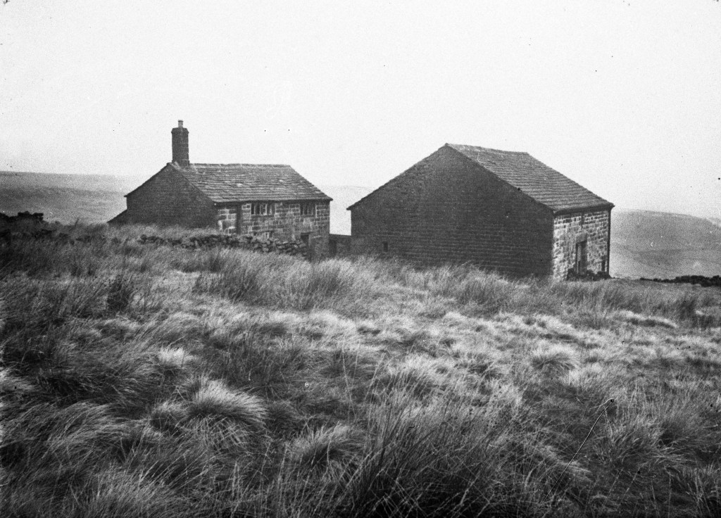
Above Red Dikes at the head of Withens Clough, imposing walls climb to the very top of Withens Gate, 1,208 feet above sea level. Yet at the time of the 1848 OS survey, Red Dikes itself stood at the head of its ground, the sweep of open moor behind it. The great walls that now stride up the slope were built only afterwards, pushing the limits of farming higher still.
The most striking example came a little earlier, in 1836, when Christopher Rawson – merchant, magistrate, ‘Father of the Borough’ – enclosed 193 acres of high moor above Cragg Vale to create nearly 50 new fields reaching 1,262 feet to the crest of Law Hill. He built five new farmsteads for them: Blaith Royd, Law Hill, Stoney Royd, Knowl and Bank Top. Meeting the uppermost enclosures of Erringden from the north, his new boundaries effectively severed the moor in two, leaving Erringden Moor an isolated island of 320 acres, cut off from the main body of Langfield Common. This had not been the case in the 1760s, when David Hartley’s Bell House stood with the full breadth of the open moor at its back.
Rawson’s grand plan even extended to a fair on the newly enclosed ground: the Johnny Gap Fair of 1836, described by the Halifax Guardian as showing ‘a great and excellent show of horned cattle’.42 It did not thrive; the annual event eventually moved down to the White Horse in Hebden Bridge, dwindling through the century until it disappeared in the 1890s.
Rawson’s vision, however, proved overreaching. At that altitude the summers were short, the soil sour and the economics unforgiving. Within 35 years Law Hill was abandoned, followed by Bank Top and Knowl Hill. By the Second World War Blaith Royd too had gone. Stoney Royd lingered, but wartime inspectors found its 13 fields poor and its drainage failing.43 Much of the enclosure became gathering ground for the Morley Corporation’s Withens Clough Reservoir, and local lore has it that Bank Top met an ignominious end as target practice for the army.
Today only Knowl and Stoney Royd remain inhabited. The rest – grassed-over platforms where walls fade into rush and bent – stand as a final frontier of enclosure: the line where human enterprise met the limits of the moor.

Enclosure on Langfield and Erringden was a slow, uneven process. It began with the medieval vaccaries, continued through the shared town fields of Mankinholes, and advanced in stages up the hillsides as land was taken in, divided and worked. By the late 19th century, the limits of what could be farmed were clear. Beyond a certain height the soils were thin, the season short and the return too small. Many of the highest enclosures were soon given up, and the moor reasserted itself. The pattern we see today – enclosed fields below, open moor above – is the outcome of this long history. It reflects not only law and ownership, but the practical boundaries set by climate, labour and the nature of the ground itself.
Commons
The history of Langfield and Erringden is not only a history of enclosure, but of its necessary counterpart: the commons. Upland farming in the Pennines depended on the relationship between these two kinds of land. The enclosed fields around the farmstead provided hay and winter keep; the common moor above provided summer grazing, fuel, bedding and building material. One could not function without the other. The long, narrow shape of Langfield township makes this dependence visible. A wide spread of enclosed fields lie on the lower shelves, while a thin panhandle stretches outwards and upwards onto the moor: the inbye land and the common moor held together as a single working unit.
Commons were not the scraps left over once enclosure was done. They were integral to the farming economy, governed by custom and regulated by the people whose livelihoods depended on them. The story that follows traces how these commons came to be used, managed, defended and, in Langfield’s case, eventually owned in common by the community itself. It begins in the Middle Ages, and moves through the law, custom and collective stewardship that have shaped Langfield Common for the past four centuries.
The Moor in the Manor
Langfield appears in the Domesday Book as one of the berewicks – outlying settlements – belonging to the great Manor of Wakefield.44 Together with its neighbouring settlements in the upper Calder Valley, it formed part of the Forest of Sowerbyshire. Here, the lord of the manor – first the Crown, then the Earls of Warenne – held rights to hunt deer and game, while the land beneath served a mixture of purposes: cattle farming on the lord’s own ranches (vaccaries) at Cruttonstall and Withens, and small-scale upland farming by the local community.
Around 1330, Earl John de Warenne enclose part of Sowerbyshire at Erringden with a great boundary fence or ‘paling’. The upland moor above Mankinholes – later Langfield Common – lay on the edge of this territory. Whether by luck, negotiation or simple resistance, the moor remained outside the new boundary and continued to be treated as shared grazing land, though a rent was paid to the Warenne estate.
During this same period, the Earls of Warenne granted land in the district to local landholders. A deed of the 1330s records William of Langfield transferring lands he had held of the Earl in places including ‘Le Withins, Thornley Moss and Mankinholes’, the moorland lying ‘betwixt Mankinholes and Southstrinessbrooke’ (White Holme Clough). This charter was later confirmed by King Edward III, and a fixed annual rent to the Crown was established.
Through marriage, this Langfield estate eventually passed into the hands of the Hamerton family – powerful but non-resident landowners. Their tenure ended abruptly in 1537, when Sir Stephen Hamerton was executed for joining the Pilgrimage of Grace, a northern uprising against Henry VIII during the Reformation. Because of his rebellion, his lands, including Mankinholes Moor, were confiscated and reverted to the Crown.
By the early 17th century, Crown documents refer to the moor – under names like Mankinholes Moor and Mankinholes Edge – as royal waste: open, unenclosed land. It is from this point that its history as common land properly begins, shaped thereafter by the rights, conflicts and customs of the local farmers who depended on it.
Shared Land, Shared Rules
But what is a common? Much of what we know about how commons were used and governed in the Pennine uplands comes from the detailed work of historians Angus J.L. Winchester and Nigel Smith. Winchester’s studies45 focus mainly on the Lake District, Yorkshire Dales, North Pennines and Scottish Borders (and so cannot necessarily be assumed to apply straightforwardly to the Calder Valley), while Smith’s work46 covers Midgley and the Heptonstall township in the upper Calder Valley.
It is a widespread misconception that a common is land that is not owned by anyone, or even that is somehow owned by everyone. Rather, it refers to land owned by someone – historically, the lord of the manor – but over which certain local people have held long-established rights of use.47 In the uplands, this is usually land that is typically high moorland or fell, and therefore too rough or exposed for arable crops.
The main ‘rights of common’ were right of pasture (to graze animals), right of turbary (to cut peat), right of estovers (to gather wood, bracken, heather, rushes), and ‘common in the soil’ (to take stone, clay or sand). But these rights were never unrestricted. They were controlled by custom, limited in scope and regulated to prevent damage to the land or conflict between neighbours.48 The commons only survived because everyone understood that they should take no more than their fair share. If the system worked, it was because people recognised that the shared resource was finite, and that the livelihood of each household depended in part on the care and restraint of others.
The first and most fundamental limitation was that the rights belonged to particular farms, not to people as individuals.49 A person did not hold common rights simply because they lived in a township or parish. They held them only if they occupied a farm or house that had long been associated with those rights. If they moved away, the rights did not go with them. If they sold or inherited land, the rights passed with the land. Rights of common were woven into the history of particular holdings and their relationship to the shared landscape.
The second limitation was that the rights could only be exercised for the needs of the household.50 One could cut peat to heat the hearth, gather bracken for bedding, or collect small wood for kindling or fence repair, but these materials could not be taken for sale or profit. The commons were a subsistence resource, not a commercial one.
Grazing, too, was limited by custom. Winchester describes the widespread principle of ‘levancy and couchancy’, which held that a household should graze no more animals in summer on the common than it could feed on its own land through the winter.51 This prevented wealthier farmers from overstocking the commons in summer simply because the grazing was free, and it prevented outsiders from moving animals in simply to take advantage of the resource. The scale of farming was supposed to match the scale of a household’s land an needs, not the economic ambition of the rights-holder. In some areas, this unwritten balance was formalised into fixed numerical limits known as stints or gates.
Other limits were seasonal. Peat cutting took place after spring growth had begun, so that the upper sod could be replaced. Meadows were closed to animals while the hay crop was growing, and grazing was not permitted there until the hay had been harvested. Bracken was usually cut in late summer or early autumn, after it had reached full growth. These seasonal patterns were embedded in the farming year.52
Rights also had spatial limits. The whole moor was not used in an undifferentiated way. Households had recognised peat pits where they cut their fuel,53 and the grazings were loosely divided into areas of habitual use – heafs or hefts, where sheep knew to return; summer grounds for cattle; bracken ‘dales’ on certain slopes. Winchester describes these as landscapes organised by memory rather than maps. One could not simply go anywhere and take anything. One went to the places one’s predecessors had used.
Another key feature was the exclusion of outsiders. Common rights belonged to the community of landholders who had always used the moor. People from other townships, or those without a holding that carried rights, were not entitled to graze stock or take resources.54
Finally, common rights were accompanied by expectations of behaviour; what Winchester calls ‘good neighbourhood’.55 Animals had to be kept under control. Swine were to be ringed and yoked so they did not root up crops. Hedges and walls had to be maintained so that livestock remained where they should be. Watercourses, on which everyone depended, were not to be diverted for private advantage. Dogs were not to be set on sheep. These were rules not just of land use, but of conduct among neighbours. They protected the land, the stock and the peace of the community.
The commons, then, were not free spaces; they were shared ones, sustained by memory, cooperation and care. But this is not to say that there was no transgression of these restrictions, and there were ways of enforcing them and gaining redress. When rights are interdependent and the landscape is shared, the line between cooperation and conflict can be thin. It took only a little overgrazing, a broken gate or a diverted stream to disrupt the balance on which the whole community relied. The records suggest that most people understood this and acted accordingly, but they also show that breaches did occur and that the system depended on being able to recognise, name and correct them.
The most common infringements concerned the grazing of animals. If livestock wandered into fields before the hay had been cut, or onto land where they were not entitled to be, the damage could be significant. Straying sheep or cattle were not just an inconvenience: they threatened the core supply of winter fodder. In many upland communities, someone was appointed to watch over the stock on the common and to drive back animals that had roamed where they should not. If this did not work, the usual remedy was to have the animals impounded in the village pinfold, a small walled enclosure. The owner then had to pay a fine – known as ‘pound loose’ – to have them released. Winchester notes that in some places this could be a formalised process; in others, it could be tempered by pragmatism if the offender was a neighbour of modest means or if the boundary was unclear. It was not only the presence of animals that could be faulted, but their condition: stallions of poor quality, diseased sheep or unruly dogs could all be the subject of complaint.56
Other disputes concerned meadows and cultivated closes. Meadows were protected while the hay was growing, and even a single night of grazing cattle could ruin a year’s crop. The fines associated with the offence of failing to keep a meadow shut up or allowing animals to stray were a recognition that hay was the foundation of winter survival. Likewise, the maintenance of boundaries – walls, hedges and gates – was treated as a shared responsibility. If someone failed to keep a wall in repair and livestock strayed through the gap, the person who had let the boundary deteriorate could be held to account.
The courts also intervened to prevent people from taking unfair advantage of water, the most vital of all resources.57 Diverting a stream to supply oneself could deprive others of water for their animals. Such acts were treated as serious disruptions to communal balance. The jury would require the watercourse to be restored and would impose a fine to ensure the offence did not recur.
Not all conflicts were so clear-cut. Some concerned behaviour rather than property: quarrels on the fell, accusations of ‘setting dogs’ on sheep, or verbal harassment directed at neighbours. These, too, came before the court when they threatened to disturb the shared use of the land. The moral language of ‘good neighbourhood’ appears again and again in such cases, suggesting that what was at stake was not only material fairness but the fabric of communal life.
Enforcement worked because it was local. The people who sat on the court juries were not distant officials; they were neighbours, often men of standing in the same township. They knew the land, the families, the histories of disagreements and the practical implications of each ruling. The court did not simply punish wrongdoing; it sought to restore balance. The expectation was that people would continue to live beside one another after the judgement was passed.
In this sense, the commons were not merely landscapes of shared resource use, but landscapes of continual negotiation. The system endured not because people never broke the rules, but because when they did, there existed both the means to address the breach and a shared understanding of why it mattered. The commons demanded cooperation. They also required a forum in which cooperation could be renewed after strain. The manor court provided that forum: not only a place of law, but a place where the community reaffirmed its commitments to land and to one another.
This is all by way of introducing the general nature of the commons and their management in the Pennine uplands, but Langfield Common ended up somewhat different. This is because it became, uniquely in the upper Calder Valley, a common owned not by the lord of the manor, but owned collectively among those who used it.
From Custom to Ownership
By the beginning of the 17th century, the moor above Mankinholes was still open, unenclosed land, used by the farmers of Langfield for grazing livestock, cutting turf (peat), and gathering stone and heather. These rights were customary and long-established, but they rested on tradition rather than secure legal title. That became a problem when, in 1604, a lawyer named John Priestley claimed that he owned not just land in Langfield but the manor of Langfield itself – arguing that he had inherited it through a sale of lands once belonging to Sir Stephen Hamerton, executed after the Pilgrimage of Grace. Priestly began to behave as though the moor was his private property and attempted to sell parcels of it.58
The farmers of Langfield – freeholders of their farms and the common rights that attached to them – resisted. They petitioned the Duchy of Lancaster, arguing that Langfield was still part of the Manor of Wakefield, held by the Crown, and that the moor – known variously as Mankinholes Moor, Mankinholes Edge or Mankinholes Common – had always been used in common by the inhabitants. The case was heard in the Duchy Court. Witnesses testified that rents for Langfield land were still paid to the Crown’s bailiff, that the sovereign was recognised locally as the chief lord of the manor, and that the farmers had freely pastured their cattle and horses and cut fuel ‘at their will’ without interference until Priestley had attempted to stop them.
After lengthy inquiries, a formal survey and the production of earlier medieval records, the court gave judgement in 1606: the moor belonged to the Crown, as part of the Manor of Wakefield, and the customary rights of pasture and turbary were to continue exactly as before.
This protected the freeholders’ use of the moor – but it was not yet theirs. Their rights still depended on the goodwill of the Crown. So in 1614–1615, they petitioned again, this time asking for the moor to be granted to them jointly, as copyholders in common, so their rights could never again be challenged. The Duchy agreed. The moor was formally recognised as common land held collectively for the benefit of the inhabitants, though a rent was set that was regarded as onerous.
Over the next decades full ownership was again sought. Negotiations began with Sir Gervase Clifton, the then-lord of the Manor of Wakefield. After the upheavals of the Civil War, a purchase was finally arranged. In 1652–1653, for the sum of £150, the moor – ‘Langfield Moor, otherwise Mankinholes Moor, otherwise Mankinholes Edge’ – was conveyed into the hands of named trustees on behalf of the freeholders of Langfield, to be held in trust for the common use and benefit of the township.
From 1652 onwards, the moor was no longer merely used in common – it was owned in common, and with that ownership the responsibilities of oversight and good order moved from the manorial court to the freeholders themselves. The work that had once belonged to the lord’s steward and jury of the manor – regulating grazing, resolving disputes, repairing boundaries, and maintaining ‘good neighbourhood’ – now rested with the community of freehold landholders whose properties carried rights in the moor.
They have exercised that responsibility continuously for more than 370 years. Their self-governance can be traced in the minute book begun in 1814 (lost for a time and rediscovered in 191459), in records of boundary disputes and legal agreements, in the granting of land for the building of Stoodley Pike Monument, and in the simple rhythm of meetings advertised in the local press – such as those held at the Dog and Partridge (Top Brink) or the White Hart. Through quiet continuity rather than formal spectacle, the freeholders of Langfield have acted, decade after decade, to steward the moor in common for the benefit of those whose livelihoods, and later identities, were tied to it.
Gates and Grazing
With collective ownership established, the freeholders needed a way to manage grazing fairly and to prevent the moor from being overstocked. The solution was the gate system, in which each ‘gate’ represented the right to graze a fixed amount of livestock. The gates were tied originally to farms in Langfield, and counted not in land-area but in animal capacity. One gate was commonly taken as the right to graze one cow (or the equivalent in sheep or geese), and some farms held many gates while others held only fractions.
By the early 18th century the freeholders had fixed the total number at 304½ gates,60 a number which has remained in force ever since61. This was not simply a bookkeeping exercise: overgrazing or the building of new houses or folds on the moor was treated seriously. Records show repeated complaints of encroachment and attempts to pasture more animals than one’s gates allowed. The freeholders relied on a pinder – a herdsman responsible for watching the moor and impounding stray animals in the pinfold. (The remains of a pinfold still exist behind the Harvelin Park estate.) The office appears early in the records. In 1706, John Crowther of Heyhead (the Shepherd’s Rest) was empowered to ‘put all manner of cattle trespassing and offending…in our ancient pinfold’.62 The freeholders looked after their pinders, apparently: in the 1830s, they granted him a ‘new hat and girdle, new coat and collar, and a pair of new shoes.’63 Yet the pinder’s task was not always simple, and the freeholders did not always approve of their actions. In one later instance, a pinder named Zac. Marshall impounded four sheep from the Little Moor, but the decision proved contentious. A group of freeholders – named and appointed for the purpose – was instructed ‘to enquire into the merits of the business, and direct the said pinder how to proceed further therein.’64 The pinder, in other words, was an officer answerable to the community, not an authority above it.
Over time, as flocks grew larger and farming practices changed, the old system of impounding strays under the pinder gave way to a subtler form of shared regulation based on identification marks and collective record-keeping. In the 20th century this was embodied in the Pennine Sheep Keepers’ (later Sheepbreeders’) Association, whose job was to maintain the ‘flock books’ that recorded each farm’s distinctive smit marks or lug marks – the small cuts in ears, strokes of paint, or initials burned into horn that enabled farmers to recognise their animals at a distance. The Association began when local farmers clubbed together to support a neighbour charged with allowing sheep to stray; they paid a shilling per head of sheep to cover the court costs, then continued meeting afterwards without the man they had rescued, who declined to join. For more than 30 years the Association’s records were kept by one family: Mary Gibson’s father served as secretary until 1982, after which Mary herself held the post until the Association finally wound up in 2014.65 Among the papers she inherited was one of the old Shepherds’ Guides, first printed in 1928, listing not only the farms and flock marks but also the heafed (or hefted) territories to which each flock was accustomed – ancestral grazing patterns passed down from ewe to lamb. When the moor was gathered and sheep were brought in, the guide allowed farmers to identify strangers and return them to their rightful heaf (or heft). In this way, the work once carried out by a single pinder was replaced by a cooperative system rooted in memory, neighbourliness and the shared responsibility of those who held gates to keep the moor in good order.
The gates were also economic assets. When income came into the freeholders’ funds – such as compensation payments, quarry rents, or payments from the canal company – it was distributed to freeholders in proportion to the number of gates they held. A cash account from 1827, for instance, shows a dividend of 22 shillings per gate from canal company payments.66 A century later, the pattern is still recognised: one’s share in the moor determined both one’s grazing rights and one’s entitlement to income.
Over time, gates could be bought and sold, separated from the farms to which they were once attached. This meant that, by the 20th century, some gate-holders no longer lived or farmed in Langfield at all, and advertisements occasionally appeared offering parcels of gates for sale to outsiders.67 The need to record who held what became especially pressing after the 1965 Commons Registration Act, which required common rights to be formally registered; farmers worried that registering gates would permanently fix their grazing numbers.68 In more recent times, with around eight active gateholders left exercising their grazing rights, the common has been entered into an Environmental Stewardship Scheme, adding an extra layer of negotiation into stocking levels and grazing periods.
Yet through these changes the essential principle has remained constant for over three and a half centuries: no one owns any piece of the moor outright – but those who hold gates share the right and the responsibility to use, regulate and steward it together.
From Hill to Hearth
The right of turbary– the right to dig peat or turf for fuel – was firmly established here by the early 17th century. In the 1605 Duchy case, witnesses described how the inhabitants cut peat or ‘turves’ on Mankinholes Moor.69 This was a household necessity. In the uplands, where winters were long and timber scarce, peat was the fuel that kept homes warm, dried clothes, cooked meals and provided the steady glow around which the household gathered.
The work began in late spring, when the flaights (or fleights) – the surface of heather and grass – were pared off with a flaight spade. Beneath lay the deep black peat, which was cut into slabs with a turf spade that cut two sides of the block in one stroke. Soft and heavy with water, the turves were spread to dry out, then stacked into small pyramids, and then larger, taller stacks that stood drying for weeks in the wind until they were hard enough to be hauled down from the moor by horse, cart or sled.70 A 1693 inventory of the goods left in the will of Samuell Whiteley of ‘Studley lee’ in Langfield – along with wool, yarn, a pair of looms, a spade, shovel, axe and saw – lists a ‘Turfesled’, which would have been used to transport peat from the common down the hill to the farmstead.71 It was then stored in a turf house or peat cote for winter. Many Calder Valley farms still have their peat cotes, used as garden sheds or other outside storage.
This fuel was not taken lightly. Smith’s analysis of the Heptonstall manor court records show ‘pains’ (byelaws) concerning, for instance, the requirement to bed or turf the pit bottom, meaning the stripped turf had to be laid back into the hole after cutting, to avoid further erosion and to preserve grazing.72 Peat was to be used only within the manor or township – selling it was forbidden. Each farm held its own peat pit, and the right to dig in another’s pit was an offence. Yet peat was so central to life here that Crump records farms where a single peat fire had smouldered on the hearthstone for a century, never extinguished, only fed – its warmth linking one generation to the next.
It is difficult to say with certainty where peat was cut on Langfield Common. Some possible workings appear on the 1848 Ordnance Survey map, near Red Dikes and above the lower approach to Withens Gate, but the evidence is far from conclusive.
This is partly because a healthy peat moor is self-healing: once cutting stops, the surface vegetation gradually knits over the old faces and hollows, softening their edges until the landscape appears unbroken again. Yet traces remain, just not at the surface. Peat depth surveys reveal unexpected shallow patches in places where peat should lie deep and undisturbed.73 These irregularities are most convincingly explained not by natural variation but by the long, steady exercise of turbary rights, where peat was systematically cut for fuel over generations.
Walking the Bounds
Once the freeholders held Langfield Moor in common, its boundary became something they had to actively maintain. The line that marked where Langfield ended and its neighbours began was not a quiet or settled one: it was walked, argued, measured, marked and at times defended with considerable resolve. The earliest surviving record of this vigilance comes from 1688, when repeated ‘incroachers’ were brought before a panel of four impartial inhabitants, empowered to impose fines for the sake of the township.74 To encroach on the common was to undermine the shared resource on which every farm depended; the community responded with formal, binding judgement.
By the early 19th century these principles were being applied in more complex circumstances. In 1814, when Samuel Fielden of Lumbutts took a strip of common to enlarge his mill reservoir, the freeholders allowed the encroachment, but only at a price per square yard, with the proceeds distributed according to the number of gates each freeholder held.75 This was not simply compensation – it was an assertion that the moor was owned together, and any loss or gain had to be shared out equitably. In the same year the freeholders purchased a minute book to record every such decision, and appointed a custodian for the deeds, treating the governance of the moor with increasing administrative seriousness.76
The boundary with Sowerby became a flashpoint in 1815, when Sowerby landowners disputed Langfield’s right to Little Moor and White Holme. The freeholders responded: they arranged to walk the boundary on the ground, and resolved at the same meeting to build a six-foot stone wall from ‘Height-man Wall’ to Red Dikes, paid for out of encroachment income. In 1821, they offered a £20 reward for information about the defacing of boundary markers.77 The boundary was not just an abstract line – it was a statement of identity, memory and shared right.
The same commitment appeared when the Rochdale Canal Company pushed its way onto the moor. By 1819, the freeholders were consulting attorneys; in 1820, they threatened to cut the Canal Company’s drain bank if their rights were not recognised. By 1825, the Canal Company yielded and opened negotiations. The freeholders demanded payment per acre for land already taken and for land proposed for reservoirs, insisting also on the protection of turbary rights and access to the moor. When settlement was reached, the proceeds were again paid out proportionally per gate, in 1827, at a dividend of 22 shillings per gate.78 From draining water to maintaining bridges on moorland channels, the freeholders required that any new infrastructure acknowledge the moor as their land, held in common.
Boundary disputes intensified again in the 1830s and 1840s, when Sidney Hadwin set his own boundary stoops well inside Langfield. The freeholders took the matter to the moor itself. A committee, accompanied by ‘old persons who have walked the ground for a considerable period of time’, retraced the traditional boundary by memory and sight. They commissioned William Robinson to map it anew, and in 1840 had 25 large boundary stones erected, the old ones pulled up, the holes filled. Similar action followed against Mr Dearden, Lord of Rochdale, and later with Christopher Rawson, who owned the Turley Holes estate.79 Across these disputes, it is clear that the boundary endured because the freeholders enacted and defended it.
Centuries of Stewardship
Taken together, these episodes show that the freeholders’ role did not end with the purchase of the moor in 1652; it began there. Ownership in common required continual, active management, and the freeholders have undertaken this work with striking steadiness for centuries. They controlled quarrying, as in 1834 when measures were taken to stop stone being taken without payment to the treasurer.80 They oversaw the building of roads across the moor, such as the new route made in 1881 from Heyhead to Withens Gate, planned by John Midgley and funded entirely by John Fielden of Dobroyd Castle – but only after the freeholders had granted permission for it to cross their land.
They regulated access and behaviour on the moor. Notices appear in the local press throughout the 19th century: ‘Any person found trespassing on the above Common will be prosecuted. By order of the Freeholders’, although such warnings tended only to appear around the opening of the grouse shooting season in August.81 Similar notices were issued specifically to deter poaching, and when necessary, that warning was enforced. In 1890, for example, a Todmorden man was prosecuted after being caught shooting grouse at Ball Hill Scout; the case involved the freeholders’ secretary, their gamekeeper, and the system of shooting licences granted by agreement among the gateholders.82 The right to shoot was understood as a shared resource, just like grazing and turbary, and one that required clear rules if it was to endure.
And the freeholders made space, where they saw fit, for what the moor meant to the wider community. When, in 1814, local residents requested ground on Stoodley Pike to build a monument to mark the end of the long Napoleonic wars, the freeholders granted a precise plot of land – 123 square yards – ‘for this public monument, and for no other purpose whatever’.83 The monument that now stands at the top of the hill is familiar to thousands, but it rests on the same legal, cultural and communal footing as a peat pit, a gate or a boundary stone: it is there because the freeholders agreed that it should be so.
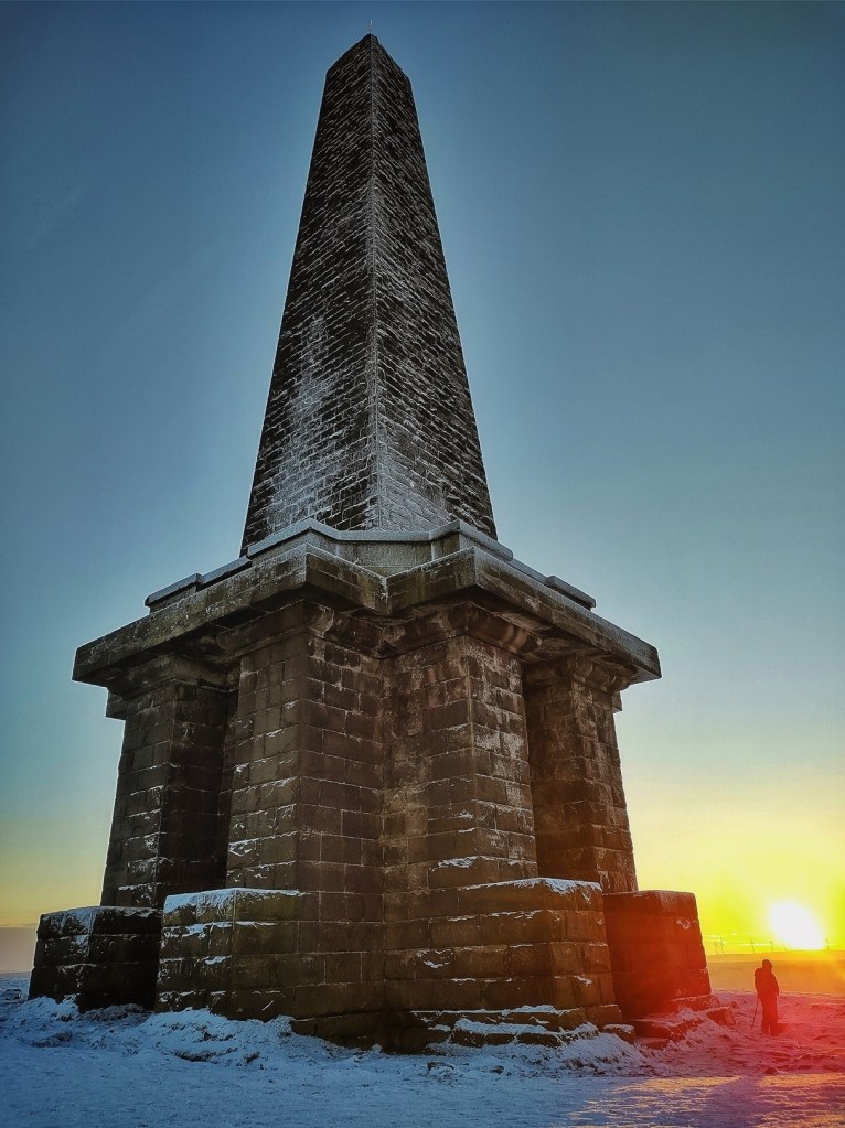
Across grazing, peat-cutting, boundary-walking, quarrying, shooting, stone-setting, and the making and maintenance of roads, the freeholders of Langfield have acted not simply as owners but as custodians – of the land, of the rights held in common and of the relationships that bind the surrounding communities to the moor. The story of Langfield Common is not only one of historical arrangements and legal rights; it is a story of ongoing care, exercised together, over ground held in trust for the common good.
Crossings
Across Langfield and Erringden, the moors are traced with old routes – stone-paved ways, hollow lanes, and later estate drives – that once connected communities and workplaces on either side of the watershed. They were the lifelines of a self-contained upland world, ways shaped by need rather than leisure: by the movement of goods, animals and people across terrain that could quickly turn from familiar to treacherous. Some routes are prehistoric, others medieval, and some were cut by 19th-century industrialists, but all tell of the effort required to cross this high ground, and of the enduring relationship between landscape, labour and passage.
Moor Ways for Hooves
Across the Pennine hills, long before maps or metalled roads, a web of paths evolved along the ridges and moorland edges, keeping to the high ground above the swampy, wooded valleys where wild boar roamed and fords were few. First beaten by animals seeking water and salt and later trodden by Mesolithic hunters, these ways linked Bronze Age clearings, stone circles and burial sites into a loose upland network. Roman engineers later formalised some of these lines, connecting forts at Ilkley, Castleshaw, Slack and Littleborough, yet the deeper patterns of movement long pre-dated them. Saxon and Norse settlers extended the system, and by the medieval period the tracks had become arteries of exchange linking manors, monasteries and markets. Drovers, lime-burners and salt merchants each had their own familiar routes – the Salter Rake Gates and the Limers’ Gates – carrying the materials that sustained Pennine life: salt for meat, lime for mortar and soil, wool for weaving.84
In time, many of the most-used tracks were paved with great flags of gritstone to withstand the weather and the hooves of packhorse trains.85 These ‘causeys’, from the Old French ‘caucie’ meaning a raised or paved way, were narrow, typically no more than two feet across, wide enough for a single file of ponies. Each flag was laid crosswise so hooves struck the centre of the stone, spreading their weight evenly and preventing the flags from rocking loose. Where smoother slabs were scarce, rough local boulders were pressed into service, their flatter faces turned upward and sometimes scored diagonally to improve grip.
Causeways were built wherever the ground was soft or eroded – over peat, across cloughs, and through fords. Some were single lines of stone running between ditches; others were double, with side-fillers of cobble or shale and kerbing stones to hold the flags in place. Drainage was vital, and shallow diagonal runnels cut into the surface kept the water moving. The craftsmanship was instinctive and vernacular, the work of local farmers and wallers whose eyes judged each stone by feel and balance. A well-laid causeway might last for centuries with only occasional resetting.
Alongside the pavements ran other marks of human passage: hump-backed bridges of rough-cut stone, ‘clam’ bridges of single slabs spanning streams, and milestone stoops cut from local grit to guide the traveller. Each line had its rhythm of ascent and contour, keeping to the shoulders of the hills rather than plunging into the valleys. The packhorse trains moved in single file, the bell horse leading 30 or more Galloway ponies laden with cloth, salt or lime, hooves ringing on the flags, the line snaking steadily across the high ground.
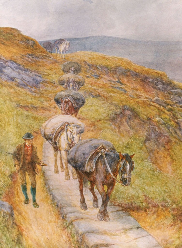
By the 16th and 17th centuries, as cloth and lime were carried in steady streams between Halifax, Rochdale and Burnley, the Pennine causeways were at their busiest. They remained so even after the turnpikes came, for they were toll-free, familiar and direct. Today the surviving causeys, half-buried in turf and peat, trace the memory of this long traffic, their narrow ribs of stone running between heather and rushes, reminders of the movement, trade and connection that once stitched the moors together.
Two Ancient Lines
Turning to our moors, among the maze of routes, two stand out as significantly older. One is Salter Rake, which curves around the hillside under Gaddings Dam from the Shepherd’s Rest into the valley of the Walsden Water. Judging by its name, it was likely an early saltway – a route by which salt was carried from the Cheshire wiches (the salt-producing towns of Nantwich, Middlewich and Northwich) across the Pennines to the upland communities of Lancashire and Yorkshire.
The other is the Long Causeway, from Lumbutts to Cragg Vale, which crosses the shallow pass at Withens Gate. It still bears its name: the causey stones climbing beside the enclosures that were added between 1848 and 1894, but clearly predating them.
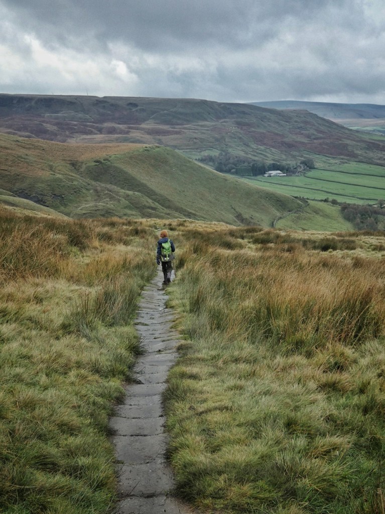
Its route from Lumbutts to Withens Clough, marked on the 1848-surveyed Yorkshire Sheet 229, is as follows:
- The purple section is the ascent from Lumbutts to Withens Gate, on which all the causeys are still intact and visible.
- The yellow section is the descent from Withens Gate beside the Red Dikes enclosures (which are not created at the time of this map). Here there is an absence of causeys, either because there never were any, or else they were either buried or removed at the time of the construction of Withens New Road (of which more later).
- The green section is where Withens New Road deviates a little from the Long Causeway, and it is possible to make out a few causeys, although most are lost among the rushes. This section finishes at the pointed tip of the reservoir’s filter bed, and the rest of the route is submerged under the reservoir.
- The blue section is where it crossed to the south side of Withens Clough – here meaning the stream itself rather than the whole wide bowl – on a bridge, continuing past a farm called Causey Side, the only one of the 15 Withens farms to stand on that southern bank. The farm has vanished, though traces of its enclosure wall survive on the slope above the water. From there, the Long Causeway meandered beside the clough stream for about 600 yards before re-crossing to the north side, just within the former boundary of the extended Erringden Deer Park, created around 1385.
- The brown section shows it after it crosses the stream, it immediately ran through a second Withens Gate – a lower counterpart to the one on the high moor, marked with a white arrow. It is a curious thought that many of its causey stones may still lie in place, now submerged beneath the reservoir.
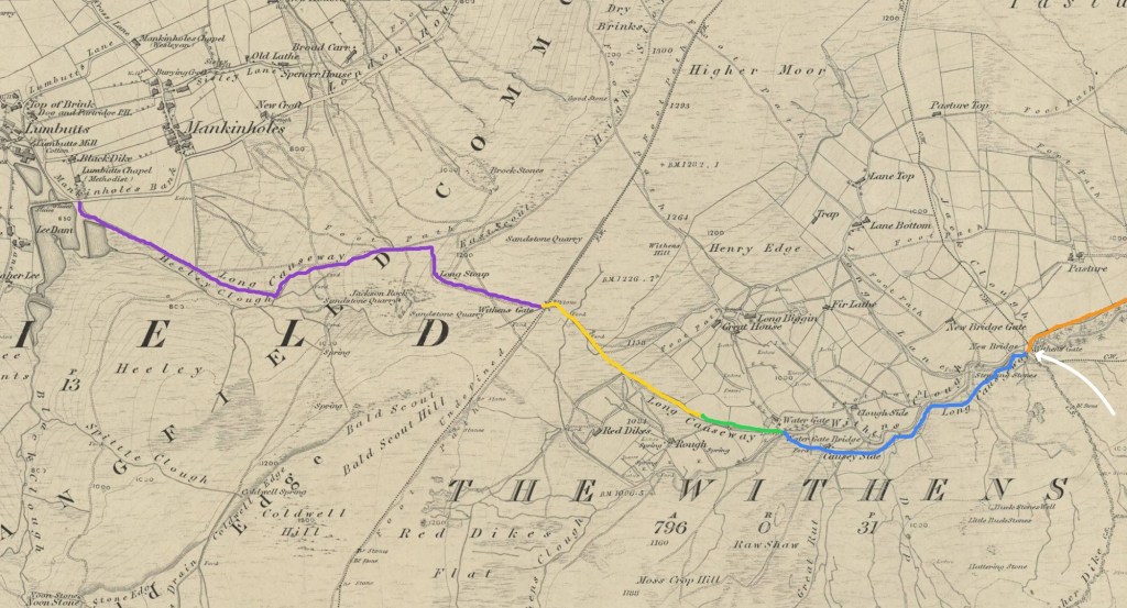
The final stretch can still be glimpsed on the neighbouring OS sheet (230), where it rises (marked in purple) from the clough to meet what was then Withens Lane (now called Withens New Road) halfway up the present ascent from the car park beside the dam, near where a little track today crosses the spillway onto the embankment. From there, its route (in green) likely became Rudd Lane, leading down to Marshaw Bridge (just beyond the edge of the map extract).
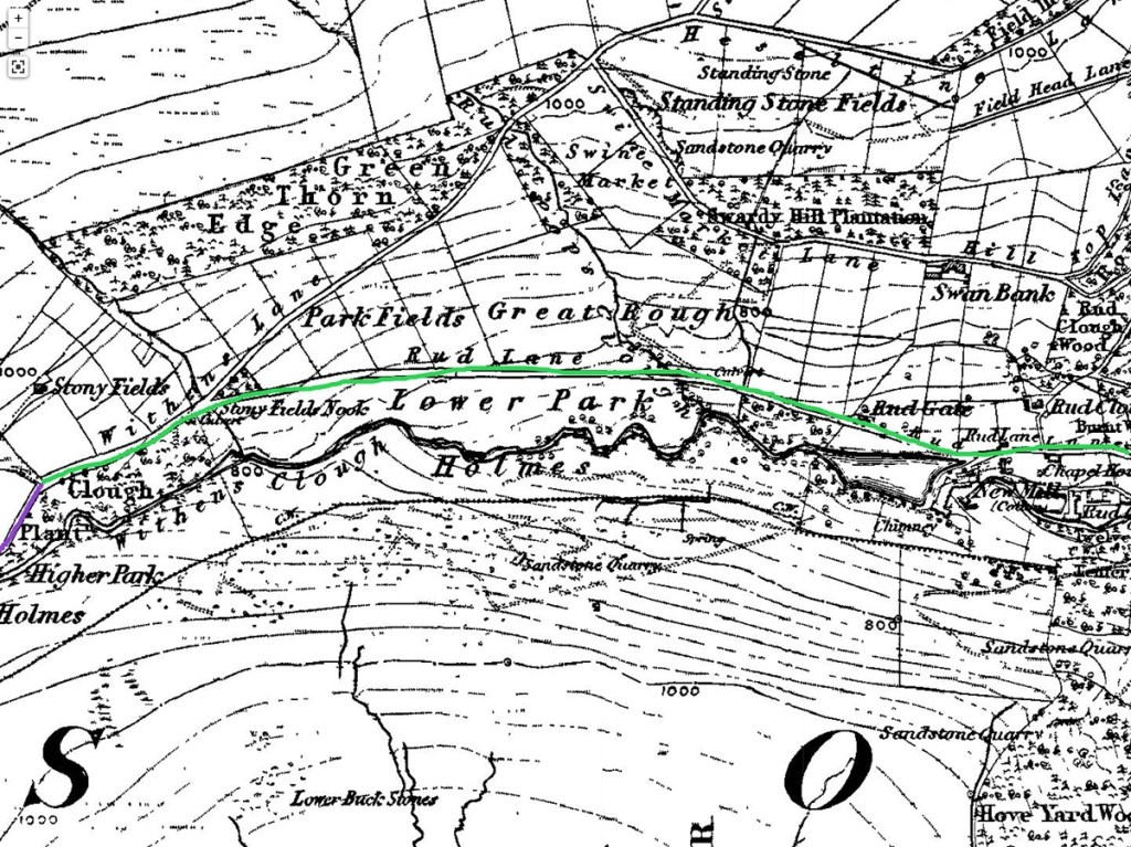
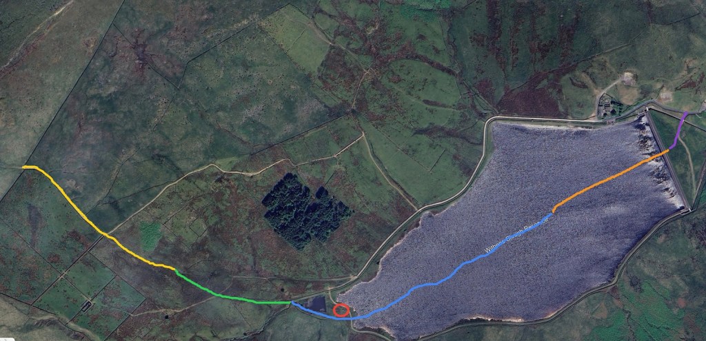
The Ways of the Dead
It is often said that the Long Causeway must have been a coffin route. Coffin routes, or ‘corpseways’, were traditional funeral paths used to carry the dead from outlying farms and hamlets to the parish church that held burial rights. These routes developed in the medieval period, when parish boundaries first took shape, and often crossed miles of moor and hillside before chapels and local graveyards existed. The body – usually wrapped in a shroud and carried on a bier or packhorse rather than in a coffin – was borne along these paths by relays of mourners, pausing at resting stones where prayers were said. Over time, such ways became hallowed by custom: keeping to steady gradients, avoiding main highways and linking the dispersed communities of the uplands with their mother church.86
It seems to be the presence of the Te Deum Stone at the higher Withens Gate that has given rise to this modern piece of folklore. The squat, weathered stone beside the ancient route is carved with a thin Latin cross and the inscription ‘Te Deum Laudamus’ – ‘We praise Thee, O Lord’ – and may date from the late medieval period, or perhaps the 17th century.87 Damaged and shortened over time, it was restored in 1956 by members of the Hebden Bridge Local History Society. Several sources state that coffins were said to have been rested upon it at the summit of the climb between Cragg Vale and Lumbutts, where prayers were offered before the descent.
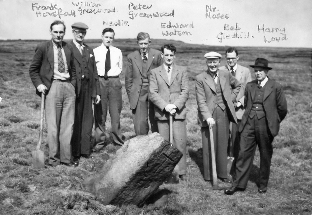
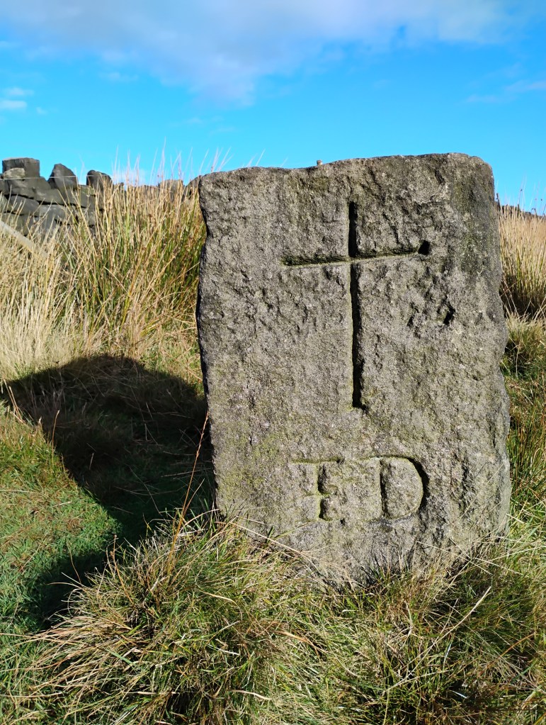
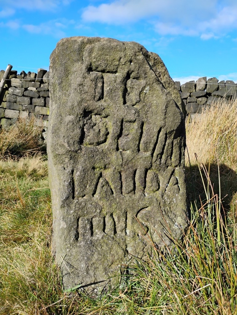
However, in our conversation with John Billingsley, local folklore expert and author of Journeys of the Soul: Vernacular Funeral Routes in Upper Calderdale, he convincingly argued that the Long Causeway is unlikely to have been a corpseway for several reasons. Corpseways were established when burials were permitted only in the consecrated ground of the parish’s mother church – originally Halifax, and later Heptonstall for the upper valley townships of Langfield, Stansfield, Wadsworth, Erringden and Heptonstall itself. The Long Causeway, by contrast, runs east–west across the moor between Cragg Vale and Lumbutts, an alignment that makes no practical sense for a funeral route to either Halifax or Heptonstall. By the time churches and chapels existed at both ends – St John’s in the Wilderness at Cragg Vale (1813), Lumbutts Methodist Chapel (1814) and Mankinholes Methodist Chapel (1877) – the old obligation to carry the dead on foot had long vanished, replaced by wheeled hearses on parish roads. There was therefore never a religious or practical need for a coffin route linking Cragg Vale with Lumbutts or Mankinholes. Instead, Billingsley traces the true Cragg Vale coffin route to Heptonstall: rising from Marshaw Bridge by way of Swan Bank and High Green, past Bell House, whose causey stones run around the rim of Broadhead Clough, then crossing Erringden Moor to Snell (or Snail) Lane, a sunken track today guarded by an ancient crab apple tree.88
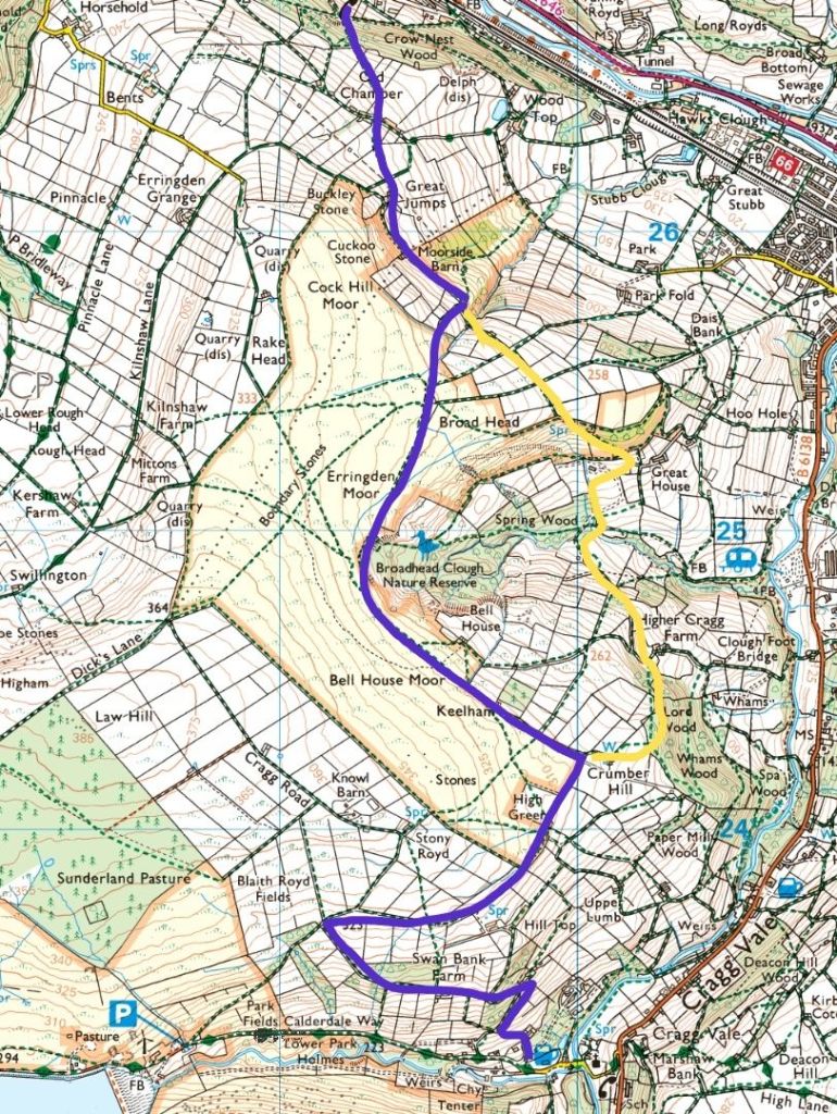
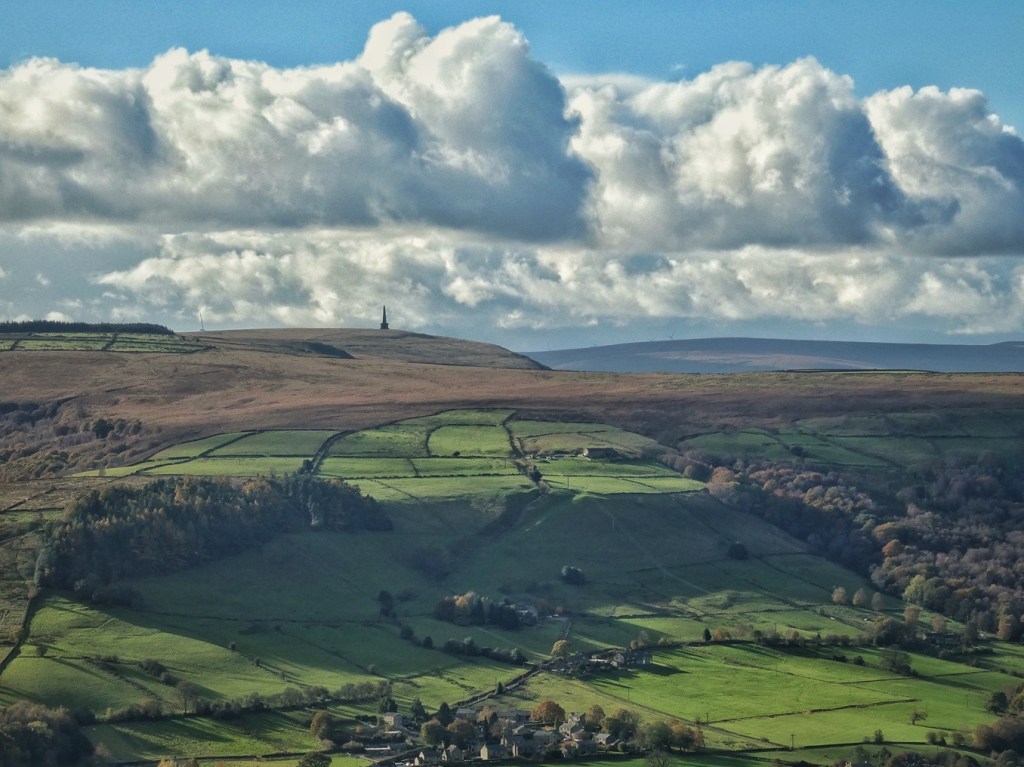
The Myth and Reality of the Cotton Famine Roads
Two later routes also cross or skirt these moors: London Road, which contours along the slopes below Stoodley Pike, and Withens New Road, which runs from the Shepherd’s Rest pub to Cragg Vale, sometimes joining the older line of the Long Causeway. It is often said that both were built by the Fielden family during the Cotton Famine of the 1860s to keep their workers employed. However, London Road, though absent from Myers’s map of the parish of Halifax in 1835, appears by the time of the 1848 OS survey, and so predates the American Civil War (although it is possible labour was used in the 1860s to improve it in some way).
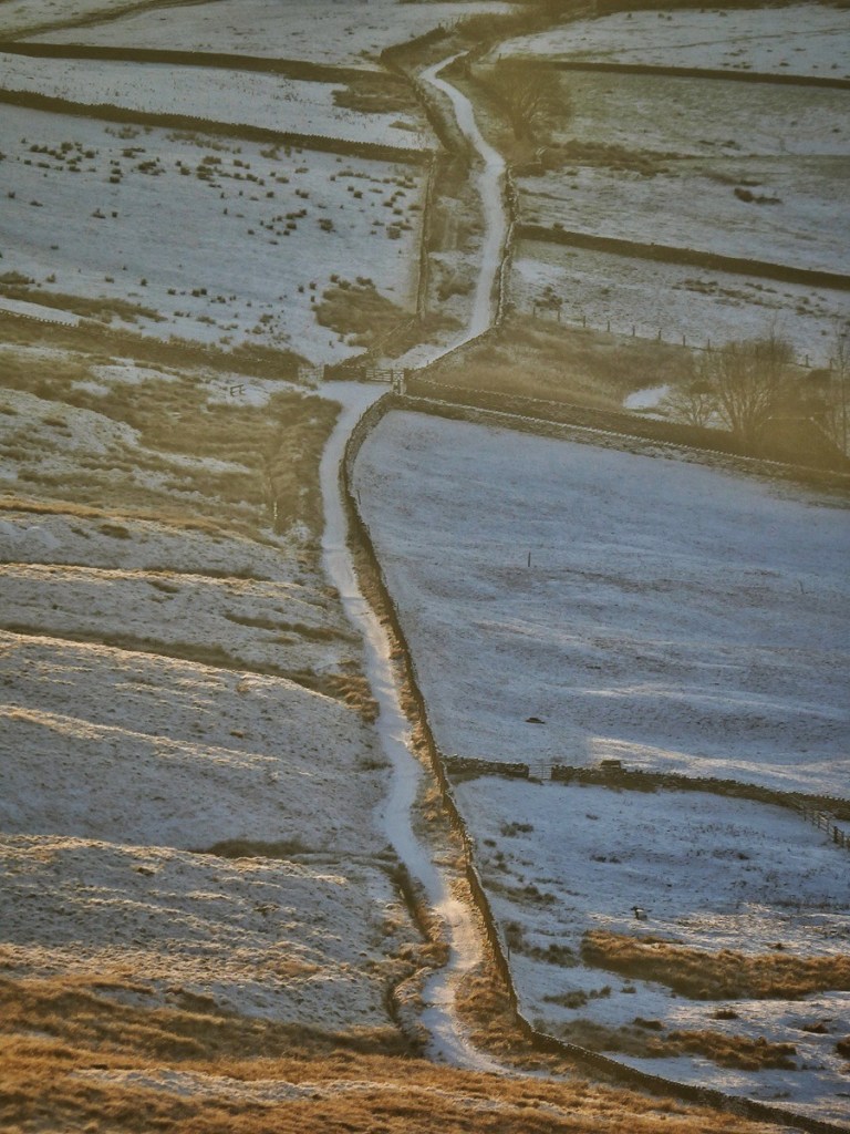
Three newspaper articles of 1881–2 record the building of Withens New Road.89 In May of 1881, John Fielden of Dobroyd Castle set men to work at Heyhead above Lumbutts, cutting the first 200 yards of what would become a two-mile road over the moor to Withens Gate. Forty men were employed under the supervision of John Midgley of Lumbutts, who had surveyed and staked out the line. The new road left Heyhead Green, passed below the old quarry road, skirted above the enclosures at Horsewood, and ran in a straight line with a gentle one-in-twenty gradient to the Long Stoop, from where it continued almost level across the moor to Withens. Ten feet wide, with passing-places for carriages, it was financed entirely by Fielden himself, with the consent of the Langfield freeholders. Described as both a practical boon for Withens farmers and a fine drive for pleasure-seekers, it was completed in 1882 and then extended down to Cragg Vale.
After a steady climb from Hey Head (marked in red on the map below), it joined the Long Causeway (where it is marked in green) just before Withens Gate. Interestingly, the causeys are intact for the short stretch to the Gate, but then it has sadly obliterated them on the descent (if indeed they were ever there). It was said to have crossed ‘Withens Brook’ by a bridge (presumably the one that crossed the Long Causeway to the south side and Causey Side) and to ‘come down Mr. Fielden’s moor’, which was Turley Holes and Higher House Moor, arriving at Bod Bridge at the Cragg Vale Inn (Hinchliffe Arms). This description in the newspaper is consistent with it simply following the route of the Long Causeway for the rest of the way, but Roy explained to us at one of our heritage gatherings that its route can be picked up again a little below the dam to the site of New Mill. This means it must have declined to re-cross ‘Withens Brook’ with the Long Causeway (from where it is marked in red again), and indeed a track is marked on the post-1880s maps, and is marked there still, although it is entirely lost to the moor’s vegetation. Once it reaches the site of New Mill, no further trace of it can be found, so it appears it crossed back to the north side here and joined Rudd Lane. The rest of the way to Higher House from Bod Bridge is in yellow. (A spur is marked in purple where its route was diverted at the time of the reservoir construction, so it could join the reservoir-side track at a comfortable angle. After this time, the reservoir-side track on the north side was named Withens New Road.)
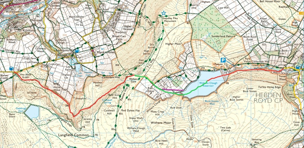
The newspapers hailed it as ‘a substantial and comfortable communication between Todmorden and Cragg Vale’ – a private benefaction that, in truth, also gave the Fieldens easy access to their grouse moor at Turley Holes and shooting lodge at Higher House. (This substantial house is the ‘shooting box’90 – as it is referred to in a sale notice of 1844 – that is often referred to as belonging to the Fieldens, not the small hut visible from the road to Blackstone Edge.)
Today, the Long Causeway remains the most direct and evocative route to Withens Gate, its flagged stretches still lifting through the rushes where the moor begins to breathe. The Fieldens’ road, meanwhile, lies half-forgotten, its line in places choked by rush and water. In fact, it is worse than that, for it can hardly have lasted long at all as a passable route. It is obliterated and collapsed in multiple places by landslides. The bridge over Black Clough has been partially washed away. Long stretches are hardly discernible at all, submerged in bracken, buckled by the restless hillside. One suspects that the Fieldens’ engineers knew full well – and perhaps even tried to warn them – that the hillside under Langfield Edge was quite unsuitable, and that it would need a much more substantial investment in drainage and revetments if it was to stand a chance of lasting. But evidently their wish for a shortcut to their shoot at Higher House was worth the folly of ignoring the reality of the terrain.
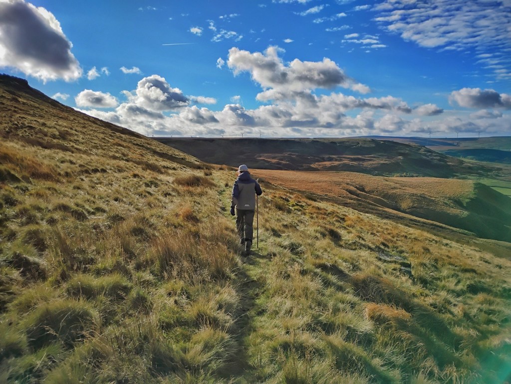
Across the moors, other tracks now carry walkers and cyclists – paths to Stoodley Pike, routes beside the Warland and White Holme catchwaters – but, as Lawrence remarked to us, the old ways were never recreational. The ancient routes, and later the industrial ones of canal, road and railway, were made for purpose, not pleasure. To our predecessors, seeing modern walkers meandering across these hills with no cargo, no destination and no reason beyond the joy of the crossing itself, would have seemed entirely baffling.
Industry
The Calder Valley moors were not only places of pasture and peat, or for transiting on the way from one valley to another, but also reservoirs of materials and power that fed the industrial valleys below. Their gritstone edges and plateaus were quarried for wallstone, building stone and paving flags; their shallow coal seams were worked wherever they cropped out; and their streams, once left to find their own way down the cloughs, were dammed and channelled to ensure a steady supply of water for mills, and later for the growing towns. New tracks and even tramlines crossed the heights carrying stone and spoil; catchwaters snaked their way around the the moorsides to lead water into reservoirs; and whole gathering grounds were bought up by distant town corporations and cleared of their farms. The moors became at once workplace, conduit and resource: supplying the material for the fabric of towns, the power for the machinery within them and the drinking water for their expanding populations. The Langfield and Erringden moors did not escape being pressed into service.
Stone and the Delvers
Across the South Pennine uplands, the bedded sandstones of the Millstone Grit were worked wherever they broke to the surface. Locally known as delphs (or delfs), these quarries were opened into the Lower and Upper Kinderscout Grits: hard, coarse sandstones that could be split, dressed and carried to the towns below. As Christopher Goddard notes, the earliest work was often simply the gathering of earthfast stones or exposed edges for walling and roofing thackstones, with moss used as packing to keep out weather.91 But with the building boom of the 19th century, quarrying expanded into a major local industry. Stone was taken for everything from paving flags, kerbs, jambs, sills and setts, to ashlar-faced public buildings and chapel fronts. To the west and east, shallow coal seams and shales were also worked, though these were far less extensive than the stone. The delvers – quarrymen – worked by hand: clearing rag (surface stone) and soil to reach the workable beds, barring out large blocks beneath natural faults, dressing them on site, and loading them onto horse-drawn carts or wagons. Steam cranes were later used, though explosives were generally avoided. The work was heavy, skilled and seasonal, with many farmers quarrying in summer to supplement winter incomes, and some families became quarrymen-farmers over generations.92
Around Langfield and Erringden, these delphs ring the moor. Jail Hole and Langfield Edge below Gaddings Dam; Jackson Rock and East Scout either side of the Long Causeway; Blue Scar, Red Scar and the Hare Stones under Stoodley Pike; Higham, Rough Head, Kilnshaw and Rake Head along the northern edge of Erringden Moor; the small quarries above the Withens Clough dam, opened for its construction; and the workings cut into the hillsides under Warland and Light Hazzles reservoirs. Each was taking broadly the same stone from the same beds. This means they are strung along a remarkably consistent elevation, all within 50 metres or so of each other. Some exposures were eaten back dramatically; all left spoil hummocks, the vegetation growing on their man-made mounds subtly different from the surrounding moor.
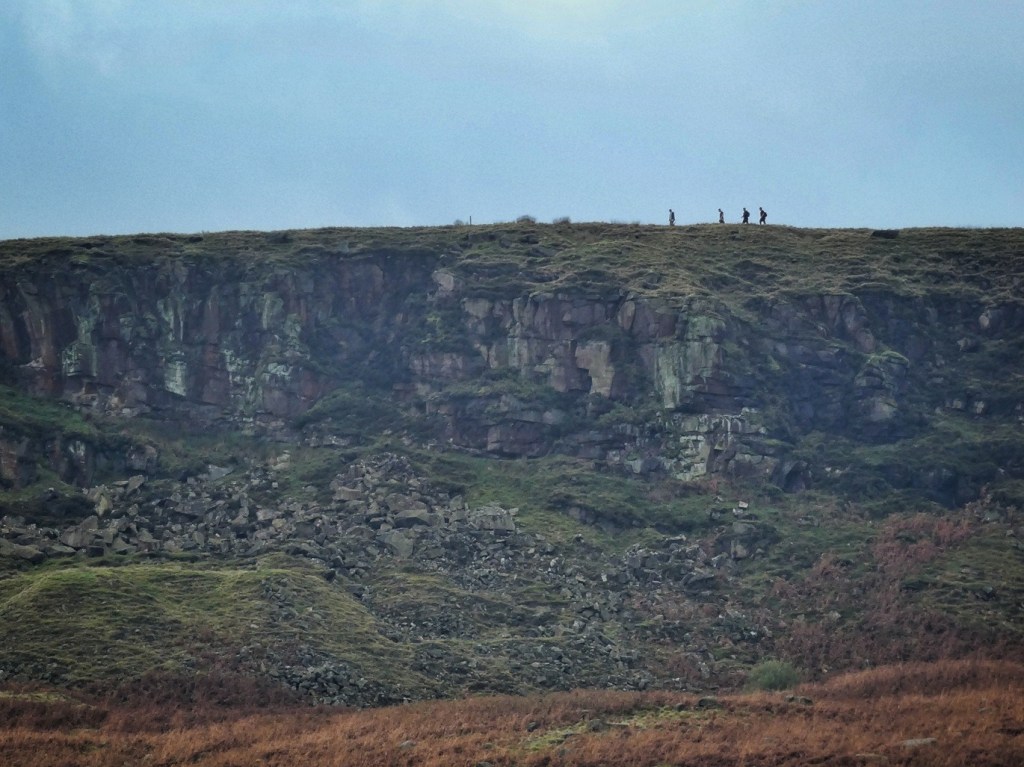
By the time the first large-scale Ordnance Survey editions were published in the 1880s and 1890s, most are already marked as ‘Old Quarry’ or ‘Quarry (dis)’. Yet their marks on the landscape remain, and their stories persist in local memory. Jim told us of stone from the Langfield delphs being carted away to Liverpool Docks. Others talk of Jail Hole being named for Manchester prisoners who were brought here to work it. Little is left of this industry on the moors but the healed-over scars.
Feeding the Reservoirs
Quarrying affected only a very small proportion of our moors – about 45 acres out of around 4500. The harnessing of water, by contrast, transformed the moors on a far greater scale. Seven reservoirs lie upon these heights. Their combined surface area is approximately 350 acres, but the more profound impact is their impact upon the hydrology of a vastly greater area. For these reservoirs do not simply collect the rain that falls within the bowl bordered by their dam walls, nor rely solely on the watercourses that happen to flow into them. Instead, they are fed by catchwater drains – long, sinuous channels that trace the contours of the hills to gather water from great distances, often diverting channels and streams that would naturally drain away from, or are even downstream of, the reservoirs themselves.
The first of these new artificial water bodies was Blackstone Edge Reservoir, built in 1798. Its natural catchment would be roughly 350 acres, but six miles of catchwater drains were cut along both sides of its namesake gritstone ridge on the far side of the road to Littleborough to draw in water that would otherwise flow east into the Ryburne or west into the Roch. These drains increased its catchment to around 870 acres. 93
White Holme Reservoir followed some time after 1807. Its natural catchment would only be in the region of 100 acres, but two remarkable drains – one an almost implausibly circuitous two-and-three-quarter-mile channel known variously as Black Castle, Cold Laughton and Byron Edge along its length; the other a one-and-a-third-mile drain intercepting the dark run-off from the southern and eastern flanks of Blake Moor – expanded its catchment to about 640 acres. Light Hazzles and Warland reservoirs, built sometime after 1828, share a similar enlarged catchment, drawing water from the northern slopes of Blake Moor. The original, eastern, Gaddings Dam, now breached and dry, was added in 1827–8.94
Along with Hollingworth Lake, Snoddle Hill (later called Higher Chelburn) and Lower Chelburn, these reservoirs were constructed not for drinking water, but were built by the Rochdale Canal Company to keep the 1,400-yard summit pound of their new trans-Pennine route supplied. The reservoirs of these moors – some of the very earliest in the country – were built, in effect, to keep an industrial trade highway flowing.
The summit pound fed 56 locks down the western side of the Pennine watershed to Castlefield, and 36 east to Sowerby Bridge. But the canal’s heyday did not last long, with the coming of the railway in the 1840s, and the rise in road traffic in the early 20th century. In 1923, with commercial canal traffic in terminal decline, the moorland reservoirs were obsolete for their original purpose. But they were needed for a new one: the Rochdale and Oldham Corporation purchased the reservoirs for domestic water supply. Today they belong to United Utilities, still serving Greater Manchester, although the surrounding moorland is largely owned by Yorkshire Water. Hollingworth Lake and Higher Chelburn remain the canal’s (sometimes inadequate) water source.
Gaddings Dam West – now known for providing the shore for ‘England’s highest beach’ (an entirely hyperbolic claim, since there is a higher one all of a mile away, let along those on the shores of Lake District tarns) – was the only reservoir on these moors built specifically for mill power. Its origin lies in disputes over water. The earlier, eastern dam, built by the Rochdale Canal Company, had reduced the flow to mills downstream. The Fieldens acquired a share in that dam and diverted its outflow through their mill at Lumbutts, but even that was insufficient to drive their new triple waterwheel at Lumbutts. In 1831 they took the neighbouring Greenwoods and Uttleys to the Assizes, demanding they share the costs of enlarging the existing dam and constructing a second. The case went to arbitration, and in 1832 it was ruled that the others must pay one third of the cost of a ‘good and sufficient new joint dam’, not exceeding £1,000 – the earliest clear reference to what became Gaddings Dam West. It was completed by 1835, together with the Horsewood Tunnel, which carries water beneath the fields to the dam, and the Gaddings Drain, which drew in water from across the moorland. Local tradition associates the dam’s construction with convict labour, supported by the presence of Jail Hole Quarry and stones marked with the government arrow, though no archival source yet confirms it.95
Although the moors themselves never hosted the dense clusters of cotton mills that came to line the valley bottoms, the two landscapes were never separate worlds. Roy explained to us that the 11 mills of Cragg Vale, situated far below the moors, were entirely dependent on the water that descended from them. In the early days of water power, their wheels turned on the steady flow of streams fed by the peatlands above. But once the great catchwater drains were dug to feed the canal reservoirs – particularly the long, looping drains serving White Holme and Warland – much of that water was intercepted before it ever reached the cloughs of Cragg Vale. Water that once ran naturally and freely down to drive the mill wheels was instead gathered, redirected and held in the high basins that kept the Rochdale Canal’s summit pound in motion. And that was even before the last great reservoir-building act in these moors: Withens Clough.
Water for a Distant Town
Just as Halifax had looked to distant Widdop in the late 1860s to supply its burgeoning population with clean water, so 18-mile-distant Morley set its sights on Withens Clough in 1889. This wide bowl cradled in the moors, once the site of a medieval vaccary which across the intervening centuries evolved into a scattered community of 15 farms, was about to be utterly transformed. The scene can be pictured of the first visit of surveyors and engineers, pacing along the lanes, gesturing at where the dam might be raised, raising their eyes thirstily to the surrounding moors. There is no way they would have remained unnoticed. A child – perhaps one of widower Betty Sunderland’s at Lane Bottom, or one of William Walton’s at Great House – would have spotted them labouring up Rudd Lane, and run inside to raise the alarm. They would have soon come to understand that their families’ days there were numbered.
It was not just these farming families that stood to be affected. To the communities of Cragg Vale and Mytholmroyd, the water did not belong to Morley by default. The valley mills depended on the same stream. The Todmorden papers warned that while Morley was welcome to build its reservoir, the villages downstream must not be left without compensation: just as Hebden Bridge had secured its own supply when Halifax dammed the Hebden Water for Widdop Reservoir, so Mytholmroyd should insist on favourable clauses.96 Opposition quickly formed in Sowerby, where the Local Board declared that ‘the people of a town twenty-one miles away’ should not take valley water without negotiation. Millowners in Cragg Vale began preparing a united front. The Rochdale Canal Company unexpectedly found themselves on the same side as the millowners. The Brighouse and Elland Boards, and the Halifax Corporation all lodged objections. Only gradually – by concession, compensation agreements and legal assurances – were these withdrawn. The Sowerby Board, reluctant to yield its water, held out the longest.
Nevertheless, the scheme progressed. It was reported that the reservoir would require 62 acres of land, most of it belonging to J.A. Fielden of Centre Vale, Mr Riley of Ewood Hall, and John Fielden of Dobroyd Castle – the latter having been responsible for the creation of Withens New Road, which now had to be diverted to make way for the works, only a decade after it was built.97
On 18th April 1891, the first sod was cut. Almost 500 people travelled by special train from Morley to Mytholmroyd, and from there a procession climbed the steep, damp lanes of Cragg Vale. It was a day of unceasing drizzle. Morley’s brass band led the way, and the boundary of the future reservoir had been marked out in white flags across the moorland slopes. One or two thousand people were reported as watching as the Mayor of Morley, Alderman John Hill, turned the first turf with a silver spade and tipped it ceremonially into a waiting wheelbarrow. Cheers rose across the wet hillside. One hundred invited guests were then conveyed to Cragg Vale Board School for a celebratory luncheon; the newspapers faithfully recorded the menu.98
Work began with around 130 men. Stone and clay of suitable quality were found nearby, but lodging was scarce and many men had to travel daily from Hebden Bridge and Todmorden until temporary huts were erected. Influenza swept through the encampment that winter. By mid-1891 railways of narrow gauge were already being laid to move clay and earth; later a small locomotive would grind its way up the steep track from Cragg Vale, replacing the horses that had hauled the wagons. And so the embankment rose, the bywash channels were cut, the artificial feeders extended across the moor, and the valley gradually filled.99
From a total of 87 inhabitants of the 15 Withens farms recorded on the 1841 census, there had been a decline across the decades, as there had across the rural hamlets of the Calder Valley. But with a prohibition on keeping cattle on the catchment of drinking water reservoirs, the families that were left living here were put on notice. Three farms – Causey Side, Clough Side and New Bridge Gate – lay close to the new reservoir’s shore and could not remain. Others, higher up the clough, lingered on for a time as the works progressed and the reservoir began to fill. William Walton’s family at Great House were still resolutely living there in 1901.
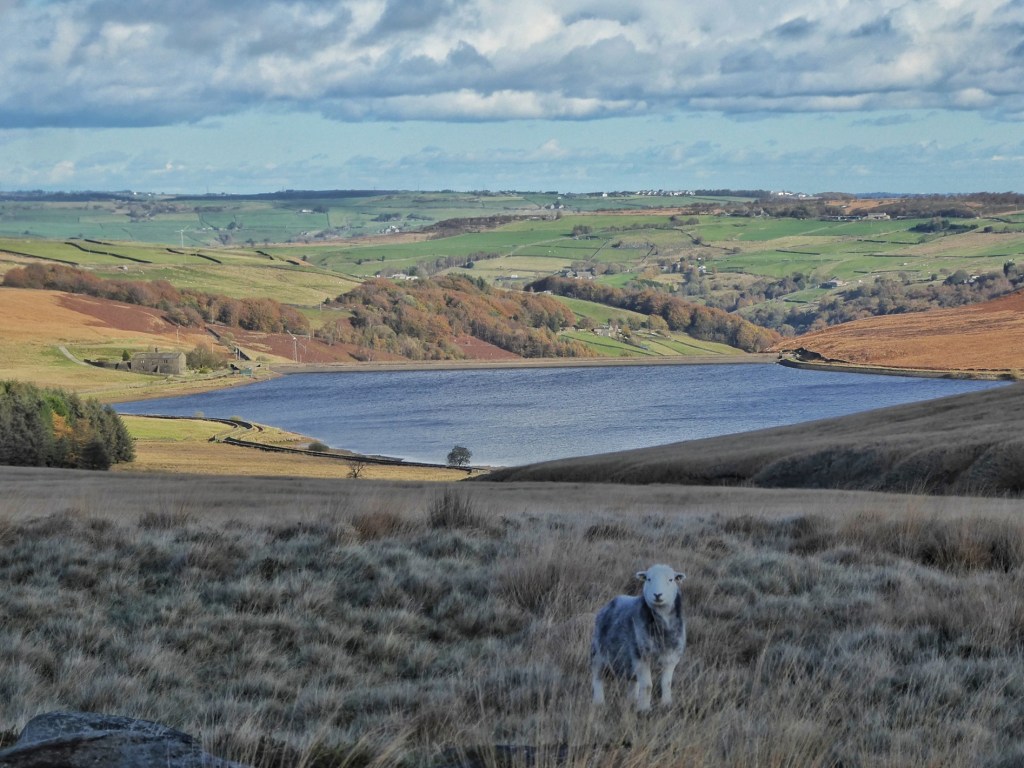
But by autumn 1902, the process was complete. With the exception of Red Dikes, all the farms surrounding the new reservoir were now tenantless. This had been done explicitly to prevent ‘impurities’ from reaching the water: no cattle, no manure, no risk of runoff. Around 100 acres were cleared of their farming occupants.100
In the summer of 1903 the buildings themselves followed. Seven farmsteads were dismantled and sold off for their materials at public auction. The auctioneer sold the stone, timber, roofing and fittings in situ; the Morley Corporation purchased most of the stonework and intended to use it to pitch the reservoir’s banks, to prevent wave-wash from eroding the slopes into the water.101 Only Pasture – kept for the reservoir keeper – and Red Dikes were left standing, repurposed as a keeper’s house. By this act, Withens Clough was no longer a farmed valley, but a water-gathering ground: a bare catchment kept intentionally empty, its population removed in the service of a distant town.
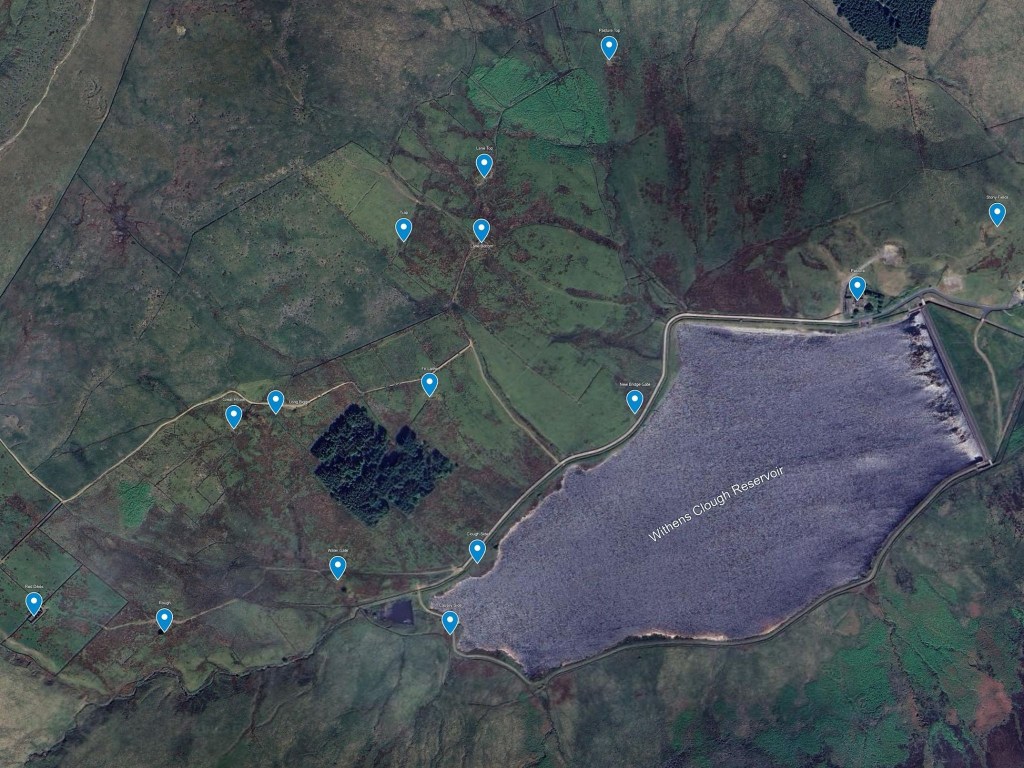
By coincidence as well as by influence, the coming of the reservoir marked the beginning of the end for the mills at the bottom of the clough. They had long abandoned water power and turned to steam, but water was still needed for other parts of the process. But when the cotton spinning mills finally closed – most within a few decades around the turn of the 20th century – the population of Cragg Vale fell just as sharply. Roy and Shirley explained to us that in the cluster of mill cottages in the valley bottom, the census shows 115 residents in 29 houses in 1901; by 1911, the same 29 houses held only 15 people. Entire rows fell silent, and the valley quietened. Only stories remain: ‘S’ recalled her mother working the mills – with six looms under her care – and talking of men stepping out from the spinning rooms ‘white with cotton’. The moors and the mills were never separate worlds, but interwoven landscapes.
Red Dikes Remembered
The hulk of Red Dikes remains a brooding presence at the head of the valley. It captures people’s imagination in a way that few other farm ruins do; Matt, in talking to us about his own family’s history in Cragg Vale, calls it ‘something straight out of Dickens’. It seems worthwhile, therefore, to step aside from the history of the reservoir itself for a moment and tell its story.
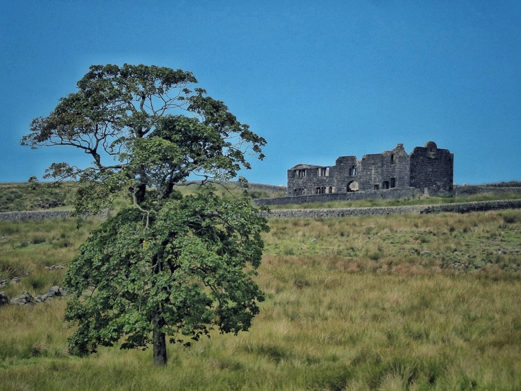
Red Dikes appears on Jefferys’ map of 1771 and likely existed long before that, part of the dispersed upland farming of the Langfield and Withens moor edges. In 1850, at the annual livestock fair at Lumbutts, the prize for best ewe was shared between Thomas Fielden of the Woodcock Inn and Hodgson Hodgson of ‘Red Dike’102 – a reminder that these farms, though isolated, were part of a shared agricultural economy with its own rhythms, competitions and reputations.
In the 19th century it was one of the Fieldens’ farms, and both the house and its surrounding fields were expanded sometime between the OS surveys of 1848 and 1888, perhaps alongside the building of the Withens New Road in 1881–2.
An auction sale notice from 1900 shows the farm stocked with six head of young cattle, a cow fresh in milk, a sow, geese, pullets and poultry, farm implements and household furniture – the ordinary equipment of a working hill farm.103 Quite how this apparent presence of cattle squares with the reasons for why the other farms and families were cleared is not clear.
The sale was to see Robert Hardy leaving, making way for James Sunderland, his wife Mary and their three children. James is recorded in the census as a farmer, though newspaper reports from the 1890s show him at that time also working as the Fieldens’ gamekeeper, catching poachers on the moor.104 A photograph of him survives in family hands.
By 1911 the gamekeeper at Red Dikes was 26-year-old Edward Clegg, living there with his wife Ethel and their newborn daughter Doris. A few years later, in 1916, Edward Clegg sought exemption from conscription, stating that he was responsible for 184 sheep on the Fielden moors from Red Dyke, with no one else to tend them. He said he no longer kept cattle, although he kept one when possible.105 The exemption was refused, but delayed.
In 1908 another farm sale at Red Dikes took place, this time for James Walton. Could this be one of the sons of William Walton who clung on at Great House? James is listed as a shepherd at Great House in the 1901 census. His sale saw him selling off 88 Lonk sheep, one red heifer, 130 head of young poultry, chiefly Black Leghorn, and two wood hencotes.106 It is unclear whether James was just farming from, or also residing at, Red Dikes at the same time as the Cleggs.
Red Dikes did not fall empty after that. The last resident was the next Fielden gamekeeper, Thomas Ormerod, born in 1875. Christine relayed to us that he was remembered as always neatly dressed in thick tweeds regardless of weather, a man who would walk out to open Withens Gate for Lady Fielden’s coach and receive sixpence for the courtesy. He arranged bulk deliveries from the Todmorden Co-operative before winter and lived alone through the winter of 1947, when the drifts were said to reach the height of bedroom windows. It was enough for him, and he made one last crossing of the moor to live in a caravan near Lumbutts.
By the 1960s the house still stood roofed. Christine recalls exploring unused upper rooms where damp floral wallpaper peeled from the stone walls, and finding ceramic pot-eggs, used to encourage hens to brood, left in outbuildings. Even then, the house was intact enough to read as recently abandoned, not ruined. Only later did the roof go, and with it the floors. Red Dikes is not simply a ruin, though; it is the trace of a bargain made and a reprieve granted when the valley ceased to be a place of farms and became instead a water-gathering ground.
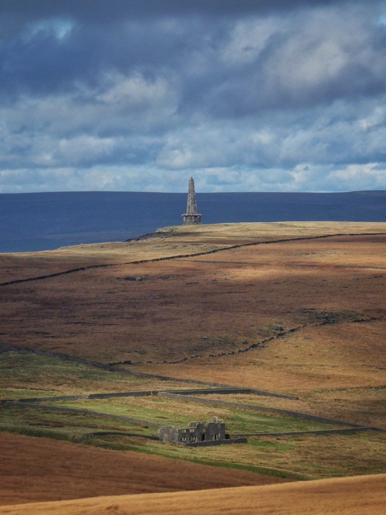
A Life Beside the Dam
We were fortunate that Christine joined us at both of our events, and was exceptionally generous with her time, stories and deep knowledge of Withens Clough. Christine has lived beside Withens Clough Reservoir for over 60 years, and her family’s connection to Pennine waterworks stretches back several generations. Her perspective comes not from archives or reminiscence alone, but from observing the reservoir and moor in all seasons, knowing the infrastructure beneath the surface and what it takes to maintain it, and witnessing the valley change around the gathered waters.
Christine was born at Green Withens Reservoir, where her father, Albert Fairbanks, was the keeper. She describes a very isolated childhood, five miles from the nearest village and a mile from the nearest neighbours. Her first contact with other children was when she went to school, aged five. The family moved to Pasture, the house just beside the reservoir dam, in 1963. Pasture is the only one of the 15 Withens farms still inhabited, saved by being taken over by the Morley Corporation and repurposed as the reservoir keeper’s house.
The work of a keeper was constant: measuring rainfall and reservoir depth, opening the compensation valves at dawn, maintaining the conduits and stone walls, clearing vegetation, rescuing stock from watercourses, and walking the water main for leaks and interference. It was meticulous, physical work that required both engineering skill and upland farming knowledge.
Christine described to us many memories and incidents in vivid detail. She remembers the winter of 1962–63, when snow isolated houses and brought down phone lines; flash floods, when half an hour of cloudburst turned the moor into a single sheet of running water and residents in Cragg Vale believed the dam had burst; storms where reservoir water blew over the dam wall and wind lifted her off her feet as a child and pinned her father under a wind-blown gate; lightning strikes on the house; summers where drought exposed railway sleepers from the construction works and moor fires burned in the deep peat for three weeks; the planting of forestry that succumbed to fire and was then replanted; snowstorms and fogs and droughts when the reservoir levels dropped five inches a day.
There was a major programme of remedial works at Withens Clough in the early 1970s, when contractors blasted a new shaft and tunnel, with explosions happening continuously, day and night, along with heavy machinery and disruption to her water and electricity supply. She has also witnessed many moments of emergency and tragedy on the moor: a hot air balloon forced down; a body found in an abandoned farm. She was raised to fear the water, a respect that was impressed upon her with the passing down of the story of two boys who drowned in the reservoir in 1922, their bodies found by Edward Clegg, the gamekeeper.
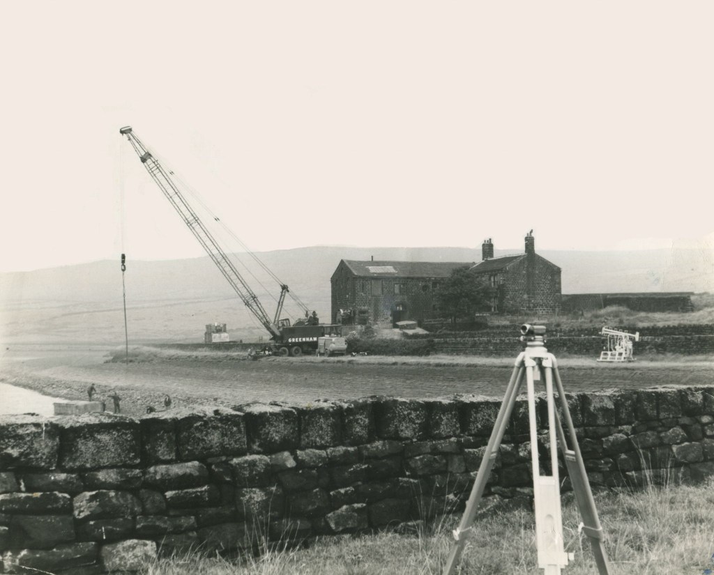
These stories, in Christine’s telling, are not anecdotes. They are part of a lived network of place, weather and labour. Her account also holds the tracework of the older landscape that pre-dated the coming of the reservoir: she tells of the the Fielden family’s enclosure walls rising to Withens Gate, the sheepfold high at the clough head, the line of the old deer park, carved boundary stones almost lost in the mires, a predecessor at Pasture who drove 2,000 sheep to Derbyshire and whose descendants farm there still.
In all Christine’s time at Withens Clough, beside the reservoir, surrounded by the moor, she has watched the valley change while the water held in its cupped hands remained a constant.
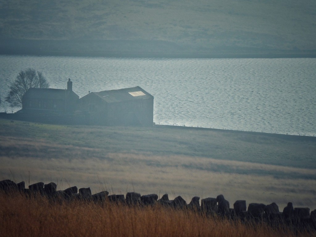
Taken together, these histories show that the moors were shaped not only by weather, farming and centuries of passage, but also by the demands of industry: stone cut from their edges, water gathered and redirected across their slopes, and whole cloughs reorganised to serve mills, canals and distant towns. The traces remain – delph faces, seeping conduits, breached dams, abandoned lanes – quiet now, yet still legible. The uplands we know today are, in part, the afterlife of that work.
Folklore
Every landscape holds its own undercurrent of story – fragments passed from mouth to mouth, half believed, half remembered. On these moors, folklore grows out of work, weather and place: coins forged in secret, boys lost to the snow, stones turned into pulpits and altars. Such tales are not simply entertainment; they are ways of making sense of a difficult land, of tracing how people have lived with it and what they have imagined within it. What follows gathers some of the legends still told around Langfield and Cragg Vale, from ancient stones to more recent ghosts, each one a thread in the moor’s long conversation between people and place.
Forging a Living on the Moor Edge
The Cragg Vale Coiners were a gang of counterfeiters who operated in the upper Calder Valley during the 1760s, when the local economy was in decline after the Seven Years War. Many of its members were small farmers and handloom weavers supplementing meagre incomes. Led by David Hartley – nicknamed ‘King David’ – from his farmhouse at Bell House on the edge of Erringden Moor, with collaborators at nearby Keelam and Hill Top, the Coiners devised a lucrative trade in ‘clipping’: shaving tiny amounts of gold from the edges of genuine coins, melting the shavings, and striking new ones with home-made dies. The altered coins, almost indistinguishable from the originals, were passed back into circulation through collaborating innkeepers.107
Hartley’s gang prospered in the isolation of the upland farms, protected by local sympathy and the difficulty of policing such a rugged district. When rumours reached London, excise officer William Deighton was sent to investigate. In 1769 he arrested Hartley, but soon after was murdered in Halifax by two of Hartley’s associates, Matthew Normanton and Robert Thomas. The killing provoked national outrage.
‘King David’ was tried at York and hanged in 1770 for diminishing the coin of the realm; the murderers followed him to the gallows a few years later. His story endures in local folklore and in Benjamin Myers’s novel The Gallows Pole, which reimagines the Coiners’ brief, defiant rebellion against poverty and authority.
The Coiners’ story is inseparable from the landscape that sustained and sheltered them. The steep flanks of Cragg Vale, the hidden folds of Broadhead Clough, and the open tracts of Erringden Moor formed a kind of natural architecture for secrecy. Their scattered farmsteads, linked by old packhorse tracks and hemmed by enclosure walls, sat at the boundary between cultivation and waste, a threshold terrain that mirrored their own blurred existence between legality and survival. Here, in a landscape of isolation and hard labour, the skills of the weaver and the ironworker turned to the craft of forging coins. The moor, with its emptiness and vantage, provided concealment as well as belonging. The Coiners’ enterprise becomes another expression of how people have drawn upon, adapted to and sometimes conspired with the moors – testing the limits of livelihood, resilience and resource in a demanding terrain.
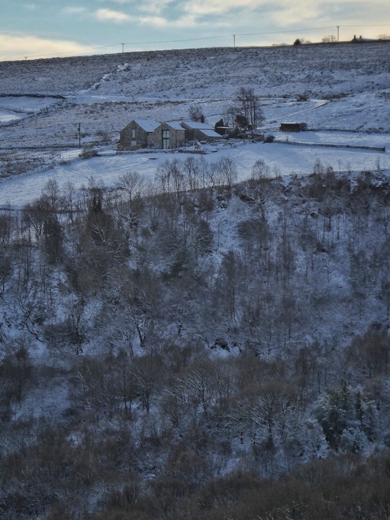
A Story Kept by the Stones
If the Coiners’ story belongs to the moor’s human history, others reach further back – to weather, loss and the stones themselves. High on the shoulder of Turley Holes and Higher House Moor stand the Two Lads – twin cairns balanced on great boulders, lonely against the sky. Local legend tells that two boys from Turvin, sent one winter’s day to Withens to fetch yeast, were caught in a sudden snowstorm on their way home. Seeking shelter behind the stones, they froze to death, and the cairns were raised where they fell.108 The story is clearly old, the name appearing on Jeffreys’ 1771 map of Yorkshire. Indeed, in the 1870s the cairns were said to have ‘stood where they now stand ever since the recollection of the oldest inhabitants’. Their story, first printed in an 1877 local almanac, lingers because the name endures – a landmark too striking to lose its tale. The story belongs to a time when such crossings of the moors were part of daily life and the weather’s turn could decide a fate. Yet traces on the western stone – a cup-mark, a water-worn hollow, and what may be the base of an early cross – suggest the place is far older, perhaps later reinterpreted through Christian and folk traditions.109 Just to the south lie the faint remains of what could once have been a larger prehistoric cairn. Whether monument or memorial, Christianized shrine or moorland myth, the Two Lads remain one of our moors’ most haunting landmarks.
Sermons and Uprisings
The Basin Stone is a striking, anvil-shaped outcrop just beyond the boundary of Langfield Common, its name taken from the shallow basin hollowed in its top. For centuries it has served as a gathering place on the high ground between Todmorden and the moors, a natural pulpit from which both preachers and protesters have addressed the people. John Wesley is said to have spoken here, and in August 1842, at the height of the Plug Riots, thousands of Chartists gathered here to demand political reform and workers’ rights, one of several vast meetings held across the Pennines during that turbulent summer.110 The scene was later painted by Alfred Bayes, who recalled attending as a boy.
The Hudsonites, followers of ‘Pope’ James Hudson, held mock religious meetings each Spaw Sunday, dressed in green coats and performing parody sermons that celebrated liberty and land rights.111 In 1923, the writer William Holt chose the same spot to declare the founding of a ‘new religion’, continuing its tradition as a place of free thought and defiance.112 The Basin Stone is both monument and platform, representing centuries of dissent, devotion and the belief that the moor itself belongs to the people.
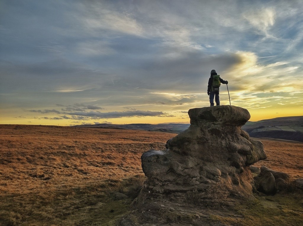
Tales of the High Ground
Not all gatherings on the moor were of protest or preaching. Some belonged to quieter, older company, the kind that met by lantern-light and vanished with the dawn. Here are brief re-tellings of tales told by John Billingsley in his Folk Tales from Calderdale: Place Legends and Lore from the Calder Valley, Vol. 1:
The Eve Stone
On the moor above Lumbutts, near the lane to the Shepherd’s Rest, once stood a great rock known as the Eve Stone. One winter night, a petty thief called Rob o’Harry’o’t’Deans of Walsden was crossing the moor after stealing cloth from Mankinholes. Hearing laughter and music, he crept behind the Eve Stone and peered over to see a company of fairies feasting by lantern-light, their table bright with silver dishes and shining cups. Drowsy with drink, Rob lay hidden, dreaming of what the fairies might leave behind. When he woke at dawn, the fairies were gone – but his stolen cloth was laid beneath his head, and a crowd of villagers stood around him, calling the constable. The fairies, it seemed, had played their own trick: turning his thieving habits back on him. Rob was carried off to Halifax, and no one in Walsden saw him again. Some say the fairies still laugh behind the Eve Stone when a storm comes in from the west.113
Tom told us the same story, and added a telling contemporary detail. When he visited the Eve Stone with his young child, they found small chocolate eggs left there, suggesting that the rock still acts today as a place of fairy-gifting – or at least of fairy play-belief. This is how supernatural landmarks persist: not through belief or disbelief, but through practice.
Stoodley Pike
Long before the monument, the high ridge above Stoodley was said to be haunted ground. Old folk spoke of bones found when the first tower was built in 1814 – maybe of a buried chieftain, maybe of a murder – and of the blood of a boy spilled at the laying of its foundation stone, ‘to strengthen the mortar’. When the first Pike fell in 1854, on the very day Britain entered the Crimean War, people whispered that the peace monument had taken its meaning too seriously. They said the Devil once lived beneath the cairn, and if anyone disturbed its stones, flames would leap up from the hillside until a farmer from Stoodley replaced them.114 Even now, lights are sometimes seen on foggy nights, said to be the glow of that hidden door opening into the hill – whether to the fairies’ realm or the Devil’s, no one knows. The Pike, rising from its moorland base above the valley, still feels like a hinge between worlds, its stones carrying both the memory of ancient burial and the uneasy peace of more recent times.
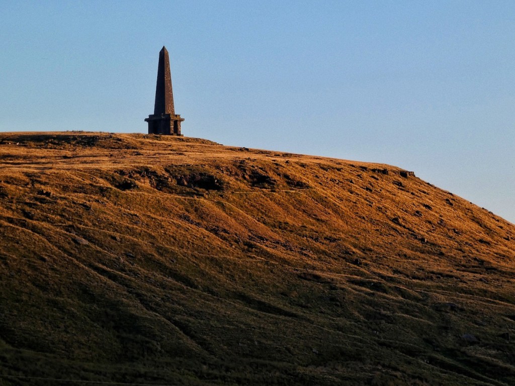
And this one is from Billingsley’s Hood, Head and Hag: Further Folk Tales From Calderdale (Folk Tales from Calderdale Vol. 2:
The Tragedy of Old Cragg Hall
Old Cragg Hall stands quiet now, but once it was a place people avoided after dark. Servants spoke of moans and lights in the porch, and of strange flutterings around the doorway – the restless ghost, they said, of a murdered maid. The story told of one of the Sunderlands, master of the house, who seduced a young servant and killed her when she revealed she was expecting his child. Her bones were later found in Burnt Wood, and from then the hall was troubled. The ghost returned nightly, crying in the porch until the years of her ‘allotted span’ had passed – only then did she find peace.F. C. Spenser heard the tale from an old woman in 1882 and wove it into his poem The Maid of Cragg Hall. Later tellings kept only the essentials: the crime, the haunting, and the belief that even death could not shorten a life destined to run its course.115 Faces carved into the porch and coach-house – charms against misfortune – still watch over the hall’s land, reminders of the dark legend that once haunted its threshold.
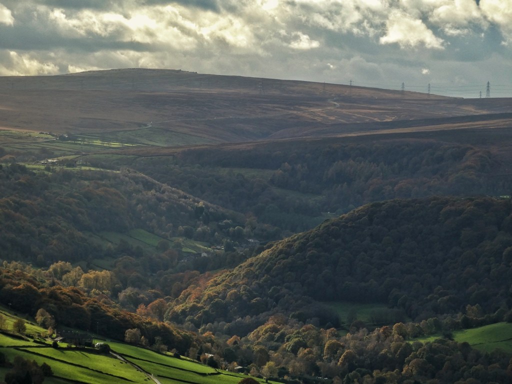
Such stories once travelled easily through the valley, carried in talk and song. In living memory they were still told and retold — until the voices themselves began to fade. When John Billingsley first came to Calderdale in the 1970s, he told us, the old stories were still alive. In the pubs, at farm gates, and over cups of tea in back kitchens, people would tell of ghosts, devil-stones and fairy tricks as naturally as they spoke of the weather. It wasn’t heritage then, it was currency – a living way of making sense of the places around them. But, as he recalls, those voices have thinned over time. The tellers have gone, the oral routes broken, and though the names remain – Eve Stone, Cragg Hall, Stoodley Pike – the stories now reach us faintly, like echoes across the moor.
For Billingsley, the moors themselves remain the last strongholds of those older presences. He sees them as liminal ground: unsettled in the physical sense, always shifting with mist and weather, and unsettled in the deeper sense too – a terrain of contact, where the boundaries between this world and the next are porous. He tells of the Gabriel Ratchets, the spectral hounds said to fly each winter from Eagle Crag to Stansfield Moor, and of one cold December night in Cragg Vale when he heard a hunting horn and saw a pale stag-form vanish into darkness. Such moments remind him – and perhaps us – that these hills still hum with other lives, other times, and other ways of knowing, waiting for those willing to listen.
Yet the power of these places has not vanished. Now and then, the old presences still make themselves felt. Matt Parker told us a story his father used to tell him. His dad worked as a gardener at Cragg Hall, the place already shadowed by its own old ghost. One day, long before Matt was born, he took his wife-to-be – Matt’s mother – up to Stoodley Pike. It was a bright day, clear enough to see the monument from every turn of the route up. But as they began their descent, she grew uneasy. Wherever they went, however they turned, the Pike seemed to move with them – not shrinking into distance as it should, but keeping its height, its shape, its gaze fixed upon them. By the time they reached the bottom, she swore it had followed her down. She never went up there again.
Lives Become Legend
Folklore is not only a matter of ghosts and fairies. The stories of real people, told and retold, also begin to take on the polish of legend. Folk tales often begin with characters – people whose lives, quirks or accidents leave a mark upon the landscape. Over time, such lives are retold, simplified and coloured by memory, until they settle into story. We were told several, by Christine and ‘C’ and Graham and Tom and Jim, of our moors’ share of these local legends.
Some are rooted, their traces deep in the soil: Beatrice Wilkinson, still haymaking with her horse-drawn gear into the 1970s, her character memorialised by a Roger Birch photograph hanging in the Top Brink; James Greenwood, known as ‘Old Bowler’, who opened a museum – a sort of rural cabinet of marvels, full of natural specimens, oddities, figurines, waxwork-style models – at what later became the Shepherd’s Rest; Jack Fern, the gamekeeper who knew every fold of the moor and offered a day’s shooting for a day’s work; Stanley Butterfield, the long-serving, meticulous reservoir keeper of Withens Clough; Tony Filpin, who pioneered laying flagstones to keep Pennine Wayfarers from eroding the moor; Tommy Ormerod of Red Dikes, last of the moorland gamekeepers, alone through the winter of 1947; and Eddie, whose runaway muckspreader once anointed 40 houses on Cragg Vale Road and who lives on in song.
Others pass through more lightly: the infamous Naked Rambler (Stephen Gough), found sheltering on the moors during his Pennine Way sojourn, scandalised that the Blackstone Edge ice cream van had refused to serve him; the Mayfair photographer and his nude model, draping herself over the crumbing walls of Red Dikes; the beacon-lighters who marked the quadricentennial of the defeat of the Spanish Armada in 1988; and the brass band, doves and French dignitaries who celebrated Stoodley Pike Monument’s bicentenary in 2014.
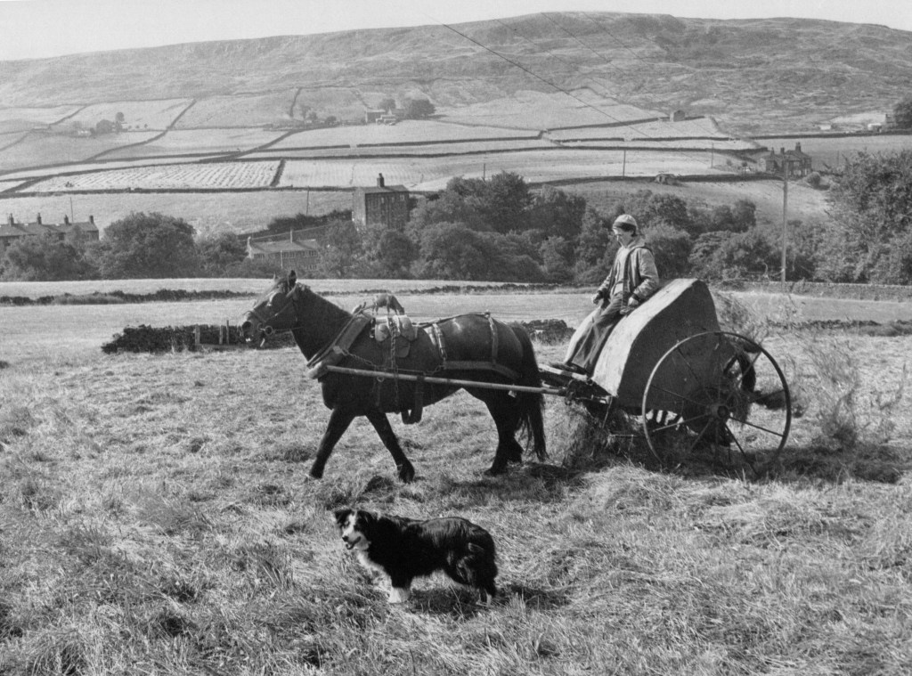
These too will fade and be retold. In time, their edges will blur and they will belong to the same long continuum of folklore – stories of people and weather, accident and endurance, told to make sense of life on the moor. The moors remember in their own way. Each name, each story, each half-forgotten incident is another layer in the same deep archive of telling, laid down slowly like peat. Whether spoken round a hearth, printed in an almanac, or passed between walkers on the Pennine Way, these tales remind us that folklore is not just of the past – it is made and re-made in each shifting present.
Leisure
The moors have long been places where work and recreation meet, overlap, and sometimes come into tension. Their openness invited different kinds of use: for sport, for fellowship, for exercise, for wandering, for challenge, for quiet. The forms of leisure practiced here have changed over time, shaped by ownership, custom, access and fashion. What follows traces some of the ways people have spent their free hours on these heights, and how those practices have shifted as the moor itself has changed.
Grouse Shooting and the Managed Moor
For much of the 19th and 20th centuries, grouse shooting was the dominant organised leisure use of these uplands. Although grouse had long been taken by hawking, netting and walking-up with dogs, the modern form of driven shooting developed in the early 1800s. From the ‘Glorious Twelfth’ of August to mid-December, parties of guns would wait in stone or turf butts while beaters, or ‘drivers’, swept the heather ahead in wide arcs, raising the birds to fly low and fast across the skyline towards the hidden ‘guns’ (referring to the shooters themselves rather than their weapon). Improvements in firearms and the growing prestige of the sport made the open moors valuable as managed shooting estates.116
This period saw a shift in emphasis from the moors as common grazing land to landscapes maintained primarily for sport. P. Horsfield and Sue Slater detail how on nearby Midgley Moor, for example, the commons of the Manor of Midgley were sold in 1802 as part of the Castle Carr estate, with their grazing capacity then emphasised – over 400 sheep a year.117 By the late-19th century, when the moor came under the ownership of John Murgatroyd, it was advertised instead as one of the ‘finest grouse moors’. Later sale catalogues made no mention of pasturage, but stressed the ‘good bags obtained’, the heather cover and the moor’s accessibility from manufacturing towns. Shooting butts were established early here, and by the mid-20th century the opening day on Midgley Moor was remembered locally as an event that brought an air of excitement: lines of drivers setting out across the slopes with flags, the guns waiting in their stone shelters and volunteers taking time off work or school to beat and earn a day’s wage.
Similar patterns shaped the Langfield, Turley Holes and Higher House, and Erringden moors. Here, the Fielden family of Todmorden held or leased the shooting rights, and employed gamekeepers to manage the ground, maintain the heather through controlled burning and monitor access. Reports from August 1868 record a strong season at Higher House Moor, where six guns shot over 48 brace (a pair) in a single day.118 Across on Erringden Moor, the Fieldens’ keeper James Sunderland is frequently mentioned in the local press in the 1880s and 1890s, often in connection with the policing of the moor during the shooting season.119 Notices issued by the Langfield freeholders’ secretary, Amos Mitchell, warned that ‘any person found trespassing in pursuit of game will be prosecuted’.120
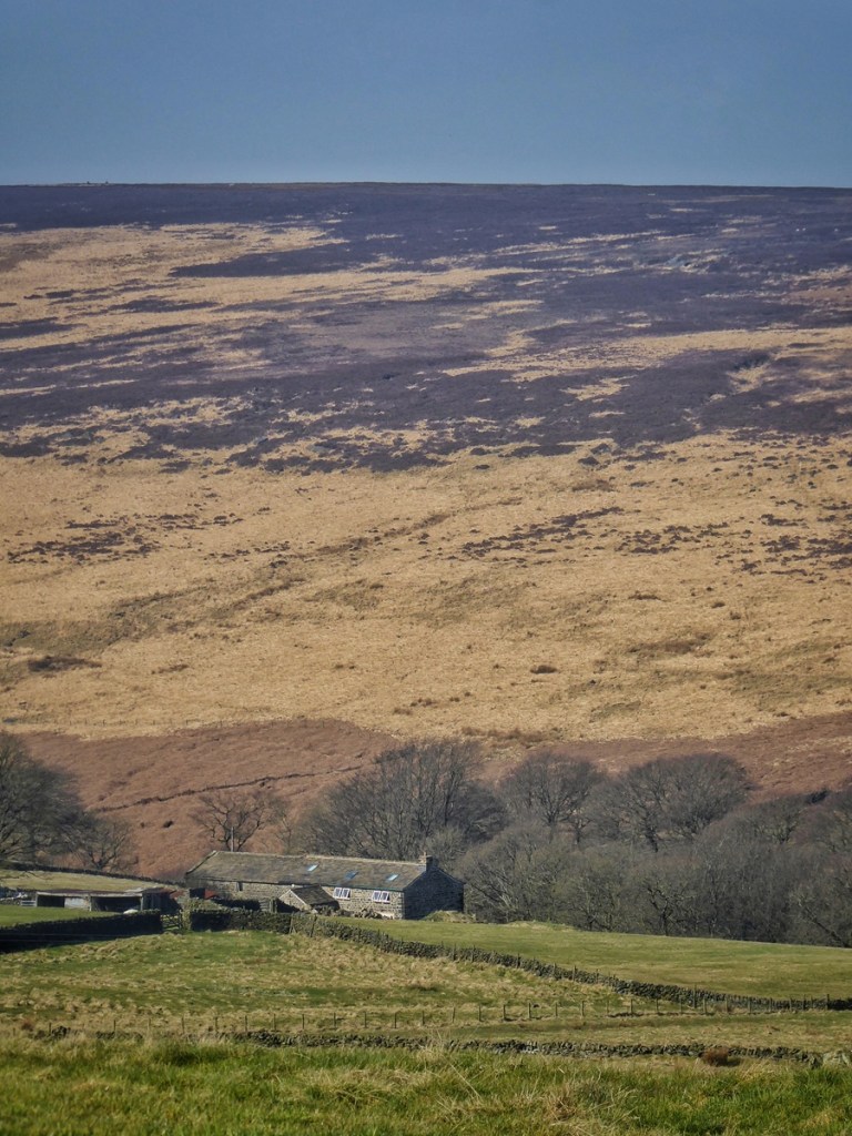
The line between everyday local use of the moor and trespass could be fine, and much depended on season, intention and interpretation. In September 1883, Henry Varley and Job Kershaw, both labourers from Erringden, were observed ‘shooing and clapping’ grouse towards a shooting party near Bell House Moor. Sunderland stated he had watched them for nearly an hour before confronting them; they replied that they had simply been walking the moor, though one acknowledged he knew he was trespassing. The magistrates handed down either a fine of £1 5s. each, or else 14 days imprisonment.121 In August 1890, Thomas Ormerod, a platelayer from Walsden (who happened to have the same name as the Fieldens’ later gamekeeper), was charged with shooting on Langfield Moor near Ball Hill Scout, grouse having been seen scattering and shots heard; he already had previous convictions connected with the same ground.122 A year later, a policeman was fined for killing a single bird on Higher House Moor after a navvy working on the reservoir witnessed him pick it up.123 In some cases, disputes continued off the moor: Sunderland himself faced an accusation of assaulting Ormerod in the Sportsman Inn at Mytholmroyd, though the charge was dismissed.124
These incidents show how the moor was a shared space with overlapping expectations. Farmers still crossed it for stock and peat, and local people spoke of simply walking the heights as they had always done. Yet during the shooting season, the moor’s primary use, and the economic structures that supported it, shaped how movement was perceived. A gesture meant by one person as the ordinary right of passing through could be seen by another as interference in the organisation of a shoot.
As the 20th century progressed, other forms of leisure began to take root on these hills, but through much of the last two centuries, the moors were defined by managing the moors for grouse, which required work spread quietly across the year – burning heather in winter, repairing drains and butts in spring, controlling predators through summer – all culminating in the brief, intense focus of the three-month shooting season from late summer and late autumn.
Early Rambles and the Naturalists’ Eye
By the late 19th century the moors above Cragg Vale and Langfield were already places to walk for pleasure. Naturalist groups, antiquarians and chapel gatherings went up ‘for the bracing air’, and the same slopes might host, on the same afternoon, a group picking over plants and stones and another simply stretching their legs to Stoodley Pike for tea. The newspapers recorded both the sociability of these excursions and the keen attention paid to birds and flowers now long vanished from this landscape.
The Hebden Bridge Scientific Association, for instance, organised summer rambles that took in Cragg Valley, Parrock Clough and the Withens. Their reports describe participants splitting off to examine slag left at ancient bloomeries, to taste the sulphurous water of Cragg Spa, and to identify plants along the stream-side walls: ragged robin, adder’s-tongue, oak fern, forget-me-not. But what stands out now are the birds they record without comment, because they were then simply part of the place. On a June ramble in 1882 they noted yellowhammer, yellow wagtail and ring ouzel alongside meadow pipit and cuckoo.125 None of these were remarked as special. All three of the first are now absent from the high valley; the fields that once heard the yellowhammer’s ‘little-bit-of-bread-and-no-cheese’ song no longer support it, the streams of Withens no longer host yellow wagtails in summer, and ring ouzels are lucky to be seen passing through on their passage north, but do not stop to breed on our moors. Cuckoos, too, are becoming increasingly rare.
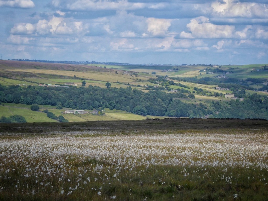
Other groups ranged the same ground for fresh air and fellowship. The Birchcliffe YMCA trekked together to Stoodley Pike in the late summer of 1891, with 90 stopping to be served tea at Stoney Royd – one of Rawson’s farms, already failing on the high moor – on the way.126 The Vale P.S.A. – a group of the Pleasant Sunday Afternoon movement associated with nonconformist chapels – walked up to the Long Stoop beside ‘a snow-white garb of nodding mosscrops’ (the local vernacular name for cotton grass), identifying wildflowers after their meal and quietly noting snipe rising from the water’s edge, wheatear on the wall and a clouded yellow butterfly resting in the grass.127 It is not a new phenomenon that the moor was seen as a place to stroll, to socialise, to feel tired in the body and clear in the mind.
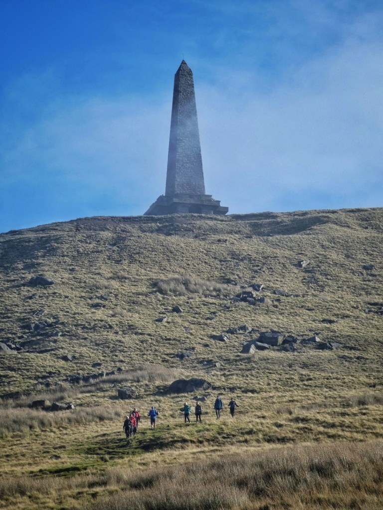
But while the moors have remained a place to walk, what the walkers move through has altered. These early rambles provide not only the developing leisure history of the high ground, but also established an unintentional baseline: a record of ordinary birds once taken for granted – yellowhammer in the pastures, yellow wagtail at the streamside, twite on the gritstone edge – which no longer find a home here.
Games on the Moor
The moors were not only places of work and, later, organised shooting; they were also grounds for games, competitions and wagers. Some of these were open and legitimate, played in sight of neighbours and with prizes offered by local publicans and farmers. Others took place out of sight, in hollows and sheltered rings. The openness of the moor provided settings both for friendly rivalry and for activities that were, officially, prohibited.
Billeting, and Knur & Spell
Billeting and knur and spell were among the most widely played upland sports in this district in the 19th and early 20th centuries. Both required a reasonably level stretch of ground so that the players could see and find the billets or knurs once they had been struck. Matches drew spectators, often from surrounding farms and hamlets, especially when a well-known local competitor was taking part.
Billeting was a distance-hitting game. Players used a long, specially shaped stick to tip a small wooden peg – the billet – into the air and then strike it as it fell. The winner was the one who could send the billet the furthest along the ground.128 A billeting handicap on Erringden Moor in May 1893 attracted 17 competitors.129 A ‘handsome spring spell’, given by Mr John Sutcliffe of Cragg Vale, was offered as the prize; after long and careful measuring, the winner was declared to be J. E. Barker with a score of 26 points.
In knur and spell, the player placed a small ball — the knur — on a spring-loaded board called the spell. When the spring was struck, the knur jumped up into the air, and the player hit it with a long stick. As with billeting, the aim was to send the ball the greatest distance.130 The games were often organised by pub customers, and wagers of up to £100 a side were not unheard of. Matches might be decided on aggregate distance or on the single longest strike. They were social occasions as much as athletic ones, remembered as gatherings, performances and tests of skill.
Cock-fighting
Other games, though equally social, were neither licensed nor officially sanctioned. Cock-fighting was once very popular in the Hebden Bridge district and although it was declared illegal in 1849, it persisted in more secluded places on the tops.
Johnny Gap at the edge of Erringden Moor was a known site. One early Sunday morning in June 1907, birds from Todmorden and from Luddenden were brought there, and several rounds were fought before a winner was declared.131 There were no advertisements, no public announcements – only word passed along familiar routes.
A much larger gathering had taken place decades earlier, on a Saturday afternoon in 1864, when around 150 people assembled to watch a fight. The bout lasted barely five minutes; the gambling that followed lasted longer. When police officers, disguised to mix in among the crowd, attempted to make arrests, the scene broke into pandemonium – men running in all directions over the heather, several attempting to free a detained man, the dead bird being seized and wrestled over, and stones thrown as the police retreated. At the ensuing Petty Sessions, one man was discharged due to mistaken identity; two others were later fined 20 shillings and costs, or a month’s imprisonment in default.132
Local farmers who know the ground well speak of still being able to see the pit where the cock-fighting took place.
New Ways of Enjoying the Moor
In recent decades, the moors have become landscapes for a wider range of outdoor pastimes. Some of these follow old lines of movement and tradition, while others make different kinds of use of space, height, water and weather.
Fell-running has grown particularly visible on these tops. The sport has its origins in 19th-century Guides Races at local shows133, but today it draws hundreds to routes across the Pennines. Lawrence, who ran for many years, said it was never only about competition. The pleasure was in the sensation of space and speed – ‘This is like flying’, a friend once said as they ran together across the crest. His wife became, as they put it, a ‘fell-running groupie’, travelling to races, filming and trading stories, and it was the shared community and visits to beautiful, remote places that they both missed most when he stopped.
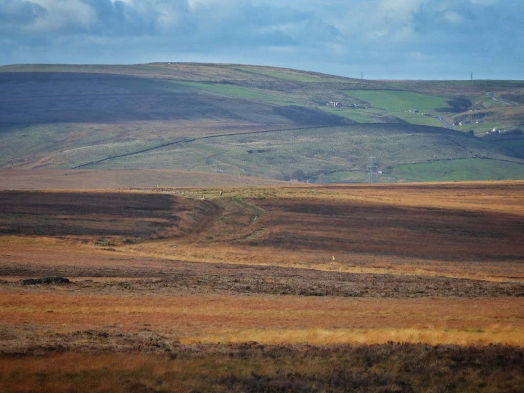
On certain days, when the air is warm and rising, paragliders drift and wheel above the shoulders of Stoodley Pike, suspended in the thermals.
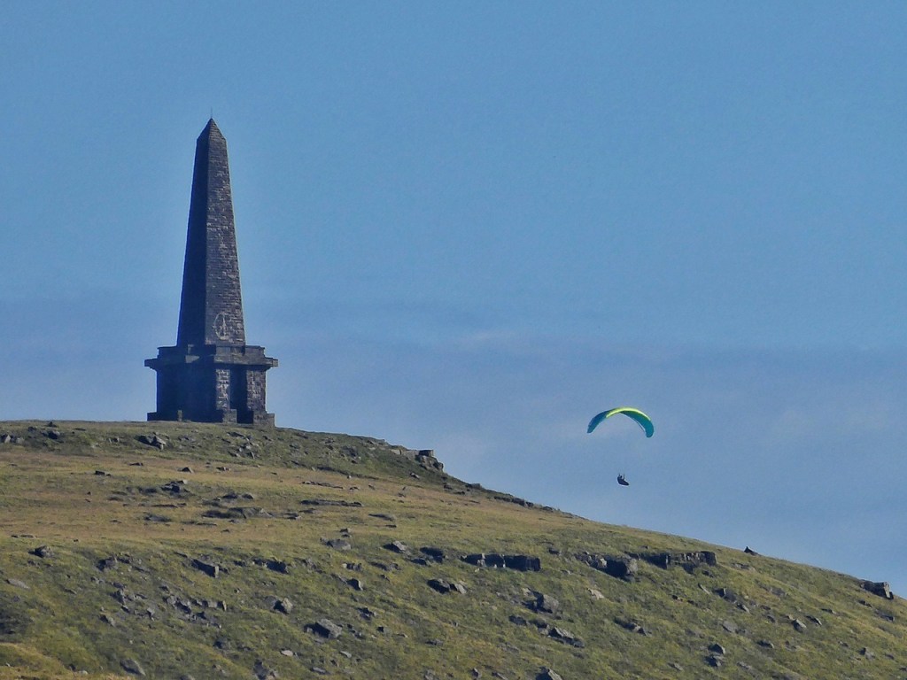
The same springy peat and gritstone tracks that appeal to runners and walkers also attract mountain bikers, but repeated wheels can cut ruts in the softer ground. ‘H’ told us she was tired of finding sections of path broken into gullies and made difficult to walk. Views differ about how best to share the moor, and this remains one of its ongoing negotiations.
Gaddings Dam West has become one of the most talked-about wild swimming spots in the North of England. What was once known only to walkers and regular dippers has, in the past decade, been picked up by national and regional press as having ‘Britain’s highest beach’ – a sandy patch on the dam’s north-eastern shore – and this publicity has fuelled increasing numbers of visitors to the moor on fine sunny days. Local councillors have appealed for good behaviour after cars were being parked on double yellow lines obstructing access for buses and emergency vehicles, or left in gateways or even in residents’ gardens. Up to 100 parking tickets have been issued on Bank Holidays as police and wardens struggled to manage the influx. As well as the parking chaos on the narrow country lane at the beginning of the walk, other consequences of the site’s popularity have included litter and increased erosion of the steep paths up to the dam.
Still, for all that the variety of leisure uses of the moors has expanded, the most common way to be on these heights is still simply to walk. The Pennine Way, the Todmorden Centenary Way and the Calderdale Way all cross these moors, linking valley-bottom settlements with the high, open ground. Many more rights of way, desire lines and unmarked trods spread outwards in every direction.
The Calderdale Way
The Calderdale Way is a 50-mile circuit around the valley’s hillsides, designed not as a single heroic trek, but as a way to thread together old routes that people were already walking. The idea began in 1973, shortly before the new Metropolitan Borough of Calderdale was created.134 Civic Trusts and conservation societies from Brighouse, Elland, Halifax, Sowerby Bridge, Ryburn, Calder and Todmorden met in Hebden Bridge to discuss two possible cross-valley routes. What emerged instead was the outline of a single circular walk that would ‘show the contrasts in the new district’ by linking rural uplands and industrial valleys. Each group took responsibility for mapping and describing its own stretch. It was a grassroots project – local walkers defining a sense of place through the act of walking.
Progress was slow. Rights of way needed negotiating, landowners needed convincing and the route needed improving. The Countryside Commission’s new emphasis in 1976 on recreation footpaths, combined with the Government’s Job Creation Scheme, provided the momentum: labour to repair sections and install signage, and grants for maps and guidebooks. Much of the coordination fell to Margaret Rooker of Elland, who worked to align the volunteer effort with county officers like Ian Kendall, Calderdale’s new Countryside Officer.
The Calderdale Way officially opened in October 1978. Lord Winstanley, chair of the Countryside Commission, unveiled a plaque at Clay House, West Vale, and the next day groups from across the district set out to walk their local parts of the circuit. In Todmorden, a planned short stroll became a 10-mile ramble in unexpected sunshine; in the papers a two-year-old Labrador named Bella was celebrated as the first dog to complete the entire route.
At the outset, there were also voices of caution. Some welcomed the walk as a way to ‘dispel the wasteland image of the industrial north’, while others worried that a single promoted line across the moors would funnel boots into a narrow trench – a ‘Pennine Way syndrome’ of eroded paths and guided crowds. One letter-writer insisted that the Way was not a new path at all, but ‘a heavy line drawn on the map over an ancient network’ that needed everyday, ordinary use, not just attention on opening weekends. It is clear these fears did not come to pass.
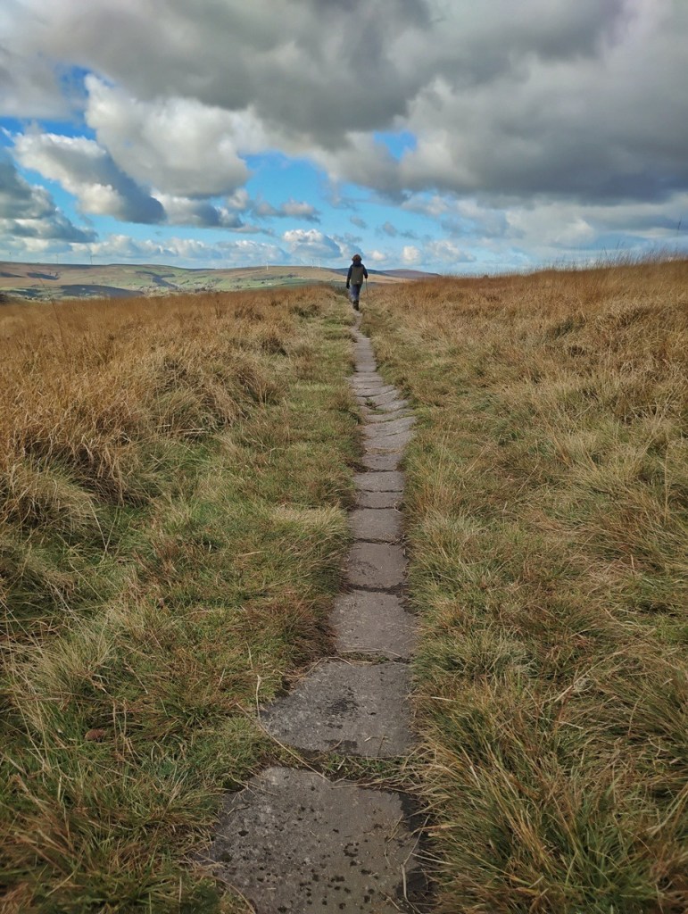
The Calderdale Way sits at the intersection of access and heritage. It invites walking as celebration, but also reminds us that paths survive only insofar as people continue to move along them. The Way is not just a route to tick off, an individual challenge to meet; it is a collective agreement to keep the uplands open and accessible in a way they have not always been. In this, judging by the popularity of Christopher Goddard’s Calderdale Way map, and from the numbers of people climbing the old causey stones of the Long Causeway from Lumbutts and descending to Withens Clough, it has undoubtedly been a success.
These newer forms of leisure, like the older ones, draw people to the moors for the sense of height, distance, weather and shared ground. They continue the long history of the moor as a place where people come together, separate from the valley floor, and find something of themselves in the wide open spaces.
The Balance of Access
All of these pursuits require access to the moor, and this was not always a given. Far from it. For much of the 20th century, access to upland ground in England was restricted by ownership patterns, game management and reservoir protection policies. The open views suggested openness of use, but the reality was often hedged about by notices, quiet understandings and seasonal sensitivities. Nationally, the struggle for access took shape in the early-20th century through rambling clubs and mass trespasses, and later through legislation. The National Parks and Access to the Countryside Act of 1949 first required local authorities to create definitive maps of rights of way, giving legal standing to many long-used paths. More than 50 years later, the Countryside and Rights of Way Act 2000 granted the public a right to roam on mapped areas of mountain, moor, heath, down and registered common – designations that came into effect for these moors in 2003. Between those two measures lies a long history of negotiation, persuasion, local work and changing attitudes.
Christine recalled that when she was growing up at Withens Clough, very few people walked there simply for pleasure. Yorkshire Water did not encourage public access around its reservoirs, and walkers were regarded more as an inconvenience than a presence to be welcomed. This began to change when a particular Calderdale councillor recognised the possibilities of tourism, and pushed for access to places such as Withens Clough to be promoted rather than discouraged. Graham, who worked as a countryside officer for Calderdale Council for 30 years, remembered the period when Yorkshire Water began to open up land around their sites and even organised guided walks. He also remembered the pioneering work of Tony Filpin in flagging stretches of the Pennine Way to prevent erosion on the most trampled peat.
‘C’, who works with CROWS (the Community Rights of Way Service), told us that many of these flags came from demolished textile mills: slabs of local gritstone, carried up and laid down to prevent the peat from being churned away. She noted that they have a curious echo of the old causeways – rows of flat stones placed centuries earlier to allow safe passage over boggy ground. Experiments were tried with heather bales, wool bundling, even floating barrel platforms to stabilise the paths. But the aim remains practical and simple: people are more likely to walk if they trust they will not be swallowed by the bog.
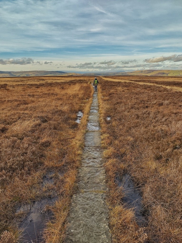
Yet the peat remains unpredictable. ‘C’ described a flagged path between Warland Reservoir and Gaddings where two sections of stonework have vanished into peat that she measured as over 12 feet deep, leaving the route impassable except in the driest conditions. CROWS, assisted by a Langfield gateholder who ferried timber up on an ATV, have now built two lengths of boardwalk to carry walkers and cyclists over the most waterlogged ground. Even heavy machinery struggles here: Graham told us of a military vehicle, newly returned from Iraq, whose driver insisted it could cross any terrain. It foundered quickly, sunk to its axles in the moor.
The ground itself demands respect. Tom told us of stepping onto a peat hummock after a storm and feeling it wobble beneath him like a drumskin of water. When he stepped clear, there was a deep, wet pop as the trapped air burst to the surface. Christine was raised to know the same danger: that water can undercut peat invisibly, hollows forming beneath what looks like solid ground. Her father taught her to treat the bog as something alive and potentially deadly, changing shape beneath the heather.
As access has grown, so too have questions about how to walk well here. ‘L’ spoke of wanting people to visit, but to do so with the right attitude. ‘H’ worried about dogs off leads during the bird breeding season, when ground-nesting birds are particularly vulnerable. Andy, who works for Natural England, noted that the sheer density of rights of way through the enclosed farmland below the moor means farmers cannot always move livestock out of the way of popular walking routes. ‘C’ was candid about the tension at the heart of her work: every improvement that makes the moor more accessible also draws more feet to it, and those same feet, in time, alter the moor they come to enjoy.
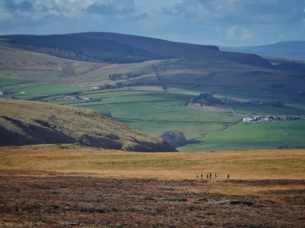
Access has therefore not been a single event, nor brought about by a single law, but is a continuing practice. Paths are made and remade. Expectations shift. Local knowledge and national policy meet on the ground, sometimes neatly, sometimes awkwardly. The moor remains open, but it also remains vulnerable; it invites, but it needs care in return.
Conservation
What the early naturalists recognised and celebrated – the richness of wild life on the moors – has become their defining value in the 21st century. Today, it is hard to overstate just how significantly these uplands are recognised and valued as habitats of national and international importance. Langfield Common, and Turley Holes and Higher House Moor, form part of the South Pennine Moors Site of Special Scientific Interest, designated for its habitats such as extensive blanket bog and upland dry heath, and for the breeding waders these habitats support, including curlew, golden plover and snipe. The same area is also covered by the South Pennine Moors Phase 2 Special Protection Area, which recognises the importance of these moors for upland birds of prey, such as merlin and short-eared owl that hunt and nest across the heathland plateaux. In addition, the moorland is part of the South Pennine Moors Special Area of Conservation, designated for European priority peatland habitats, including Northern Atlantic wet heath and the rare transition mires and quaking bogs –places where the ground trembles underfoot and where sphagnum and other peat-forming plants continue to build the landscape itself.
The successors of those early naturalists still roam and study and record on our moors. Steve and Annie came to talk to us about their love of the moors, and the natural wonders they have found there: sundew and bog asphodel, Molinia grass (the tussocky mounds of which Steve delightfully called ‘hairy grumphs’) and common lizards, ravens and peregrines coexisting on the crags, little ringed plover. Steve even recalled sightings of ring ouzel on the dam wall at Withens Clough. And it is not just the naturalists that notice, but those who have a more working relationship with the land. ‘L’, who grew up among the close-knit community of sheep farmers, told us that the corncrakes his father remembers are long gone, that hares are less common than they used to be, while peregrine falcons are more so, with consequences for the grouse. Their observations form part of a long, quiet tradition of watching and noticing – the patient work of witnessing what lives here, what thrives, what is returning and what is slipping away. How we stem the losses and bring the moors into their full and flourishing state is the question for our times.
An Old Stewardship, Renewed
For more than three and a half centuries, the freeholders of Langfield – and other commons rights-holders on Erringden and Turley Holes moors – sustained this moor through a system that was, in its essence, an early form of conservation. The gate system limited grazing to agreed amounts; peat was cut under customary rules; and disputes were settled through neighbourly negotiation backed by communal authority. If ‘sustainability’ means the ability of a landscape to endure in use without being used up, then Langfield more than proved the principle. Generation after generation lived by, worked with and cared for the moor, and the moor endured.
Yet the moor has never existed in a sealed world of its own. Over the past 200 years it has been exposed to outside forces on a scale that no local grazing system – however careful – could be expected to counter: smoke and acid deposits from the surrounding industrial valleys and cities; wildfires in drought years, increasing as the climate warms; the draining and gripping of the uplands to increase game and improve grazing; the erosion of heavily-walked paths; storms and increasingly intense rainfall events that scour peat from slope and clough. Through the second half of the 20th century, the result of these external forces became all too visible in patches of bare and exposed peat: places where the living surface had been stripped away and the deep, ancient bog beneath lay open to wind and weather. When peat dries, it breaks down and is washed away. Carbon is released, water darkens and runs faster from the moor, habitats thin, and the land downstream becomes more vulnerable to flood.
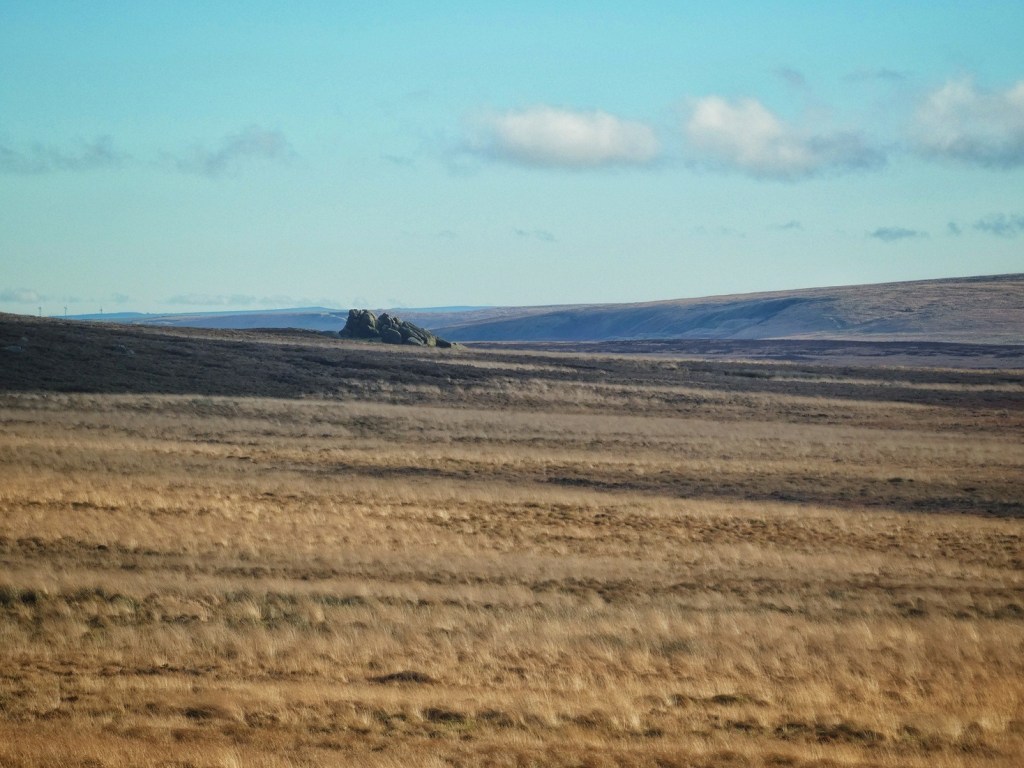
The move to bring Langfield Common and Erringden Moor into an Environmental Stewardship agreement in recent years should be understood not as a departure from the moor’s long history of shared management, but as its continuation under changed circumstances. The principles remain familiar: stock levels are agreed collectively; certain areas are rested at certain times of year; and those who forego grazing in the interests of the wider moor are recognised and compensated. The scheme does not replace the freeholders’ responsibility; it supports it – providing guidance, coordination and funding for restoration work such as re-wetting peat, repairing eroded ground and shepherding stock to encourage healthier grazing patterns. Where once the freeholders regulated their own use of the moor to preserve it for their neighbours and heirs, they now work with conservation bodies – Natural England, Moors for the Future and others – to preserve it also for the wider watersheds, wildlife and communities downstream.
Restoration, then, is not a judgement on the past, nor a claim that the moor was once mismanaged. It is an acknowledgement that the ground has been asked to bear more than its old systems were designed for, and that the freeholders – who have governed the moor in common for over 370 years – are again adjusting their shared stewardship to meet the needs of the present.
Moors for the Future at Turley Holes
Moors for the Future is a long-running landscape partnership working to restore and protect the blanket bogs of the Peak District and South Pennines. The Partnership works to reverse damage by restoring moorland habitats, gathering evidence to support good management and inspiring people to value and care for the moors.
Alongside their practical work, the Partnership undertakes extensive scientific monitoring and delivers a public engagement programme that includes volunteering, citizen science and outreach such as that delivered by the travelling ‘Bogtastic’ van. Since its formation, it has raised over £50 million, restored more than 35 square kilometres of bare peat and helped to shift both public attitudes and land management practices, contributing to a landscape better able to store carbon, support wildlife and buffer climate change.
The partnership’s restoration approach can be seen clearly in the work carried out in their Turley Holes project, which covers the moors to the south of Withens Clough and the long panhandle of Langfield Common. The first priority, in 2008, was to erect stock fencing, which follows the line of the Mandike and the Langfield boundary from Turvin Clough all the way to the walls of Red Dikes, with a loop around Bird Nest and Mosscrop Hill. In 2011, further fences were erected on the north side of Withens Clough, and walling secured at Red Dikes.
They then worked to stabilise the bare peat. Cut heather brash was flown in and spread across large areas to protect the fragile surface from wind and rain and to create the sheltered conditions in which new plants can germinate. On steeper slopes where brash could not stay in place, rolls of biodegradable geo-textile were laid to hold the peat while vegetation re-established.
To kick-start growth, lime and fertiliser – 360 tonnes of it – were used to lift the acidity of the peat just enough for a temporary nurse crop of grasses to establish from sown seed. These grasses are not intended to persist: their purpose is to root into the peat, hold it together and create a protective canopy under which slower-growing dwarf shrubs such as heather, bilberry and crowberry can return.
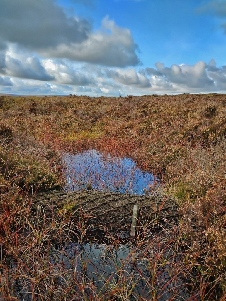
Together, these works have begun to shift Turley Holes and Higher House Moor, and areas of Langfield Common on deep peat, from a drying and eroding landscape towards a functioning blanket bog once more – one capable of storing carbon, supporting wildlife, regulating water and slowly rebuilding itself. The project demonstrates not only what has been lost from these moors, but also what can be recovered with sustained, carefully targeted effort.
Landscapes for Water at Withens Clough
Landscapes for Water is a joint programme led by the National Trust and Yorkshire Water, with support from partners including the Woodland Trust and the White Rose Forest. Its aim is to restore the South Pennine uplands so that the landscape naturally holds more water, supports richer wildlife, stores more carbon and reduces fire risk and flood risk for the valley communities below. The programme focuses on the moorland plateaux and the small steep-sided cloughs that drain them, recognising that water connects these places as a single system: what happens on the tops shapes what happens downstream.
Withens Clough is the first site in the Upper Calder Valley where this new approach is being put into practice. Around the reservoir, plans are in place to plant 55,000 native trees on the moorland fringes and clough slopes. These are places where woodland would once have grown naturally, but where past grazing and moorland management have held it back. The young trees – species such as rowan, birch, oak and hawthorn – will help to stabilise soils, intercept rainfall and create cooler, moister ground conditions. Over time, they will build up a more layered upland habitat, providing food and shelter for birds such as redstart, pied flycatcher and ring ouzel.
Alongside tree planting, the project will install around 400 natural flood management ‘leaky dams’ in the small gullies and channels that run into Withens Clough Reservoir. These partial barriers – made from stone, timber or living willow – do not stop water, but slow it. In heavy rain, they allow water to back up and soak into the peat instead of rushing downslope. This helps to hold water on the moor for longer, reducing the force and speed of stormflows and lowering flood risk in Cragg Vale and Mytholmroyd. Slowing the flow also keeps the moorland wetter for longer into the summer: a key step in making it more resilient to drought and wildfire, and in supporting the recovery of blanket bog vegetation.
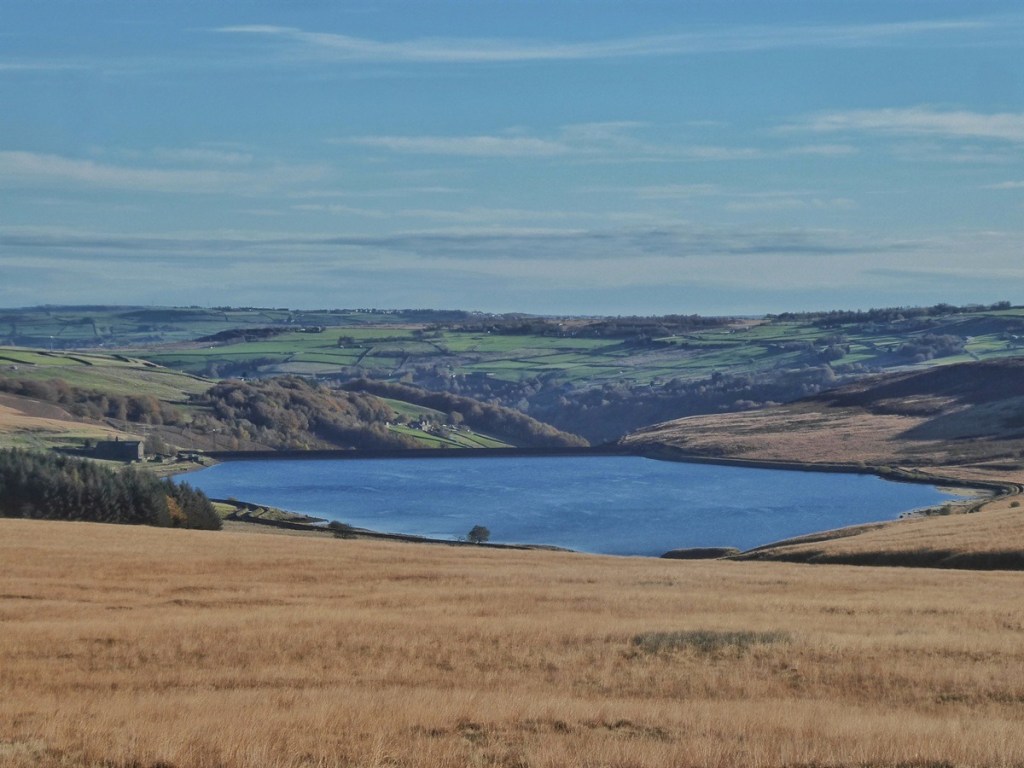
The work at Withens Clough is still in its early stages, but a strong emphasis has already been placed on community involvement. Public information events in Mytholmroyd have set the scene for how the landscape may change, and volunteers are being invited to join planting days. Local groups are being encouraged to take part, from schools to walking clubs to those with limited mobility. The programme team has also committed to sharing ecological survey findings and to adapting plans where needed to respect archaeology, access, visual character and farming use.
By focusing on the cloughs – the corridors where water gathers and moves – Landscapes for Water aims to restore the uplands not just as scenery, but as working living systems: landscapes that can hold water, hold carbon, hold wildlife, and hold together under the pressures of a changing climate. What happens at Withens Clough will be a key part of that story.
Clough Woods and Hilltop Plantations
Our moorland plateaux have been bare of trees since at least the Iron Age, but woodland has survived in the cloughs that bite into them. Most notably, the bowl of Bell Hole, or Broadhead Clough as it is better known, supports a classic South Pennine clough woodland: alder, birch, oak and holly lining a fast, shaded beck, with pockets of rare upland wet woodland and peat mires. These saturated hollows support sphagnum and star mosses, liverworts, rushes, early purple orchids and fungi such as bog beacon, birch woodwart and blushing brackets. Rich communities of invertebrates make their home here, and birds, too, including cuckoo and great spotted woodpecker, and it is an ideal habitat for the secretive woodcock.
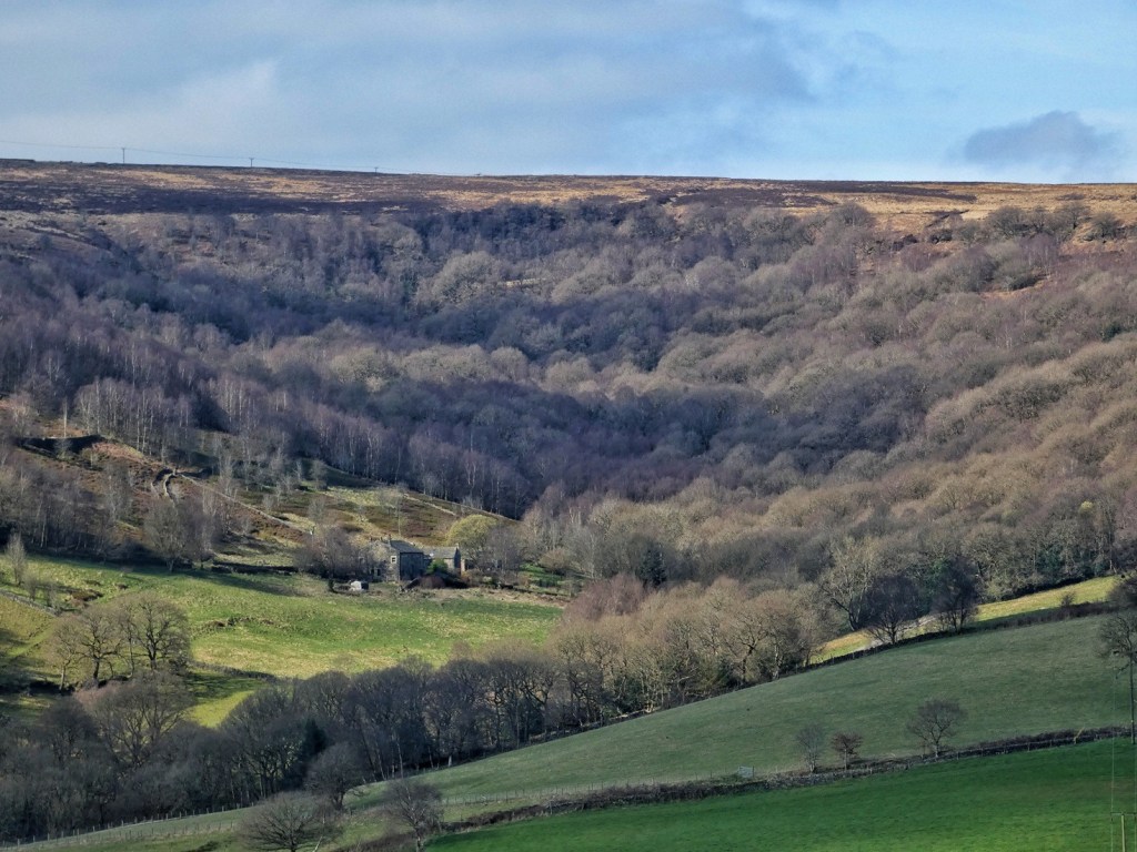
Judging by the 19th-century OS maps, it was much denuded at that time. It is actually made up of four named woodlands, and only the lowest, Spring Wood, appeared to be in good heart. Old House Wood and Bell Bottom Wood beneath Bell House, and Broad Head Plantation at the head of the clough, are depicted as scrubby and only sparsely populated with trees. Nonetheless, it has had its status as ancient woodland reaffirmed in the recent review of the Ancient Woodland Inventory, and it has been a Site of Special Scientific Interest since 1983. In 1981, the Yorkshire Wildlife Trust purchased it and has managed it as a nature reserve ever since. Volunteer groups work regularly in the reserve, most recently tackling holly where it has become too dominant.
Since last year, Slow The Flow volunteers have been working with the Yorkshire Wildlife Trust to strengthen its wet woodland bog areas using natural flood management measures – small leaky dams and contour logs – similar to those they have deployed at Hardcastle Crags. These interventions help hold water for longer, reducing flood peaks downstream while also enhancing habitat and storing carbon, making Broadhead Clough a key local site for both nature recovery and flood resilience.
The riotous diversity of Broadhead Clough could not stand in greater contrast to the deadened darkness of the plantation on Sunderland Pasture above Withens Clough. It stands as something of an anomaly in the landscape, for the upper Calder Valley has largely been spared the muted green blocks of commercial forestry plantations which swathe other parts of the Pennines. But in 1957, Forestry Commission research teams planted experimental plots – just two acres each, one near the reservoir, the other above Pasture, where the plantations still stand today – beginning what was called the Hebden Royd Forest plan. It was being tested whether ploughing and fertiliser would help establish the seedlings, and which species – larch, fir, spruce – would thrive. It was uncertain, too, what effect the pollution that westerlies would bring from Manchester would have on their chances.135
How long the trials took is unclear, but within a few years larger-scale planting went ahead – the lower plantation covers just over five acres, but the higher amounts to a little over 100 acres. But this was not the intention. Rather, at the outset, the hope was to plant 700 acres, which comfortably would have surrounded the reservoir on all sides and filled the clough to the brim of the moors. It was all planned with the intentions that we would recognise today – to improve the water catchment, stabilise soils and slow the flow into the reservoir, as well as contribute to the nation’s timber reserve.
One of the first actions of the forestry teams was to install warning boards and leave birch fire beaters ready for use. Picnicers and walkers were warned in the newspaper about how much damage one dropped cigarette could do. But the seedlings were barely in the trial plots when fire threatened, with troops from Halifax’s Wellesley Barracks helping forest rangers and firemen save them. Mytholmroyd Fire Brigade were back at Sunderland Pasture in 1960 and 1965, but the latter time, Christine recalls, they were not able to save it, and it was completely destroyed. It had to be replanted in the 1970s. And the fact that this replanting survives to this day owes a great deal to Christine’s constant watchfulness. Time and again, she was the one who noticed the smoke first, and who called the fire brigade. She learned to read the weather, the ground and the line of flame; to recognise when a moor blaze was merely skimming across dead grass in cool spring air, and when it was sinking deep into peat where it could burn for weeks. Her calls brought forestry workers, gamekeepers, farmers and fire crews to hold the line – sometimes through long nights, sometimes when the ground was too hot to touch. Without that vigilance, and the willingness to act quickly and repeatedly, the plantations would quite simply not be there at all, and the surrounding moor and all the life that thrives there would have been scorched again and again.
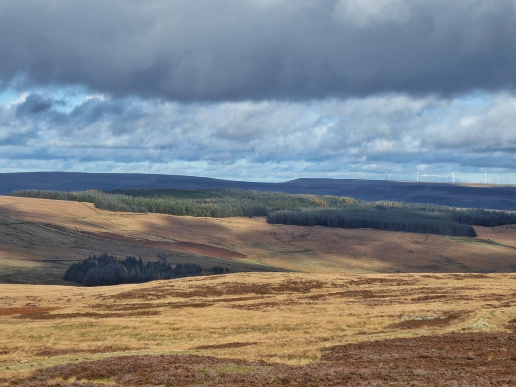
Caring for the Moor
To speak of caring for the moors is to immediately step into contested ground. Every action taken here rests on an idea of what the moor is, what it should be, and who it is for. And those ideas differ. Burning can be read as destruction, an assault on an already vulnerable landscape. Yet ‘L’ reminded us that, at times, burning has been used precisely to safeguard the heather from beetle damage, and to create a patchwork of growth that suits nesting and feeding birds. In such acts, care is not always gentle; sometimes it is intervention, disturbance, even harm in one register, done for the sake of flourishing in another.
In recent years, the stewardship schemes have attempted to formalise another kind of care – reducing grazing pressure, slowing and reversing erosion, promoting sphagnum and peat recovery, all working at catchment scale. Jim and Graham spoke of the changes in grazing density, with far fewer sheep on the moors than 40 years ago, and the consequent change in the vegetation; Andy told us of the emerging Landscape Recovery scheme – Calder Connects – that promises to carry some of the work of Moors for the Future forward. Graham recalled when their work felt experimental, work that is now widely recognised in the mainstream as vital restoration. But these forms of care work over decades; they ask for patience from communities for outcomes that may be slow, uncertain, or uneven.
But care is not only ecological. It is also cultural, social and moral. On the question of who cares for the moor, the answers were various. ‘L’ believes that shooters, with their close knowledge of the land and long presence upon it, have safeguarded habitat in ways that official conservation bodies have failed to understand. Some argued that the farmers grazing sheep are keeping the moors open, preventing scrub encroachment, maintaining a living working landscape and a rural economy that might otherwise collapse. Others look to the freeholders, whose collective responsibilities stretch back centuries, and whose decisions are made not for profit, but out of a quiet, long-standing obligation to the place. ‘C’ and Stella emphasised the volunteers of CROWS who maintain paths, repair stiles and drainage, and keep access open – a different but equally material form of care.
Yet care is always shadowed by harm. Some bemoaned dogs disturbing nesting birds, and mountain bikes cutting gullies through fragile peat, with so-called environmentally-friendly e-bikes adding weight and speed; walkers stepping off paths and eroding slopes; bracken taking over slopes unchecked; fences that claimed to protect habitats but do so by hindering the traditional movements of grazing stock; overgrazing that hollows the land; under-grazing that lets Molinia close upon it; drainage work that once served shooting or farming but now runs counter to restoring peat’s wet resilience. All of these were named. All of them matter.
What emerges from these conversations is not a simple lesson, nor a final judgement, but a recognition: care is plural. It is expressed through different practices, different knowledges, different kinds of belonging. It can be local, inherited, embodied in the patterns of grazing or the memory of how a fire runs across the moor. It can be scientific, shaped by data, satellite imagery and hydrological modelling. It can be communal, shared through voluntary labour and neighbourly repair. It can even be recreational, rooted in love of being out on the heights and wanting them to endure.
To care for the moor, then, is not to insist on one correct vision. It is to remain in conversation, to acknowledge that others may love the same place differently, and to act with an awareness that every intervention has consequences beyond the immediate moment. The moor has been sustained for centuries through systems of shared responsibility, mutual watching, negotiation, restraint and adaptation. Those principles remain relevant now.
If there is a final note to strike, it is perhaps this: the moor is not simply something to be used, nor simply something to be preserved, but something to live with. It asks attention, patience, humility and the willingness to change our minds. Care, in the end, may be less a fixed doctrine than an ongoing practice of listening – to the land, to its histories, and to one another.
Footnotes
1. Bell, Richard. 1996. Yorkshire Rock: A Journey Through Time. Nottingham: British Geological Survey, pp. 20–21.
2. I learnt much about the underlying geology of individual features and areas of the local landscape from poring over the British Geological Survey Viewer at https://geologyviewer.bgs.ac.uk/ and also their GeoIndex Onshore at https://mapapps2.bgs.ac.uk/geoindex/home.html
3. Sullivan, Lawrence. 2007. ‘The Geology Which Shaped Midgley,’ in Bailey, Ian, David Cant, Alan Petford and Nigel Smith (eds). 2007. Pennine Perspectives: Aspects of the History of Midgley. Midgley: Midgley Books, p. 10.
4. West Yorkshire Geology Trust. [n.d.]. The Geology of Calderdale. [publisher unknown]. https://www.wyorksgeologytrust.org/misc/Geology%20of%20Calderdale.pdf
5. Fletcher, David. 1982. Setting the Scene: An Introductory Outline to the Man-made Landscape of the South Pennines. Hebden Bridge: Pennine Heritage Network, p. 4.
6. Fletcher, David. 1982. Setting the Scene: An Introductory Outline to the Man-made Landscape of the South Pennines. Hebden Bridge: Pennine Heritage Network, p. 5.
7. Goddard, Christopher. 2019 (originally published 2013). The West Yorkshire Moors: A Hand-Drawn Guide to Walking and Exploring the County’s Open Access Moorland, 2nd edition. Hebden Bridge: Gritstone Publishing, p. xviii.
8. Breakell, Bill, Maria Murtagh and Gillian Smith. 1981. How the South Pennines Were Made: 350 Million Years of Landscape Building. Hebden Bridge: Pennine Heritage Network.
9. Gaddings Dam, Bald Scout Hill, Higher Moor, Harry Edge and the Woolpack Stone.
10. Blake Moor (Little Holder), Withins Moor, Turvin Clough, Turley Holes Edge and Buckstones Edge.
11. Turvin Stone, Buckstones, Turley Holes Edge and Turley Holes. In addition, the Rudstoop is situated in a field that would have been taken in from the moor.
12. Todmorden Advertiser and Hebden Bridge Newsletter. 21st December 1906. ‘The Yorkshire Coiners.’ p. 5.
13. Todmorden Advertiser and Hebden Bridge Newsletter. 21st March 1890. ‘Round About Todmorden And Its Hills And Dales.’ p. 8.
14. Goddard, Christopher. 2019 (originally published 2013). The West Yorkshire Moors: A Hand-Drawn Guide to Walking and Exploring the County’s Open Access Moorland, 2nd edition. Hebden Bridge: Gritstone Publishing, p. xix.
15. Smith, A. H. 1961. The Place-Names of the West Riding of Yorkshire, Part III: Morley Wapentake. Cambridge: Cambridge University Press, p. 175.
16. Smith, Nigel. 2017. ‘Township boundaries and commons disputes in the South Pennines: Langfield and the case of the Mandike’, in Smith, Nigel (ed.). 2017. History in the South Pennines: The Legacy of Alan Petford. Hebden Bridge: Hebden Bridge Local History Society, on behalf of the South Pennine History Group and the Alan Petford Memorial Fund, p. 19.
17. Smith, A. H. 1961. The Place-Names of the West Riding of Yorkshire, Part III: Morley Wapentake. Cambridge: Cambridge University Press, p. 171.
18. Smith, A. H. 1961. The Place-Names of the West Riding of Yorkshire, Part III: Morley Wapentake. Cambridge: Cambridge University Press, p. 163.
19. Smith, A. H. 1961. The Place-Names of the West Riding of Yorkshire, Part III: Morley Wapentake. Cambridge: Cambridge University Press, p. 162.
20. Smith, A. H. 1961. The Place-Names of the West Riding of Yorkshire, Part III: Morley Wapentake. Cambridge: Cambridge University Press, p. 178.
21. Smith, Nigel. 2017. ‘Township boundaries and commons disputes in the South Pennines: Langfield and the case of the Mandike’, in Smith, Nigel (ed.). 2017. History in the South Pennines: The Legacy of Alan Petford. Hebden Bridge: Hebden Bridge Local History Society, on behalf of the South Pennine History Group and the Alan Petford Memorial Fund, p. 19.
22. Smith, Nigel. 2021. The Medieval Park of Erringden. Hebden Bridge: Hebden Bridge Local History Society, pp. 26–31.
23. Goddard, Christopher. 2019 (originally published 2013). The West Yorkshire Moors: A Hand-Drawn Guide to Walking and Exploring the County’s Open Access Moorland, 2nd edition. Hebden Bridge: Gritstone Publishing, pp. 98–99.
24. Smith, Nigel. 2009. ‘The Medieval Park of Erringden: Creation and Extent in the Fourteenth Century,’ Transactions of the Halifax Antiquarian Society 900, p. 48.
25. Smith, Nigel. 2017. ‘Township boundaries and commons disputes in the South Pennines: Langfield and the case of the Mandike’, in Smith, Nigel (ed.). 2017. History in the South Pennines: The Legacy of Alan Petford. Hebden Bridge: Hebden Bridge Local History Society, on behalf of the South Pennine History Group and the Alan Petford Memorial Fund, p. 25.
26. Smith, Nigel. 2017. ‘Township boundaries and commons disputes in the South Pennines: Langfield and the case of the Mandike’, in Smith, Nigel (ed.). 2017. History in the South Pennines: The Legacy of Alan Petford. Hebden Bridge: Hebden Bridge Local History Society, on behalf of the South Pennine History Group and the Alan Petford Memorial Fund, p. 27.
27. The whole of the following account is taken from Savage, E. M. 1972. Stoodley Pike. Todmorden: Todmorden Antiquarian Society.
28. Jennings, Bernard (ed.). 1992. Pennine Valley: A History of Upper Calderdale. Hebden Bridge: Hebden Bridge Local History Society, p. 28.
29. Smith, Nigel. 2007. ‘The Location and Operation of Demesne Cattle Farms in Sowerby Graveship circa 1300,’ Transactions of the Halifax Antiquarian Society 878.
30. Smith, Nigel. 2008. ‘Cruttonstall Vaccary: The Extent in 1309,’ Transactions of the Halifax Antiquarian Society 887.
31. Smith, A. H. 1961. The Place-Names of the West Riding of Yorkshire, Part III: Morley Wapentake. Cambridge: Cambridge University Press, p. 176.
32. Calderdale Council. 2008. Lumbutts & Mankinholes Conservation Area: Character Appraisal. Calderdale Council, p. 5.
33. Smith, Nigel. 2007. ‘Farming Before the Nineteenth Century’, in Bailey, Ian, David Cant, Alan Petford and Nigel Smith (eds). 2007. Pennine Perspectives: Aspects of the History of Midgley. Midgley: Midgley Books.
34. Calderdale Council. 2008. Lumbutts & Mankinholes Conservation Area: Character Appraisal. Calderdale Council, p. 5.
35. See Fletcher, David. 1982. Setting the Scene: An Introductory Outline to the Man-made Landscape of the South Pennines. Hebden Bridge: Pennine Heritage Network, pp. 11–12; Pridmore, Elizabeth Jane. 1989. The Fabric of the Hills: The Interwoven Story of Textiles and the Landscape of the South Pennines. The Standing Conference of South Pennine Authorities Heritage/Landscape Working Group, no page numbers (see sections entitled ‘…woodland clearance and land enclosure’, ‘…Pennine walls’ and ‘…Enclosure Acts’; Goddard, Christopher. 2019 (originally published 2013). The West Yorkshire Moors: A Hand-Drawn Guide to Walking and Exploring the County’s Open Access Moorland, 2nd edition. Hebden Bridge: Gritstone Publishing, pp. xxi–xxii; Jennings, Bernard (ed.). 1992. Pennine Valley: A History of Upper Calderdale. Hebden Bridge: Hebden Bridge Local History Society, pp. 54–57; Barnes, Bernard. [n.d.]. Field and Yard: Changing Landscapes in the South Pennines, 1780–1840. Hebden Bridge: Pennine Heritage Network, pp. 5–6.
36. See Crump, W. B. 2023 (originally published 1951). The Little Hill Farm. Revised edition edited by Nigel Smith. Hebden Bridge: Hebden Bridge Local History Society, pp. 39–44 and Wood, Steven and Peter Brears. 2016. The Real Wuthering Heights: The Story of the Withins Farms. Stroud: Amberley Publishing, pp. 55–56.
37. See my Upper Calder Valley Farm Map at https://landscapestory.co.uk/2018/11/14/the-upper-calder-valley-farm-map/
38. For a more detailed history, see my ‘A History of the Farming in the Upper Calder Valley’, at https://landscapestory.co.uk/2025/01/28/a-history-of-farming-in-the-upper-calder-valley/
39. See my ‘Weaving Through the Calder Valley’, https://landscapestory.co.uk/2020/07/19/weaving-through-the-calder-valley/, originally published in October 2019 in issue #2 of the Campaign for the Protection of Rural England’s West Yorkshire branch Ways of Seeing magazine.
40. Crawford, Mike and Stella Richardson (eds). 2015. Erringden, Langfield and Stansfield Probate Records 1688–1700. Hebden Bridge: Hebden Bridge Local History Society.
41. In addition to the sources listed in footnotes 35 and 36, see also Brears, Peter. 2025. Everyday Life in Seventeenth-Century Calderdale. Hebden Bridge: Hebden Bridge Local History Society, pp. 27–36; Smith, Nigel. 2007. ‘Farming Before the Nineteenth Century’, in Bailey, Ian, David Cant, Alan Petford and Nigel Smith (eds). 2007. Pennine Perspectives: Aspects of the History of Midgley. Midgley: Midgley Books; and Jennings, Bernard (ed.). 1992. Pennine Valley: A History of Upper Calderdale. Hebden Bridge: Hebden Bridge Local History Society, pp. 172–73.
42. Halifax Guardian. 15th October 1836. ‘John O’Gap’s Fair.’ p. 3.
43. National Farm Survey return for Stony Royd, held at the South Pennine Archives.
44. The following history is based on the following sources: Smith, Nigel. 2017. ‘Township boundaries and commons disputes in the South Pennines: Langfield and the case of the Mandike’, in Smith, Nigel (ed.). 2017. History in the South Pennines: The Legacy of Alan Petford. Hebden Bridge: Hebden Bridge Local History Society, on behalf of the South Pennine History Group and the Alan Petford Memorial Fund; Todmorden & District News. 27th April 1945. ‘Historical Notes On Langfield.’ p. 8; Cockroft, Laurence. 2021. ‘The Freedom of the Common – a history of Langfield Common’. Upper Stoodley Residents’ Association. https://usra.org.uk/history-of-our-area. [Accessed on 14th September 2025.]; Gaddings Dam Preservation Society. 2016. ‘History of the Dam.’ http://www.gaddingsdam.org/index.php?page=history [Accessed (via the Wayback Machine) on 24th September 2025]; Todmorden & District News. 17th July 1914. ‘Local Activities In The Bygones.’ p. 4; Todmorden & District News. 7th August 1914. ‘Stoodley Pike Centenary – Timely Reminder – Our Famous Peace Memorial; Todmorden & District News. 11th September 1914. ‘Langfield Freeholders’ Records – Our Easy-Going Forefathers (Third Article).’ p. 2; and Todmorden & District News. 18th September 1914. ‘Langfield Freeholders’ Records – Our Easy-Going Forefathers (Fourth And Last Article).’ p. 3.
45. Winchester, Angus J.L. 2000. The Harvest of the Hills: Rural Life in Northern England 1400–1700. Edinburgh: Edinburgh University Press.
46. Smith, Nigel. 2007. ‘Farming Before the Nineteenth Century’, in Bailey, Ian, David Cant, Alan Petford and Nigel Smith (eds). 2007. Pennine Perspectives: Aspects of the History of Midgley. Midgley: Midgley Books and Smith, Nigel and Neville Ingrey (eds). 2025. Heptonstall Court Records 1570–1626. Hebden Bridge: Hebden Bridge Local History Society.
47. Slater, Sue. 2007. ‘Common Rights on Midgley Moor,’ in Bailey, Ian, David Cant, Alan Petford and Nigel Smith (eds). 2007. Pennine Perspectives: Aspects of the History of Midgley. Midgley: Midgley Books, p. 107.
48. Winchester, Angus J.L. 2000. The Harvest of the Hills: Rural Life in Northern England 1400–1700. Edinburgh: Edinburgh University Press, Ch. 2.
49. Winchester, Angus J.L. 2000. The Harvest of the Hills: Rural Life in Northern England 1400–1700. Edinburgh: Edinburgh University Press, p. 32.
50. Winchester, Angus J.L. 2000. The Harvest of the Hills: Rural Life in Northern England 1400–1700. Edinburgh: Edinburgh University Press, p. 32.
51. Winchester, Angus J.L. 2000. The Harvest of the Hills: Rural Life in Northern England 1400–1700. Edinburgh: Edinburgh University Press, p. 79.
52. The pattern of the farming calendar is detailed in Winchester, Angus J.L. 2000. The Harvest of the Hills: Rural Life in Northern England 1400–1700. Edinburgh: Edinburgh University Press, Ch. 3.
53. Winchester, Angus J.L. 2000. The Harvest of the Hills: Rural Life in Northern England 1400–1700. Edinburgh: Edinburgh University Press, pp. 126–133 and Smith, Nigel and Neville Ingrey (eds). 2025. Heptonstall Court Records 1570–1626. Hebden Bridge: Hebden Bridge Local History Society, pp. xxx–xxxi.
54. Winchester, Angus J.L. 2000. The Harvest of the Hills: Rural Life in Northern England 1400–1700. Edinburgh: Edinburgh University Press, pp. 32–33.
55. Winchester, Angus J.L. 2000. The Harvest of the Hills: Rural Life in Northern England 1400–1700. Edinburgh: Edinburgh University Press, pp. 45–48; and Smith, Nigel and Neville Ingrey (eds). 2025. Heptonstall Court Records 1570–1626. Hebden Bridge: Hebden Bridge Local History Society, pp. xxviii–xxx.
56. Winchester, Angus J.L. 2000. The Harvest of the Hills: Rural Life in Northern England 1400–1700. Edinburgh: Edinburgh University Press, pp. 117–118 (pound loose), 103 (stallions), 115–116 (dogs).
57. Smith, Nigel and Neville Ingrey (eds). 2025. Heptonstall Court Records 1570–1626. Hebden Bridge: Hebden Bridge Local History Society, pp. xxviii–xxix.
58. For sources, see footnote 44.
59. Todmorden & District News. 7th August 1914. ‘Stoodley Pike Centenary – Timely Reminder – Our Famous Peace Memorial.’
60. Todmorden & District News. 11th September 1914. ‘Langfield Freeholders’ Records – Our Easy-Going Forefathers (Third Article).’ p. 2.
61. Cockroft, Laurence. 2021. ‘The Freedom of the Common – a history of Langfield Common’. Upper Stoodley Residents’ Association. https://usra.org.uk/history-of-our-area. [Accessed on 14th September 2025.]
62. Todmorden & District News. 11th September 1914. ‘Langfield Freeholders’ Records – Our Easy-Going Forefathers (Third Article).’ p. 2.
63. Todmorden & District News. 11th September 1914. ‘Langfield Freeholders’ Records – Our Easy-Going Forefathers (Third Article).’ p. 2.
64. Todmorden & District News. 11th September 1914. ‘Langfield Freeholders’ Records – Our Easy-Going Forefathers (Third Article).’ p. 2.
65. I first met Mary in 2019, and visited her on several occasions at her home in Charlestown thereafter. During those visits, and later through a number of telephone conversations during the COVID-19 pandemic, I greatly enjoyed listening to her recollections of her childhood and early life, and of the farming community in which she grew up, at Strait Hey and Spencer House in Langfield, beneath Stoodley Pike, during the 1930s, ‘40s and ‘50s. I was pleased to learn that she was in the process of writing these memories down, with a particular focus on her family history and the wider community of farms and farmers among whom she was raised. Sadly, Mary passed away in November 2025, so with the permission of her family, I have deposited the final draft on which she was working in the Hebden Bridge Local History Society archive at the Birchcliffe Centre. It is entitled A Hilltop Community and the Changes in a Lifetime.
66. Todmorden & District News. 18th September 1914. ‘Langfield Freeholders’ Records – Our Easy-Going Forefathers (Fourth And Last Article).’ p. 3.
67. Todmorden & District News. 26th March 1999. ‘For sale – Moor rights’. p. 13.
68. Todmorden & District News. 16th December 1966. ‘A Long Time Gone.’ p. 4.
69. Smith, Nigel. 2017. ‘Township boundaries and commons disputes in the South Pennines: Langfield and the case of the Mandike’, in Smith, Nigel (ed.). 2017. History in the South Pennines: The Legacy of Alan Petford. Hebden Bridge: Hebden Bridge Local History Society, on behalf of the South Pennine History Group and the Alan Petford Memorial Fund, p. 14.
70. See Smith, Nigel and Neville Ingrey (eds). 2025. Heptonstall Court Records 1570–1626. Hebden Bridge: Hebden Bridge Local History Society, pp. xxx–xxxi; Brears, Peter. 2022. Traditional Food in the South Pennines. Hebden Bridge: Hebden Bridge Local History Society, pp. 183–185; and Crump, W. B. 2023 (originally published 1951). The Little Hill Farm. Revised edition edited by Nigel Smith. Hebden Bridge: Hebden Bridge Local History Society, pp. 44–47.
71. Crawford, Mike and Stella Richardson (eds). 2015. Erringden, Langfield and Stansfield Probate Records 1688–1700. Hebden Bridge: Hebden Bridge Local History Society.
72. Smith, Nigel and Neville Ingrey (eds). 2025. Heptonstall Court Records 1570–1626. Hebden Bridge: Hebden Bridge Local History Society, pp. xxx–xxxi.
73. In answer to my question at a talk she gave to the Peat Appreciation Society if there was any evidence of where past peat extraction had taken place, Tia Crouch, Peat Ecologist at the National Trust, answered that peat depth surveys sometimes reveal anomalous shallow areas that are best explained as being the site of historic peat pits.
74. Todmorden & District News. 11th September 1914. ‘Langfield Freeholders’ Records – Our Easy-Going Forefathers (Third Article).’ p. 2.
75. Todmorden & District News. 11th September 1914. ‘Langfield Freeholders’ Records – Our Easy-Going Forefathers (Third Article).’ p. 2.
76. Todmorden & District News. 11th September 1914. ‘Langfield Freeholders’ Records – Our Easy-Going Forefathers (Third Article).’ p. 2.
77. Todmorden & District News. 11th September 1914. ‘Langfield Freeholders’ Records – Our Easy-Going Forefathers (Third Article).’ p. 2.
78. Todmorden & District News. 18th September 1914. ‘Langfield Freeholders’ Records – Our Easy-Going Forefathers (Fourth And Last Article).’ p. 3.
79. Todmorden & District News. 18th September 1914. ‘Langfield Freeholders’ Records – Our Easy-Going Forefathers (Fourth And Last Article).’ p. 3.
80. Todmorden & District News. 18th September 1914. ‘Langfield Freeholders’ Records – Our Easy-Going Forefathers (Fourth And Last Article).’ p. 3.
81. For example, Todmorden & District News. 24th September 1886. ‘Langfield Common – Notice To Trespassers.’ p. 4 and Todmorden & District News. 3rd August 1888. ‘Trespassers On Langfield Common.’ p. 4.
82. Todmorden & District News. 5th September 1890. ‘Poaching On Langfield Moor.’ p. 8.
83. Todmorden & District News. 7th August 1914. ‘Stoodley Pike Centenary – Timely Reminder — Our Famous Peace Memorial.’
84. See Drake, Margaret and David Drake. 1983. Early Trackways in the South Pennines. Hebden Bridge: Pennine Heritage Network; Pridmore, Elizabeth Jane. 1989. The Fabric of the Hills: The Interwoven Story of Textiles and the Landscape of the South Pennines. The Standing Conference of South Pennine Authorities Heritage/Landscape Working Group, no page numbers (see sections entitled ‘…early tracks and packways’, ‘…bridging the rivers’, ‘…Pennine packhorse bridges’ and ‘…ancient guideposts’; Goddard, Christopher. 2019 (originally published 2013). The West Yorkshire Moors: A Hand-Drawn Guide to Walking and Exploring the County’s Open Access Moorland, 2nd edition. Hebden Bridge: Gritstone Publishing, pp. xix–xxi; Porter, John. 1980. The Making of the Central Pennines. Ashborne: Moorland Publishing Co., pp. 127–130; and Thornber, Titus. 2002. Seen on the Packhorse Tracks. Mankinholes: South Pennines Packhorse Trails Trust.
85. The following account is drawn from Thornber, Titus. 2002. Seen on the Packhorse Tracks. Mankinholes: South Pennines Packhorse Trails Trust, Ch. 4.
86. Billingsley, John. 2021. Journeys of the Soul: Vernacular Funeral Routes in Upper Calderdale. Northern Earth, pp. 1–15.
87. ‘Te Deum Stone’. Official list entry for Historic England. https://historicengland.org.uk/listing/the-list/list-entry/1228996?section=official-list-entry
88. Billingsley, John. 2021. Journeys of the Soul: Vernacular Funeral Routes in Upper Calderdale. Northern Earth.
89. Todmorden & District News. 13th May 1881. ‘The New Road From Lumbutts To Withens.’; Todmorden Advertiser and Hebden Bridge Newsletter. 27th May 1881. ‘The New Road Into Erringden.’ p. 5.; Todmorden & District News. 29th September 1882. ‘The New Road To Cragg-Valley.’ p. 4.
90. Halifax Guardian. 1st June 1844. ‘Cragg Hall Estates.’ p. 4.
91. Goddard, Christopher. 2019 (originally published 2013). The West Yorkshire Moors: A Hand-Drawn Guide to Walking and Exploring the County’s Open Access Moorland, 2nd edition. Hebden Bridge: Gritstone Publishing, p. 68.
92. In addition to Goddard, see also Ellis, David. [n.d.]. Industrial Landscapes. Hebden Bridge: Pennine Heritage Network, pp. 2–3; Horsfield, P. 2007. ‘Quarrying on Midgley Moor’, P. Horsfield, in Bailey, Ian, David Cant, Alan Petford and Nigel Smith (eds). 2007. Pennine Perspectives: Aspects of the History of Midgley. Midgley: Midgley Books; Pridmore, Elizabeth Jane. 1989. The Fabric of the Hills: The Interwoven Story of Textiles and the Landscape of the South Pennines. The Standing Conference of South Pennine Authorities Heritage/Landscape Working Group, no page numbers (see section entitled ‘…the building boom and stone quarries’).
93. These measurements are approximate; I used online area calculators which work with satellite imagery, and eyeballed the catchments.
94. Todmorden Advertiser and Hebden Bridge Newsletter. 28th March 1890. ‘Round About Todmorden And Its Hills And Dales.’ p. 8.
95. Gaddings Dam Preservation Society. 2016. ‘History of the Dam.’ http://www.gaddingsdam.org/index.php?page=history [Accessed (via the Wayback Machine) on 24th September 2025].
96. Todmorden & District News. 31st January 1890. ‘The Proposed Construction Of A Reservoir At Withens.’ p. 8.
97. Todmorden & District News. 31st January 1890. ‘The Proposed Construction Of A Reservoir At Withens.’ p. 8.
98. Todmorden Advertiser and Hebden Bridge Newsletter. 24th April 1891. ‘Cutting Of The First Sod Of Morley Waterworks At Withens.’ p. 6; Todmorden & District News. 24th April 1891. ‘The Morley Reservoir At Withens – Cutting The First Sod.’ p. 6.
99. Botwell, Harold D. 1979. Reservoir Railways of the Yorkshire Pennines. The Oakwood Press.
100. Todmorden & District News. 31st October 1902. ‘Cragg-Vale — The Withens Reservoir.’ p. 5.
101. Todmorden & District News. 26th June 1903. ‘Sale Of Farm Buildings.’ p. 5.
102. Halifax Guardian. 14th September 1850. ‘Annual Cattle Fair.’
103. Todmorden & District News. 7th December 1900. ‘Red-Dyke Farm, Withins.’ p. 4.
104. Todmorden & District News. 5th September 1890. ‘Poaching On Langfield Moor.’ p. 8; Todmorden & District News. 31st July 1891. ‘Extraordinary Affair On The Higherhouse Moor — A Police Constable Fined For Killing A Grouse.’ p. 7; Todmorden & District News. 23rd October 1891. ‘Trespassing In Pursuit Of Game.’ p. 8.
105. Todmorden & District News. 14th July 1916. ‘Edward Clegg (31), Married, Two Children, Red Dyke.’ p. 7.
106. Todmorden Advertiser and Hebden Bridge Newsletter. 28th August 1908. ‘Red Dyke Farm, Withins.’ p. 4.
107. Hartley, Steve. 2023. The Yorkshire Coiners: The True Story of the Cragg Vale Gang. Stroud: Amberley Publishing.
108. Billingsley, John. 2011. Hood, Head and Hag: Further Folk Tales from Calderdale (Folk Tales from Calderdale Vol. 2). Mytholmroyd: Northern Earth, pp. 43–44.
109. Bennett, Paul. ‘Two Lads, Withens Moor, West Yorkshire’. The Northern Antiquarian. https://megalithix.wordpress.com/2011/02/16/two-lads/ [Accessed 25th September 2025.]
110. Todmorden Advertiser and Hebden Bridge Newsletter. 7th June 1901. ‘Todmorden And The Plug Riot Of August, 1842.’ p. 3.
111. Goddard, Christopher. 2019 (originally published 2013). The West Yorkshire Moors: A Hand-Drawn Guide to Walking and Exploring the County’s Open Access Moorland, 2nd edition. Hebden Bridge: Gritstone Publishing.
112. Cockroft, Laurence. 2021. ‘The Freedom of the Common – a history of Langfield Common’. Upper Stoodley Residents’ Association. https://usra.org.uk/history-of-our-area. [Accessed on 14th September 2025.]
113. Billingsley, John. 2011. Folk Tales From Calderdale: Place Legends and Lore from the Calder Valley, Vol. 1. Mytholmroyd: Northern Earth, pp. 30–32.
114. Billingsley, John. 2011. Folk Tales From Calderdale: Place Legends and Lore from the Calder Valley, Vol. 1. Mytholmroyd: Northern Earth, pp. 33–38.
115. Billingsley, John. 2011. Hood, Head and Hag: Further Folk Tales from Calderdale (Folk Tales from Calderdale Vol. 2). Mytholmroyd: Northern Earth, pp. 86–87.
116. Goddard, Christopher. 2019 (originally published 2013). The West Yorkshire Moors: A Hand-Drawn Guide to Walking and Exploring the County’s Open Access Moorland, 2nd edition. Hebden Bridge: Gritstone Publishing, pp. xxii–xxiii.
117. Horsfield, P. and Slater, Sue. 2007. ‘Sports and Pastimes,’ in Bailey, Ian, David Cant, Alan Petford and Nigel Smith (eds). 2007. Pennine Perspectives: Aspects of the History of Midgley. Midgley: Midgley Books.
118. Yorkshire Post and Leeds Intelligencer. 14th August 1868. ‘Twelfth Of August.’
119. Todmorden & District News. 5th September 1890. ‘Poaching On Langfield Moor.’ p. 8; Todmorden & District News. 31st July 1891. ‘Extraordinary Affair On The Higherhouse Moor – A Police Constable Fined For Killing A Grouse.’ p. 7; Todmorden & District News. 23rd October 1891. ‘Trespassing In Pursuit Of Game.’ p. 8.
120. For example, Todmorden & District News. 24th September 1886. ‘Langfield Common – Notice To Trespassers.’ p. 4 and Todmorden & District News. 3rd August 1888. ‘Trespassers On Langfield Common.’ p. 4.
121. Hebden Bridge Times. 26th September 1883. ‘Saturday, Trespassing In Pursuit Of Game (Grouse).’ p. 4.
122. Todmorden & District News. 5th September 1890. ‘Poaching On Langfield Moor.’ p. 8.
123. Todmorden & District News. 31st July 1891. ‘Extraordinary Affair On The Higherhouse Moor – A Police Constable Fined For Killing A Grouse.’ p. 7.
124. Todmorden & District News. 23rd October 1891. ‘Trespassing In Pursuit Of Game.’ p. 8.
125. Todmorden & District News. 16th June 1882. ‘Scientific Ramble Up The Cragg And Withens Valley.’ p. 5.
126. Todmorden & District News. 4th September 1891. ‘Birchcliffe YMCA Ramble To Stoodley Pike.’ p. 5.
127. Todmorden & District News. 21st June 1901. ‘Vale P.S.A. Ramble.’ p. 5.
128. Horsfield, P. and Slater, Sue. 2007. ‘Sports and Pastimes,’ in Bailey, Ian, David Cant, Alan Petford and Nigel Smith (eds). 2007. Pennine Perspectives: Aspects of the History of Midgley. Midgley: Midgley Books.
129. Todmorden & District News. 5th May 1893. ‘Billeting Handicap.’
130. Horsfield, P. and Slater, Sue. 2007. ‘Sports and Pastimes,’ in Bailey, Ian, David Cant, Alan Petford and Nigel Smith (eds). 2007. Pennine Perspectives: Aspects of the History of Midgley. Midgley: Midgley Books.
131. Halifax Daily Guardian. 21st June 1907. ‘Cock Fighting.’ p. 4.
132. Todmorden Advertiser and Hebden Bridge Newsletter. 23rd January 1914. ‘Cock-Fighting.’ p. 2.
133. Goddard, Christopher. 2019 (originally published 2013). The West Yorkshire Moors: A Hand-Drawn Guide to Walking and Exploring the County’s Open Access Moorland, 2nd edition. Hebden Bridge: Gritstone Publishing, p. 72.
134. The sources for the following account are: Todmorden & District News. 13th July 1973. ‘18 Mile Calderdale Footpath.’ p. 6; Todmorden & District News. 21st September 1973. ‘Twin Footpaths For Calderdale.’ p. 1; Todmorden & District News. 7th October 1977. ‘Long Walk End In Sight.’ p. 1; Todmorden & District News. 6th October 1978. ‘Slides Of Area Walk.’ p. 11; Todmorden & District News. 20th October 1978. ‘Special: Walks To Start New Way.’ p. 13; Huddersfield Daily Examiner. 23rd October 1978. ‘Stepping Out On The Way.’ p. 5; Huddersfield Daily Examiner. 28th October 1978. ‘The Calderdale Way.’ p. 7; Huddersfield Daily Examiner. 28th October 1978. ‘Challenge Of The Open Route.’ p. 7; Todmorden & District News. 27th October 1978. ‘Four Tired Legs – It’s A Dog’s Life.’; Todmorden & District News. 27th October 1978. ‘Sunshine For Walkers.’ p. 7; Hebden Bridge Times. 27th October 1978. ‘250 On The Way.’ p. 6; Todmorden & District News. 3rd November 1978. ‘Scouts On Way.’ p. 5; Hebden Bridge Times. 10th November 1978. ‘Footpaths: Keep On Using Them.’ p. 6.
135. Halifax Evening Courier. 29th July 1957. ‘700-acre forest scheme over moorland at Withens Clough.’ p. 5.
Bibliography
Bailey, Ian, David Cant, Alan Petford and Nigel Smith (eds). 2007. Pennine Perspectives: Aspects of the History of Midgley. Midgley: Midgley Books.
Barnes, Bernard. [n.d.]. Field and Yard: Changing Landscapes in the South Pennines, 1780–1840. Hebden Bridge: Pennine Heritage Network.
Bell, Richard. 1996. Yorkshire Rock: A Journey Through Time. Nottingham: British Geological Survey.
Billingsley, John (ed). 2002. Aspects of Calderdale: Discovering Local History. Barnsley: Wharncliffe Books.
Billingsley, John. 2007. ‘Finding the Past’, in Bailey, Ian, David Cant, Alan Petford and Nigel Smith (eds). 2007. Pennine Perspectives: Aspects of the History of Midgley. Midgley: Midgley Books, pp. 31–36.
Billingsley, John. 2011. Folk Tales From Calderdale: Place Legends and Lore from the Calder Valley, Vol. 1. Mytholmroyd: Northern Earth.
Billingsley, John. 2011. Hood, Head and Hag: Further Folk Tales from Calderdale (Folk Tales from Calderdale Vol. 2). Mytholmroyd: Northern Earth.
Billingsley, John. 2021. Journeys of the Soul: Vernacular Funeral Routes in Upper Calderdale. Northern Earth.
Birch, Roger (ed. Daniel Birch). [n.d.]. Todmorden People: A Celebration of Local Folk 1973–1996. Todmorden: The Woodlands Press.
Botwell, Harold D. 1979. Reservoir Railways of the Yorkshire Pennines. The Oakwood Press.
Breakell, Bill, Maria Murtagh and Gillian Smith. 1981. How the South Pennines Were Made: 350 Million Years of Landscape Building. Hebden Bridge: Pennine Heritage Network.
Brears, Peter. 2022. Traditional Food in the South Pennines. Hebden Bridge: Hebden Bridge Local History Society.
Brears, Peter. 2025. Everyday Life in Seventeenth-Century Calderdale. Hebden Bridge: Hebden Bridge Local History Society.
Calderdale Council. 2008. Lumbutts & Mankinholes Conservation Area: Character Appraisal. Calderdale Council.
Caunce, Stephen. 2007. ‘Revealing a New Northern England: Crossing the Rubicon with Daniel Defoe,’ Prose Studies: History, Theory, Criticism 29: 136–152.
Cockroft, Laurence. 2021. ‘The Freedom of the Common – a history of Langfield Common’. Upper Stoodley Residents’ Association. https://usra.org.uk/history-of-our-area. [Accessed on 14th September 2025.]
Crawford, Mike and Stella Richardson (eds). 2015. Erringden, Langfield and Stansfield Probate Records 1688–1700. Hebden Bridge: Hebden Bridge Local History Society.
Cragg Vale Local History Group. 2021. Remembering Cragg Hall: Commemorating the 100th Anniversary of the Fire 11th August 2021. [publisher unknown].
Crump, W. B. 2023 (originally published 1951). The Little Hill Farm. Revised edition edited by Nigel Smith. Hebden Bridge: Hebden Bridge Local History Society.
Drake, Margaret and David Drake. 1983. Early Trackways in the South Pennines. Hebden Bridge: Pennine Heritage Network.
Ellis, David. [n.d.]. Industrial Landscapes. Hebden Bridge: Pennine Heritage Network.
Fletcher, David. 1982. Setting the Scene: An Introductory Outline to the Man-made Landscape of the South Pennines. Hebden Bridge: Pennine Heritage Network.
Gaddings Dam Preservation Society. 2016. ‘History of the Dam.’ http://www.gaddingsdam.org/index.php?page=history (Accessed (via the Wayback Machine) on 24th September 2025).
Gibson, Mary. [n.d.]. A Hilltop Community and the Changes in a Lifetime. [unpublished].
Goddard, Christopher. 2019 (originally published 2013). The West Yorkshire Moors: A Hand-Drawn Guide to Walking and Exploring the County’s Open Access Moorland, 2nd edition. Hebden Bridge: Gritstone Publishing.
Graham, Sheila. 2014. Enclosing the Moors: Shaping the Calder Valley Landscape Through Parliamentary Enclosure. Hebden Bridge: Hebden Bridge Local History Society..
Greenwood, W. Stanley. 1987. Crimsworth Dean, Pecket Well and Hebden Bridge: A Bit of Local History. Self-published.
Haigh, Michael R. 2002. ‘The Early Prehistory of Calderdale,’ in Billingsley, John (ed). 2002. Aspects of Calderdale: Discovering Local History. Barnsley: Wharncliffe Books.
Hartley, Steve. 2023. The Yorkshire Coiners: The True Story of the Cragg Vale Gang. Stroud: Amberley Publishing.
Hindley, Reg. 2004. Oxenhope: The Making of a Pennine Community. Self-published.
Horsfield, P. 2007. ‘Quarrying on Midgley Moor’, P. Horsfield, in Bailey, Ian, David Cant, Alan Petford and Nigel Smith (eds). 2007. Pennine Perspectives: Aspects of the History of Midgley. Midgley: Midgley Books, pp. 117–126.
Horsfield, P. and Slater, Sue. 2007. ‘Sports and Pastimes,’ in Bailey, Ian, David Cant, Alan Petford and Nigel Smith (eds). 2007. Pennine Perspectives: Aspects of the History of Midgley. Midgley: Midgley Books, pp. 95–106.
Horsfield, P. and Slater, Sue. 2007. ‘Water from the Moor,’ in Bailey, Ian, David Cant, Alan Petford and Nigel Smith (eds). 2007. Pennine Perspectives: Aspects of the History of Midgley. Midgley: Midgley Books, pp. 127–132.
Jennings, Bernard (ed.). 1992. Pennine Valley: A History of Upper Calderdale. Hebden Bridge: Hebden Bridge Local History Society.
Lumb, Edgar. 2000. Born to be a Farmer. Todmorden: Delta G.
Lumb, Edward. 2010. Mount Tabor Farmer. Self-published.
Petford, Alan. 2007. ‘Of Meres and Bounders: Disputes, Maps and Boundaries,’ in Bailey, Ian, David Cant, Alan Petford and Nigel Smith (eds). 2007. Pennine Perspectives: Aspects of the History of Midgley. Midgley: Midgley Books, pp. 87–94.
Porter, John. 1980. The Making of the Central Pennines. Ashborne: Moorland Publishing Co.
Pridmore, Elizabeth Jane. 1989. The Fabric of the Hills: The Interwoven Story of Textiles and the Landscape of the South Pennines. The Standing Conference of South Pennine Authorities Heritage/Landscape Working Group.
Savage, E. M. 1972. Stoodley Pike. Todmorden: Todmorden Antiquarian Society.
Shepherd, Dave. 2007. ‘Prehistory in the Midgley Area,’ in Bailey, Ian, David Cant, Alan Petford and Nigel Smith (eds). 2007. Pennine Perspectives: Aspects of the History of Midgley. Midgley: Midgley Books, pp. 15–30.
Slater, Sue. 2007. ‘Common Rights on Midgley Moor,’ in Bailey, Ian, David Cant, Alan Petford and Nigel Smith (eds). 2007. Pennine Perspectives: Aspects of the History of Midgley. Midgley: Midgley Books, pp. 107–116.
Smith, A. H. 1961. The Place-Names of the West Riding of Yorkshire, Part III: Morley Wapentake. Cambridge: Cambridge University Press.
Smith, J.D. 1972. A History of Crimsworth Dean in the Nineteenth Century. Self-published.
Smith, Nigel. 2007. ‘Farming Before the Nineteenth Century’, in Bailey, Ian, David Cant, Alan Petford and Nigel Smith (eds). 2007. Pennine Perspectives: Aspects of the History of Midgley. Midgley: Midgley Books, pp. 47–70.
Smith, Nigel. 2007. ‘The Location and Operation of Demesne Cattle Farms in Sowerby Graveship circa 1300,’ Transactions of the Halifax Antiquarian Society, New Series, 2007, Vol.15, pp. 17–32.
Smith, Nigel. 2008. ‘Cruttonstall Vaccary: The Extent in 1309,’ Transactions of the Halifax Antiquarian Society, New Series, 2008, Vol.16, pp. 18–23.
Smith, Nigel. 2009. ‘The Medieval Park of Erringden: Creation and Extent in the Fourteenth Century,’ Transactions of the Halifax Antiquarian Society, New Series, 2009, Vol.17, pp.32–57.
Smith, Nigel. 2013. Settlement and Field Patterns in the South Pennines: A Critique of Morphological Approaches to Landscape History in Upland Environments. PhD thesis. Lancaster University.
Smith, Nigel (ed.). 2017. History in the South Pennines: The Legacy of Alan Petford. Hebden Bridge: Hebden Bridge Local History Society, on behalf of the South Pennine History Group and the Alan Petford Memorial Fund.
Smith, Nigel. 2017. ‘Township boundaries and commons disputes in the South Pennines: Langfield and the case of the Mandike’, in Smith, Nigel (ed.). 2017. History in the South Pennines: The Legacy of Alan Petford. Hebden Bridge: Hebden Bridge Local History Society, on behalf of the South Pennine History Group and the Alan Petford Memorial Fund, pp. 1–32.
Smith, Nigel. 2021. The Medieval Park of Erringden. Hebden Bridge: Hebden Bridge Local History Society.
Smith, Nigel and Neville Ingrey (eds). 2025. Heptonstall Court Records 1570–1626. Hebden Bridge: Hebden Bridge Local History Society.
Sullivan, Lawrence. 2007. ‘The Geology Which Shaped Midgley,’ in Bailey, Ian, David Cant, Alan Petford and Nigel Smith (eds). 2007. Pennine Perspectives: Aspects of the History of Midgley. Midgley: Midgley Books, pp. 5–14.
Thornber, Titus. 2002. Seen on the Packhorse Tracks. Mankinholes: South Pennines Packhorse Trails Trust.
Watson, John. 1775. The History and Antiquities of the Parish of Halifax.
Weatherhead, Paul. 2021. Weird Calderdale. Hebden Bridge: Tom Bell Publishing.
West Yorkshire Geology Trust. [n.d.]. The Geology of Calderdale. [publisher unknown]. https://www.wyorksgeologytrust.org/misc/Geology%20of%20Calderdale.pdf
Winchester, Angus J.L. 2000. The Harvest of the Hills: Rural Life in Northern England 1400–1700. Edinburgh: Edinburgh University Press.
Wood, Steven and Peter Brears. 2016. The Real Wuthering Heights: The Story of the Withins Farms. Stroud: Amberley Publishing.
Other Resources
1841–1921 Censuses. Available via Ancestry, Findmypast and local record offices.
From Weaver to Web: Online Visual Archive of Calderdale History. Calderdale Council.
https://www.calderdale.gov.uk/wtw/ (accessed 2025).
National Farm Survey, 1941–43. The National Archives, MAF 32.
Ordnance Survey Maps (Six-inch and 25-inch series, 1841–1952). National Library of Scotland Map Images.
https://maps.nls.uk/os/6inch-england-and-wales/
https://maps.nls.uk/os/25inch-england-and-wales/ (accessed 2025).
BGS Viewer and BGS GeoIndex Onshore.
Pennine Horizons Digital Archive.
https://penninehorizons.org/ (accessed 2025).
Smith, Nigel. Settlements, Buildings and Fields of the Upper Calder Valley.
https://settlements.hebdenbridgehistory.org.uk/map (accessed 2025).
The Megalithic Portal. https://www.megalithic.co.uk/ (accessed 2025).
A Walk Around Todmorden with the Fieldens. Pennine Horizons e-trail booklet and audio tour.
Cragg Vale: Mills & Dynasties, Wilderness & Traditions. Pennine Horizons e-trail booklet and audio tour.
Riots and Protests: Radical History around Todmorden. Pennine Horizons e-trail booklet and audio tour.
British Newspaper Archive. https://www.britishnewspaperarchive.co.uk/ (accessed 2025).
Newspaper articles used:
Halifax Guardian. 15th October 1836. ‘John O’Gap’s Fair.’ p. 3.
Halifax Guardian. 1st June 1844. ‘Cragg Hall Estates.’ p. 4.
Halifax Guardian. 14th September 1850. ‘Annual Cattle Fair.’
Halifax Courier. 25th November 1854. ‘Hebden Bridge, Hare Hunting.’
Yorkshire Post and Leeds Intelligencer. 14th August 1868. ‘Twelfth Of August.’
Todmorden Advertiser and Hebden Bridge Newsletter. 19th September 1879. ‘Oldfield For Sale.’ p. 4.
Todmorden & District News. 13th May 1881. ‘The New Road From Lumbutts To Withens.’
Todmorden Advertiser and Hebden Bridge Newsletter. 27th May 1881. ‘The New Road Into Erringden.’ p. 5.
Todmorden & District News. 29th September 1882. ‘The New Road To Cragg-Valley.’ p. 4.
Todmorden & District News. 9th June 1882. ‘Historical Notes On Heptonstall And Its Church.’ p. 6.
Todmorden & District News. 16th June 1882. ‘Scientific Ramble Up The Cragg And Withens Valley.’ p. 5.
Todmorden & District News. 15th June 1883. ‘Cragg Vale – Storm.’
Hebden Bridge Times. 26th September 1883. ‘Saturday, Trespassing In Pursuit Of Game (Grouse).’ p. 4.
Todmorden Advertiser and Hebden Bridge Newsletter. 23rd May 1884. ‘Walking The Boundary.’
Todmorden Advertiser and Hebden Bridge Newsletter. 18th July 1884. ‘Ramble Up Cragg Valley.’ p. 5.
Todmorden & District News. 27th February 1885. ‘Some Historic Causeys.’ p. 6.
Todmorden & District News. 24th September 1886. ‘Langfield Common – Notice To Trespassers.’ p. 4.
Todmorden & District News. 3rd August 1888. ‘Trespassers On Langfield Common.’ p. 4.
Leeds Mercury. 11th October 1889. ‘Proposed New Water Scheme For Morley.’
Todmorden & District News. 18th October 1889. ‘To-Day We Publish Details Of The Reservoir At Withens.’
Todmorden & District News. 31st January 1890. ‘The Proposed Construction Of A Reservoir At Withens.’ p. 8.
Todmorden Advertiser and Hebden Bridge Newsletter. 21st March 1890. ‘Round About Todmorden And Its Hills And Dales.’ p. 8.
Todmorden Advertiser and Hebden Bridge Newsletter. 28th March 1890. ‘Round About Todmorden And Its Hills And Dales.’ p. 8.
Todmorden & District News. 5th September 1890. ‘Poaching On Langfield Moor.’ p. 8.
Todmorden & District News. 16th January 1891. ‘The Proposed Reservoir At Withens.’ p. 5.
Todmorden Advertiser and Hebden Bridge Newsletter. 24th April 1891. ‘Cutting Of The First Sod Of Morley Waterworks At Withens.’ p. 6.
Todmorden & District News. 24th April 1891. ‘The Morley Reservoir At Withens – Cutting The First Sod.’ p. 6.
Todmorden & District News. 5th June 1891. ‘[Untitled].’ p. 8.
Todmorden & District News. 31st July 1891. ‘Extraordinary Affair On The Higherhouse Moor – A Police Constable Fined For Killing A Grouse.’ p. 7.
Todmorden & District News. 4th September 1891. ‘Birchcliffe YMCA Ramble To Stoodley Pike.’ p. 5.
Todmorden Advertiser and Hebden Bridge Newsletter. 25th September 1891. ‘A Hebden Bridge Lady Visits Scenes Of Her Childhood.’ p. 3.
Todmorden & District News. 9th October 1891. ‘Old Road Has Been Diverted.’ p. 5.
Todmorden & District News. 23rd October 1891. ‘Trespassing In Pursuit Of Game.’ p. 8.
Todmorden Advertiser and Hebden Bridge Newsletter. 4th March 1892. ‘Todmorden Local Board.’ p. 5.
Todmorden & District News. 5th May 1893. ‘Billeting Handicap.’
Halifax Evening Courier. 16th October 1897. ‘Johnny Gap Fair.’ p. 6.
Todmorden & District News. 7th December 1900. ‘Red-Dyke Farm, Withins.’ p. 4.
Todmorden Advertiser and Hebden Bridge Newsletter. 7th June 1901. ‘Todmorden And The Plug Riot Of August, 1842.’ p. 3.
Todmorden & District News. 21st June 1901. ‘Vale P.S.A. Ramble.’ p. 5.
Todmorden & District News. 31st October 1902. ‘Cragg-Vale – The Withens Reservoir.’ p. 5.
Todmorden & District News. 26th June 1903. ‘Sale Of Farm Buildings.’ p. 5.
Todmorden Advertiser and Hebden Bridge Newsletter. 21st December 1906. ‘The Yorkshire Coiners.’ p. 5.
Halifax Daily Guardian. 21st June 1907. ‘Cock Fighting.’ p. 4.
Todmorden Advertiser and Hebden Bridge Newsletter. 13th September 1907. ‘Halifax Antiquarian’s Visit – An Interesting Afternoon’s Tour.’
Todmorden Advertiser and Hebden Bridge Newsletter. 28th August 1908. ‘Red Dyke Farm, Withins.’ p. 4.
Todmorden Advertiser and Hebden Bridge Newsletter. 23rd January 1914. ‘Cock-Fighting.’ p. 2.
Todmorden & District News. 17th July 1914. ‘Local Activities In The Bygones.’ p. 4.
Todmorden & District News. 7th August 1914. ‘Stoodley Pike Centenary – Timely Reminder – Our Famous Peace Memorial.’
Todmorden & District News. 11th September 1914. ‘Langfield Freeholders’ Records – Our Easy-Going Forefathers (Third Article).’ p. 2.
Todmorden & District News. 18th September 1914. ‘Langfield Freeholders’ Records – Our Easy-Going Forefathers (Fourth And Last Article).’ p. 3.
Todmorden & District News. 14th July 1916. ‘Edward Clegg (31), Married, Two Children, Red Dyke.’ p. 7.
Todmorden & District News. 20th May 1927. ‘A Link With The Past – The Old Packhorse Route Through Langfield.’ p. 5.
Todmorden & District News. 15th October 1937. ‘Johnny Gap Fair.’ p. 8.
Todmorden & District News. 26th August 1938. ‘Hand Looms At Withens.’ p. 4.
Todmorden & District News. 5th July 1940. ‘Moorland Pillars.’ p. 3.
Todmorden & District News. 7th July 1944. ‘Langfield Moor: Some Of Its Plants And Birds.’ p. 3.
Todmorden & District News. 27th April 1945. ‘Historical Notes On Langfield.’ p. 8.
Todmorden & District News. 29th March 1946. ‘Case Of Sheep Trespass.’ p. 5.
Todmorden & District News. 20th August 1948. ‘Sportsman’s Gate.’ p. 3.
Rochdale Observer. 22nd February 1950. ‘Cotton Famine Road.’ p. 4.
Todmorden & District News. 23rd May 1952. ‘Legal Notices.’ p. 2.
Todmorden & District News. 19th September 1952. ‘Legal Notices.’
Halifax Evening Courier. 1st June 1956. ‘“Te Deum” Stone.’ p. 6.
Todmorden & District News. 1st June 1956. ‘“Te Deum” Stone Straightened.’ p. 5.
Halifax Evening Courier. 29th July 1957. ‘700-acre forest scheme over moorland at Withens Clough.’ p. 5.
Todmorden & District News. 28th December 1963. Sutcliffe, E. ‘Strange Encounter.’ p. 8.
Todmorden & District News. 19th August 1966. ‘Freeholders Of Langfield Common.’ p. 2.
Todmorden & District News. 16th December 1966. ‘A Long Time Gone.’ p. 4.
Todmorden & District News. 17th May 1968. ‘Freeholders Of Langfield Common.’
Todmorden & District News. 1st August 1969. ‘Permits To Shoot Over Langfield Common.’ p. 2.
Todmorden & District News. 13th July 1973. ‘18 Mile Calderdale Footpath.’ p. 6.
Todmorden & District News. 21st September 1973. ‘Twin Footpaths For Calderdale.’ p. 1.
Todmorden & District News. 7th October 1977. ‘Long Walk End In Sight.’ p. 1.
Todmorden & District News. 6th October 1978. ‘Slides Of Area Walk.’ p. 11.
Todmorden & District News. 20th October 1978. ‘Special: Walks To Start New Way.’ p. 13.
Huddersfield Daily Examiner. 23rd October 1978. ‘Stepping Out On The Way.’ p. 5.
Huddersfield Daily Examiner. 28th October 1978. ‘The Calderdale Way.’ p. 7.
Huddersfield Daily Examiner. 28th October 1978. ‘Challenge Of The Open Route.’ p. 7.
Todmorden & District News. 27th October 1978. ‘Four Tired Legs – It’s A Dog’s Life.’
Todmorden & District News. 27th October 1978. ‘Sunshine For Walkers.’ p. 7.
Hebden Bridge Times. 27th October 1978. ‘250 On The Way.’ p. 6.
Todmorden & District News. 3rd November 1978. ‘Scouts On Way.’ p. 5.
Hebden Bridge Times. 10th November 1978. ‘Footpaths: Keep On Using Them.’ p. 6.
Todmorden & District News. 30th August 1996. ‘Keep Us Informed.’ p. 5.
Todmorden & District News. 14th June 1996. ‘‘Behind Closed Doors’ Move Over Moorland.’ p. 1.
Todmorden & District News. 26th March 1999. ‘For sale – Moor rights’. p. 13.
