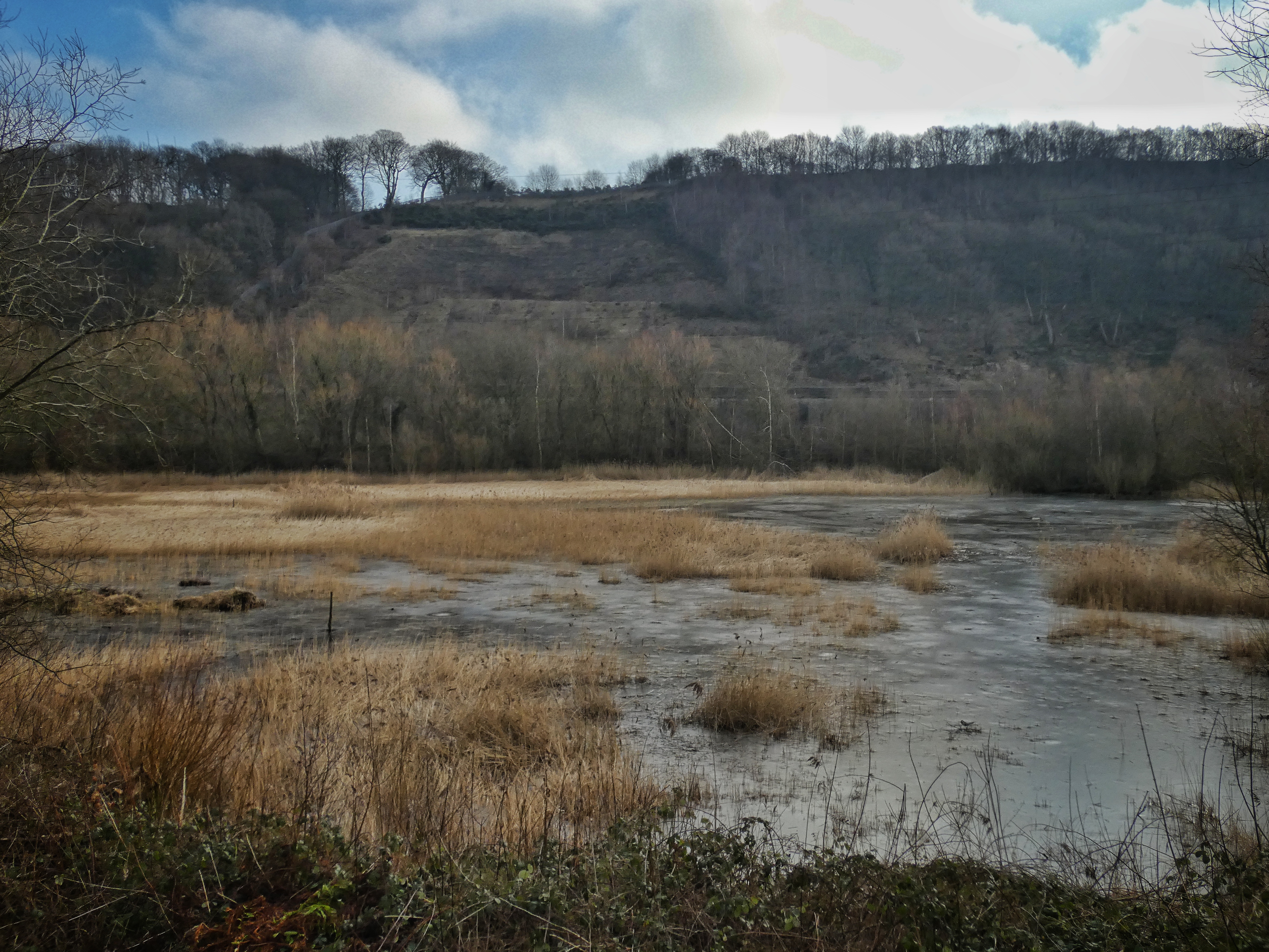
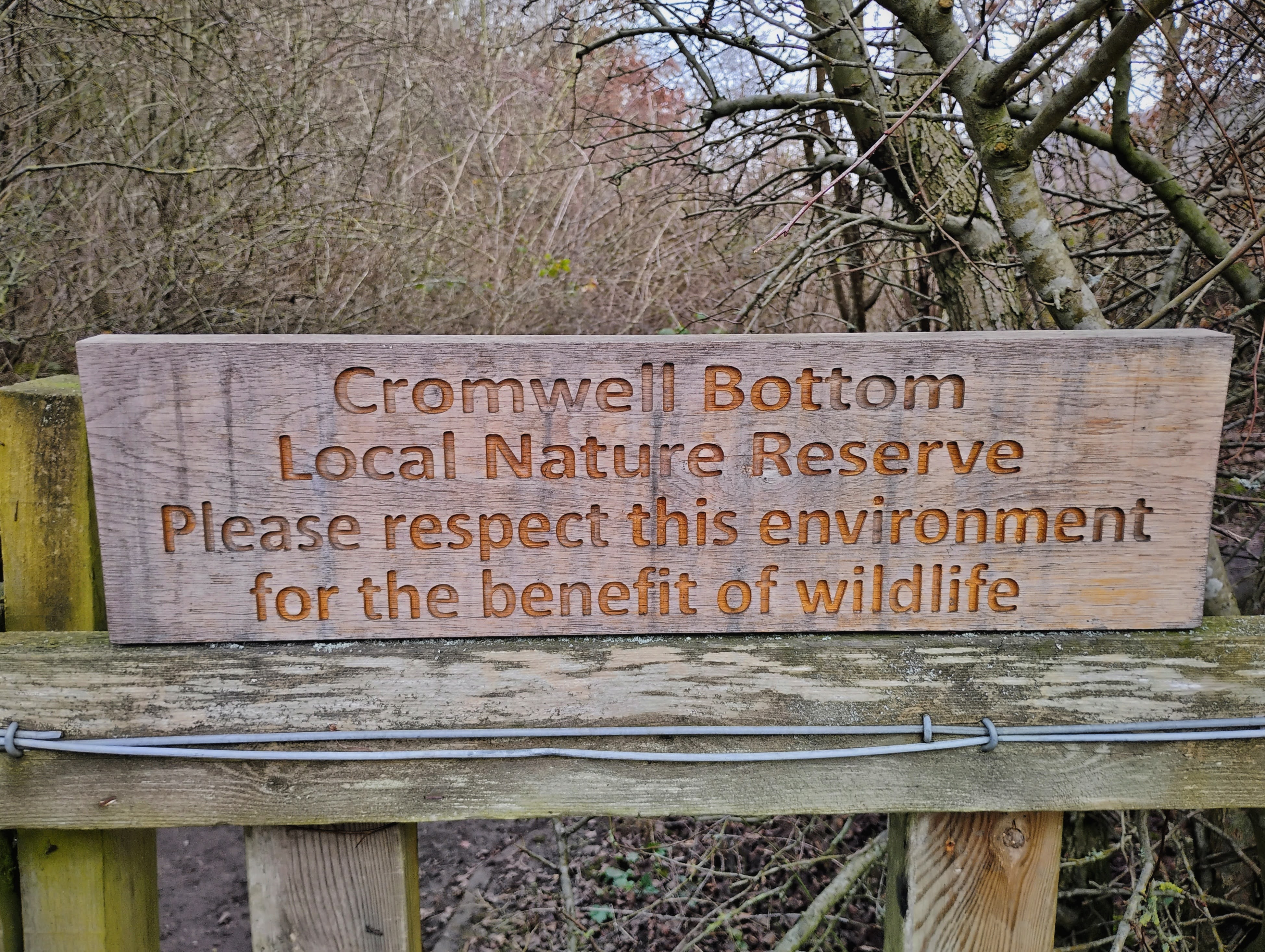
Cromwell Bottom is a 70-acre nature reserve on the flat valley floor between Elland and Brighouse. It consists of a mosaic of habitats, with areas of dry and wet woodland, open meadow, ponds, an old disused canal and also the River Calder meandering through. It is owned by Calderdale Council and managed by the volunteers of a charity, the Cromwell Bottom Wildlife Group, who balance the needs of its spectacular mix of biodiversity – insects, birds, amphibians, bats and other mammals, wild flowers and trees of all kinds – with welcoming visitors on its accessible paths. They also regularly host school groups from across the borough at an area of the reserve dedicated to environmental education.
To visit this haven for wildlife and people today, it is difficult to imagine the long history of human use and exploitation Cromwell Bottom has been through. It has had its woodland cleared for pasture, then this farmland destroyed for sand and gravel pits, then these filled with the waste fuel ash from Elland Power Station, and then this was re-excavated for road building, and finally it was turned into a municipal tip. Its release from this relentless servitude to human wants and needs came very recently; it has only been a nature reserve since 2000. But it is Cromwell Bottom’s turbulent history and remarkable rejuvenation that makes it so rich for reflection on what it means for us to damage and degrade nature for our own benefit, and then to make good the harm we have caused.
The following route, with ten stopping places, will give an overview of the site, its history, ecology and wildlife.
1. Bailey Bridge
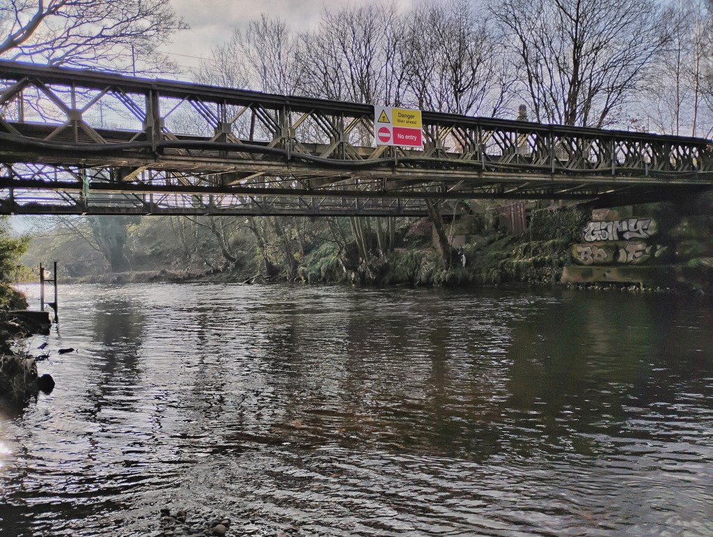
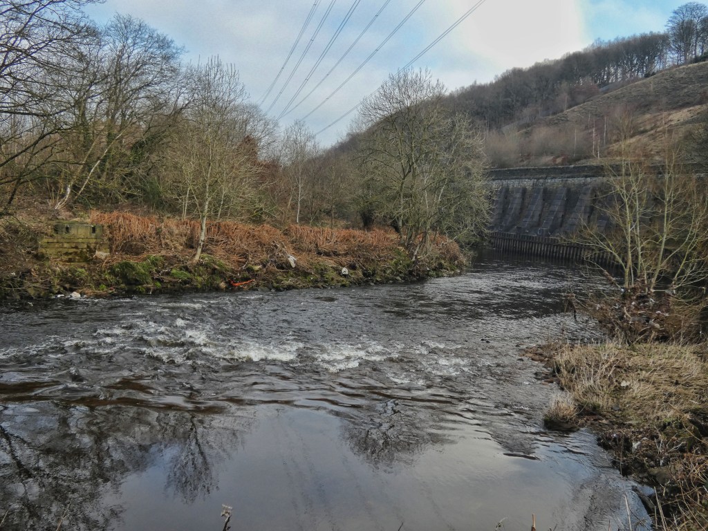
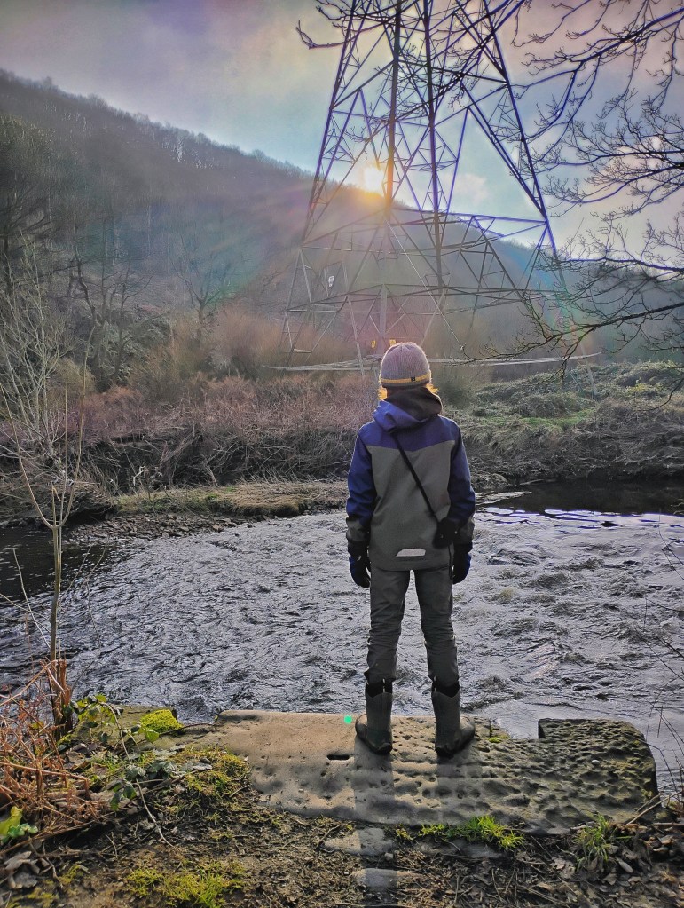
This is the River Calder. At this point, we are about a third of the way along its 53-mile journey. It still has a long way to go, though; from here, it runs on through Brighouse, Mirfield and Wakefield, before joining the River Aire at Castleford. The Aire, in turn, merges with the Ouse – a river formed by the Ure, Swale, and Wharfe flowing southeast from the Yorkshire Dales – before the Ouse becomes the Humber where it meets the Trent.
Here the Calder Valley is wide and the river meanders, almost for the first time in its life. This is what Cromwell means; it is thought to be a corruption from Crumblebottom, which contains the Old English ‘crum’, meaning crooked. It is canalised and confined and often underground for so much in its infancy through Cornholme and Todmorden and Hebden Bridge, but here it retains something of a natural meander, and we can imagine it more like a wild river, changing its course on a whim, leaving rocky shoals and wetlands in its wake. It would originally have been wooded and wild and full of life.
Despite concerns about sewage overflows, overall water quality has improved in recent decades. Local angling clubs catch trout, grayling, chub, perch and dace and the Environment Agency reintroduced salmon. From the bridge you may see dippers, teal, goosanders, grey wagtails or even a kingfisher. Even in the last decade, the hope that otters would recolonise these stretches has been fulfilled.
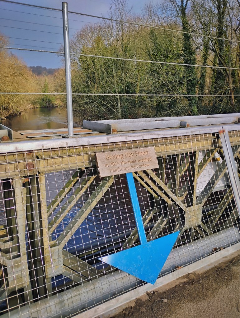
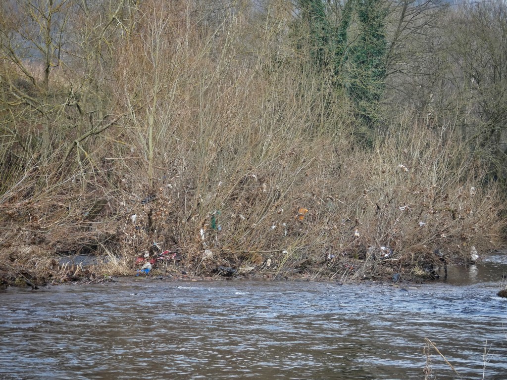
You may be able to see debris and rubbish caught in the willows on the banks from when the river floods. River cleanups are organised to clear the banks and vegetation of litter, but unfortunately the next flood always replenishes it. Since this wide part of the valley is naturally a floodplain, the river would always have broken out of its banks, but the frequency and severity of these events is increasing as the climate warms. The most devastating recent flood was on Boxing Day 2015; there is a marker on the Bailey Bridge to show the height the river reached in that event. Access to the reserve was restricted for nearly two years afterwards, while Crowther Bridge, which spans the Calder and Hebble Navigation and which you will have crossed to enter the reserve, was rebuilt after being destroyed when a canal boat was swept into it.
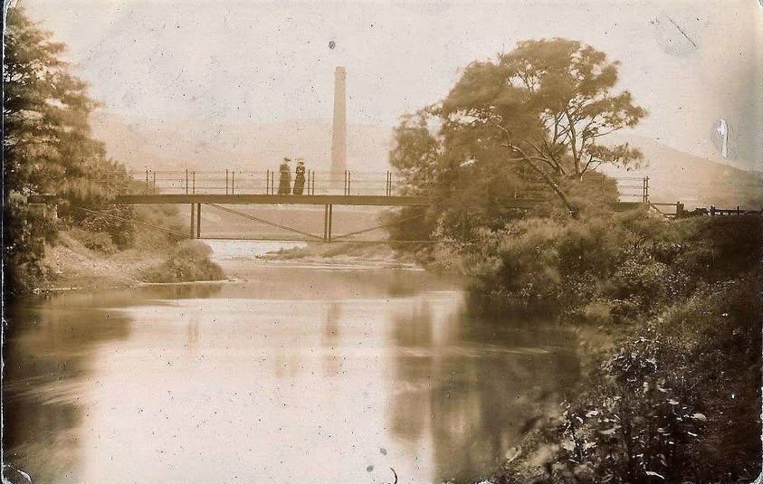
The meanders we can see from here will become important later on, as will the fact that this is a substantial and quite modern bridge – a Bailey Bridge, a kind of prefabricated structure developed during the Second World War. But for now, we can see a first instance of an important message this reserve conveys, about how wildlife not only accommodates itself to, but sometimes thrives in conditions that humans create and that look, at first glance, unpromising. If you are here in spring, summer or autumn, look closely at the metal framework and wires of the bridge’s parapets, and you will see they are laced with spiders’ webs. These are made by the bridge spider, an orb-web spider now rarely seen on vegetation. They are nocturnal, so they may be out of sight in the nooks and crannies of the metal during the day. They feed on the midges and other small insects that congregate above the water, and have adapted to bridges and the structures they provide for their webs. The males of the species are kleptoparasitic, meaning they not only live on the webs that the females build, but also steal the prey their webs catch. The females, however, sometimes eat the smaller males in lean times.
We will now move on to the next stop. We will be walking along a route that was quite contentious in the 19th century. Quarrymen from Rastrick who worked in the Southowram quarries on the opposite hillside would like to have used this direct route to cross the river, but at the time there were only stepping stones at the bridge we have just crossed. But even when they could not use them due to the river level being too high and had to take a more circuitous route, they found themselves at odds with the owner of Cromwell House Farm, the site of which is above the reserve car park, who disputed that it was a public right of way. The case ended up in court, where evidence that Southowram residents regularly formed a marching band to demonstrate their right to use the route won victory for the quarrymen. A footbridge was eventually built, later replaced by the modern bridge we use today.
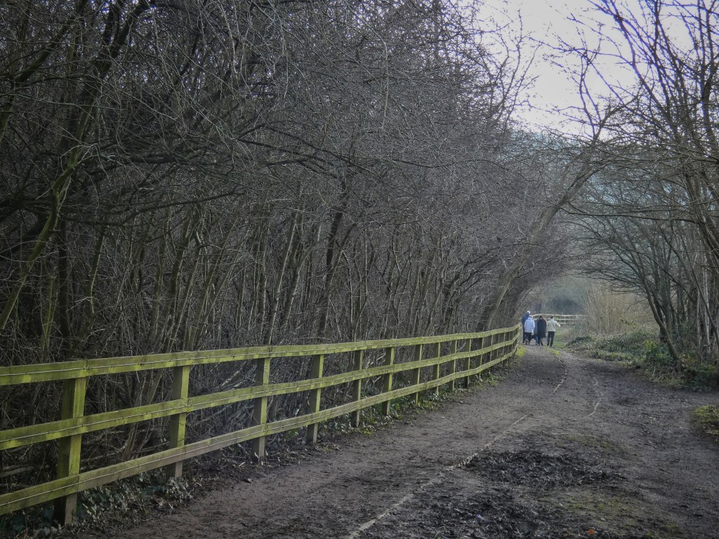
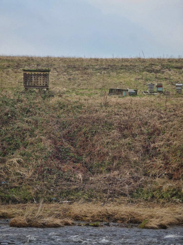
On the way, enjoy the hedgerow that was planted by volunteers along the perimeter of the reserve. Made up of hawthorn and blackthorn, it provides good nesting habitat and autumn berries for birds. In summer, you may hear a whitethroat singing, while in winter redwings feed on the berries. Along its base, butterflies such as orange tip will feed on dandelion nectar and peacocks lay eggs on the nettles. Also, look across the river to the opposite bank, which is also part of the reserve, to see beehives and an artificial sand martin nest wall. Sand martins burrow tunnels into river banks, and inside the chambers at the end they lay their eggs and raise their young. These burrows are, however, vulnerable to flooding, and an artificial nest wall allows them to stay out of danger, both of floods and predators.
2. Tag Hole
We are now in an area known as Tag Hole. According to local legend, it was once haunted by a headless ghost named Tag, who drove a carriage pulled by a two-headed horse. In contrast to this eerie tale, the area also has brighter associations; in the 19th century, it was the site of a fair featuring refreshments, swings and boats for hire.
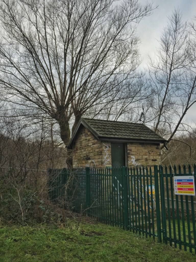
There was once a mill here, and the weir you just passed was built to serve it. The weir creates a pool of water behind it, which helped regulate the flow into a head race, or goit, which channeled water to power a waterwheel. Known as Tag Cut Mill, it operated as a woollen textile mill, a stone mill, and later a dyeworks. An auction notice from the mid-19th century reveals that the mill had tenters – long wooden frames used to stretch drying cloth and prevent it from shrinking. We can imagine rows of these frames alongside the mill. By 1907, the mill had been demolished, leaving only its weir behind. Today, the only structure in the vicinity is the modern gauge station beside its weir.
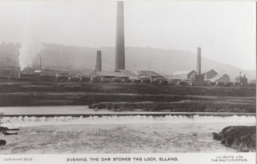
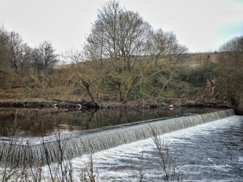
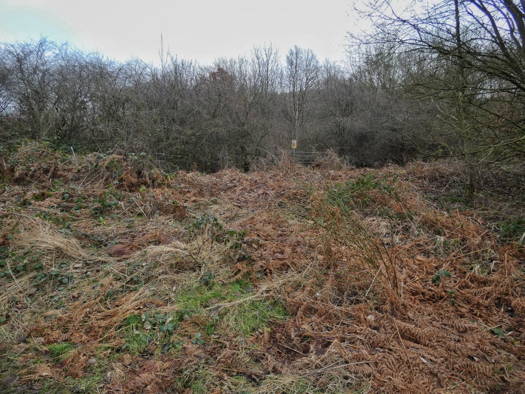
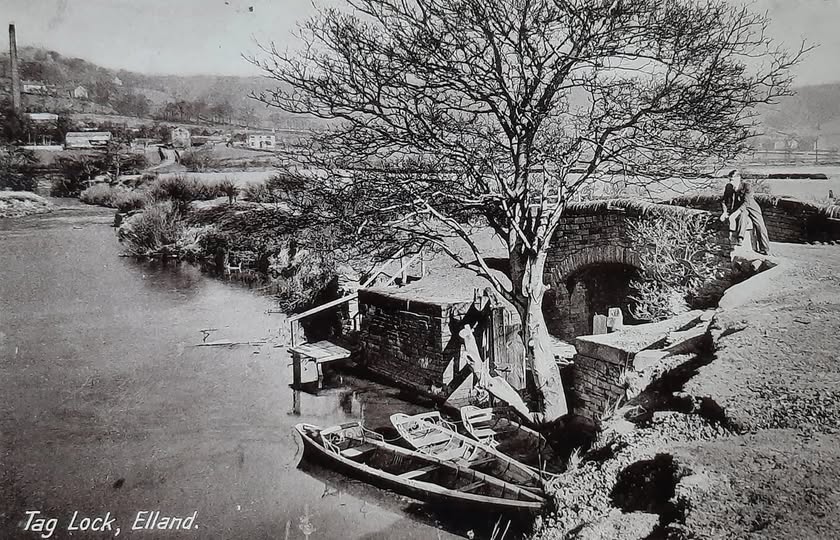
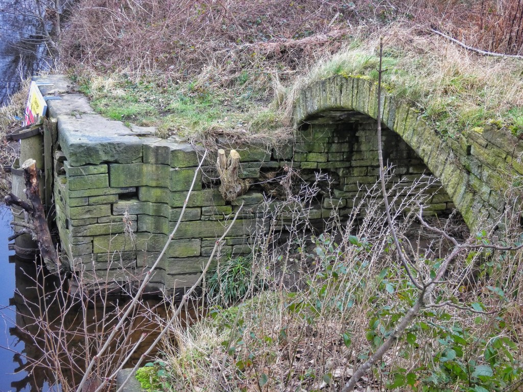
The mill took its name from a short section of canal called Tag Cut, whose beginning you’re now standing at. Although this end has been filled in, you can still trace its outline. Picture water entering it from the river under the stone arch of the packhorse bridge, with a lock once situated in the hollow now overgrown with weeds. The story of Tag Cut will unfold as we continue, but for now, let’s explore why it was built.
In the 18th century the River Aire was made navigable to barges and boats, and a part of that scheme – the Aire and Calder Navigation – was to make the Calder navigable from Castleford to Wakefield. A navigation is not simply a canal because the river is used where it is wide and calm and deep, and then sections of canals, called cuts, are dug to avoid stretches of the river that are shallow, twisting or narrow.
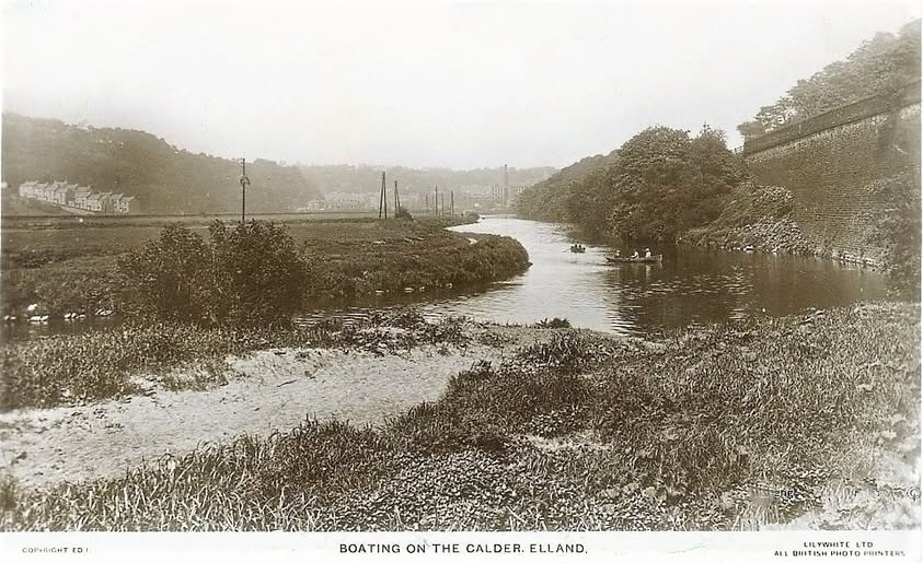
Late in the 1750s, a new scheme began to be planned, the Calder and Hebble Navigation, to link Wakefield to Sowerby Bridge. As we have already seen, the river embarks on a wide meander here, and there were two things that made it impossible to navigate for barges. The first is the weir for the mill. The second obstacle, downstream around the meanders that we saw at the spider bridge, are shallows that were deemed too significant to dredge. So it was decided to make a 660-yard long cut: Tag Cut. This is one possible explanation of its name: to ‘tag’ was to tack two things together, in this case, two sections of the River Calder.
The project was overseen by James Smeaton, known as the “father of civil engineering,” who defined the profession as works carried out for the public good. Although no records of Tag Cut’s construction survive, we can imagine the bustling encampment of navvies who worked here – digging, facing the canal with stone, and building locks and bridges. Their efforts had a lasting impact, supporting the rapid industrial growth of nearby Brighouse and Elland. By the following century, the area was home to dozens of textile mills, dyeworks, ironworks, breweries, and other industries.
In the past, this area of Tag Hole was dominated by industry, with the mill and the entrance to Tag Cut serving as key hubs of activity. The landscape was shaped by the demands of extraction and production, with the river diverted and the land carved up to serve human needs. However, today, this once-industrial area is part of a much larger, restored landscape. The change is striking, illustrating the remarkable capacity for the environment to recover when given the opportunity.
The packhorse bridge, of which only the arch remains, was built to span this end of the cut when it was completed in 1770. Originally featuring an elegant parapet that survived until at least the mid-20th century, it has a storied history. In the 1950s, Fred Craddock built a small wooden jetty here and became well known for renting out rowing boats for 3d an hour. They were affectionately called “Craddock’s subs”. These boats came equipped with oars – and a can for bailing!
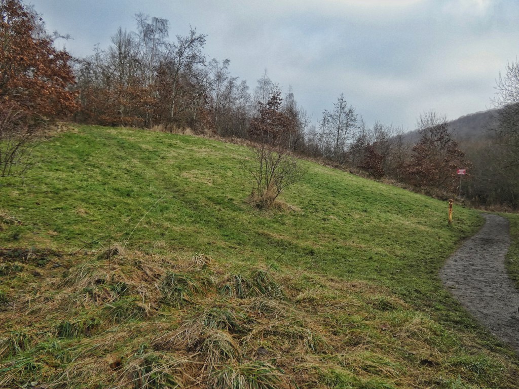
As we move on to our next stop, take a moment to observe the grass banking on your left. In summer, it comes alive with bird’s-foot trefoil and common blue butterflies, just two of over 20 butterfly species recorded on the site. Each species is specially adapted to thrive in the reserve’s diverse habitats.
3. Tag Cut – Iron Pool
Here you can start to see that there is a waterway flowing, which further downstream will become apparent is the man-made Tag Cut. But at this stage, it is still partially filled in, and a natural pool has formed, where deer come to drink. The water is red; this is from iron oxide leaching out of the shales on the hillside above, high in Strangstry Wood, but this does not affect the plant life, with purple loosestrife, meadowsweet and yellow flag iris thriving here.
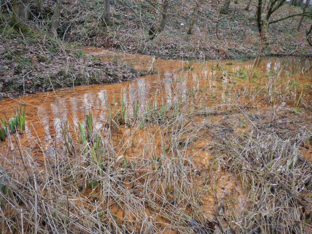
The hillside above was extensively quarried during the 18th and 19th centuries. Here, the layers of soft shale interleave with sandstone strata. To extract the sandstone, miners, known as delvers, would dig out the shales beneath, temporarily propping up the rock with wooden supports. Once the sandstone was removed, the supports were deliberately collapsed, causing the remaining material to fall in. This dangerous work took a heavy toll – delvers had a life expectancy of only around 45 years.
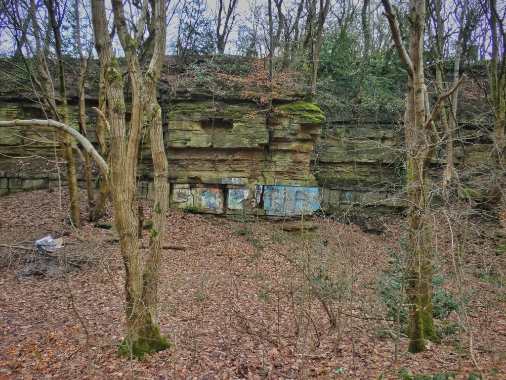
The delvers and other industrial workers may not have intended harm, yet their actions left scars on the land, legible marks that can be read as part of a complex narrative in which both nature and human endeavour intersect.
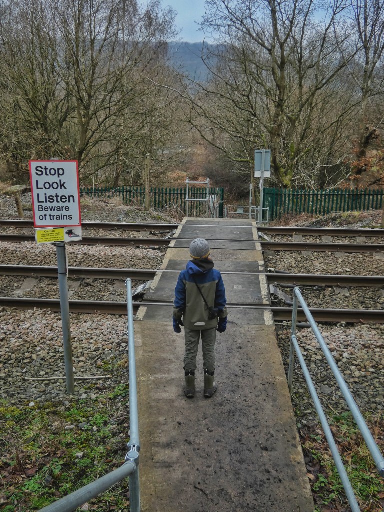
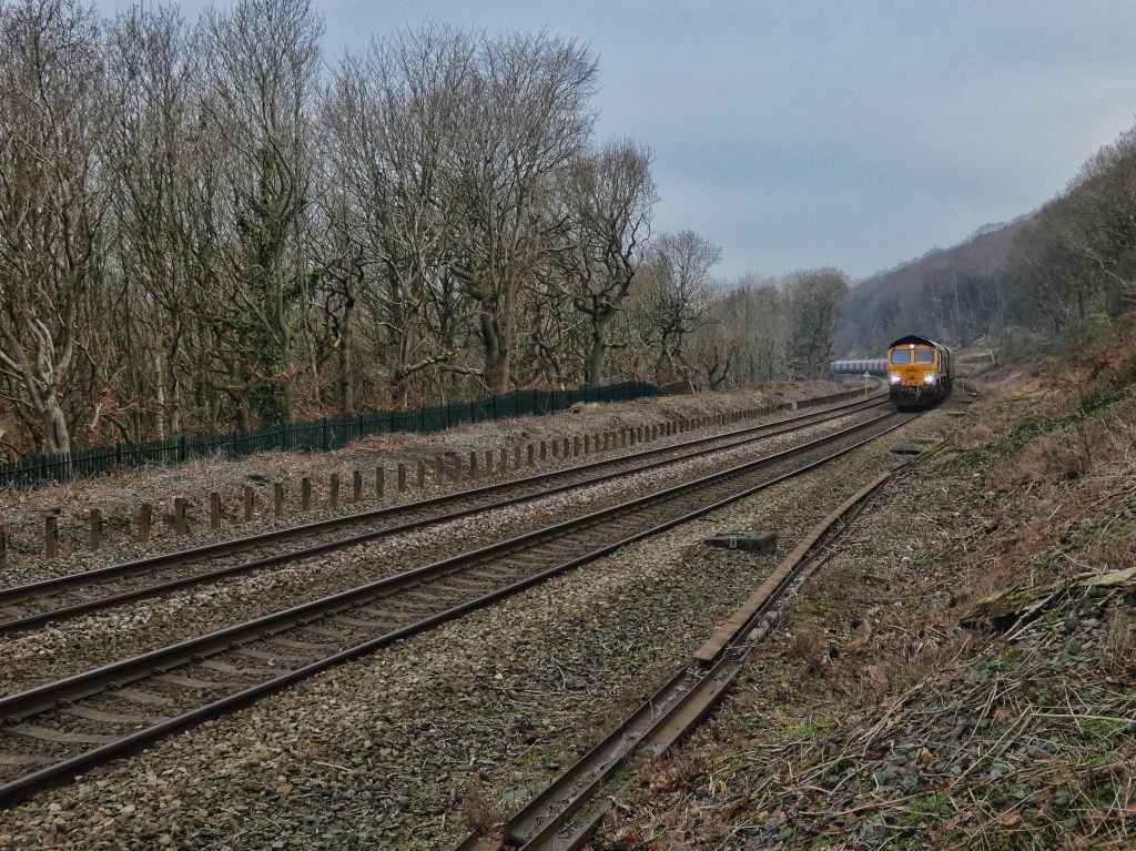
Beyond the cut, you can see the anti-trespass fence for the railway line, which was constructed long after Tag Cut, in the 1840s. Delvers had to cross the railway to reach the quarries in Strangstry Wood, and this public right of way still exists today, crossing the line just above the packhorse bridge. A cottage was built nearby to house the level crossing guard, and for a time, it was home to Ellen Buckley, a widow from Prestwich in Lancashire. Known locally as Red Ellen, she lodged railway workers at the cottage, as shown in census records.
Tag Cut, completed in 1770, served for 38 years as a vital route for transporting coal, stone, flour, lime, and other goods. By 1808, it was replaced by a longer canal section called Freeman’s Cut, which bypassed this entire stretch of river. Originally, the Calder and Hebble Navigation was planned to connect to the Rochdale Canal, but delays caused by the American War of Independence meant the Rochdale Canal wasn’t finished until 1805. During the interim, this modest section of waterway – now little more than a ditch that many visitors barely notice – was a critical link. For a brief time, it made a transnational crossing possible, connecting the North Sea to the Irish Sea. From here, it is 49 miles east via 38 locks to Goole and the Ouse/Humber.
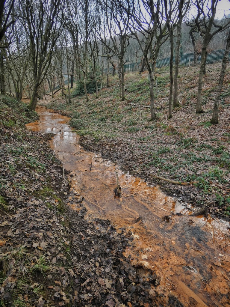
As we continue toward the next stop, keep an eye on Tag Cut as it becomes deeper. Notice how the red water gradually clears as the reeds help to purify it.
4. Pond Dipping Station
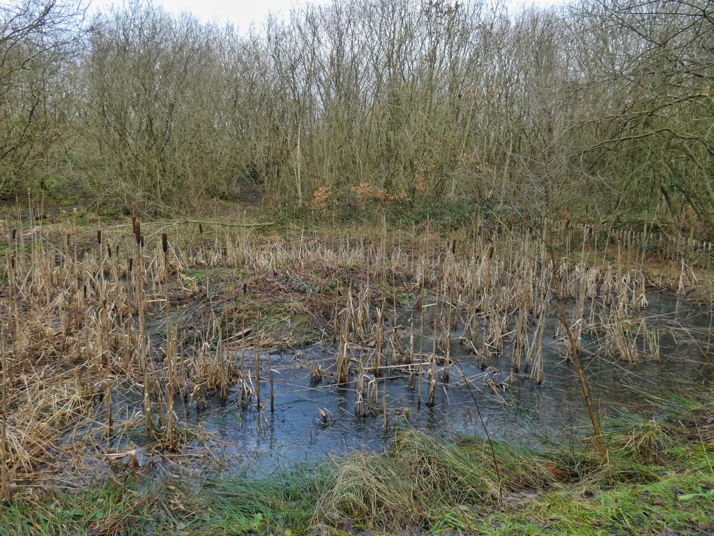
The wildlife pond is a thriving habitat for a variety of aquatic plants and creatures. It is home to pond skaters, water beetles, great diving beetles, and water boatmen. Amphibians such as common frogs, common toads, and both common and palmate newts can also be found here. The pond also supports an array of plant life, including flag iris, water plantain, marsh marigold, and bulrush, around which common red and blue damselflies, broad-bodied chasers, and southern hawker dragonflies can be seen buzzing. In fact, the reserve hosts 11 species of damselflies and dragonflies in total. On the grass banking behind the pond, marsh orchids and southern marsh orchids can be found.
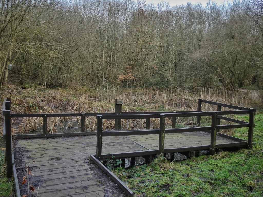
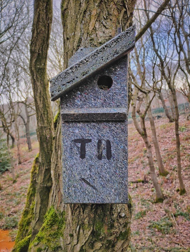
In 2017, the reserve volunteers constructed the pond dipping platform. Although the reserve is owned by the council, these volunteers – members of the Cromwell Bottom Wildlife Group – carry out much of the management of the reserve. The Group was formed in 2011 and works in close partnership with Calderdale Council’s Countryside and Woodlands Service. The Group’s volunteers contribute significantly to the upkeep and enhancement of the reserve. They manage the visitor centre and café, which are open on Thursdays and Sundays, and organize work parties every Tuesday and Thursday. These work parties tackle a variety of practical tasks, including maintaining accessible paths, planting and removing trees (sycamores, for instance, are removed to prevent them from overtaking open areas and reducing biodiversity), mowing meadows, coppicing, and building benches. You will also notice many bird boxes throughout the reserve, each of which are numbered so that their occupants can be monitored and recorded.
The dedicated work of volunteers at Cromwell Bottom speaks to a collective desire to make amends for the damage of the past. Their efforts not only restore the land but also help heal our relationship with nature, offering hope that we can reorient our relationship with nature from one of viewing its value solely in terms of how it can serve human society, to one of respect and reciprocity.
Another important aspect of the Group’s work is hosting school visits. The reserve features a dedicated environmental education area, located in a part of the reserve that is normally off-limits to the public. This purpose-built area includes a marquee, a wildlife observation building, and two minibeast hunting zones. Visiting schoolchildren can engage in activities such as pond dipping, birdwatching, and scavenger hunts, as well as hands-on tasks like bulb planting.
The educational programmes at Cromwell Bottom help foster a new relationship with nature, one based on respect and understanding. By teaching the next generation about the delicate balance between human activity and the environment, we begin to heal the rift created by past exploitation.
5. Tag Cut – Wharf and Lock-keeper’s Cottage
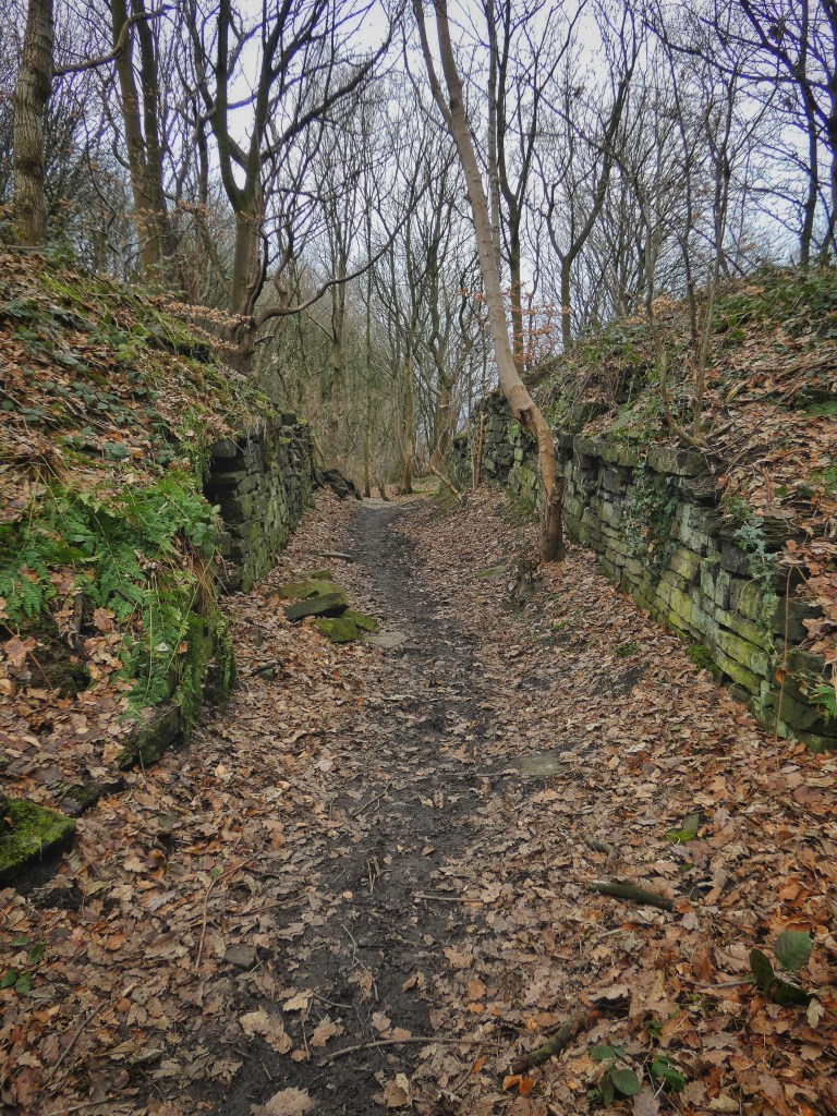
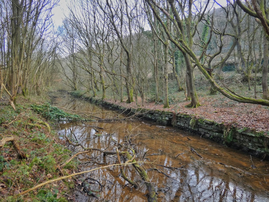
As we move on from the pond, we can complete the story of Tag Cut. Just as the path and the cut begin to diverge, you can catch your first glimpse of the stone sides of the canal through the willows. What until now has appeared to be a natural ditch is revealed as a man-made waterway.
Tag Cut became redundant as a through-route when Freeman’s Cut, a new section of the Calder and Hebble Navigation, was completed in 1808. The Freeman family, who owned the Southowram hillside quarries above Cromwell Bottom, played a pivotal role in this development. Shortening the distance required to transport their stone to canal barges was in their best interest, and a new wharf at Brookfoot rendered Tag Cut obsolete.
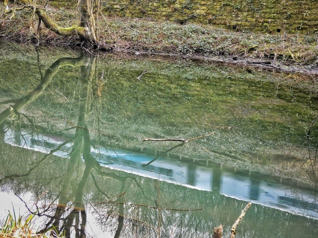
However, Tag Cut remained in use until the 1870s, continuing to transport stone from quarries in Strangstry Wood and Lower Edge, across the railway line. Delvers carried the stone in leather harnesses strapped to their backs, loading it onto wooden carts or sleds. These were then taken down the steep hillside to be loaded onto barges at a now-overgrown wharf downstream.
At this point, we are roughly halfway along Tag Cut, which continues until it rejoins the Calder after the river completes its wide meandering arc. At its end there was a lock, a lock-keeper’s cottage, and a wooden footbridge. Old photographs depict the cottage as a homely-looking stopover, with washing hanging out, a small garden, and a moored boat. The footbridge allowed the horses hauling the barges to cross from the river’s towpath to Tag Cut’s towpath. A small toll was required to cross. This bridge was eventually swept away in a flood and never replaced.
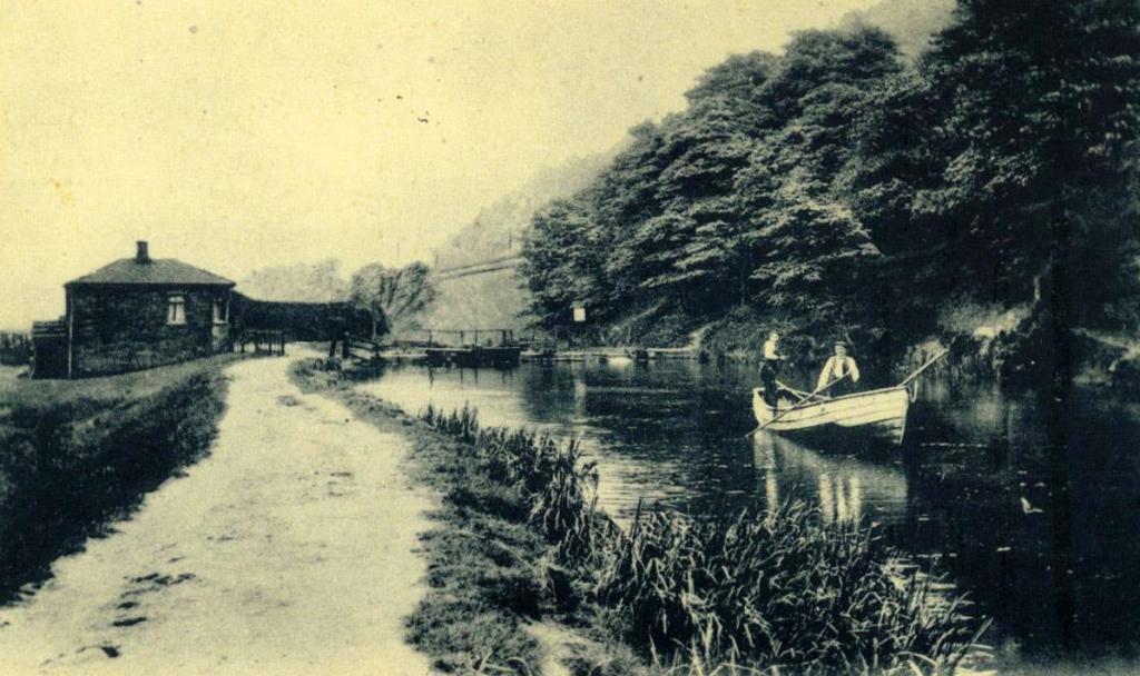
It’s fascinating to imagine the bustling activity here during Tag Cut’s heyday. Clydesdale and Shire horses would have been fed and reshod by farriers, while carpenters maintained carts, masons shaped stone for transport, and bargemen tended to their boats. Families of the bargemen lived aboard, cooking meals while their children played along the towpath.
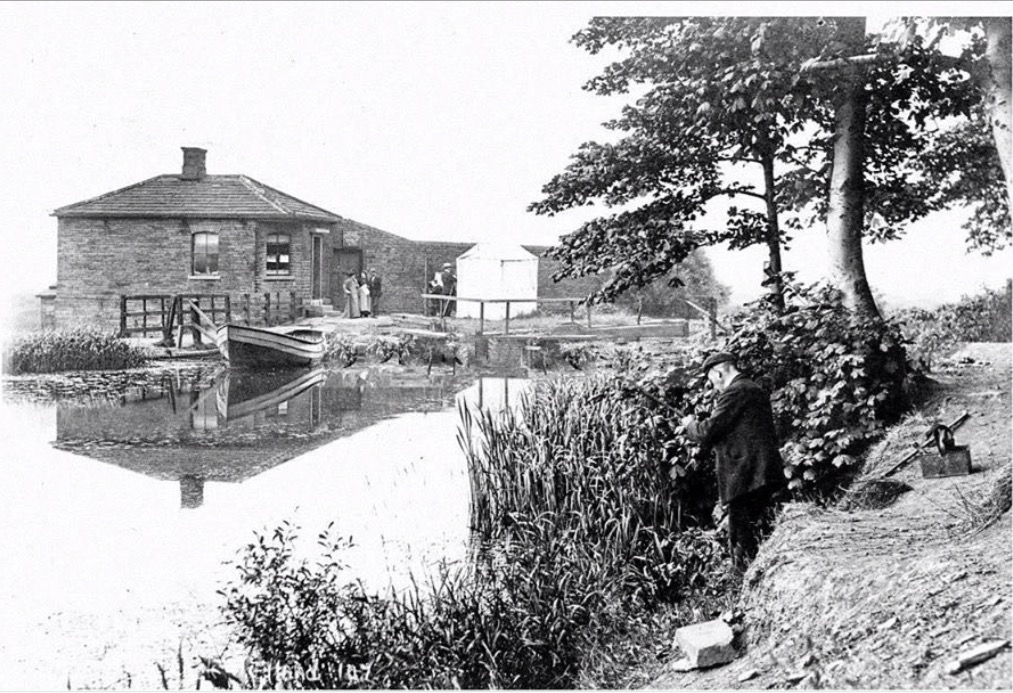
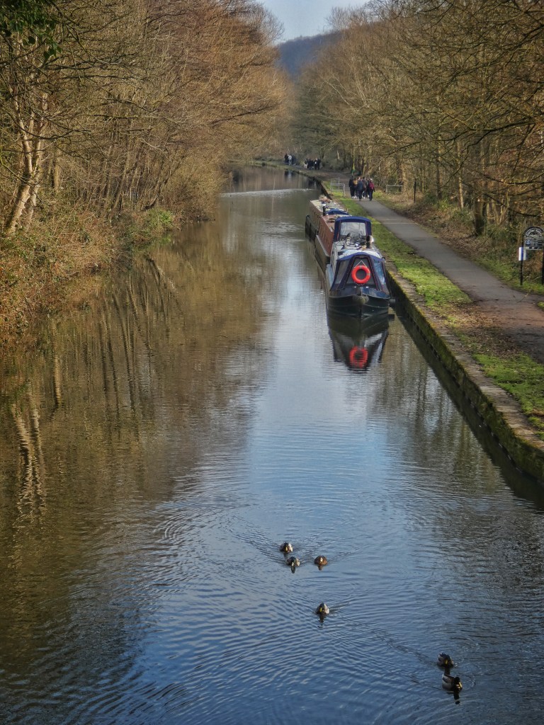
Even after Tag Cut was abandoned, this area went on to have a different life. By 1895 it was already an area popular for recreation. Barges were repurposed from cargo to paying passengers, who dressed in their finery for pleasure cruises upriver from Brighouse to visit the area. Angling societies, such as the Halifax Amicable Brothers Angling Society, stocked Tag Cut with roach and trout and hosted fishing competitions.
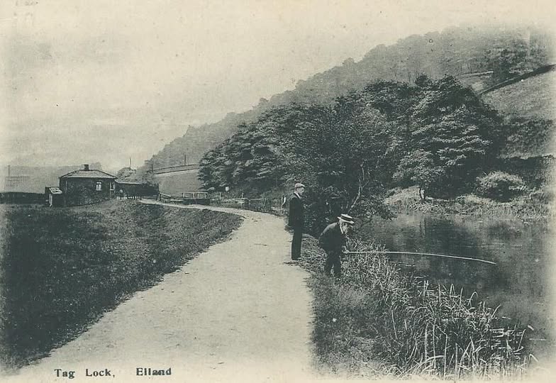
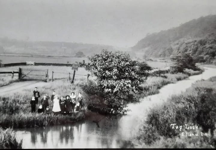
Naturalist groups, including the Lindley Mechanics Institute Naturalist Society, organized outings to Tag Cut to search for rare flowers. Their finds included red campion, yellow toadflax, sweet cicely, purple medick, naked-flowered crocus, meadow clary, and amphibious bistort. The Halifax Scientific Society documented these visits extensively in its journals, with articles highlighting different species groups, from freshwater snails to plants.
6. Little Hay Meadow
We now arrive at one of the larger open areas of the reserve, known as the ‘little hay meadow.’ The strength of Cromwell Bottom as a nature reserve lies in its remarkable diversity, a diversity that is both natural and shaped by its industrial history. The reserve is a mosaic of habitats, including dry and wet woodlands, open grassland, ponds, reedbeds, a unique lowland sphagnum bog, standing open water in the lagoons, the slow-flowing watercourse of Tag Cut, and a fast-flowing river.
The grasslands – such as the little hay meadow, the larger hay meadow we will visit later, and the orchid banks – are intentionally managed to prevent them from gradually turning into woodland, as much of the rest of the reserve has. This management is crucial for maintaining habitat for specialist plant species, as well as for insects like grasshoppers, skipper butterflies, and burnet moths. The council cuts the grass once a year, managing these areas similarly to traditional hay meadows, which were once part of a pastoral agricultural system used to provide winter fodder for livestock.
In fact, the entire reserve was once farmland, with pastures and meadows stretching across the landscape. On 19th-century Ordnance Survey maps, a field boundary – likely a dry stone wall – is marked as crossing right through the center of what is now the ‘little hay meadow.’ The five fields that make up this part of the reserve were likely farmed from Cromwell House, located near the entrance to the site, where a small industrial estate now stands. Cattle would have grazed here, and some of the meadows were likely periodically flooded, enriching the soil and creating a diverse range of wildflowers. Lime, transported by barge to the wharf at Tag Cut along with the quarried stone, would have been spread on the fields to reduce their acidity and improve productivity for grazing.
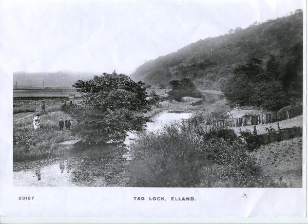
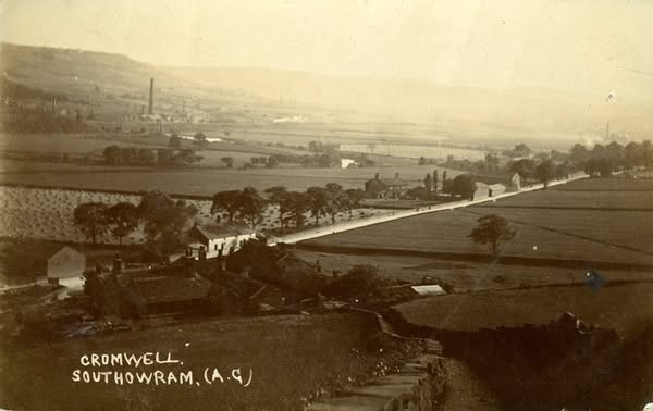
While old field boundaries and gateways visible in Victorian photographs have been lost over time, a new boundary has been established around the little hay meadow. Volunteers have planted a hedge of 3,000 saplings – including hawthorn, hazel, dog rose, holly, and rowan – creating a valuable woodland-edge habitat where many bird and insect species thrive.
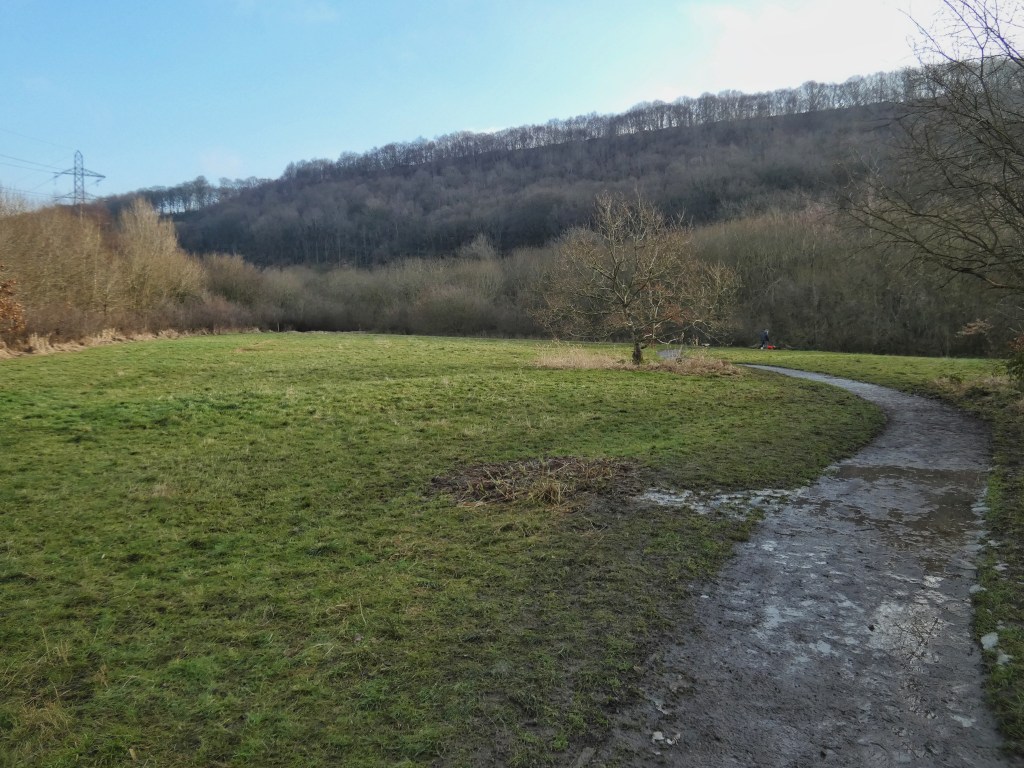
This hay meadow, once scarred by human intervention, now stand as a symbol of redemption. The grasslands, managed to maintain their rich biodiversity, reflect the ongoing efforts to heal the wounds left by past exploitation and to restore the land’s ecological health.
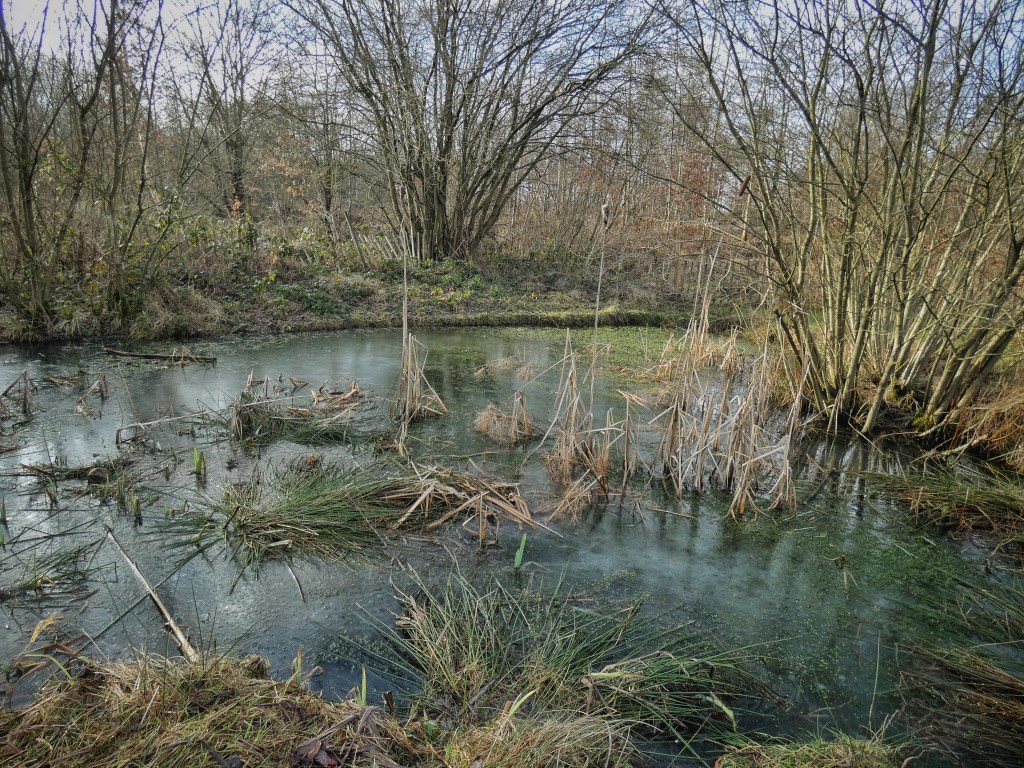
As you pass by, notice the small pond known as the ‘tip pond.’ It’s home to some of the same species found in the larger wildlife pond, including leeches that can grow up to six inches long. Like the open grasslands, the ponds require regular management to maintain their value as wildlife habitats. This includes dredging the ponds to remove leaves and detritus from the surrounding woodland, ensuring the right balance between open water and vegetation, and clearing invasive non-native species, such as New Zealand pygmyweed.
7. Bird Feeding Station
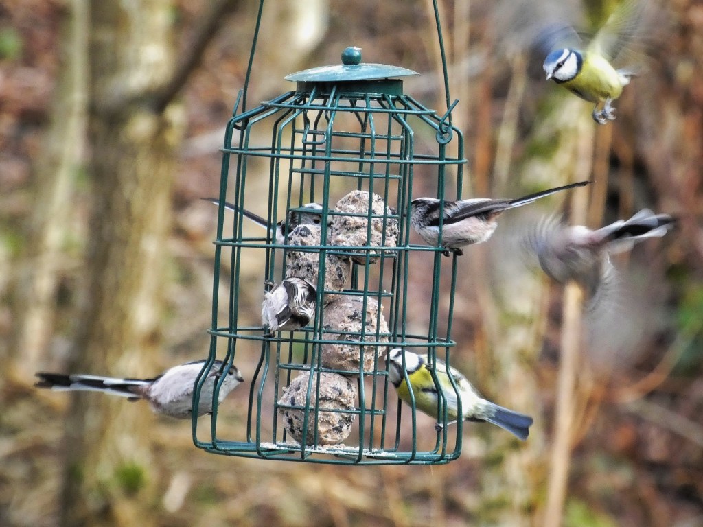
The bird feeding station is a popular spot for visitors, offering an up-close view of local wildlife. It is regularly visited by great and blue tits, goldfinches, nuthatches, siskins, redpolls, as well as jays, sparrowhawks, and squirrels. Volunteers work hard to keep the station stocked and to keep up with the high demand from the hungry birds. For many, it provides a rare opportunity to observe wildlife up close – especially for those without gardens of their own.
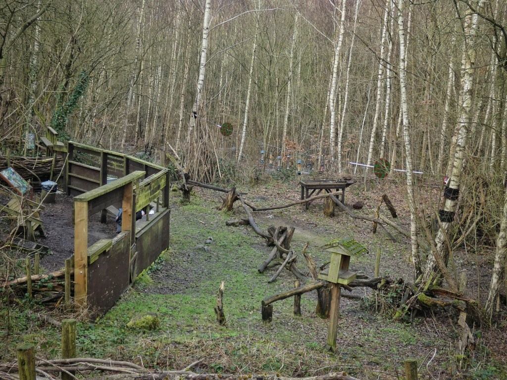
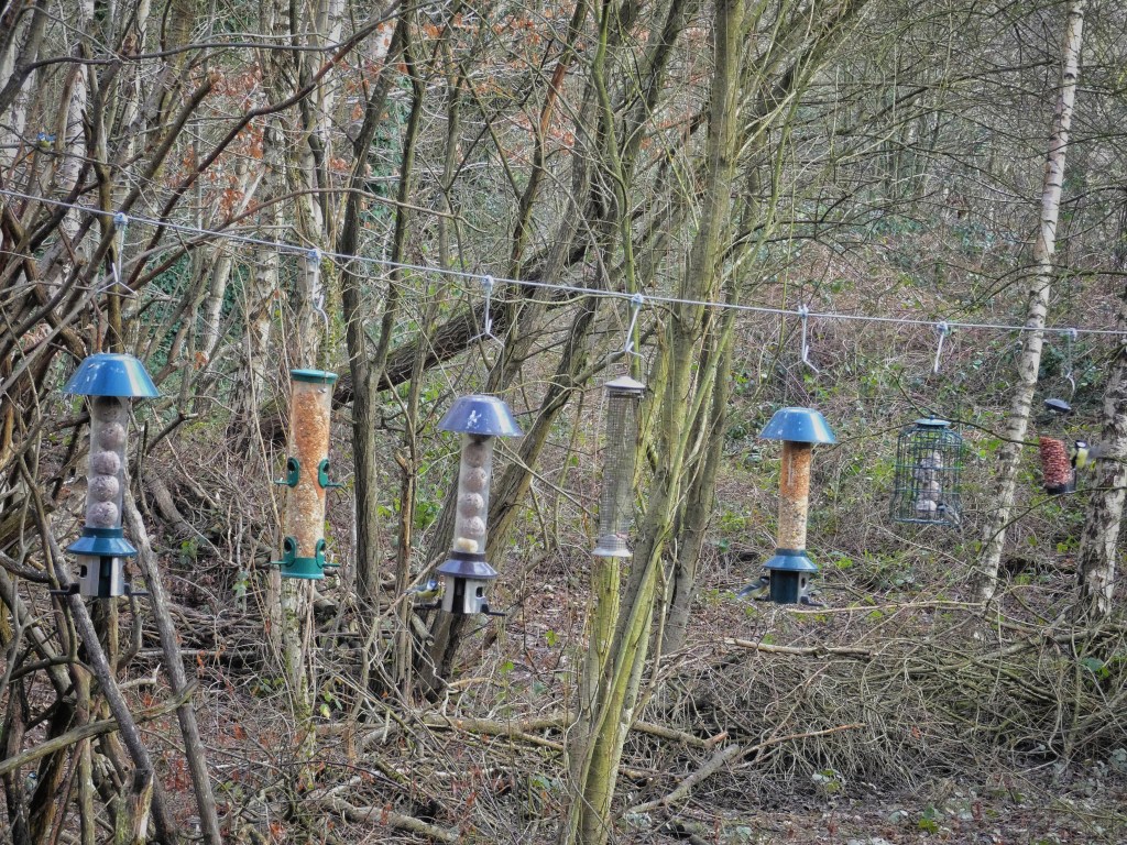
While large-scale bird feeding does come with some risks, such as the potential spread of diseases due to the concentration of animals in one area, the value it brings in connecting people with wildlife is undeniable. This is why many nature reserves, including Cromwell Bottom, have feeding stations. In 2023, a remarkable 81 bird species were recorded across the reserve.
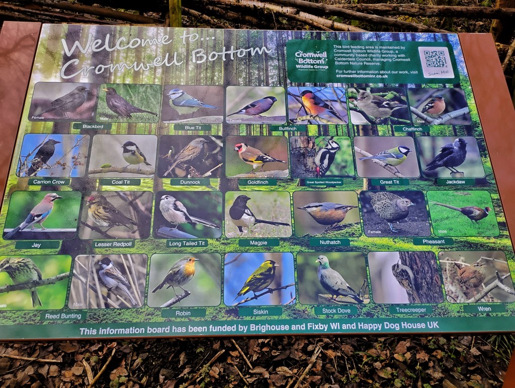
This brings us to reflect on the broader significance of the reserve, not only for the wildlife that calls it home but for the many thousands of visitors who come each year. As Calderdale Council’s only official nature reserve, it is freely accessible to all. Thanks to the dedicated efforts of volunteers, the reserve is wheelchair-friendly, welcoming a diverse range of visitors. It is a sanctuary not only for nature but for people as well. And Cromwell Bottom attracts more than just casual walkers out for a breath of fresh air; it is also a regular destination for seasoned naturalists and wildlife photographers, drawn by the reserve’s astonishing array of species.
The birds that now flock here represent not just nature’s resilience but also the potential for humans to amend past wrongs by providing spaces where wildlife can thrive again. Their return can feel like an act of forgiveness.
8. Osier Beds
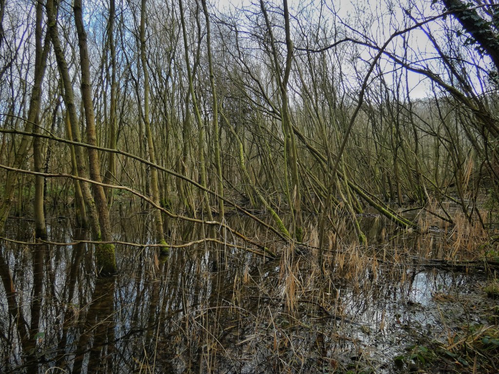
To create the pastures and water meadows, the woodland that would have once colonized the floodplain had to be cleared. However, in the 19th century, this area of today’s reserve was managed as an osier bed. Osiers are a species of willownon-native but introduced to Britain thousands of years ago. Known for their flexibility and strength, they were the preferred species for basket-making. The osier beds here were cultivated to supply the basket-making industry, particularly for creating skeps – large, rectangular baskets with lids used to contain spun yarn on bobbins.
Hundreds of skeps, each holding up to 500 bobbins, taking most of a day to make but lasting for up to 50 years, were used in the many textile mills of Elland and Brighouse. For a fascinating look at this lost craft, you can watch a poignant 1978 documentary called Albert’s Last Skep for free on the BFI Player. The film captures the entire process, from bundles of ‘withies’ arriving with73-year-old Albert Gaff, who became an apprentice skep-maker soon after leaving school at age twelve, to the final, completed skep.
Today, this area is still populated by willows. There are many species of willow in the UK, including grey, white, crack, weeping, goat, and eared willows, all of which freely hybridize with one another, making identification a challenge. Yet, it is possible that within this marshy ground lies a genetic remnant of the osier beds that once supported a thriving local industry.
9. Lagoon
In front of you is a substantial body of water, known as the lagoon – an unusual term in a British context, but one that reflects its former purpose. Like much of the reserve, this area was once simply a field, probably a water meadow grazed by cattle. But as we have seen, beneath the whole area lies a geological diversity that matches the biological richness of the valley, with layers of sandstone, shale, coal, sands, and gravels all contributing to the area’s unique soil and drainage conditions.
Five hundred million years ago, this area was positioned 60 degrees south of the equator, where mudstone was being formed from silt. Over the next 200 million years, the land moved north toward the equator, where a delta – stretching from the Midlands to Scotland – laid down soft sandstone in lagoons, coarse sandstone in riverbeds, and coal formed from fossilized peat bogs. Eventually, what would become the Pennines was folded, followed by millions of years of erosion and a 100,000-year of glaciation. During the final glacial period, gravel from Lancashire and the Lake District rushed down into what was then Lake Calderdale.
This geological diversity was extensively exploited over the centuries. We’ve already heard about the delvers of Strangstry Woods. Nearby, the Calder Fireclay Company made bricks from the blue clay and shale deposits on the hillside, employing 40 miners by the end of the 19th century. The company continued operations until 1985, and you can still see piles of discarded bricks scattered about, but a massive shale quarry continues carving away at the hillside.
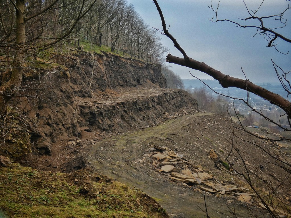
The hillsides behind you on the north side of the valley were once lined with cranes from the quarries that extracted sandstone from the Elland Flags. There was enormous demand for this stone, especially after acts of parliament were passed to improve city streets. The Freeman family’s quarries supplied stone for London’s streets, docks, roads, bridges, and statue pedestals, contributing to iconic landmarks like Trafalgar Square, the British Museum, the Royal Exchange, Billingsgate, Smithfield markets, and Crystal Palace. The family was also involved in projects like Admiralty Arch, New Scotland Yard, and Buckingham Palace, amassing great wealth. Two members of the Freeman family left fortunes equivalent to nearly £30 million in their wills. The quarrying industry declined after competition from North Wales blue slate and harder setts from Leicestershire and Aberdeenshire, but there are still working quarries in the area today.
These industries were concentrated on the edges and surrounding areas of the valley, with most of them closing around World War I. Afterwards, the Calder and Hebble Navigation continued to transport coal and flour until it was officially abandoned in 1947. And then in the 1950s and 1960s, the area in front of you that is today a lagoon became the site of massive excavation for glacial gravels and sands, which were used in the building industry. This area, which became known as the Elland Gravel Pits, gave rise to Brookfoot Lake behind you, which was created in 1965 when it was deliberately flooded. The lake is now shared between anglers and waterskiers.
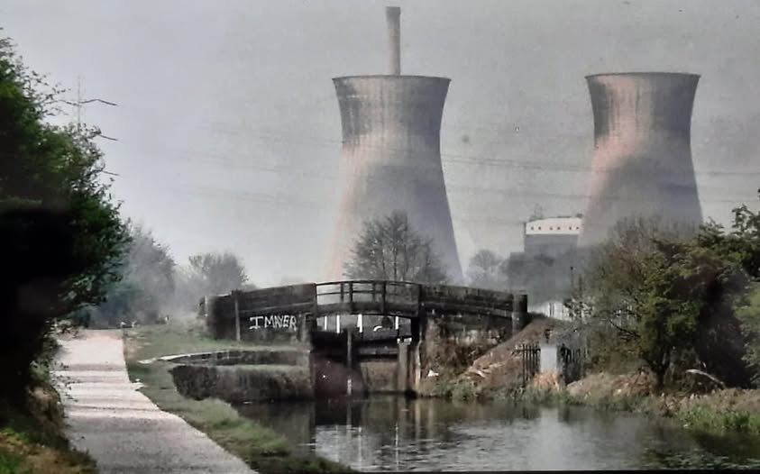
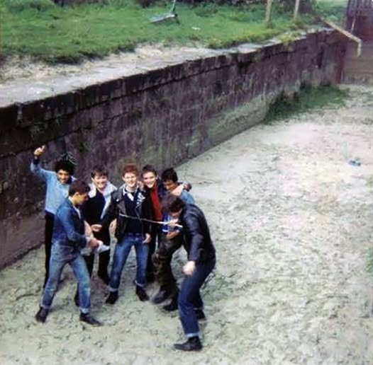
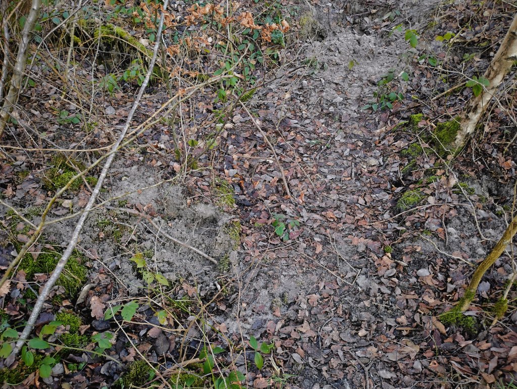
From the 1960s to the late 1980s/early 1990s, the pits in front of us were repurposed as a disposal site for the pulverized fly ash (PFA) byproduct from the Elland Power Station, a coal-fired facility that began operations in 1959. These pits were filled with PFA and boiler slag, byproducts of coal burning laced with mercury, cadmium, and arsenic. Many locals remember playing on what they called the ‘Wibbly Wobbly’, which was where the PFA got into the watercourses, including Tag Cut, and then dried to a crust on top but was still liquid underneath. After getting covered in ash, they would then swim in the river, which was warm from the power station discharging its cooling water. The PFA was later extracted for use in constructing roads, including the M62. We can only imagine the trucks thundering over the Bailey Bridges we’ve crossed, carrying their toxic cargo. The power station ceased operations in 1991, and its cooling towers were demolished in 1996. The lagoon was then landscaped with the remaining gravel and PFA and allowed to fill naturally.
But look at it now! Nature has worked its magic, transforming this post-industrial landscape into something truly remarkable. Wetlands like this would have been rare in the Calder Valley due to the region’s topography, and they have become even rarer as many floodplains have been drained and developed. This lagoon is now a precious remnant of that lost habitat. It’s hard to believe that it wasn’t created by nature, but by human hands in a post-industrial landscape. The area is teeming with wildlife: sedge warblers, little-ringed plovers, willow warblers, reed buntings, little grebes, kingfishers, moorhens, Canada geese, coots, and snipe all thrive here.
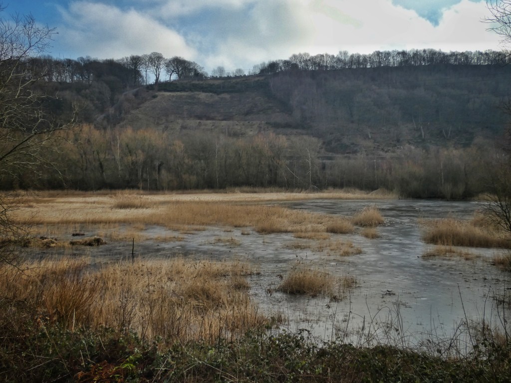
However, as the lagoon is cut off from the river and surrounding water sources, maintaining its water levels is an ongoing challenge. In summer, the water can often dip so low that it nearly dries out entirely. Finding sustainable ways to manage its water is an ongoing project, but the lagoon’s success as a thriving wetland habitat is a testament to nature’s resilience.
The lagoon’s creation, born of industrial necessity, is now a powerful example of nature’s ability to heal. The ongoing restoration efforts, including managing water levels and removing invasive species, reflect our responsibility in ensuring that the ecological systems we’ve impacted are restored to health.
10. Large Hay Meadow
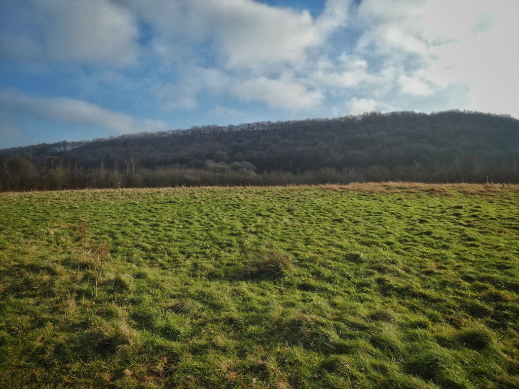
For the first time, up on this hill, we can step back and take in an overview of the site, appreciating our position between the wooded valley sides to the south and north. There has always been a hill here, nestled in the crook of this meander of the Calder. However, the final indignity visited upon Cromwell Bottom came in the 1980s and ‘90s, when over a million tonnes of municipal and industrial waste were dumped here. You are actually standing on an artificial hill, created by this waste.
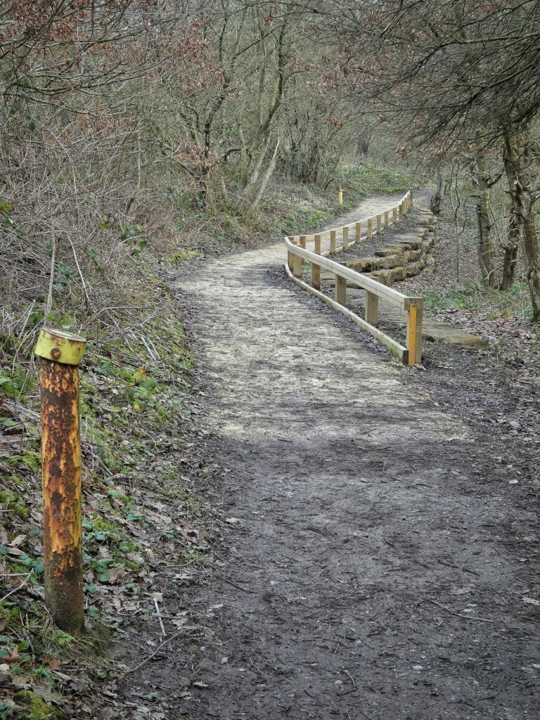
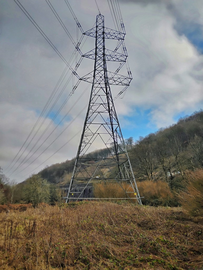
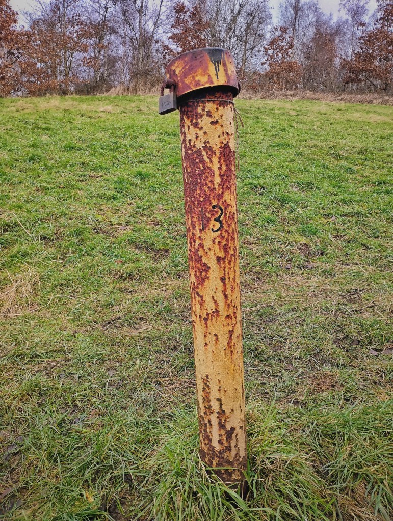
This is why you’ll notice vents scattered around the reserve – short yellow pipes poking up out of the woods near Tag Cut, for instance. These vents allow the various gases released by the decomposing waste to escape and also the testing of groundwater. Taller towers are flares to periodically burn off methane. These systems are all connected by an underground network of pipes. Once the waste was capped with topsoil, grass was sown, and what was once a tip has since become the large hay meadow we see today. This area is now home to butterflies like the meadow brown, gatekeeper, heath, and small copper, and is bordered by trees such as field maple, rowan, alder, and willow.
The restoration of Cromwell Bottom, including the gravel pits and waste tip, was no simple task. It took decades of committee meetings, surveys, reports, plans, memoranda, tenders, and reviews – documents now archived in council basements. But it was the determined work of councillors, council officials, other local civic leaders and staff from the industries that had once exploited Cromwell Bottom that made this transformation possible. And while, of course, nature would eventually have recolonized the site, as it did wherever the land was abandoned, it is thanks to this forward-thinking collaboration that Cromwell Bottom has become the wildlife jewel in the borough’s crown.
Cromwell Bottom’s transformation from an industrial wasteland to a thriving nature reserve reflects both the resilience of nature and the capacity for human redemption. This restored landscape is not just a refuge for wildlife but a powerful symbol of the possibility for healing and reconciliation with the natural world.
Bibliography
Beaumont, Rebekah, Steven Heathcote and Rachel Brady. 2022. Cromwell Bottom Lagoon – Impact Assessment of Options. JBA Consulting.
Cromwell Bottom Wildlife Group. https://cromwellbottomlnr.co.uk/
Cromwell Bottom Wildlife Group. Cromwell Bottom Nature Reserve: Self-guided Walks.
Cromwell Bottom Wildlife Group. Cromwell Bottom Nature Reserve: Shorter Walks and Wheelchair Friendly Routes.
Eccles, Andy. 2019. ‘The History of Cromwell Bottom’, in Lydia Orchard (ed). 2019. Thank You for the Days. Cromwell Bottom Wildlife Group, pp. 14–23. Available at https://cromwellbottomlnr.co.uk/wp-content/uploads/ThankYouForTheDays-1.pdf
Eccles, Andy. ‘The Calder and Hebble Navigation – Tag Cut’. https://myrastrick.com/tag-cut/
Eccles, Andy. ‘Historic Photographs of the Calder & Hebble Navigation Between Brighouse and Elland’. https://myrastrick.com/historic-calder-and-hebble/
Fletcher, David. 1982. Setting the Scene: An Introductory Outline to the Man-made Landscape of the South Pennines. Hebden Bridge: Pennine Heritage.
Goddard, Chris. 2021. The West Yorkshire Woods: Part I: The Calder Valley. Hebden Bridge: Gritstone Publishing Co-operative.
Hall, Eric. 1978. Albert’s Last Skep. https://player.bfi.org.uk/free/film/watch-alberts-last-skep-1978-online
Hardcastle, Rayner. July 30th 1994. ‘This dump could be a site for sore eyes’. Halifax Evening Courier.
Natural England. Cromwell Bottom Local Nature Reserve – Audio Tour. https://webarchive.nationalarchives.gov.uk/ukgwa/20140605112245/http://www.naturalengland.org.uk/regions/yorkshire_and_the_humber/ourwork/cromwellbottom/default.aspx
Ogden, John. 1972. Yorkshire’s River of Industry: The Story of the River Calder. Lavenham: Terence Dalton Limited.
Porter, John. 1980. The Making of the Central Pennines.
Richard Wilson Ecology. 2017. Terrestrial Invertebrate Survey, Cromwell Bottom Nature Reserve, nr. Brighouse, West Yorkshire.
Smith, A.H. 1961. The Place-Names of the West Riding of Yorkshire.
Unknown author. August 25th 1989. ‘MP’s views on waste site’. Brighouse Echo.
Unknown author. 15th June 1984. ‘Frogs’ and toads’ part in £1.3m scheme’. Huddersfield Daily Examiner.

