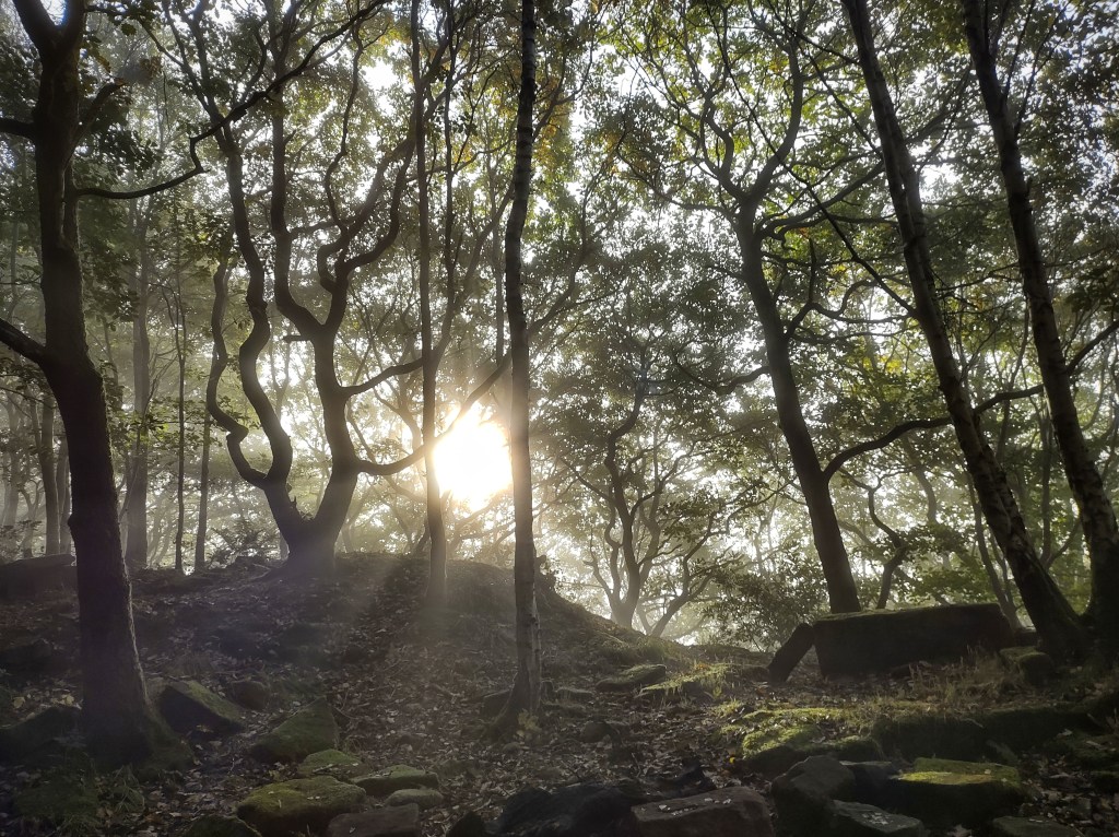
A gauze of mist wreaths through the oaks that have colonised the Brock Hole Delphs on the headland of Heptonstall. The sun slings shafts through their twisted etchings, and spiders have suspended bowed threads between every branch, each strand sagging under a weight of water droplets.
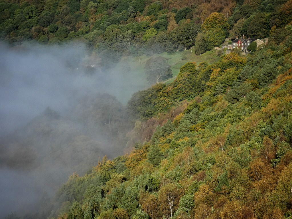
Clear a century ago, the slow flooding tide of trees has risen in recent decades up this promontory. But it has not yet quite reached the top, and just as the woodland cover thins as elevation is gained, so does the mist, both breaking against the sandy shores of dying bracken. The sounds of submerged morning traffic on road and rail floats up from the fathoms. Pigeons and crows launch from the depths and skim the white caps and crests. The pale waters seem frozen, but nonetheless, without any obvious movement, roiling breakers surge along Crow Nest Wood and swell against Callis Nab.
Lumb Bank watches unperturbed as the glacial surf curls up Colden Clough against the brown sugar glitter of the birch and pastel green pine of Eaves Wood. But the strong sun, now casting the long shadows of the bellowing Horsehold herd back towards the farm, wins the race and melts the mist before it blinds the writing centre’s crimson-ivy-framed windows.
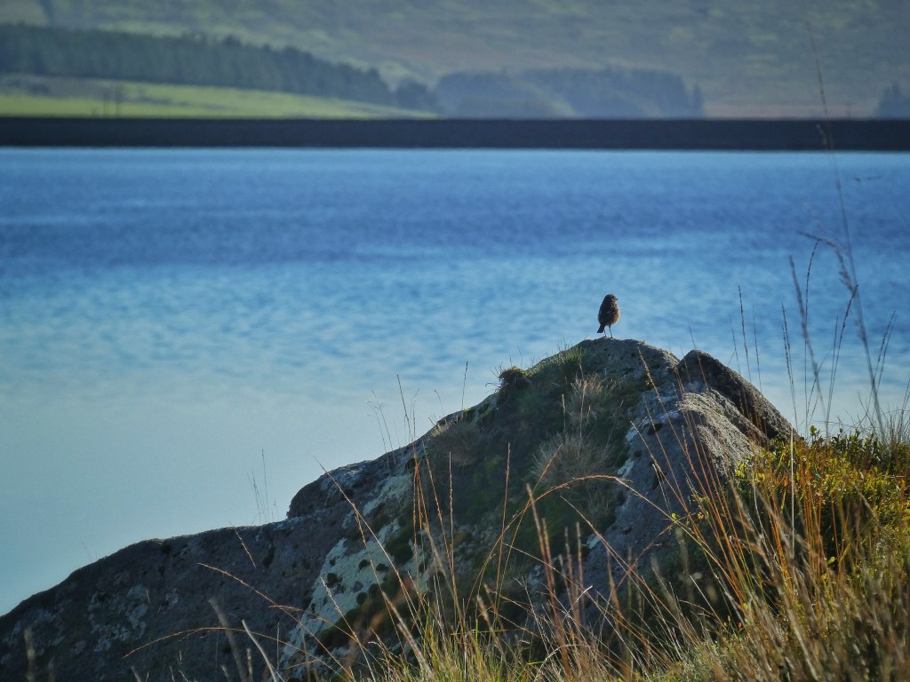
High in the cradle of the moors, barely a breath troubles the composed surface of Widdop Reservoir, the reflections of its fringe of sickly sycamores gazing back at themselves. The pleasing diamond shape of its banks is mirrored a hundred feet higher by the shape of the intake walls of the four farms that once made a little community here in the ‘wide hope’, this sheltered bower in the hills, their lights pooling in the darkness just as the waters that extinguished them would come to do.
On the north side in the parish of Wadsworth and under the straggling crags of The Scout there was Lower Houses, which remains inhabited and was joined by the reservoir keeper’s lodge as a neighbour; Higher Houses, of which a barn remains; New Laithe and Pastures House, whose footprint of foundations can just be made out beside the lonely road that climbs over the border into Lancashire. Pastures House became the Traveller’s Rest Inn, where ‘good homely entertainment can be had’ according to an 1879 guide to Hardcastle Crags, but which in decades past had been a ‘notorious den of rogues’, who hid their ill-gotten gains ‘in the recesses of the rocks on the moor side’, and who were eventually transported for sheep stealing. It was still standing, apparently uninhabited, for Ralph Cross to photograph some time during or after the 1930s.
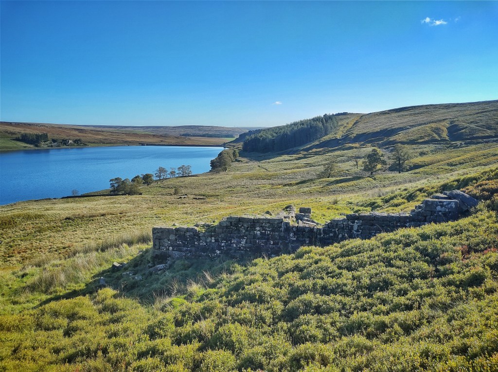
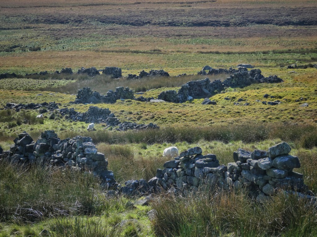
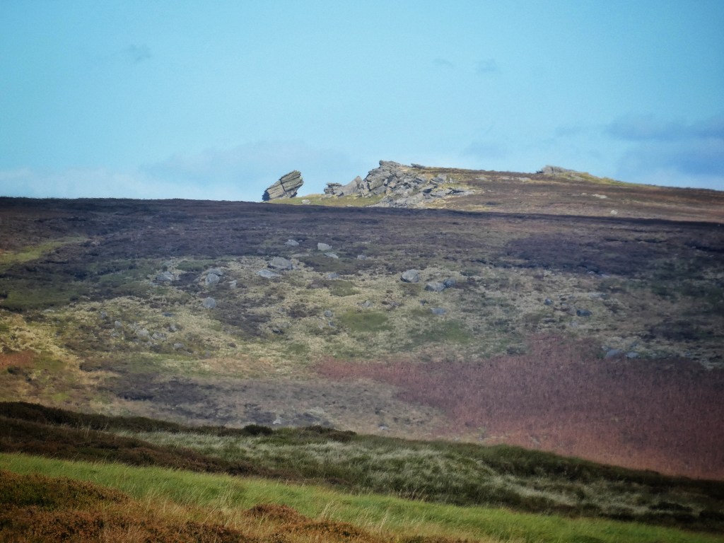
Across the stepping stones over the Widdop Water on the south side, in the parish of Heptonstall under the Clattering Stones, World’s End, a long stepped ruin, a tumble of coarse stone with blooms of pink lichen, cellar open to the sky, roof slates stacked neatly still awaiting collection, the spring that once watered it burbling away, its fields now spongy cushions of bilberry; Wood Plumpton, where a red admiral dances over its few courses of stone and a spill of lintels; Ladies Walk, memorialised by a copse of ragged sycamores and a green sward, a memory of the fertility it once brought to these sour acres; and Old House, where very little remains but a decade ago a Charles I silver sixpence was found. Above Old House is the slow-motion catastrophe of the Cludders, slipped blocks of sandstone littering the slopes under the teetering shadowed crags, with the famous Rocking Pig the most precariously perched.
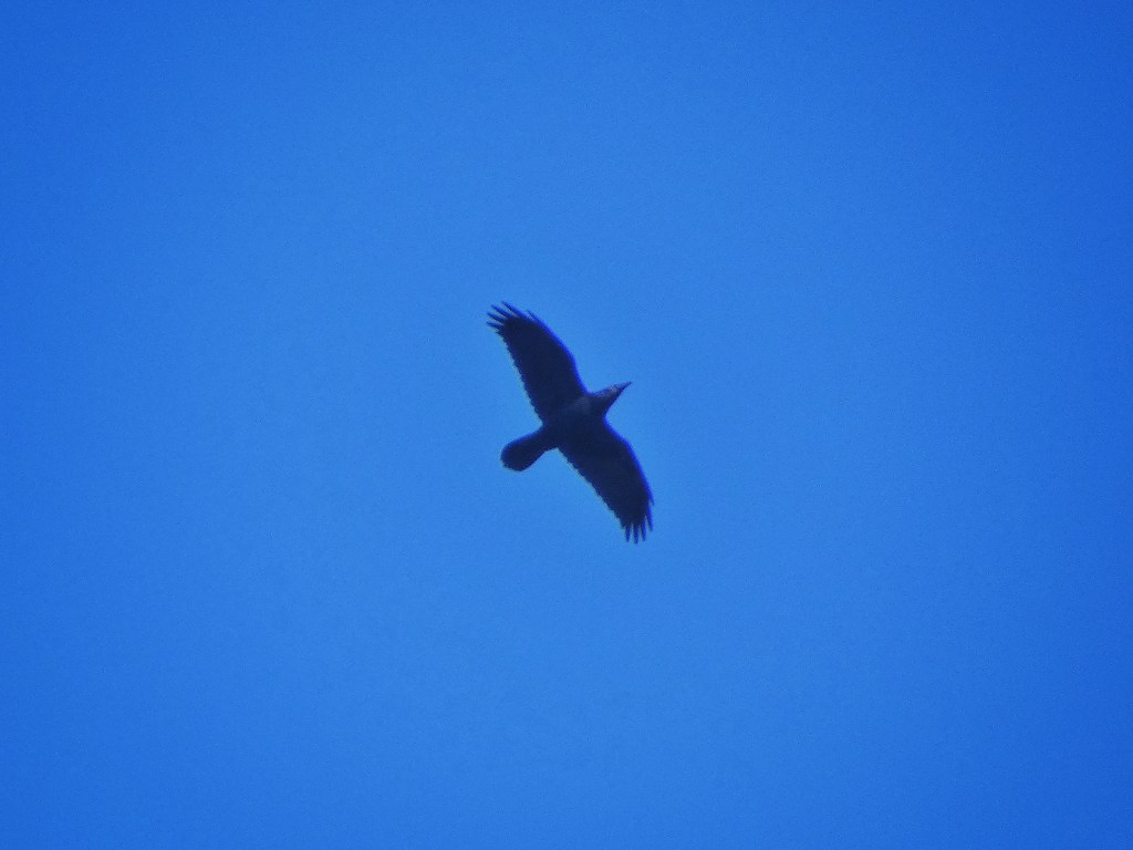
A buzzard soars and mews over the Raven Stones above Lower Houses, and a raven, put out at this imposition, cronks over World’s End, gliding then collapsing into a dive, then gliding again, eating up the distance across the reservoir. On a day like today, when the deranged laughter of the grouse and the rasp of Canada geese wings and a raven-buzzard dispute are the only pebbles to ripple the still pool of silence, it is easy to imagine that this scattered settlement could have had hollared conversations with one another from their doorways, that John Shackleton’s ancestors, who he has traced back to the early 17th century here, never felt lonely for all their remoteness. Until, that is, the years following the coming of the navvies to dam their valley, as one by one the hearths of the farms grew cold.
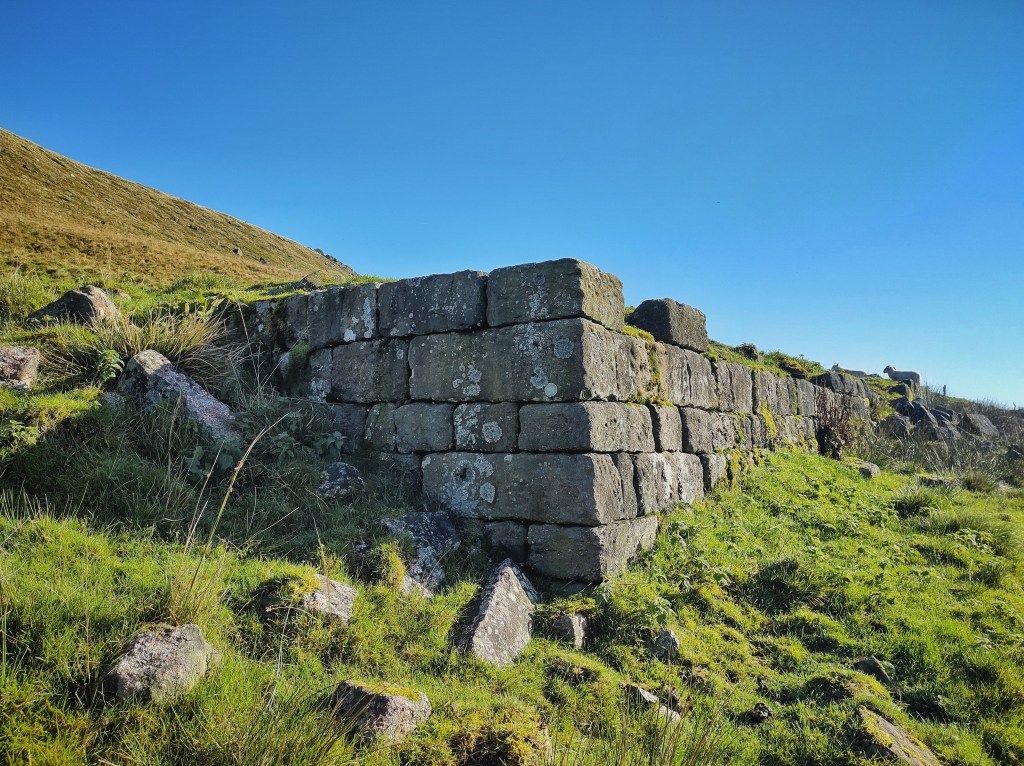
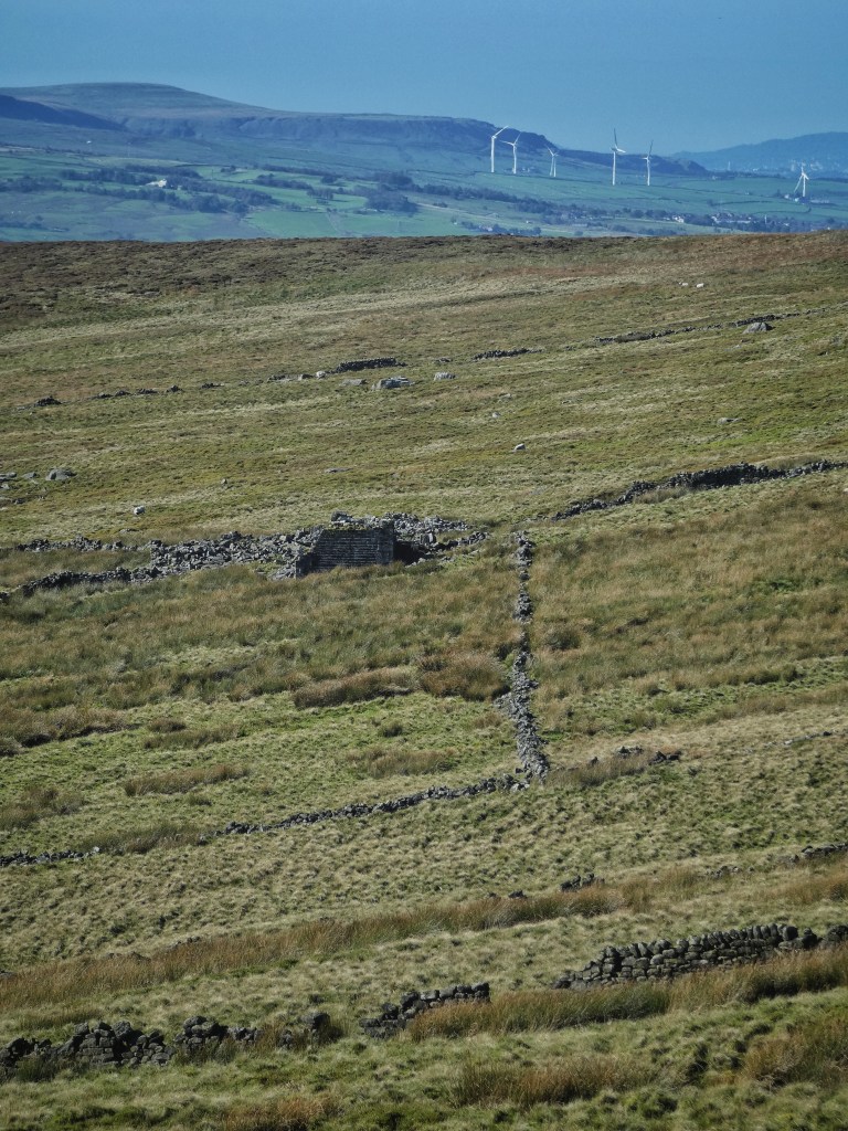
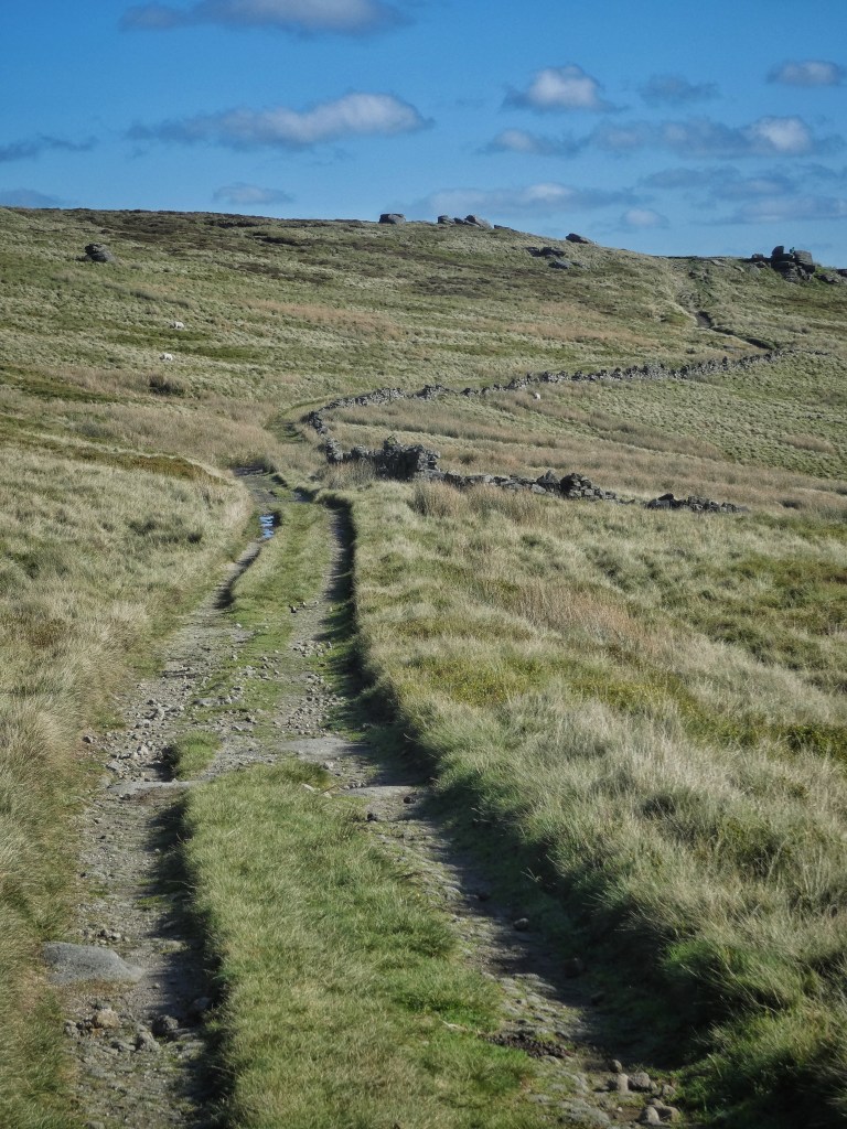
Up the old packhorse route that went from these farms to Worsthorne over the shoulder of the hill, where bilberry leaves skitter across the glittering rough surface of the enormous Round Stone, seven fields were once carved out of the sweep of Black Moor to support Gorple, one of the highest and certainly the most isolated farms in the area. It was, remarkably, still inhabited at the time of the 1911 census, but it was likely abandoned by 1927, when Halifax had exhausted the water that could be supplied by Widdop and the three Walshaw reservoirs, and needed two more in the valley of the Reaps Water. Although its nearest neighbours would have been the Widdop farms, it would not have been able to see them. Rather, James and Betty Uttley, raising their seven children across the decades from the 1840s to the 1870s, would have had to turn to the mile-distant glow at Raistrick Greave, set amongst its seven fields, for a sense of companionship as twilight drew in, when the waste pressed on all sides against its fragile field walls. Although Gorple would have lost even this solace when the Mitchells abandoned this other improbably marooned farmstead in the 1880s. In its final decades, Gorple was inhabited by gamekeepers.
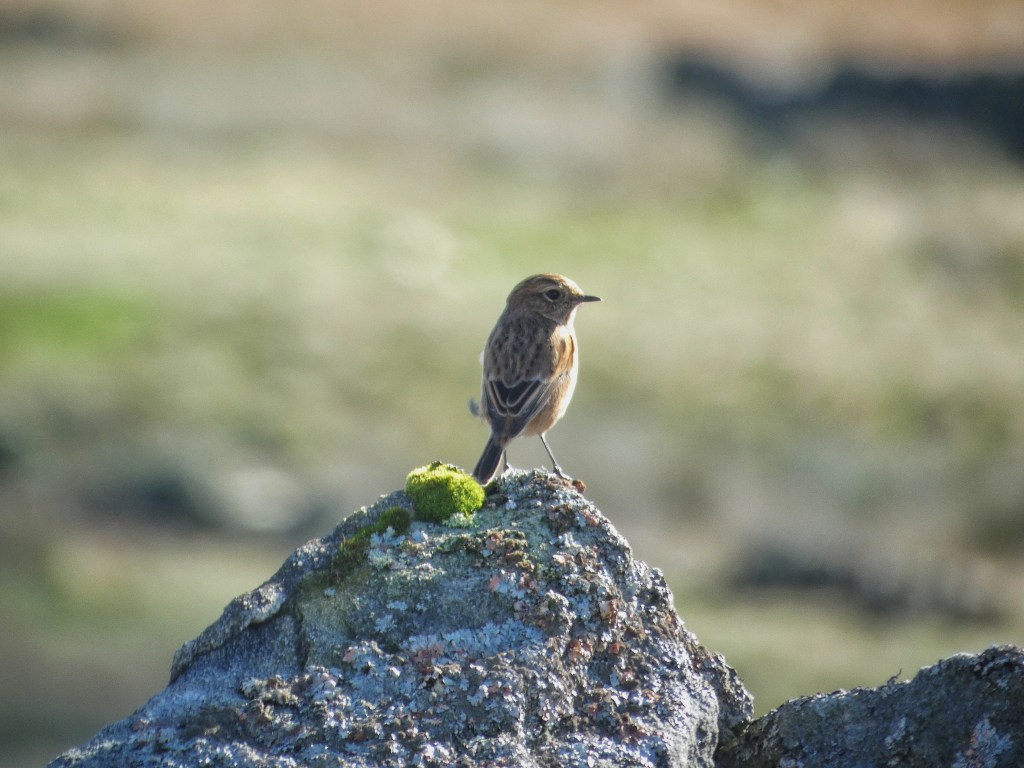
Today, a kestrel hovers in the piercing blue, scanning for the life that still inhabits this place, and the only green left here is on the track from the packhorse trail of Gorple Gate down to the ruins, where it raises itself above a bog on a curious causeway, rusting ironwork on its side suggesting that carts were once steadied by railings. A buttress leans against the last stacked stones of its barn, the serendipitous fall of a roof timber leaving it angled into the sky, meaning it has outlasted all the others. Across a little pitched path, a female stonechat flits among the two walls of the house that still stand, and green chickweed has tucked into a nook that would once have held a candle. Sheep still graze within these enclosures, but are no longer enclosed now the walls have become jagged with gaps. Down the slope they wisely stop once they reach the irredeemable mires of Thistelden Dean, whose namesake beck still flows into the reservoir, as does the parallel Gorple Water. Their meeting to form the Reaps Water, where the dam was constructed, created a tongue of land called Gorple Bottom, along which a track balanced its careful way from the border pass at the Hare Stones between the shadowed, bilberried slopes of Hameldon Hill and the dramatic gritstone wedges of the Hanging Stones. Somewhere under the waters, it is still there.